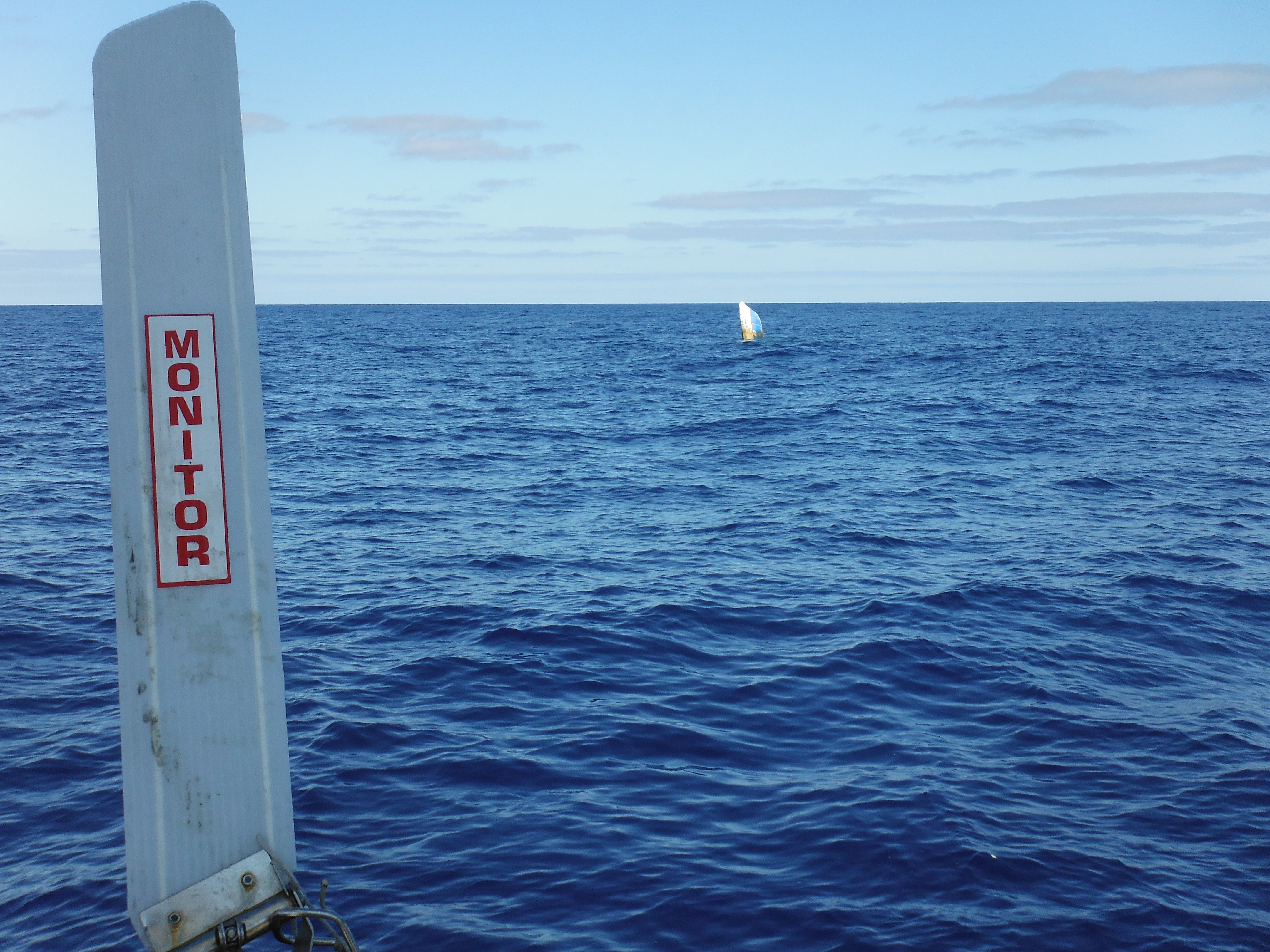
Drying Fish, Killing vs Eating, and Marine Debris–VIDEO
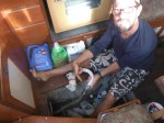
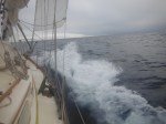
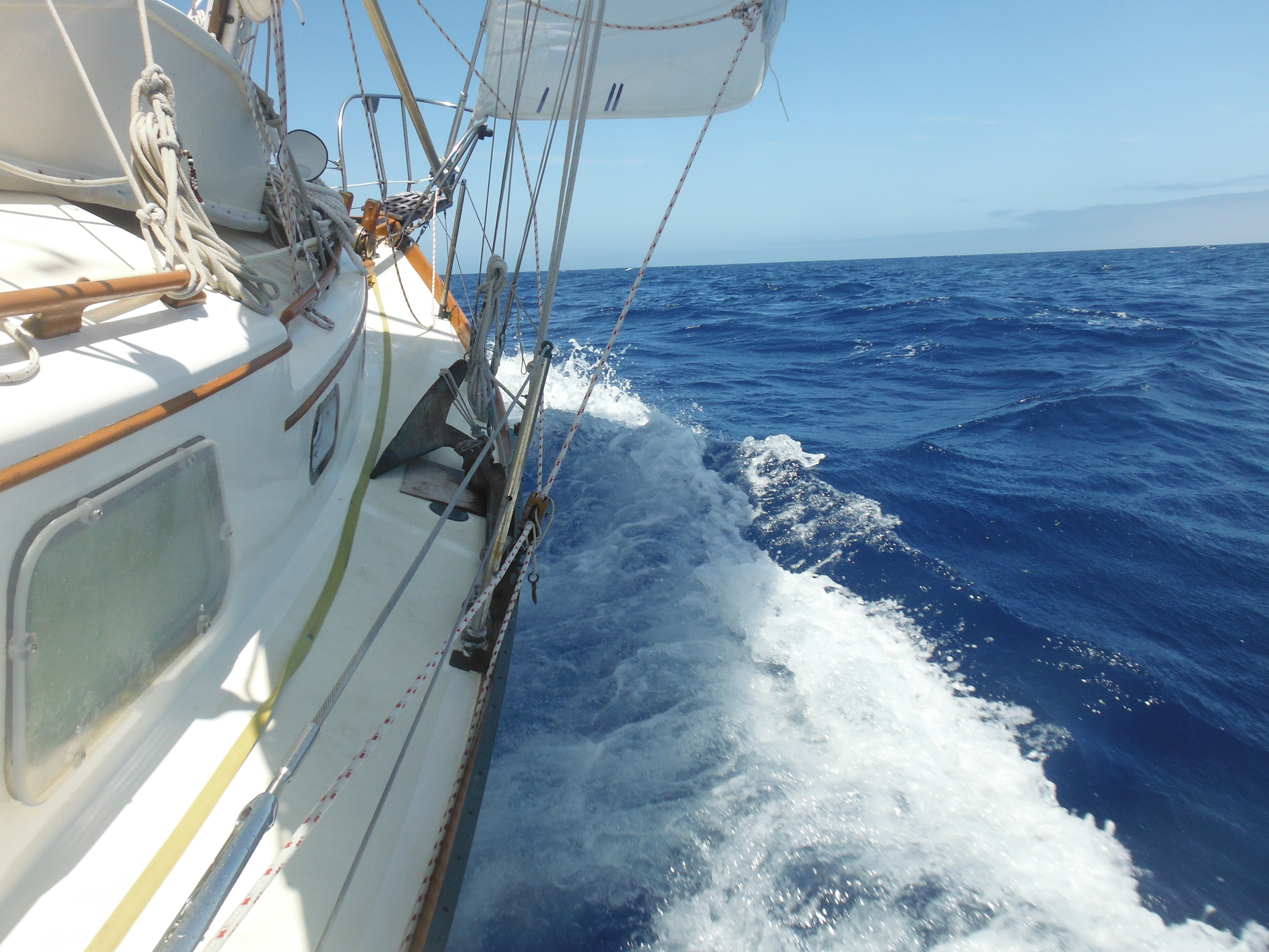
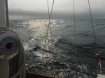
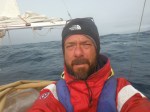
In this report from June 27, Murre and I are almost 900 miles north of Hawaii. It’s day 7 and we’ve caught a big fish…
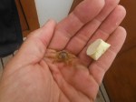
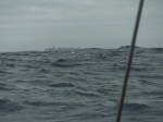
(By way of reminder, this is the fish.)

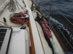
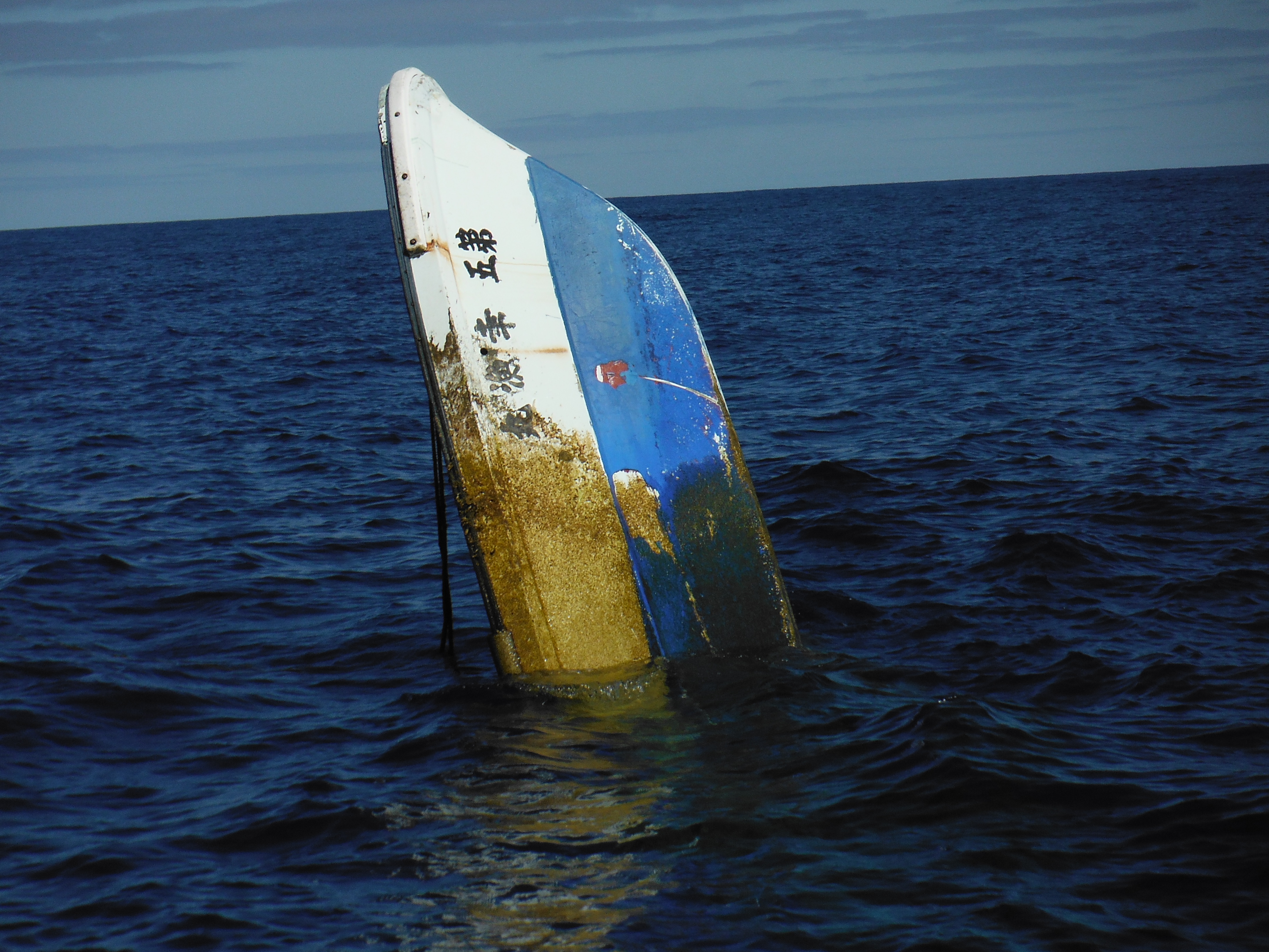
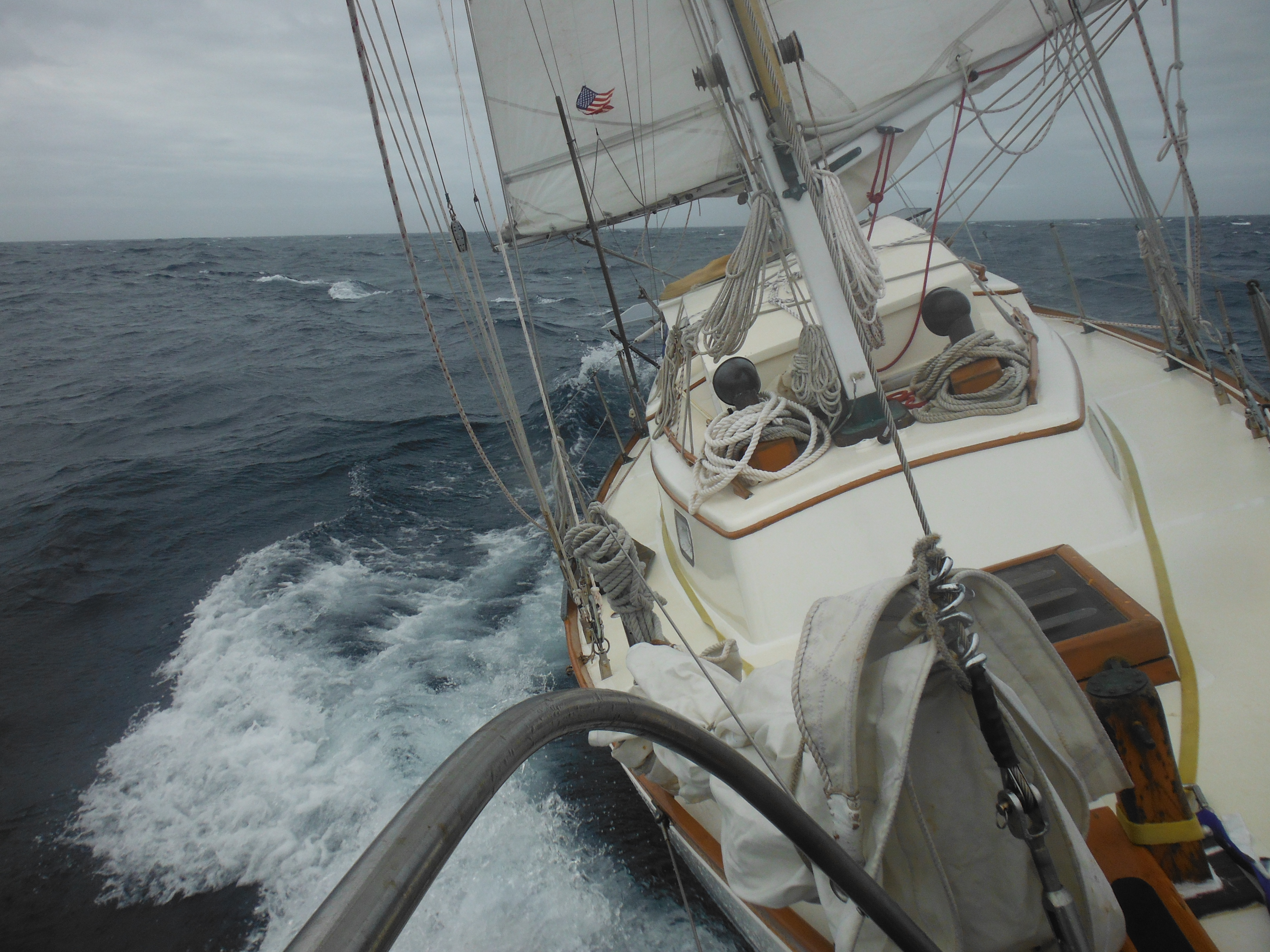
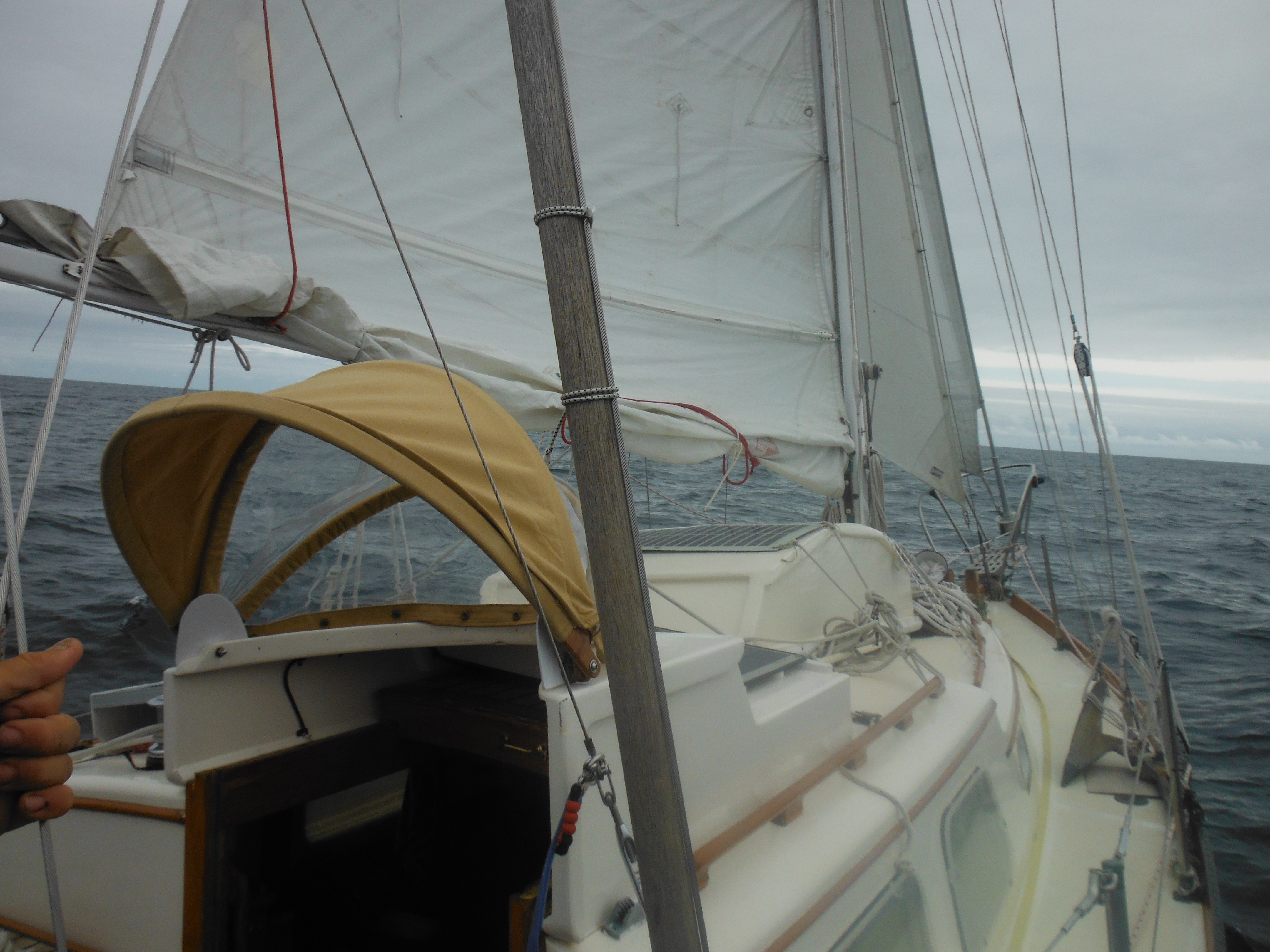
Six foot Marlin–but this was caught with a big hook.
–
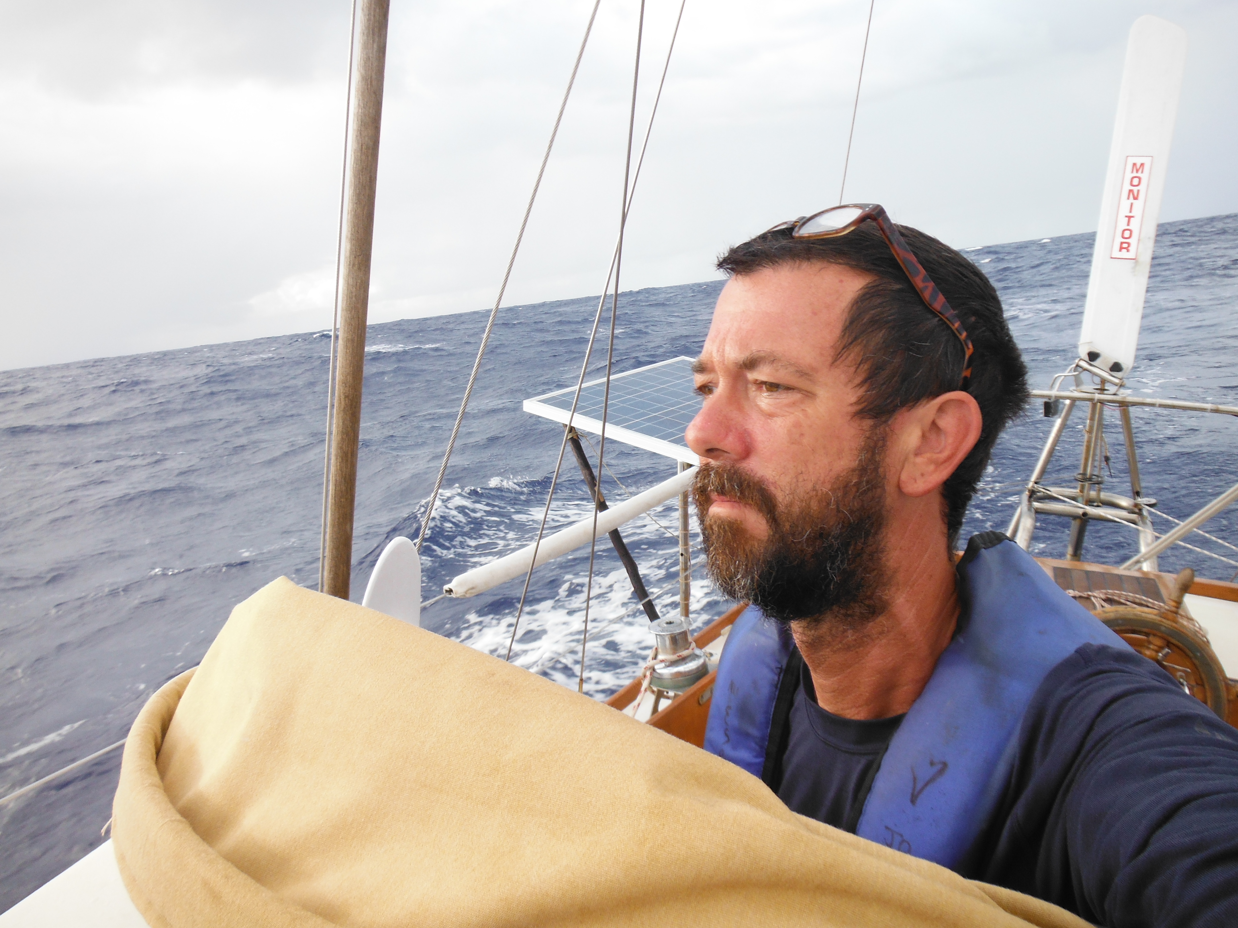
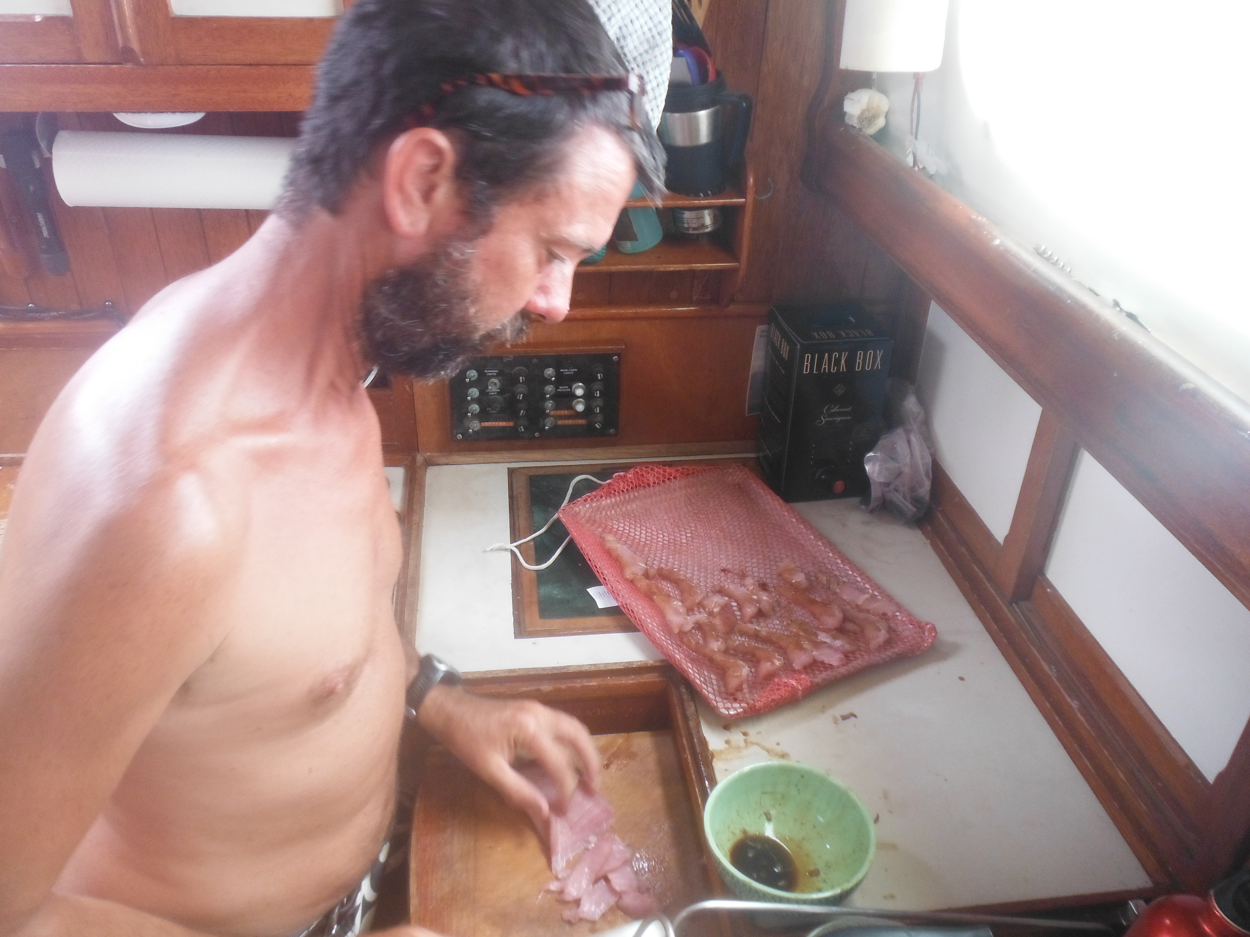
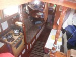
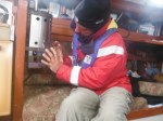
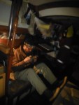
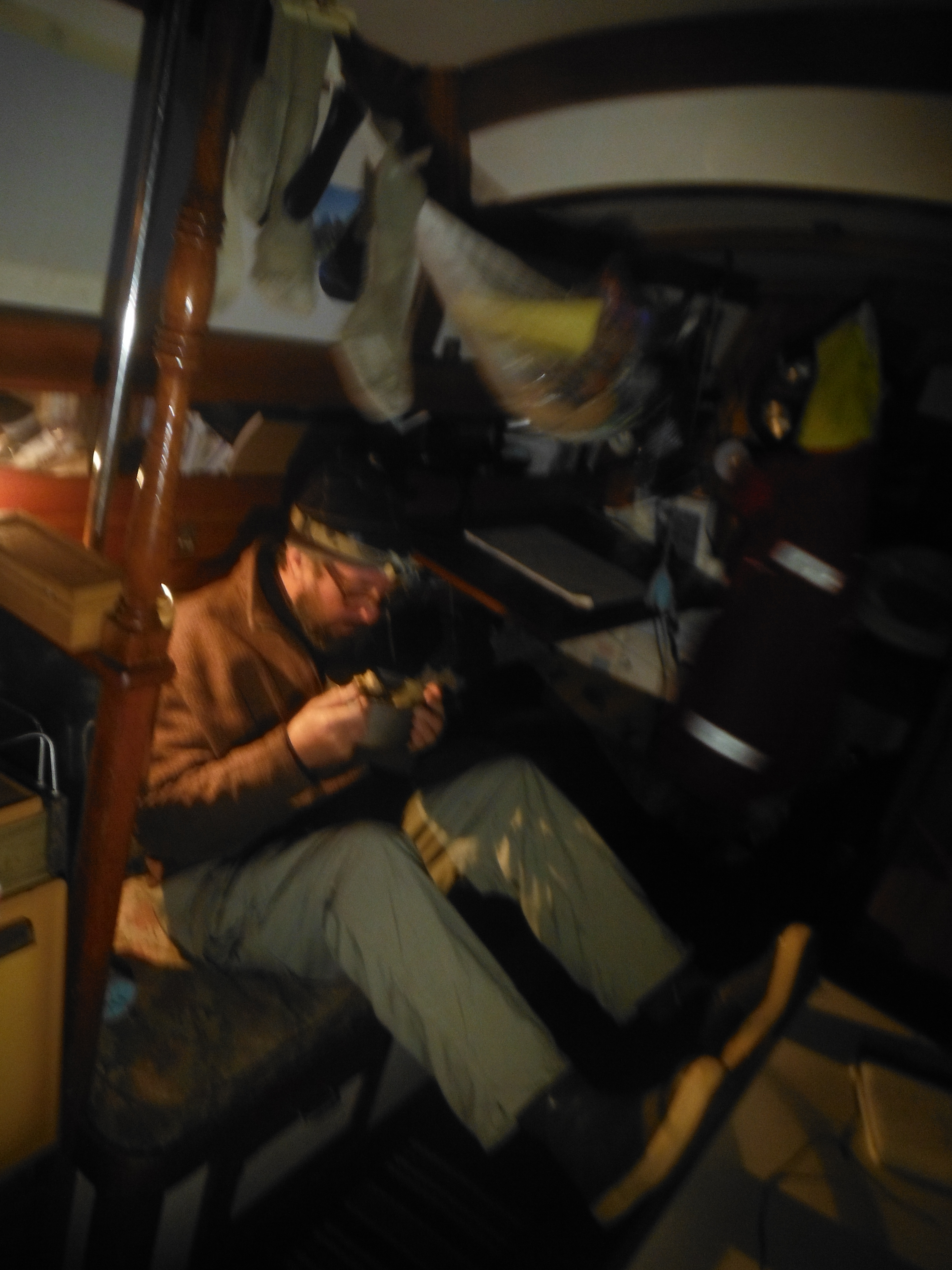
The video log comes from the cabin where I’m preparing the meat.
UP NEXT:
Reflections upon falling overboard…
Hawaii to Alaska, THE VIDEOS
I had promised to shoot video blogs of the passage from Kauai to Sitka, and I did.
But it felt an unwelcome interruption at first, an act out of step with the solitude of singlehanding, another chore among many to call me from my favorite gawking-post at the hatch. Why had I ever suggested such a thing? Who takes himself to the middle of the ocean to make a movie … of himself?
And then it grew on me. The task became fun, a diversion from pondering dinner’s limited menu of canned goods and, later, the endless cold. What to talk about today? Subjects ranged from fixing a leaky bilge pump to my techniques for drying strips of fresh-caught Marlin to the penitent mood that results from falling overboard 2000 miles from anywhere.
Sadly, that these videos became interesting to me does not mean they increased in quality, only frequency and length.
The first three appended here, all shot on the same day, demonstrate this. One refuses to focus and another ends abruptly when the camera battery dies. A personal requirement was that these be one-take videos, which I thought would increase their immediacy and keep me from endless reshooting. And if immediacy implies a certain lack of polish, then this strategy was a great success.
_____
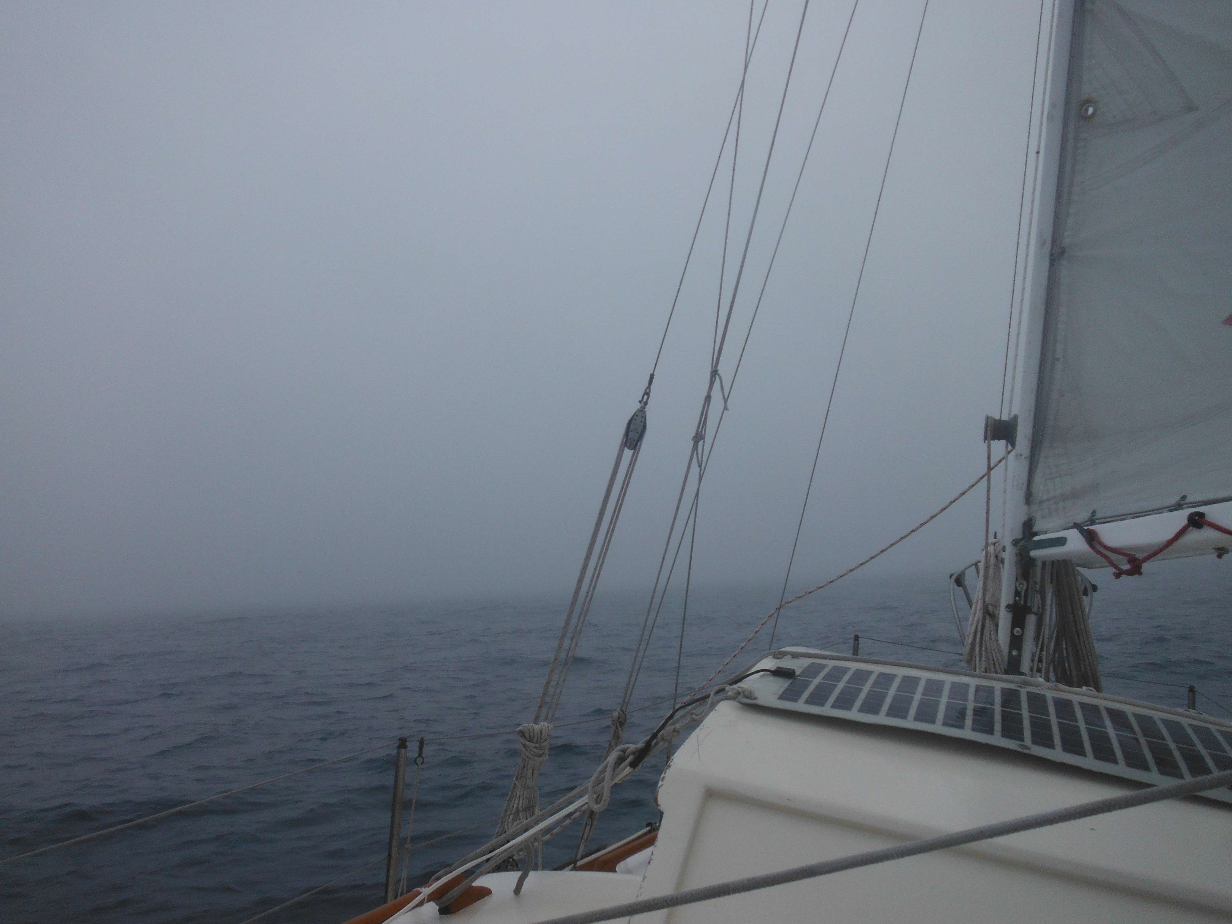
This inaugural video finds itself in an unusual location, the bilge. It’s the morning of third day; Murre swings on the waves 300 miles north of Hawaii, and I have some problems, camera focus being only one…
–
Next is a look around the deck on the same day. Much more refreshing. Then the camera battery dies…
–
And finally a look around…
UP NEXT
Drying Marlin and the morality of fishing…

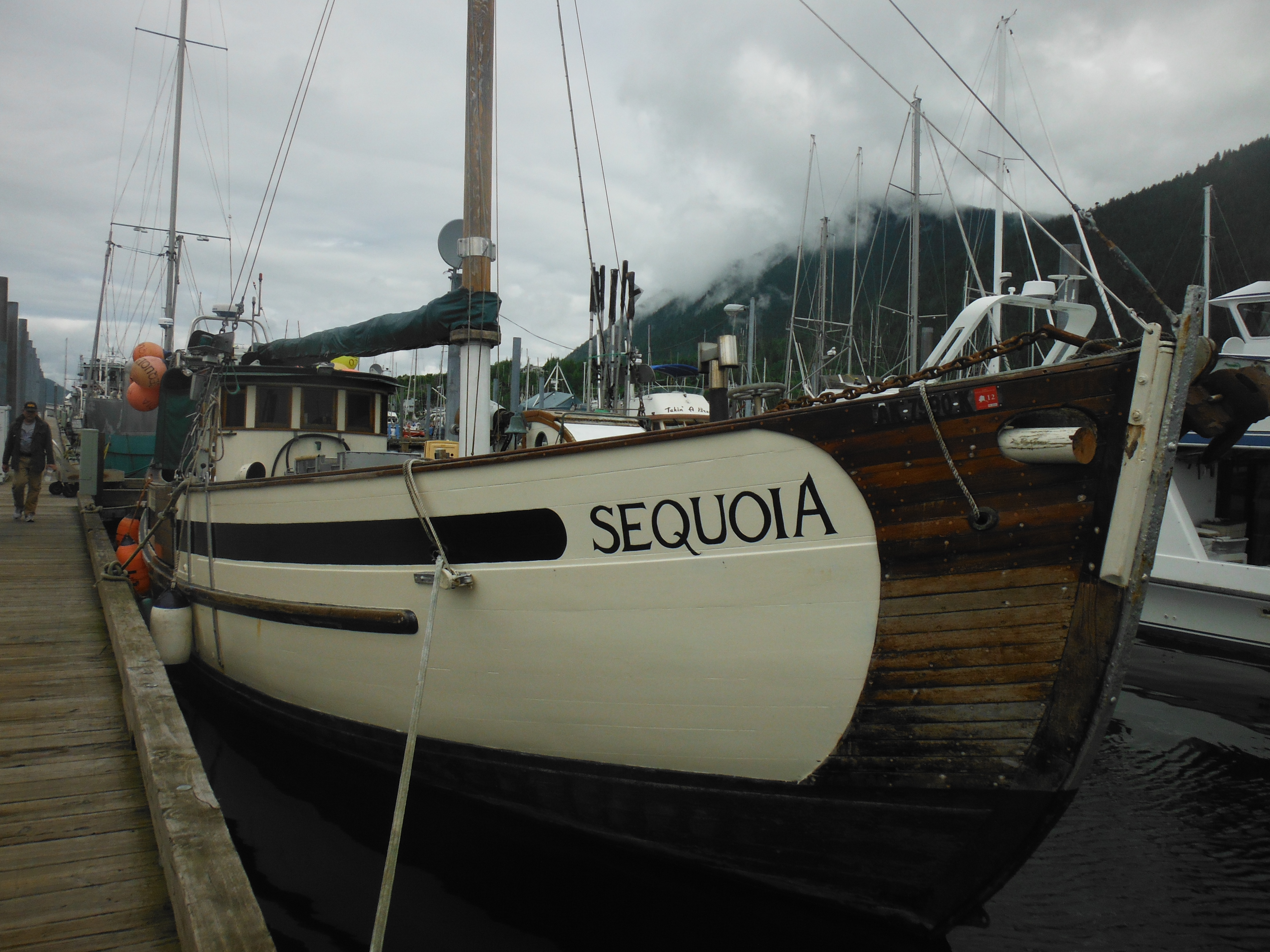
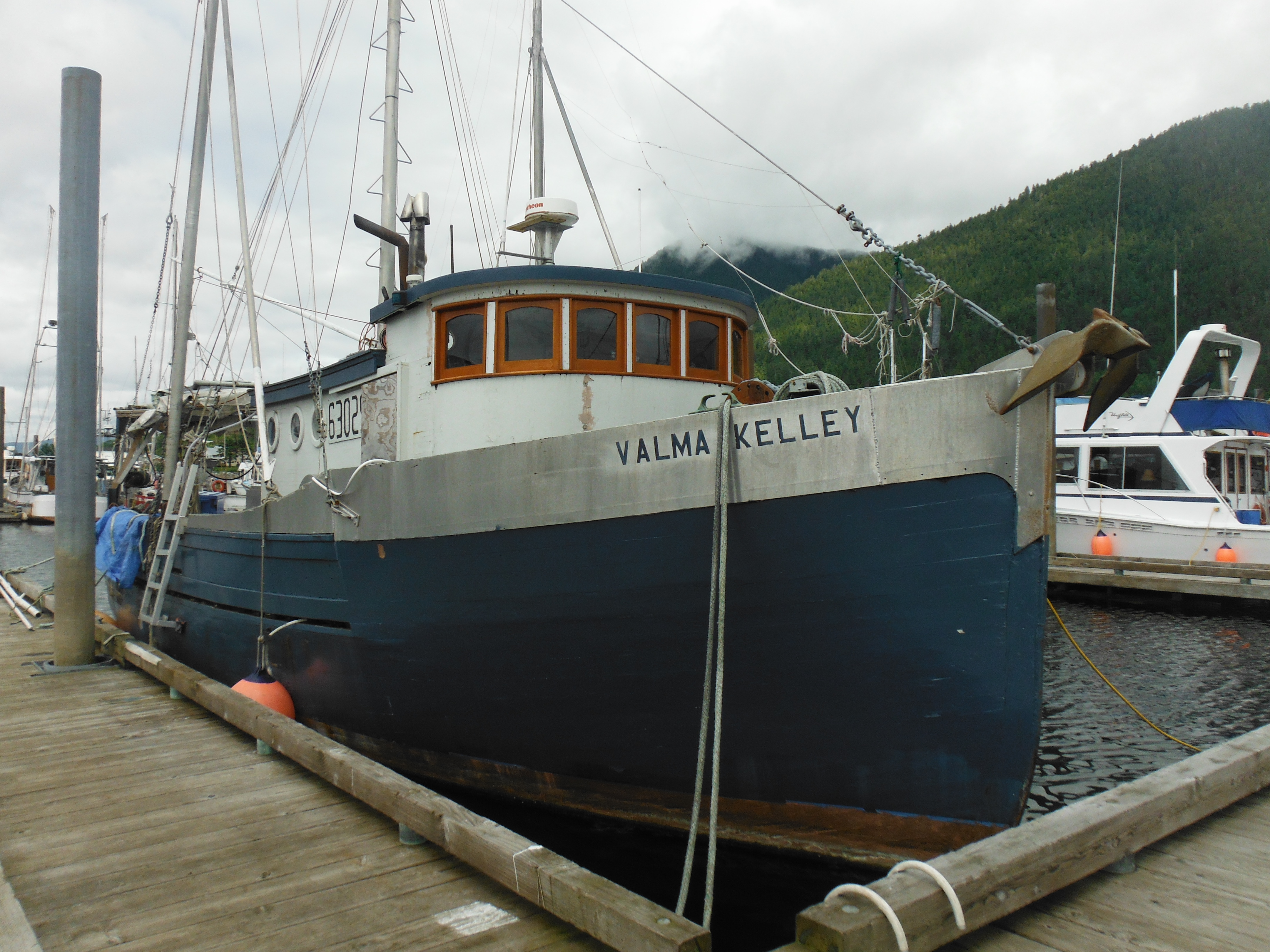
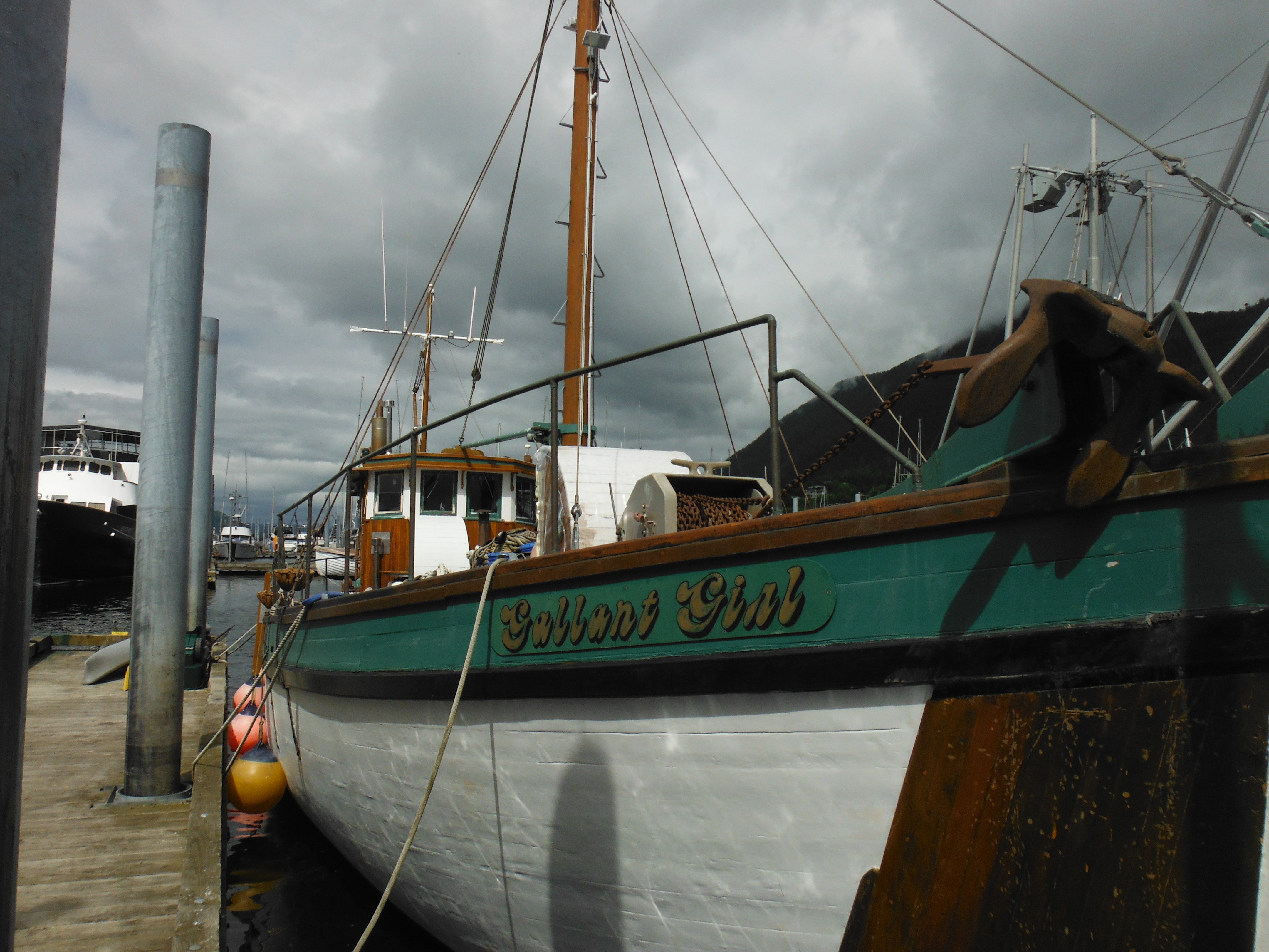
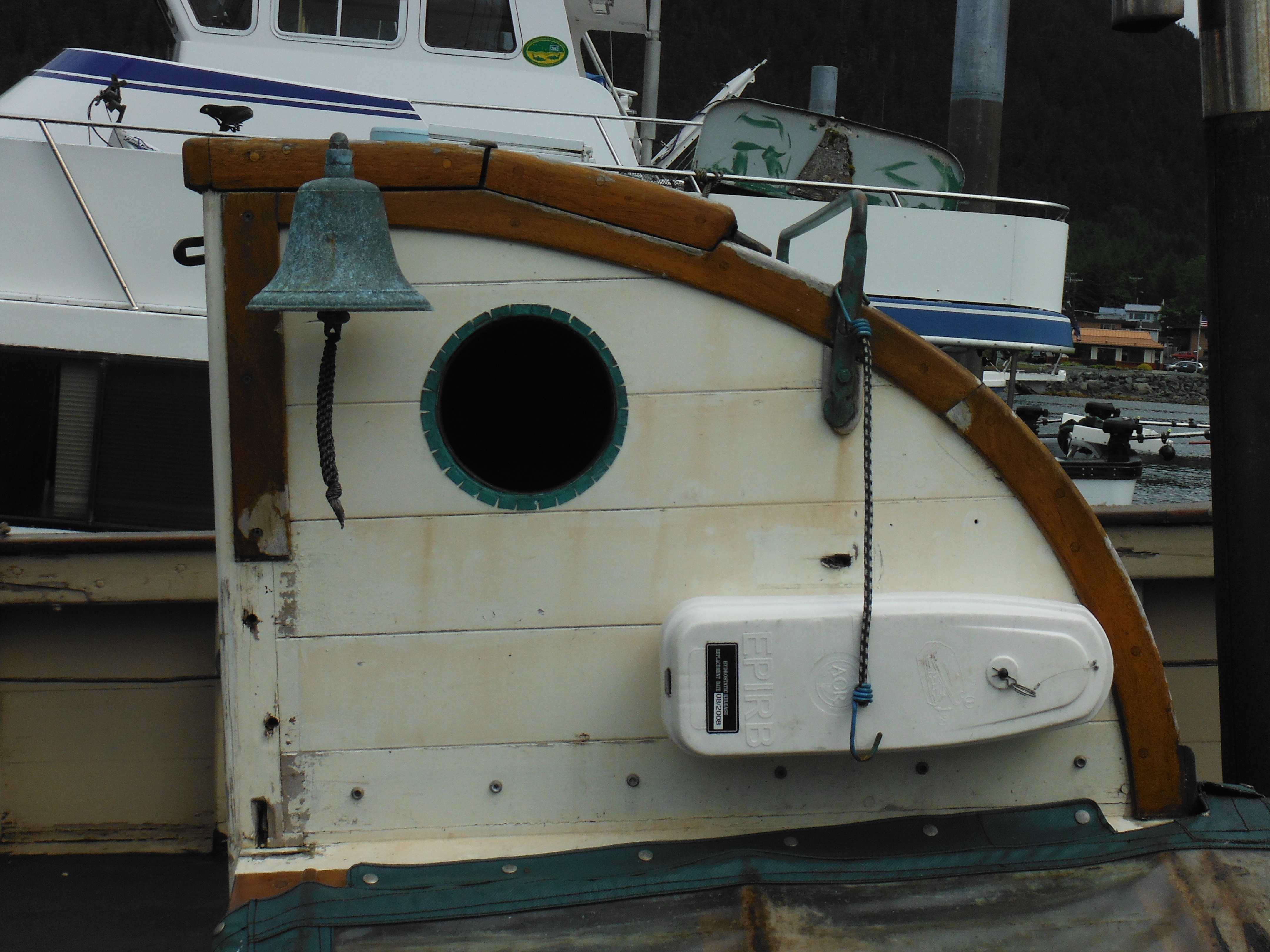
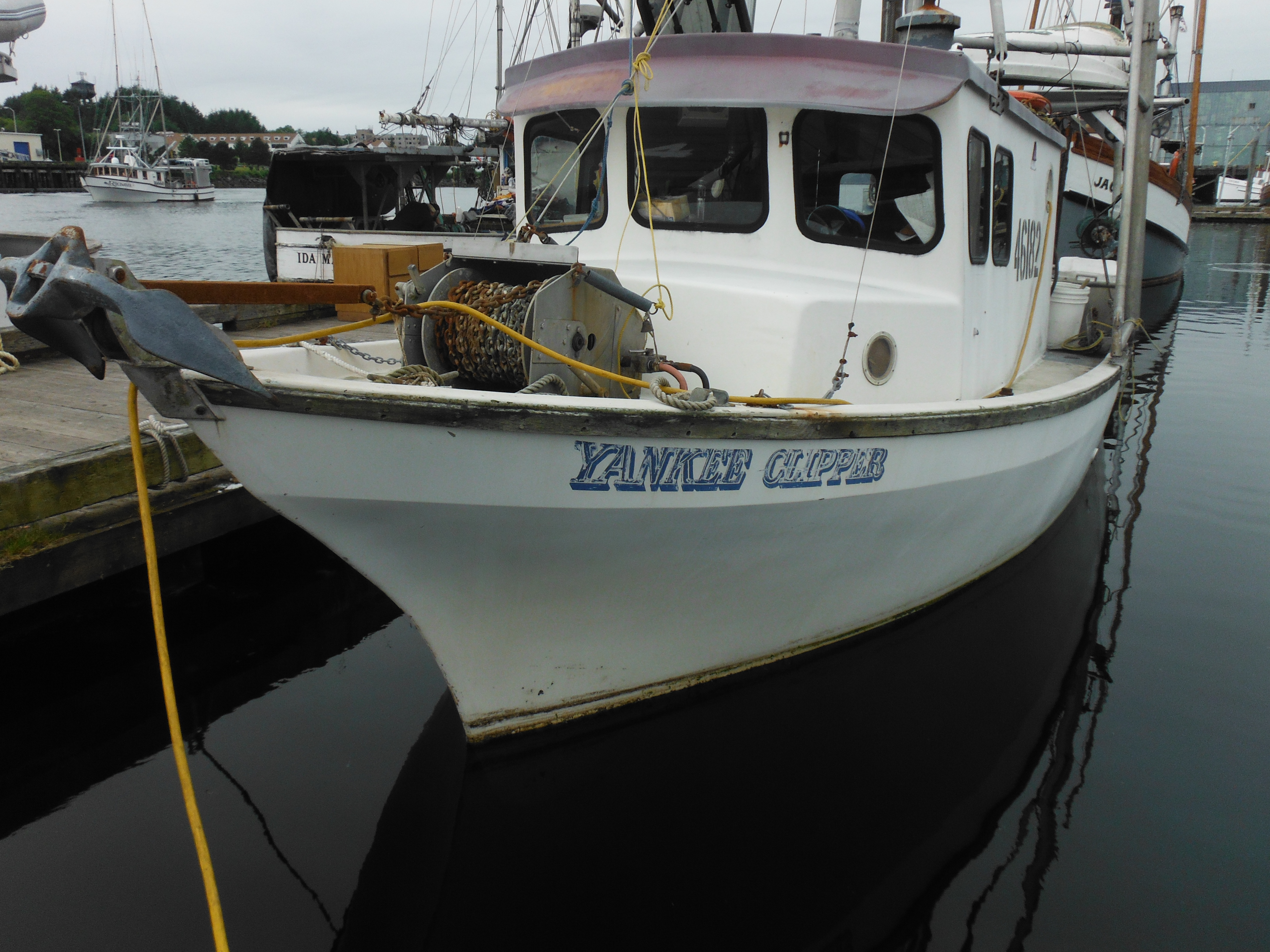
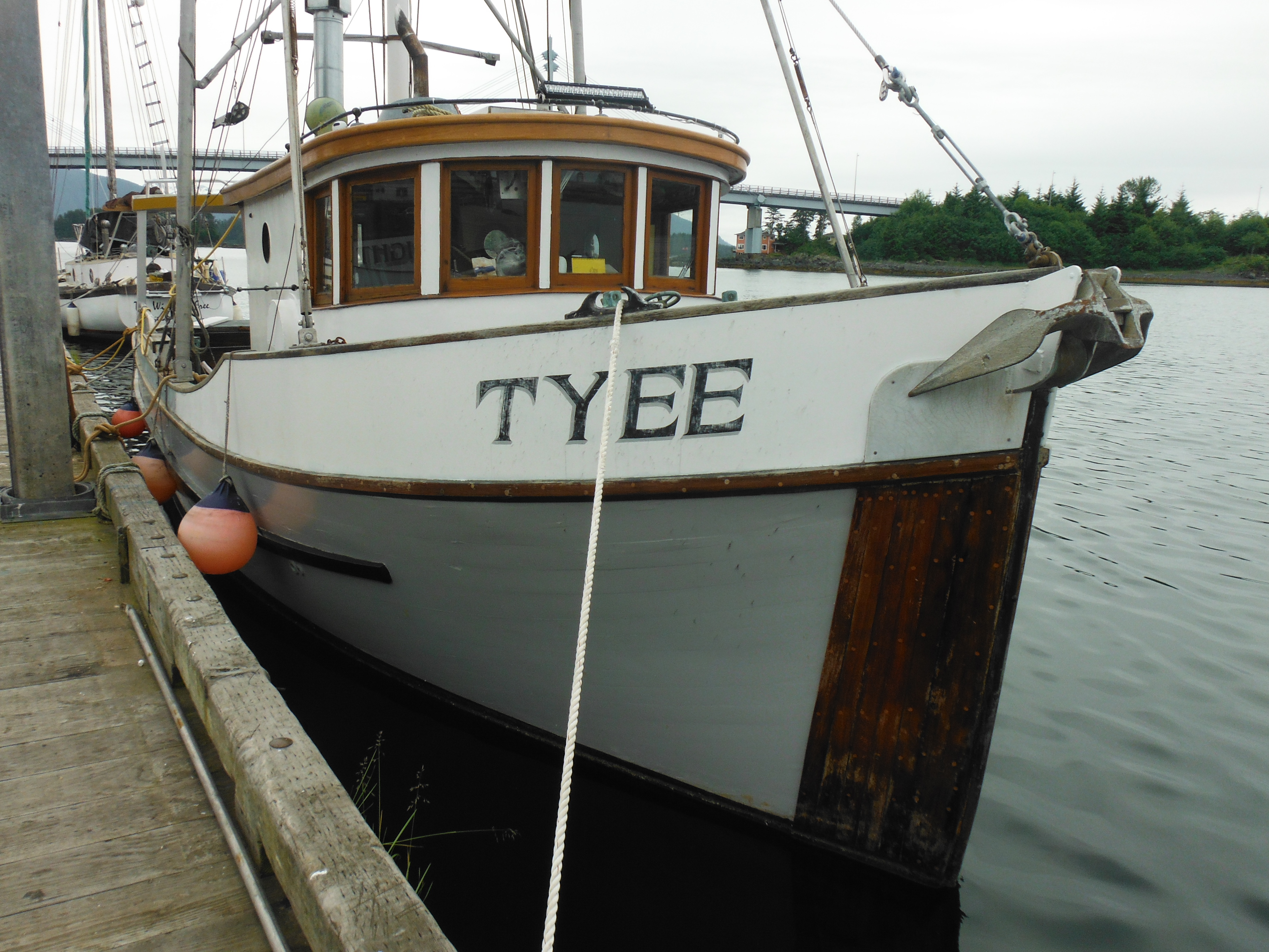
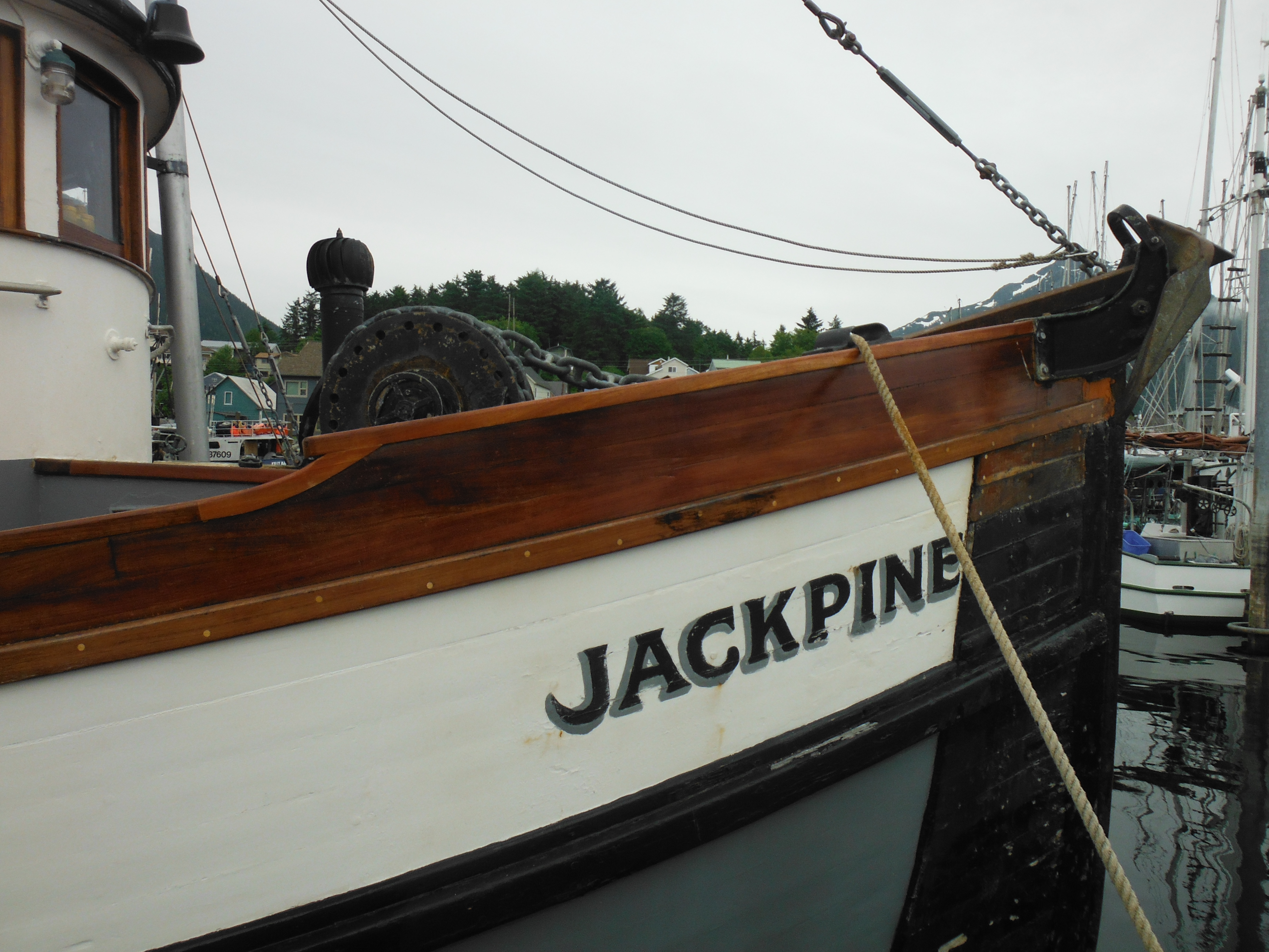
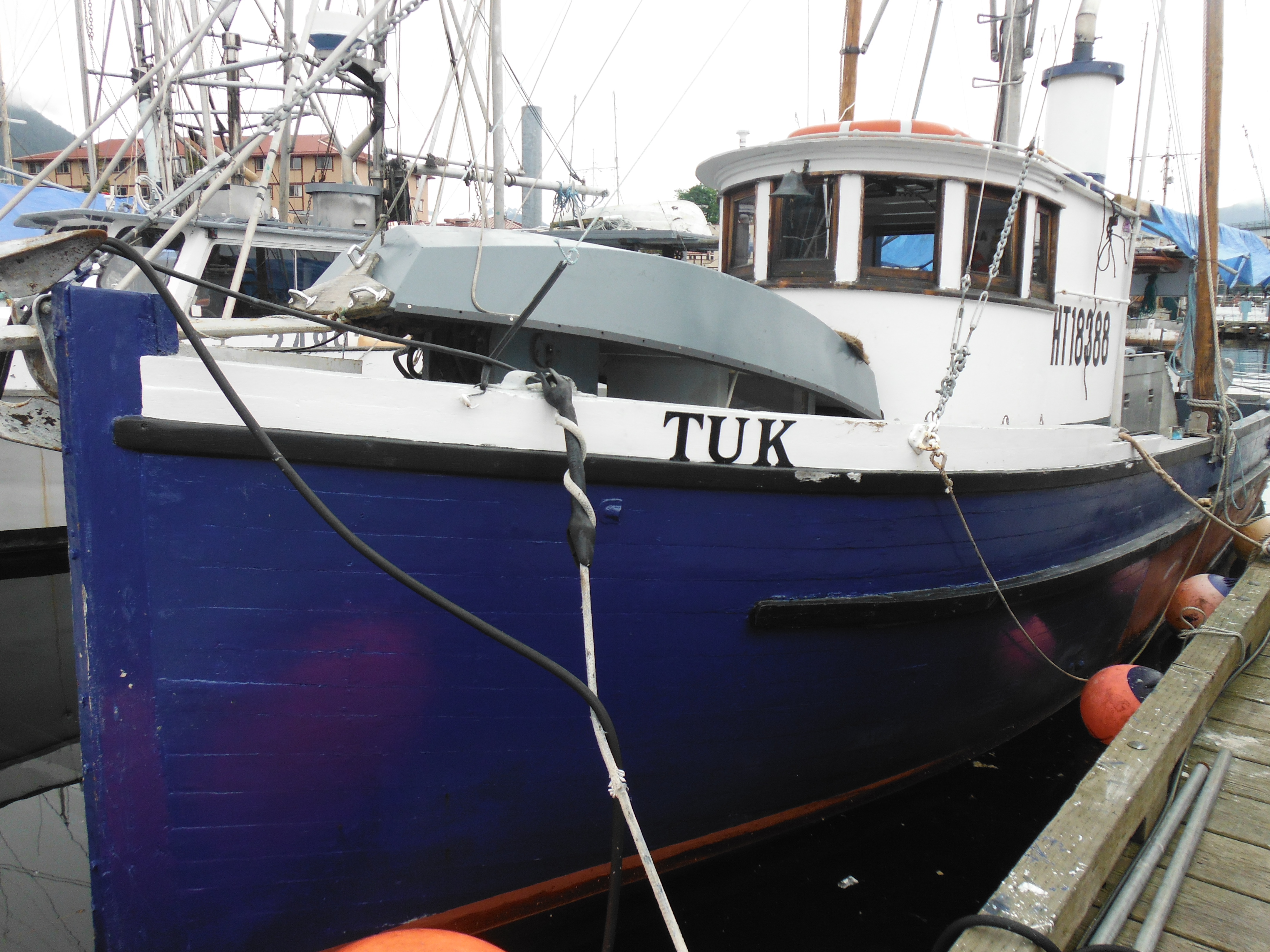
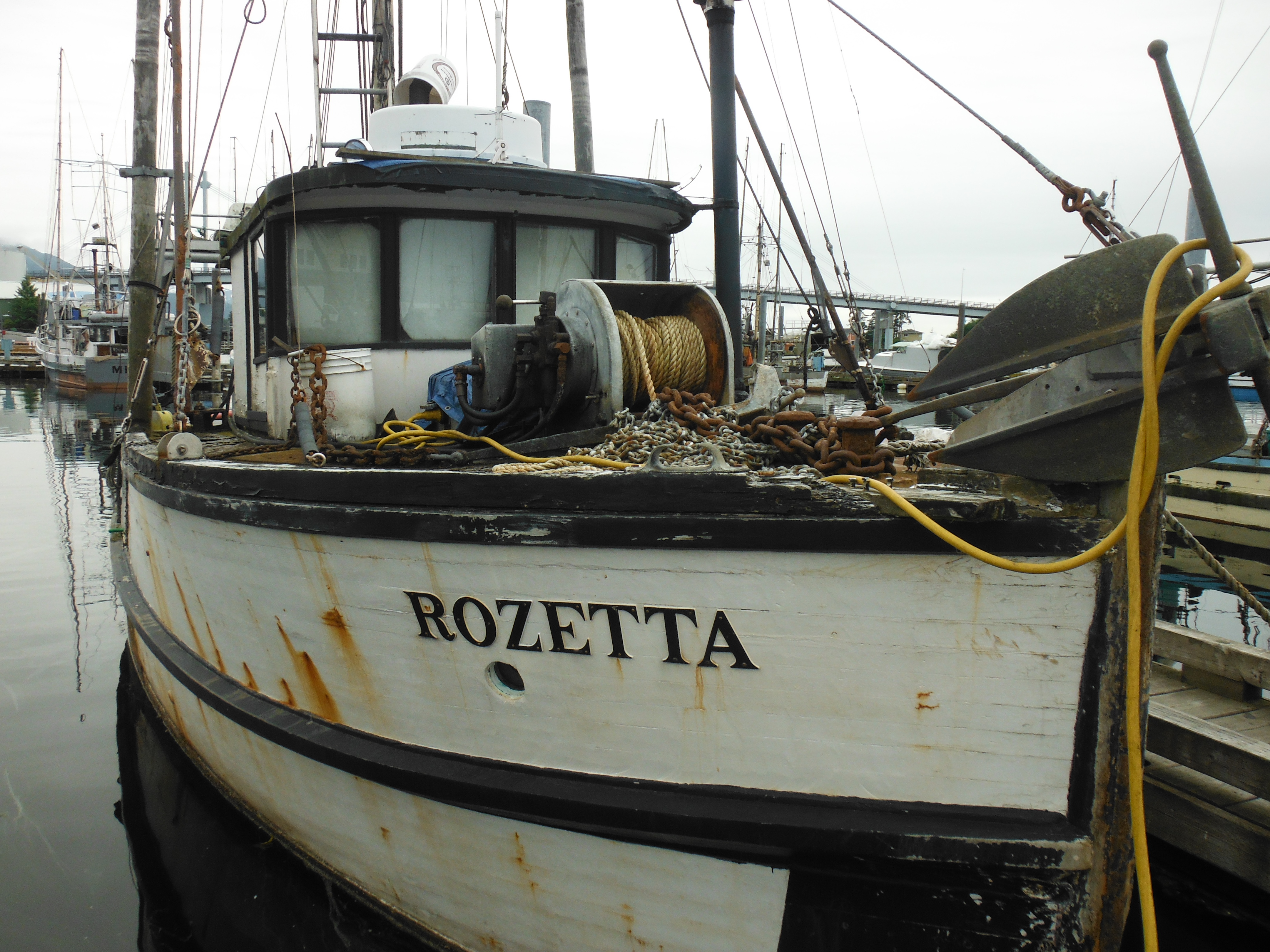
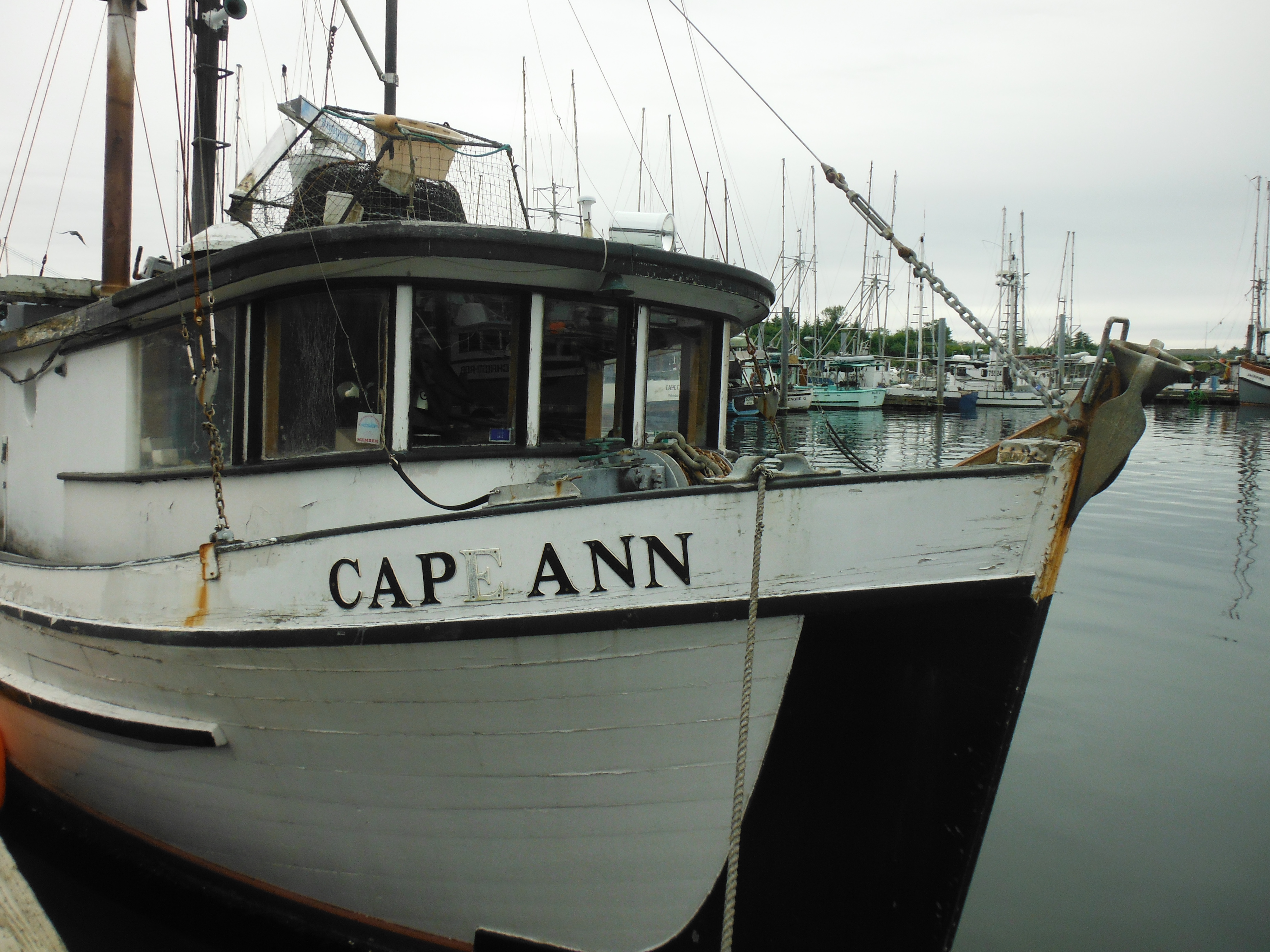
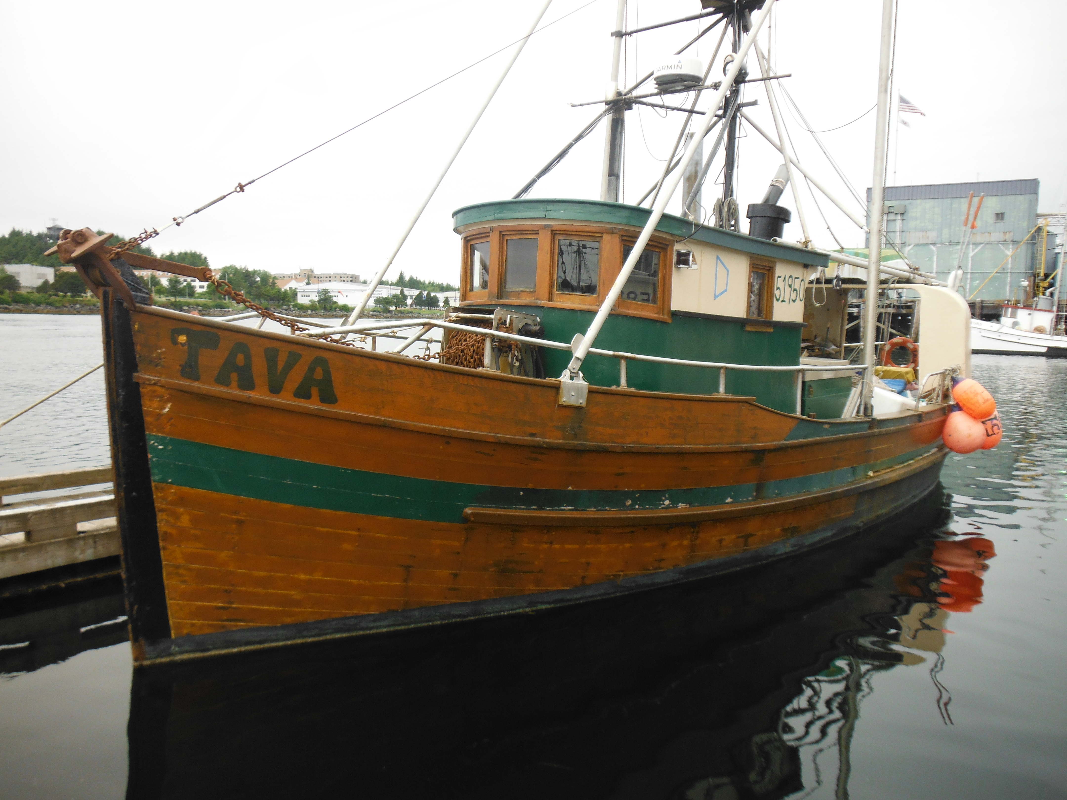
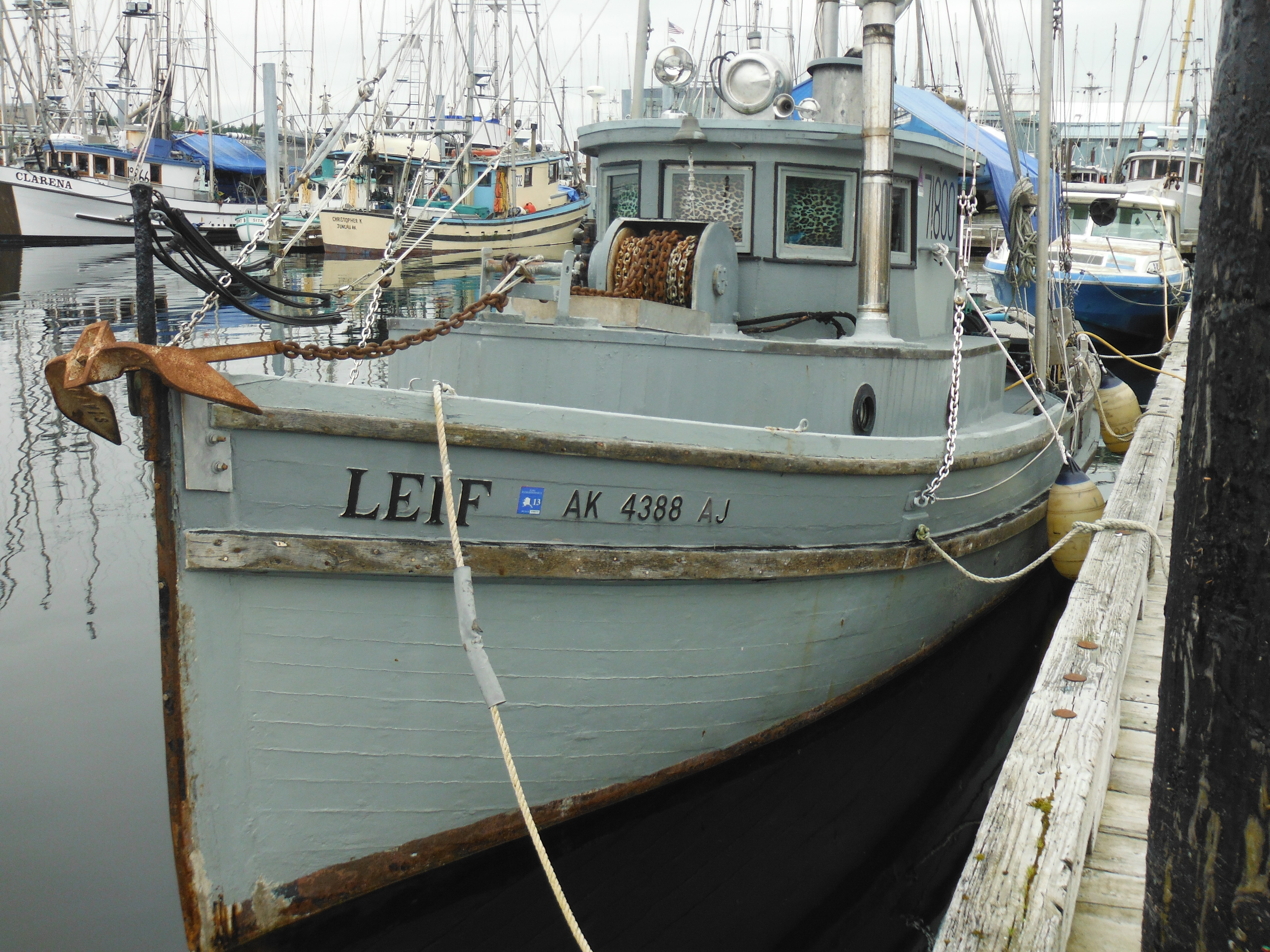
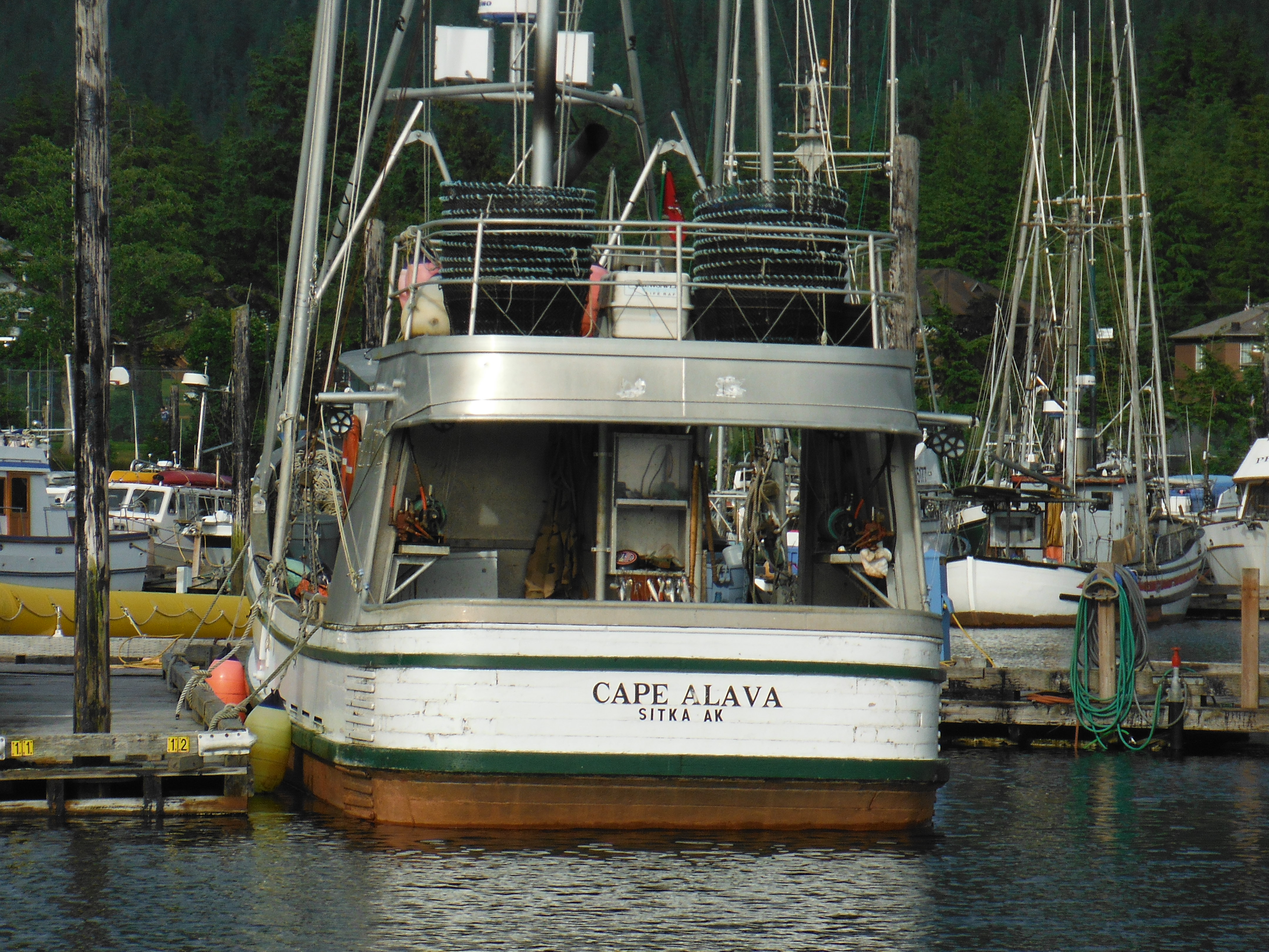
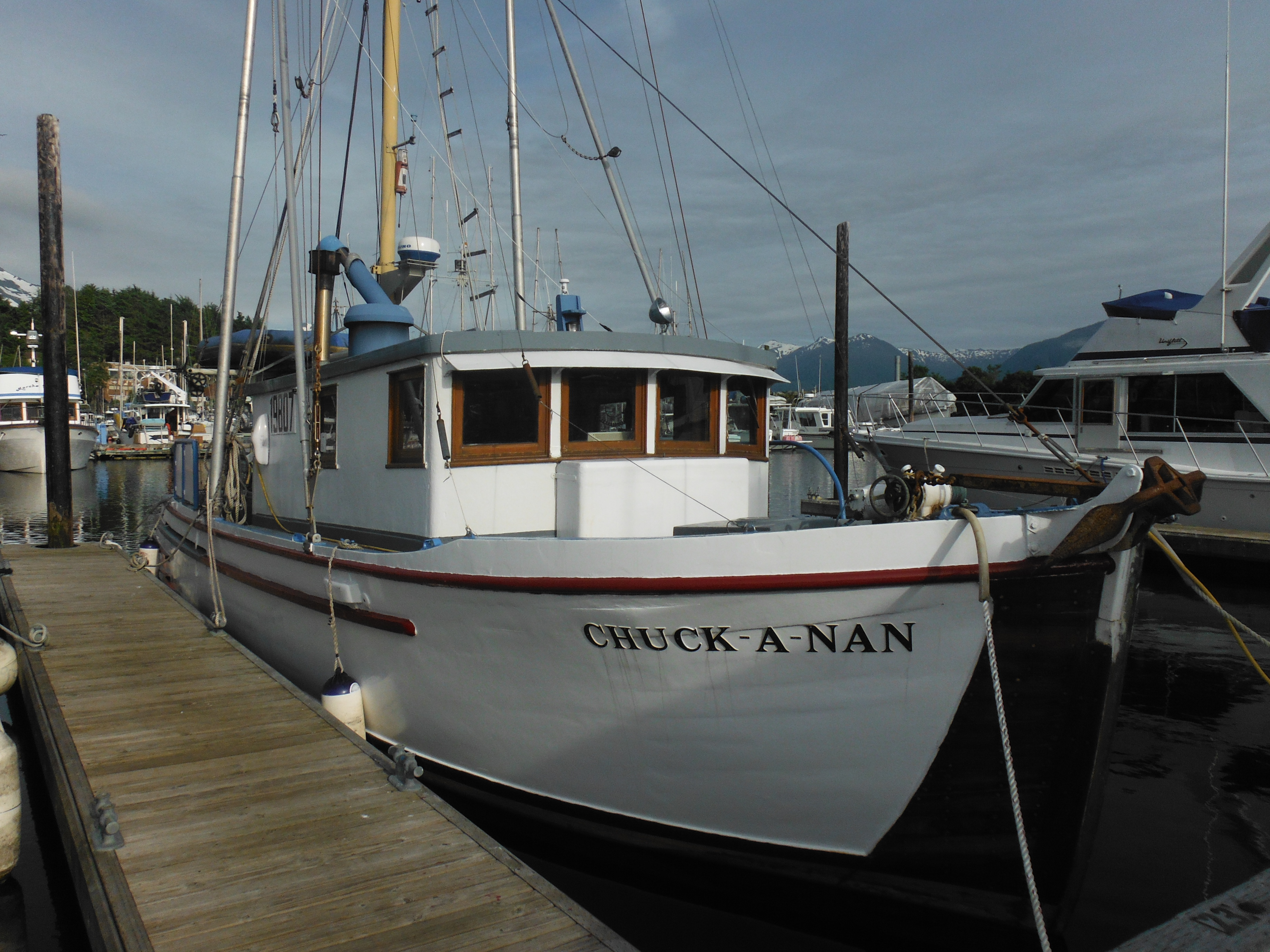
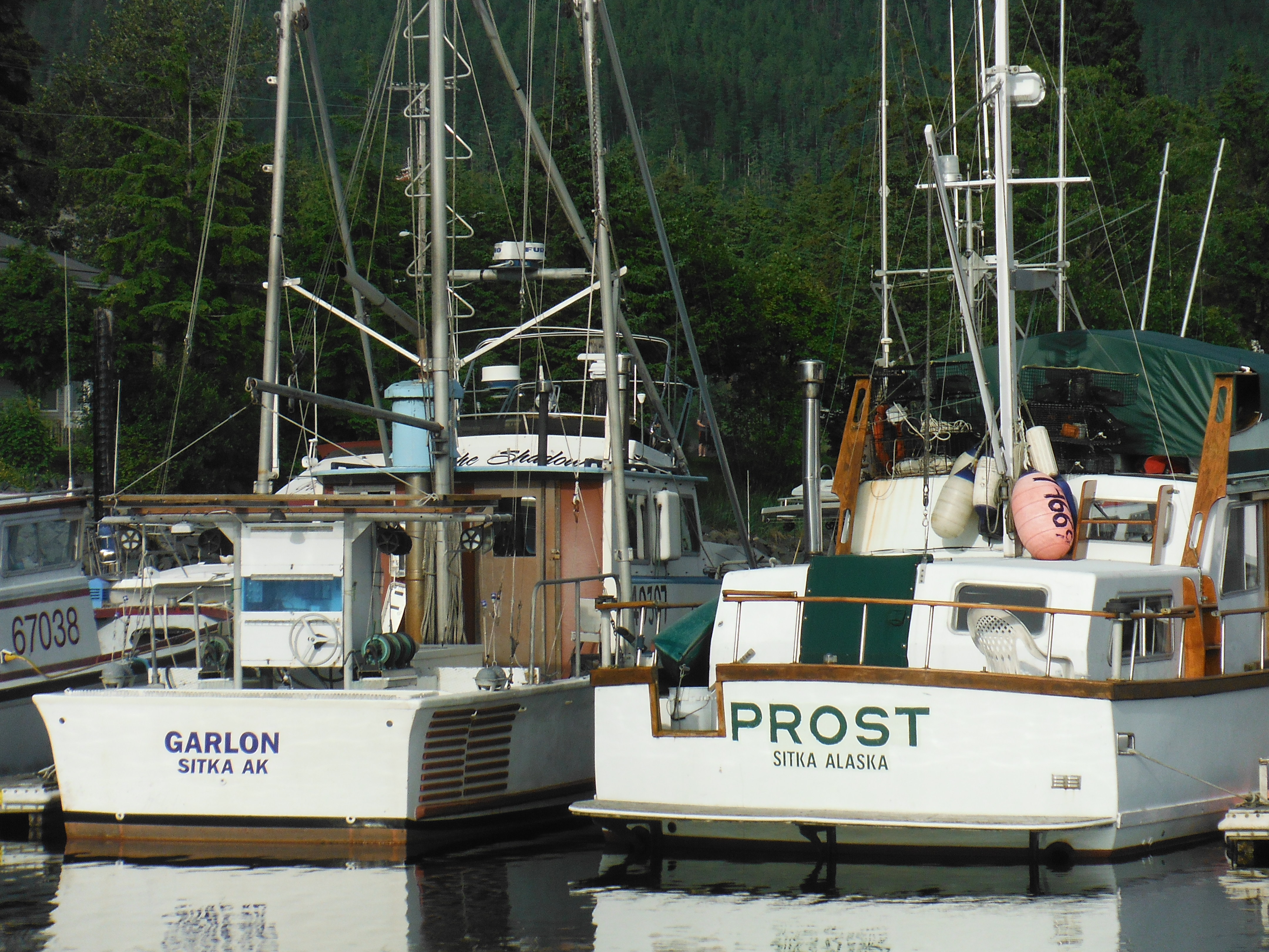
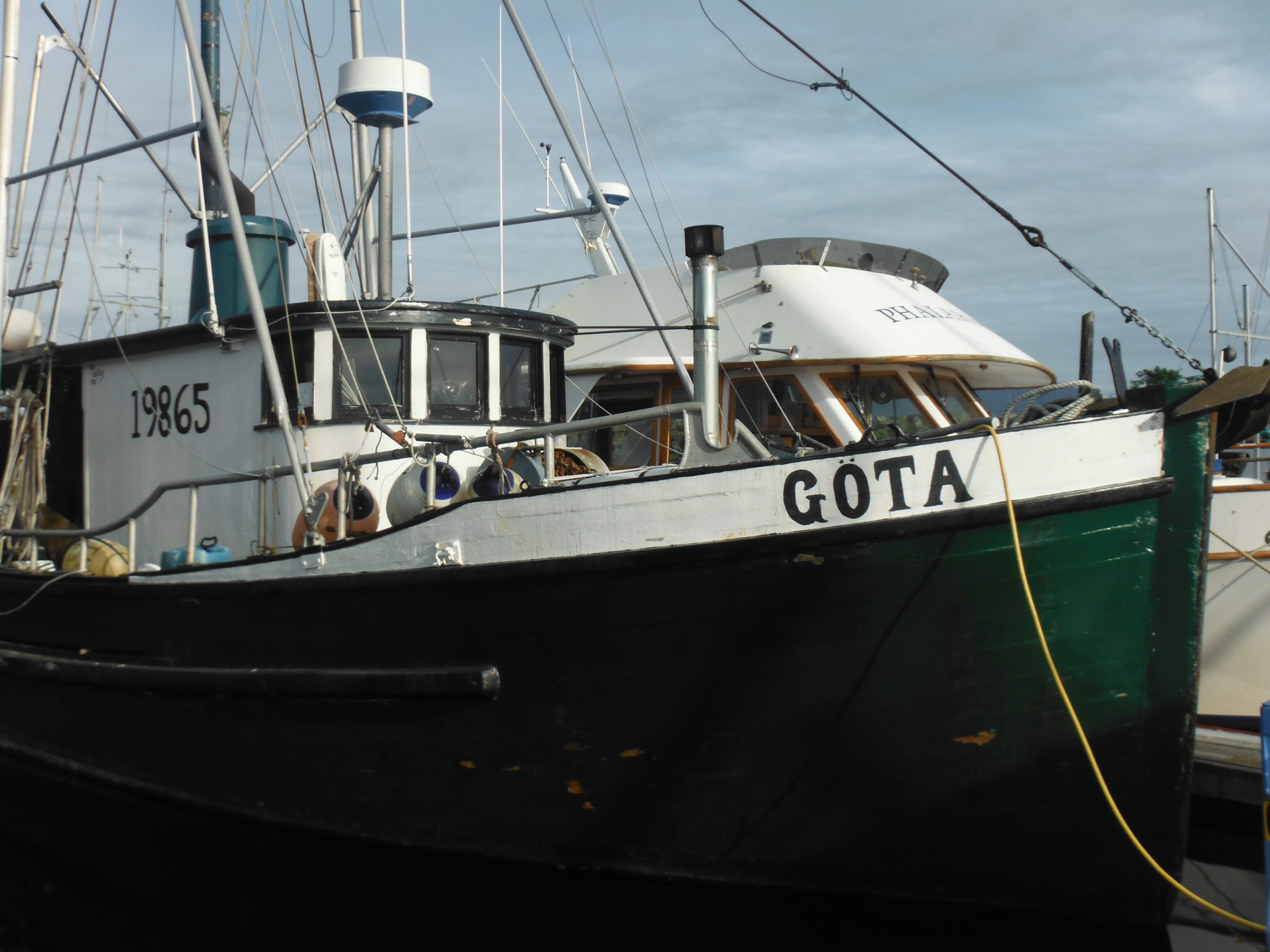
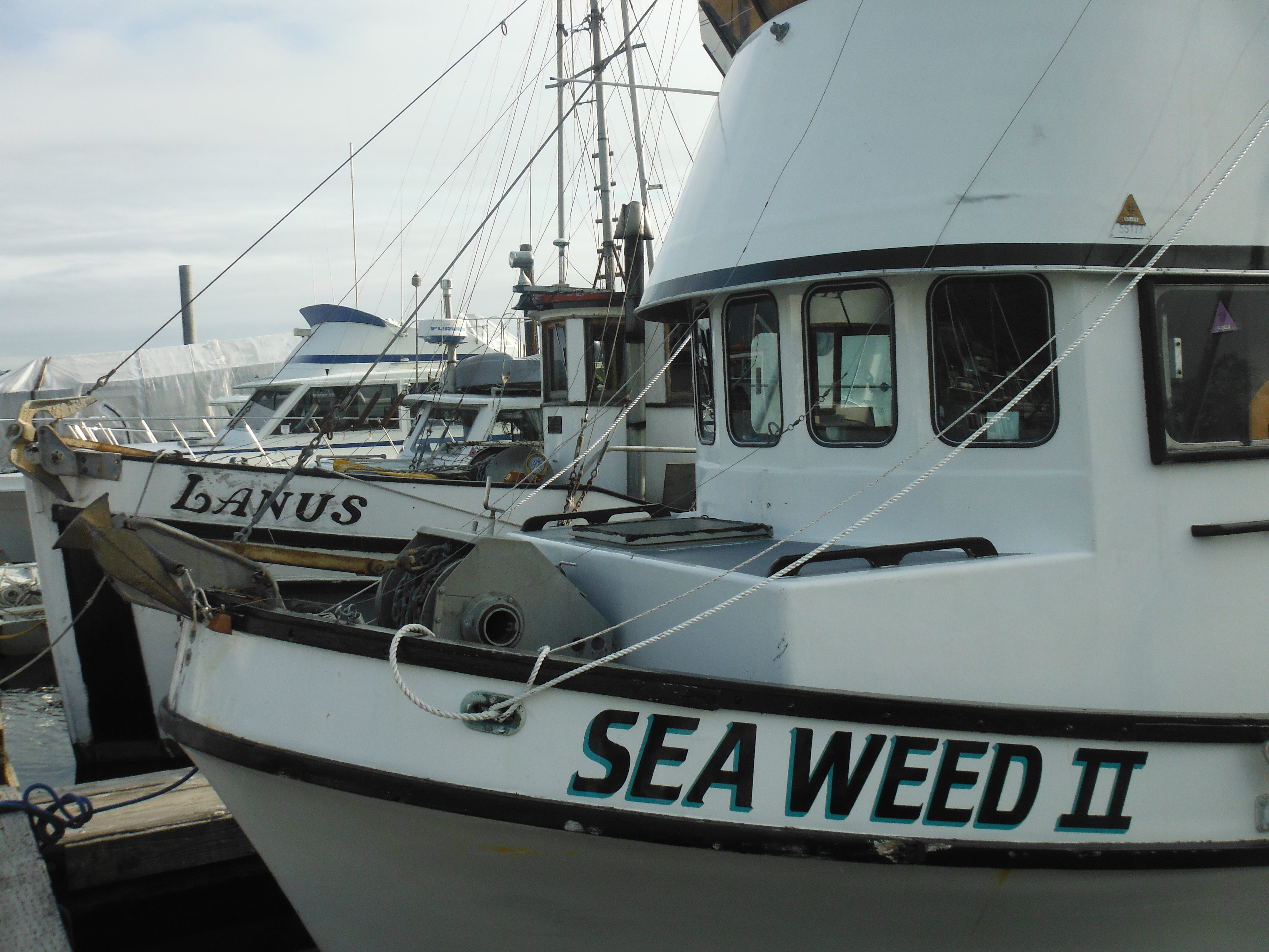
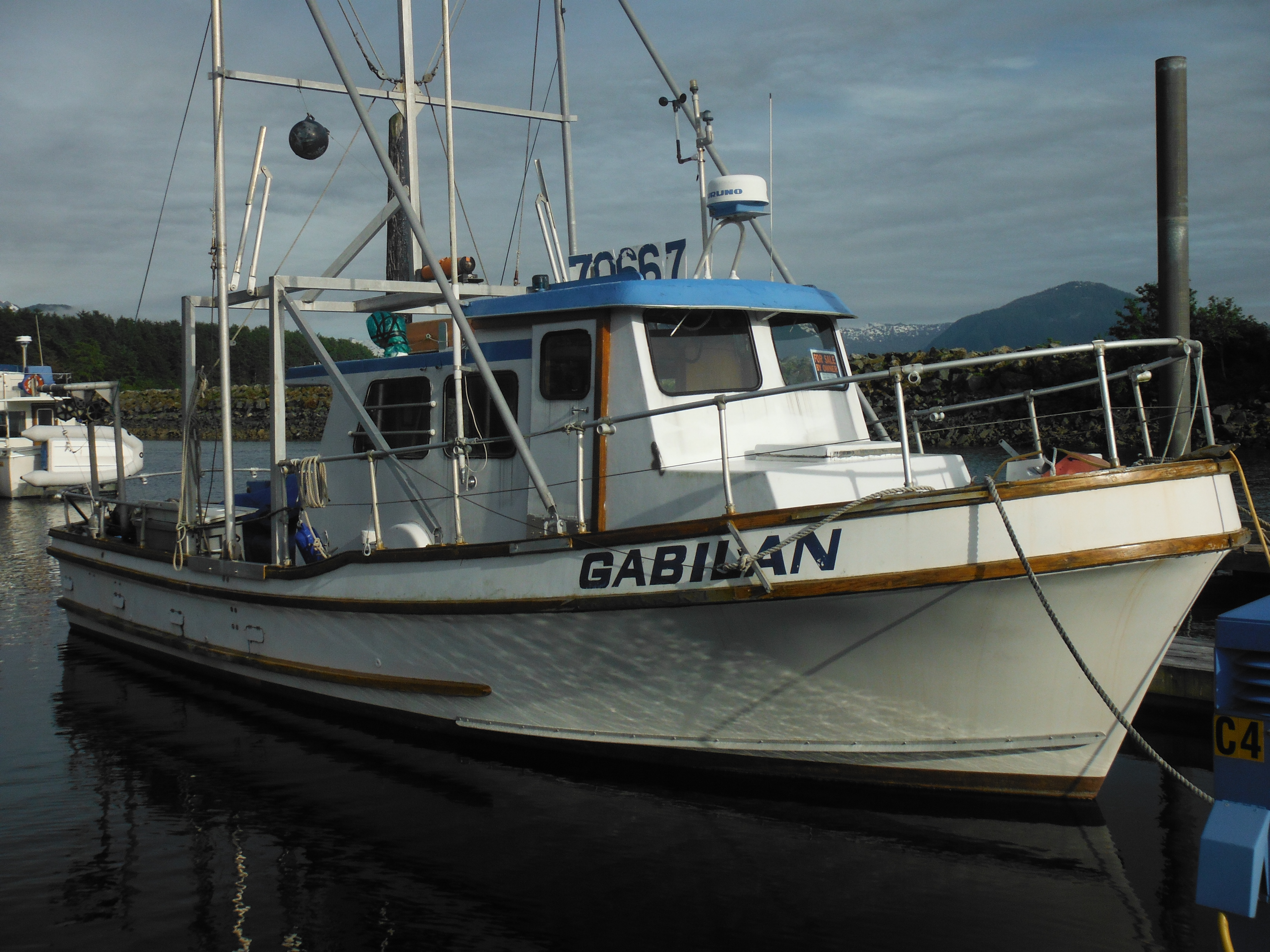
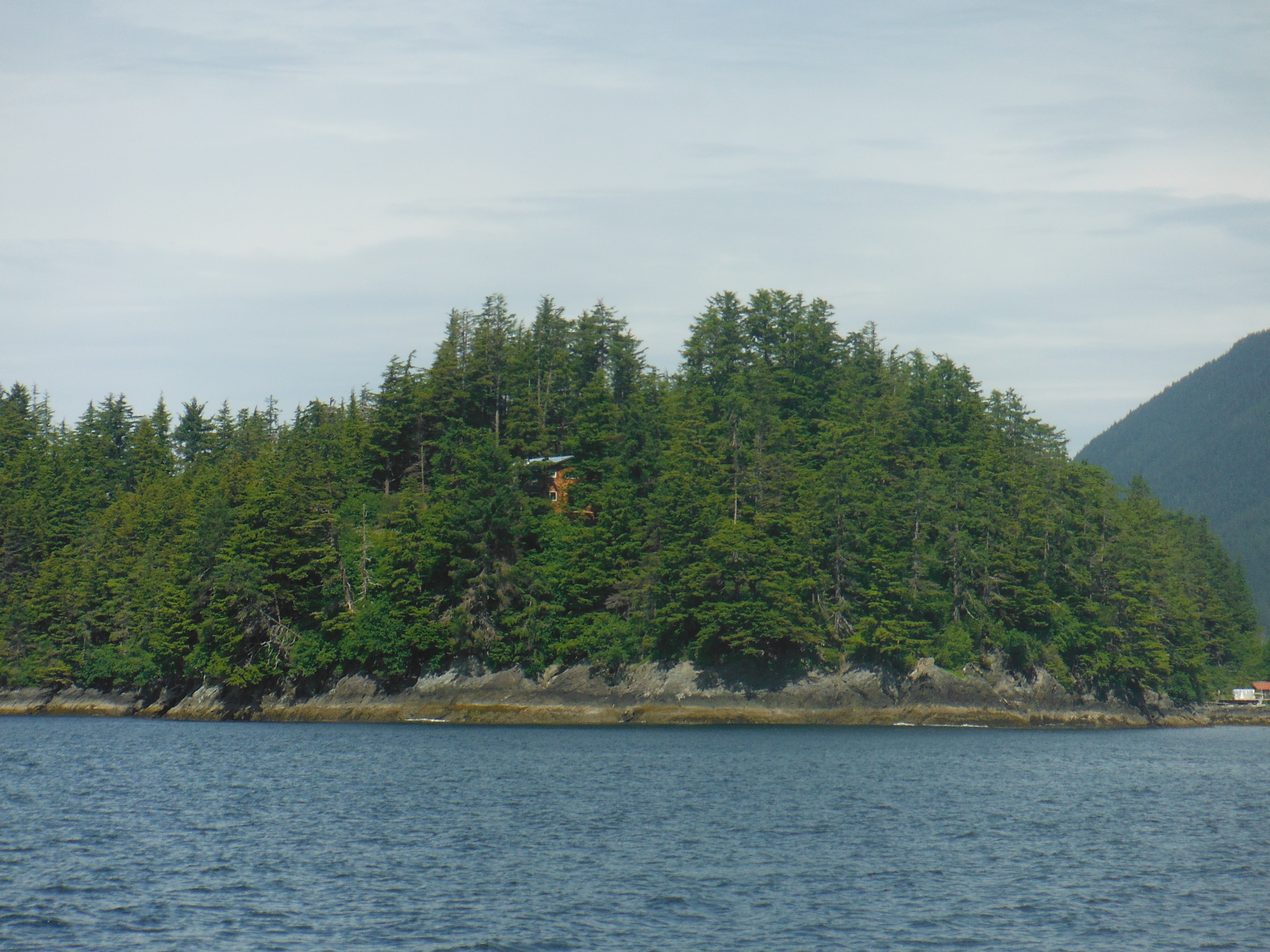
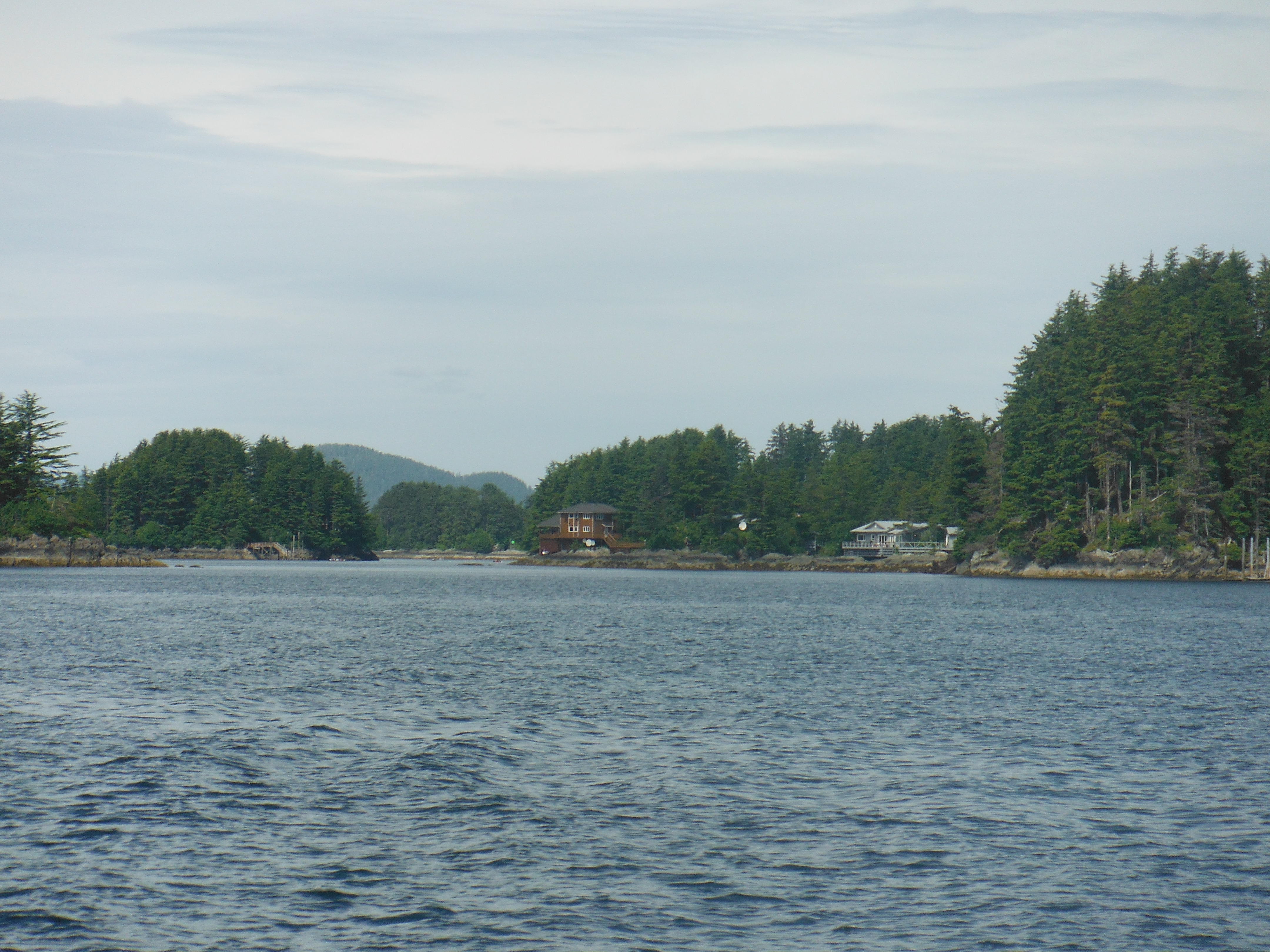
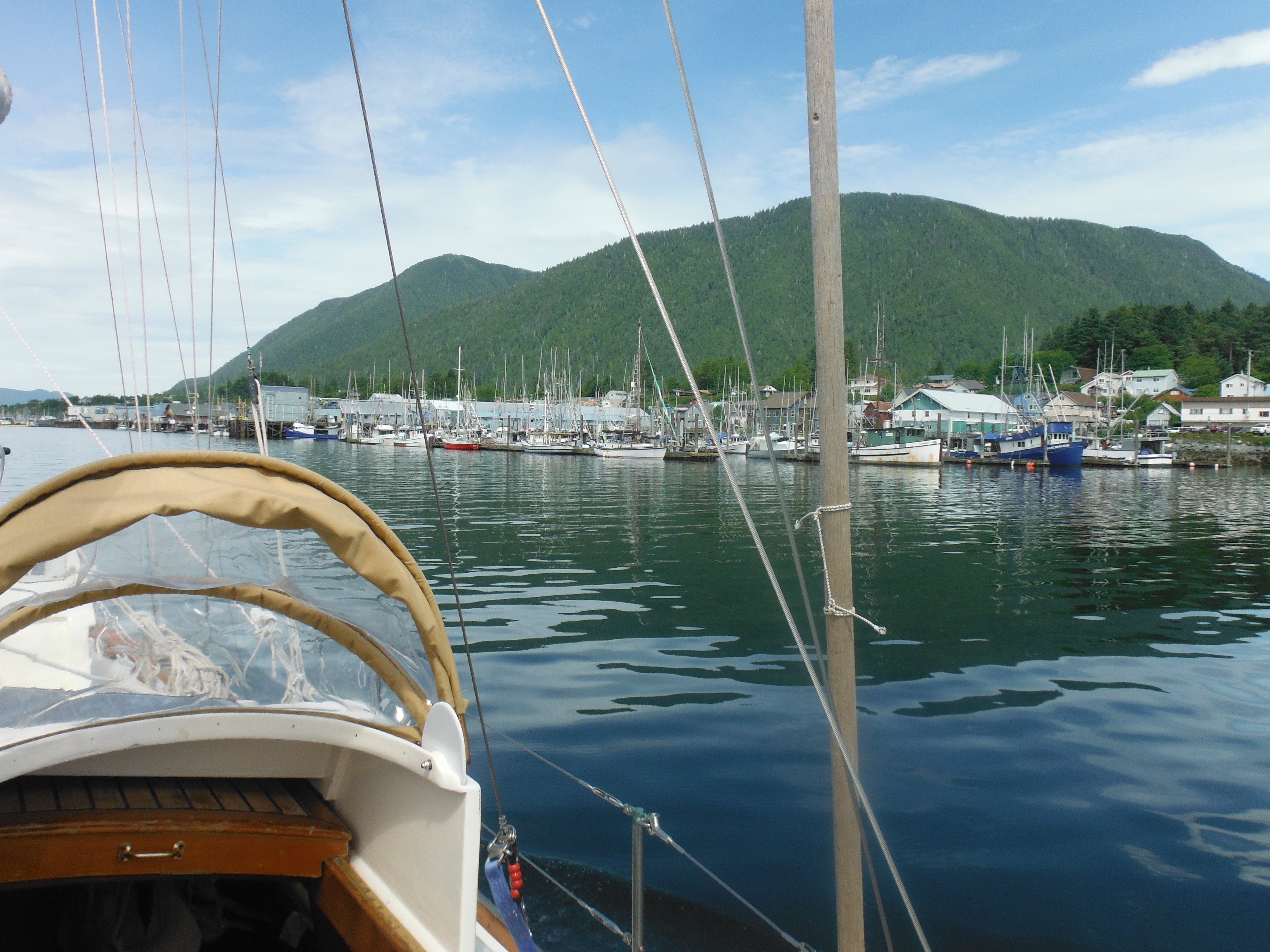
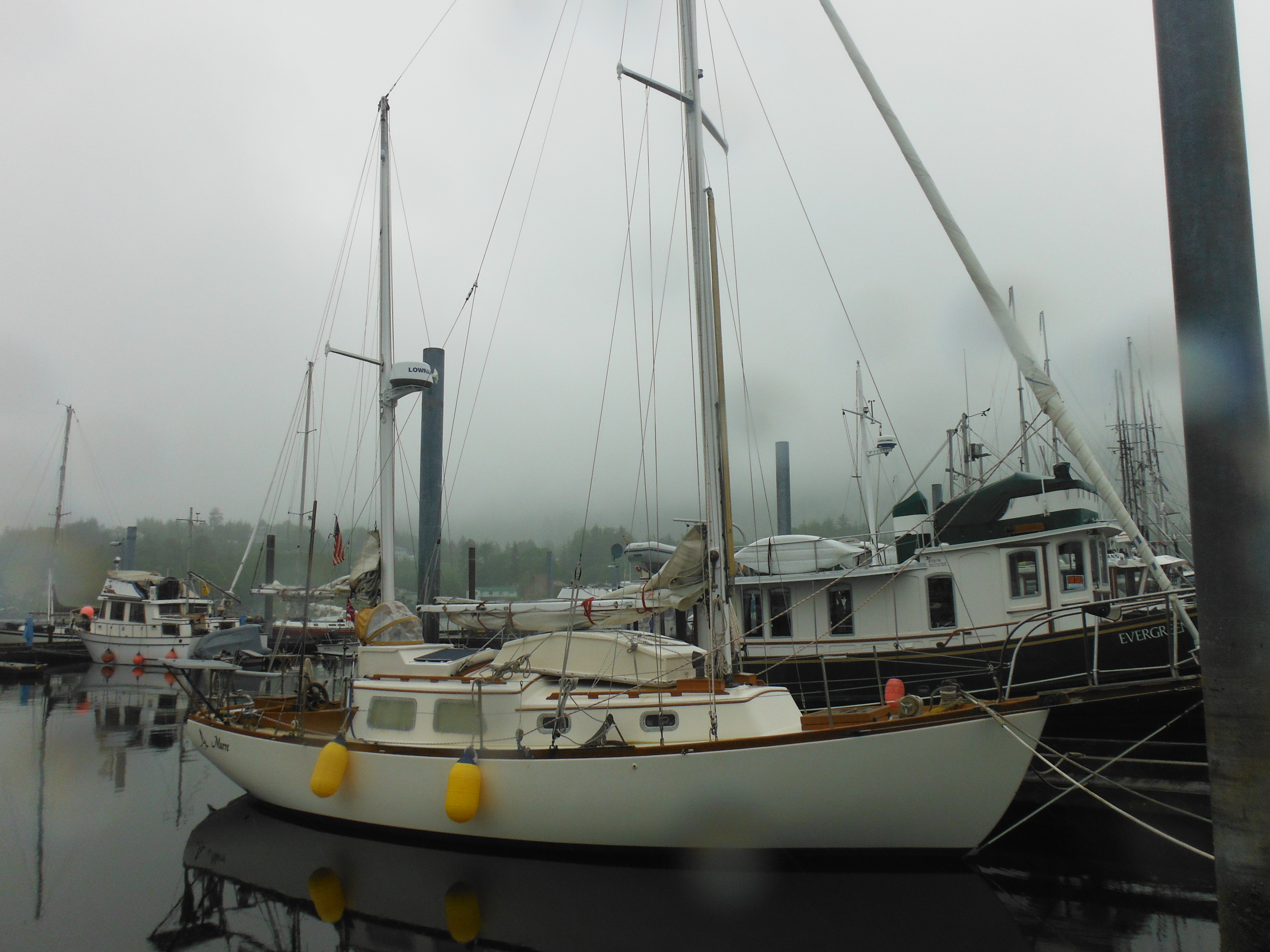
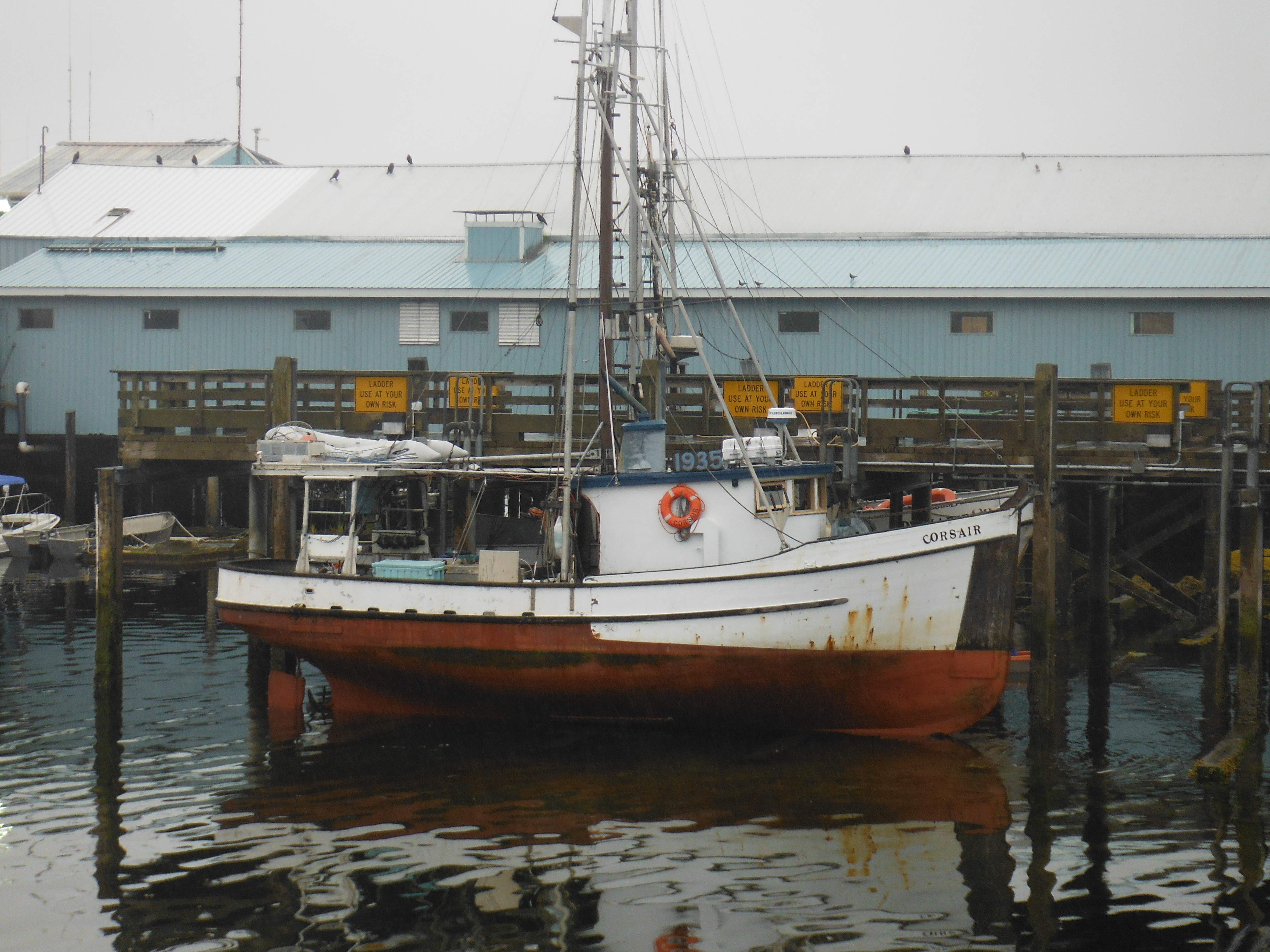
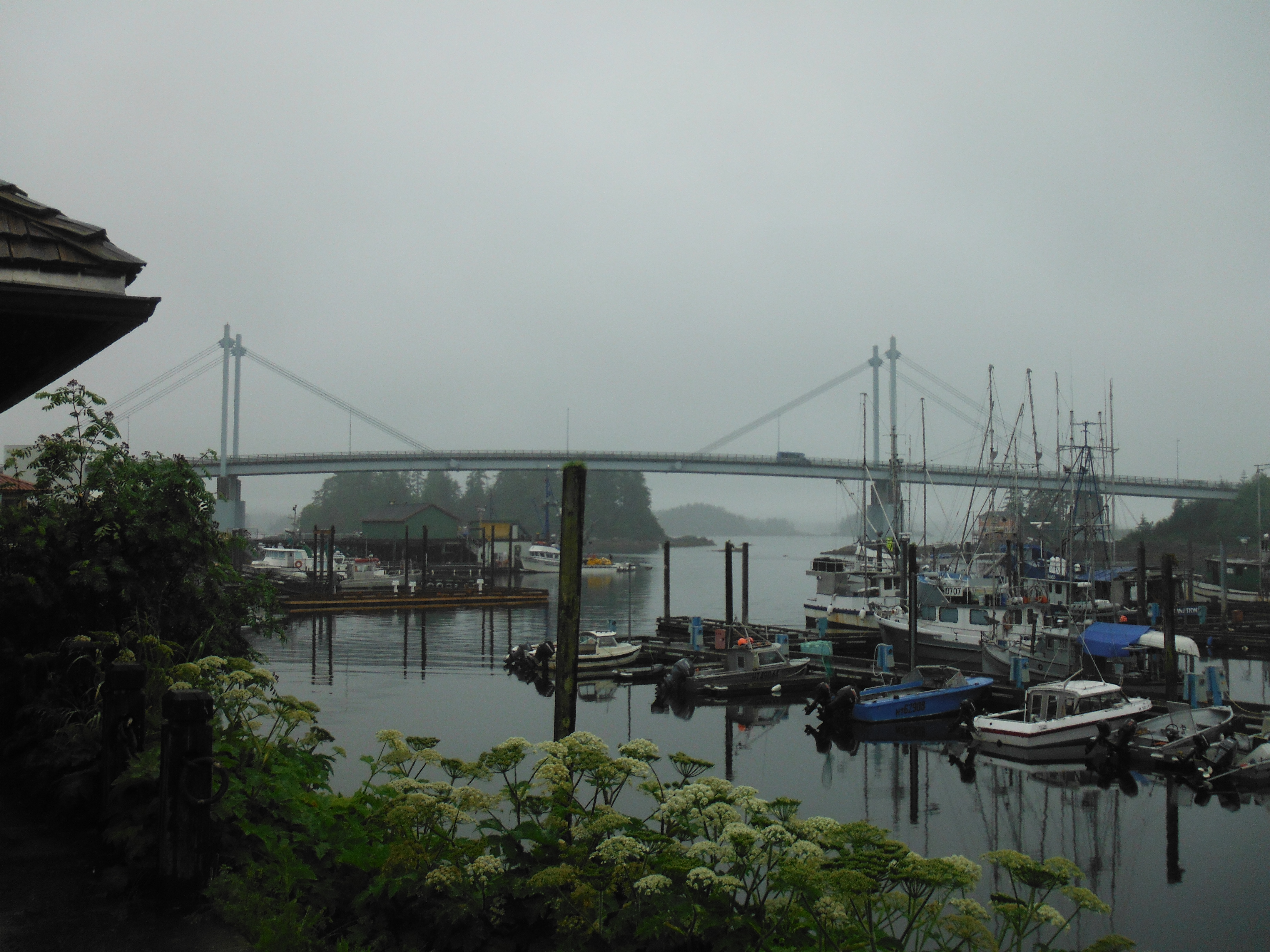
I remain near the docks my first few days in Sitka.
Stretching from old St. Peter’s By-The-Sea on the east side of town to well past the bridge and the Coast Guard station and way down the channel to the west, these docks are the area’s main feature after subtracting out the mountains. In Sitka there is one boat slip for every eight of its 8,000 residents, a proportion not seen by Murre and me in all of our travels. Sitka has more slips to rent than it has apartments or hotel rooms.
But that’s not why I can’t pull away.
The fishing fleet is in. The King Salmon season has closed and Cojo opens in just a few days. The harbor is jammed with seiners and trawlers of all kinds making last minute preparations, and I wander this city of workboats content never to go further ashore than the pub. My own private heaven is floating here.
These were the boats that captured my imagination as a child, and to me they still seem the perfect combination of purposefulness and grace, individuality and efficiency. I think of Jeffers Boats in Fog: “It is bitter earnestness that makes beauty, the mind knows, grown adult,” he says of similar boats and their fishermen of Monterey. After the romance fades, when the work is just work and not even very profitable, still there is the beauty of the boat, her ability, her fitness, even when the fish are gone.
I am old enough to know better, yet I want immediately to sell Murre, to buy an old wooden trawler, to become a full-time fisherman. I make the mistake of describing this fantasy to my wife and receive a veto whose earnestness and efficiency nears the deadly.
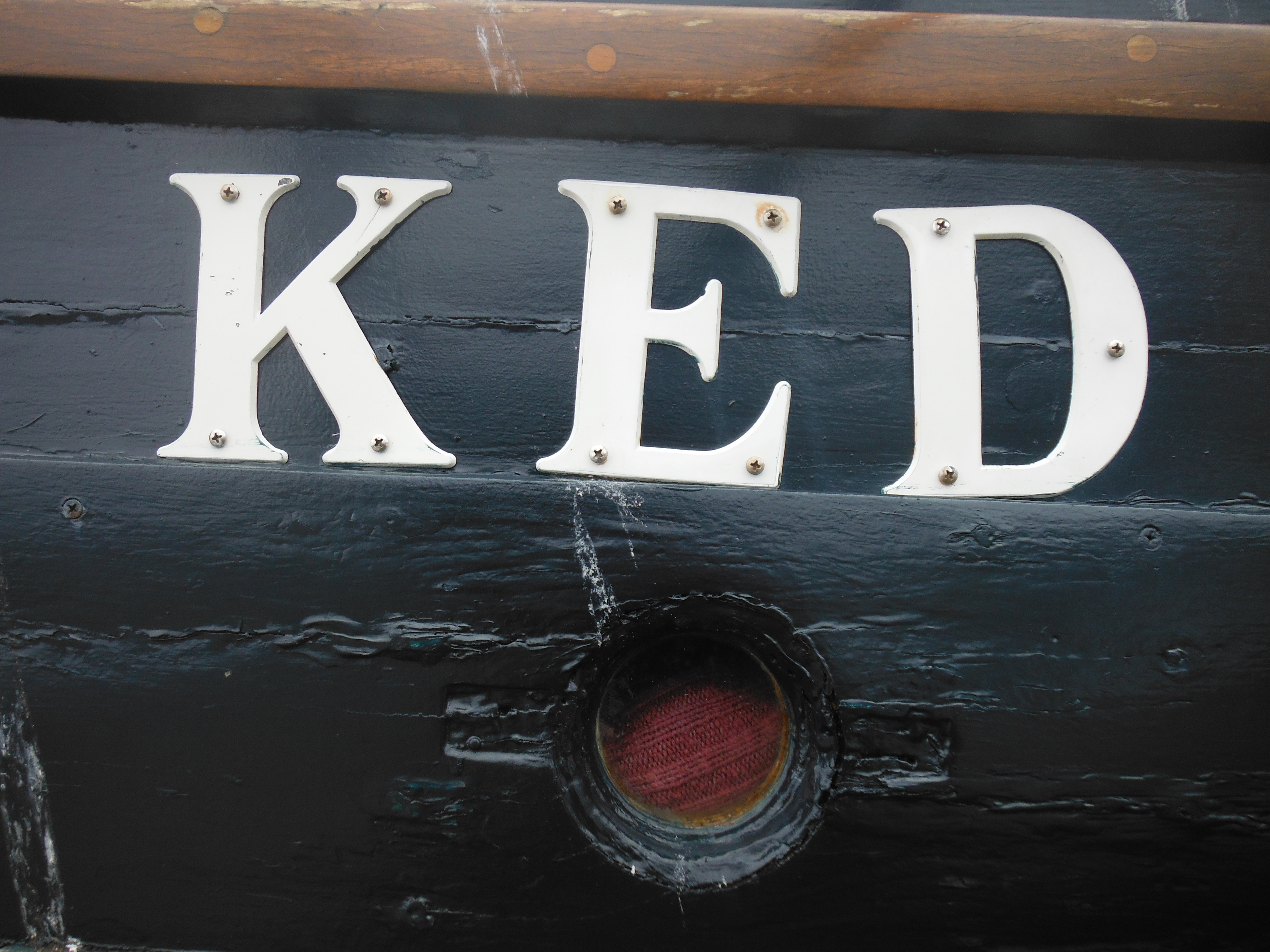
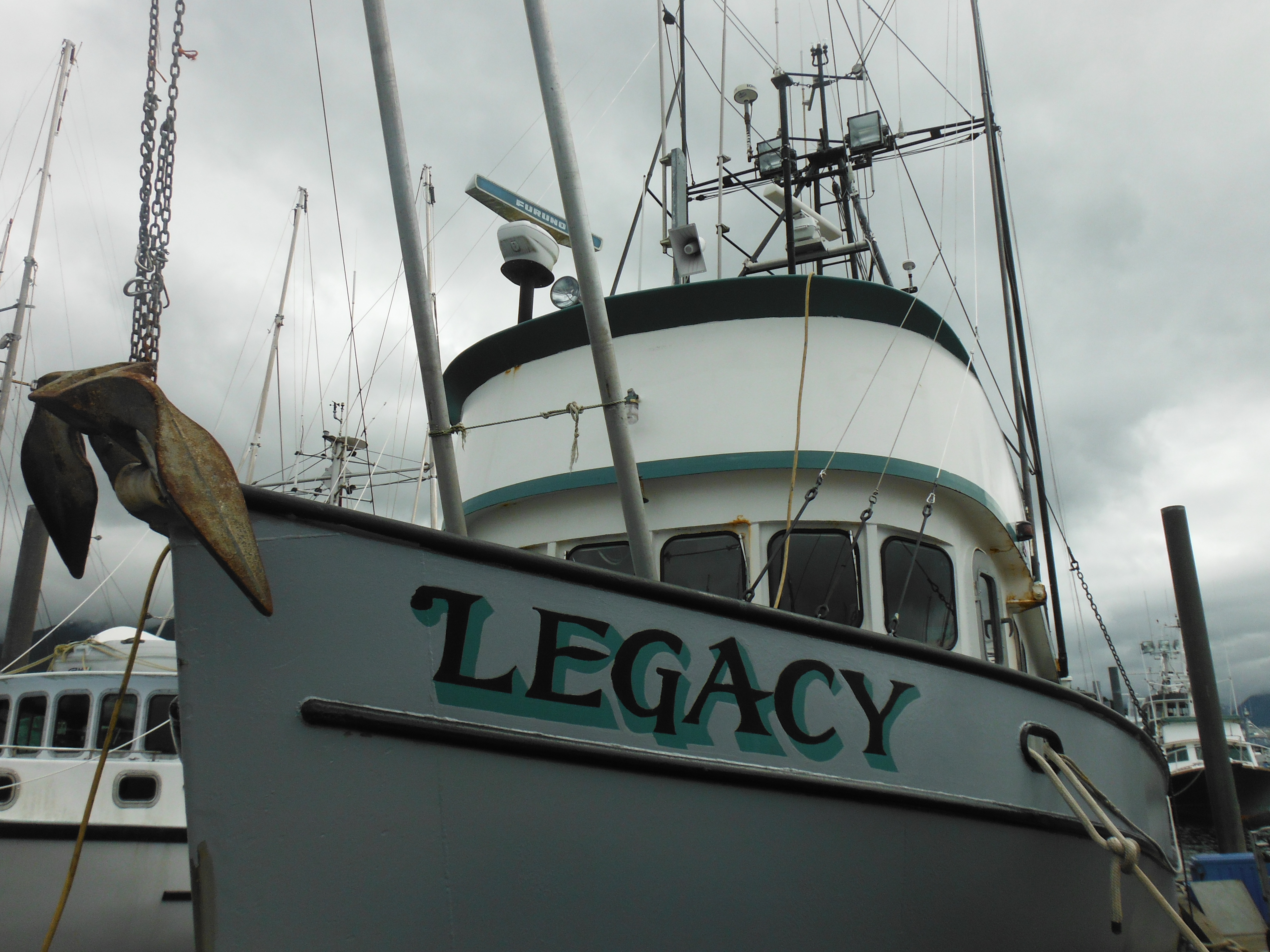
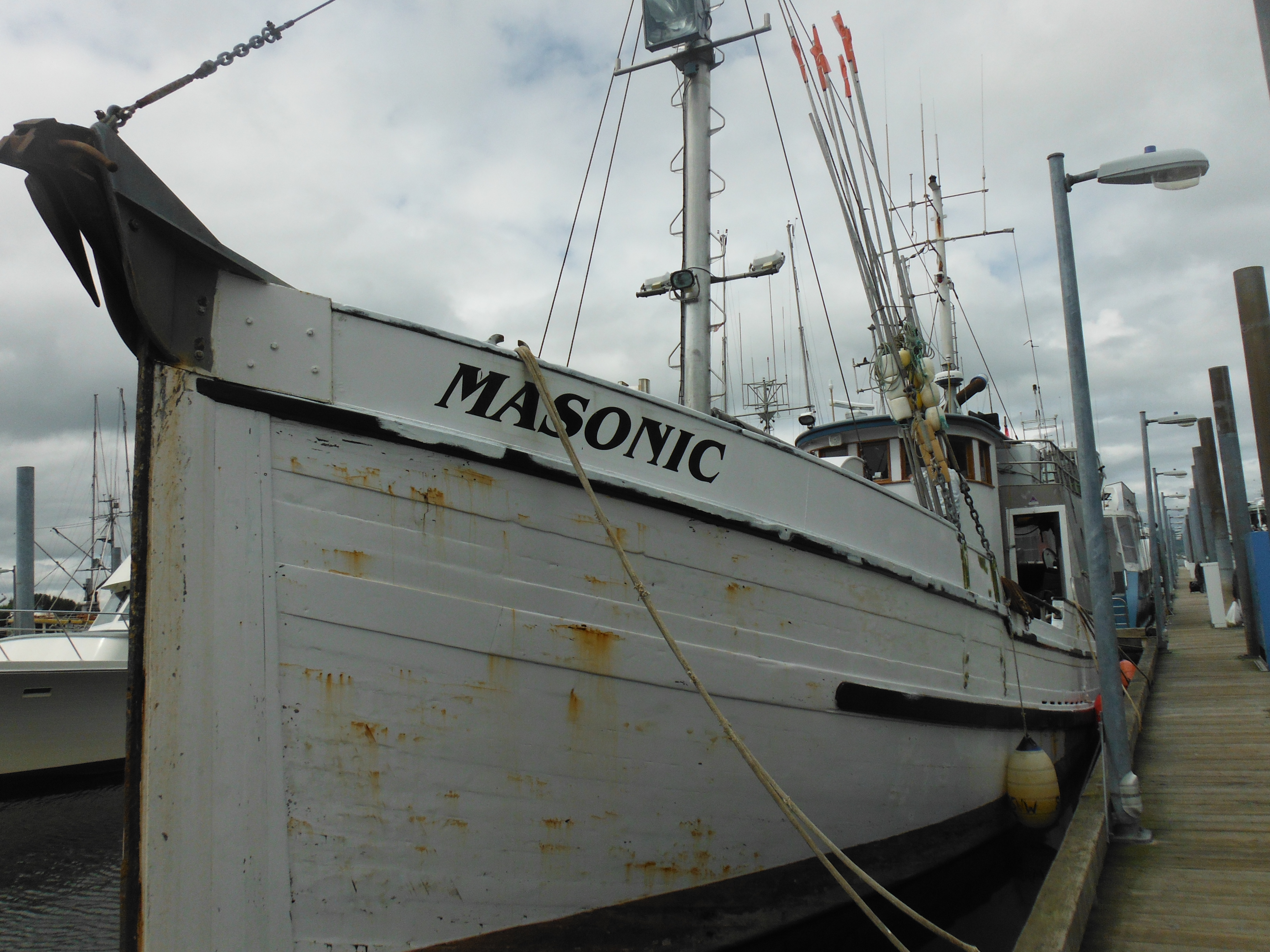
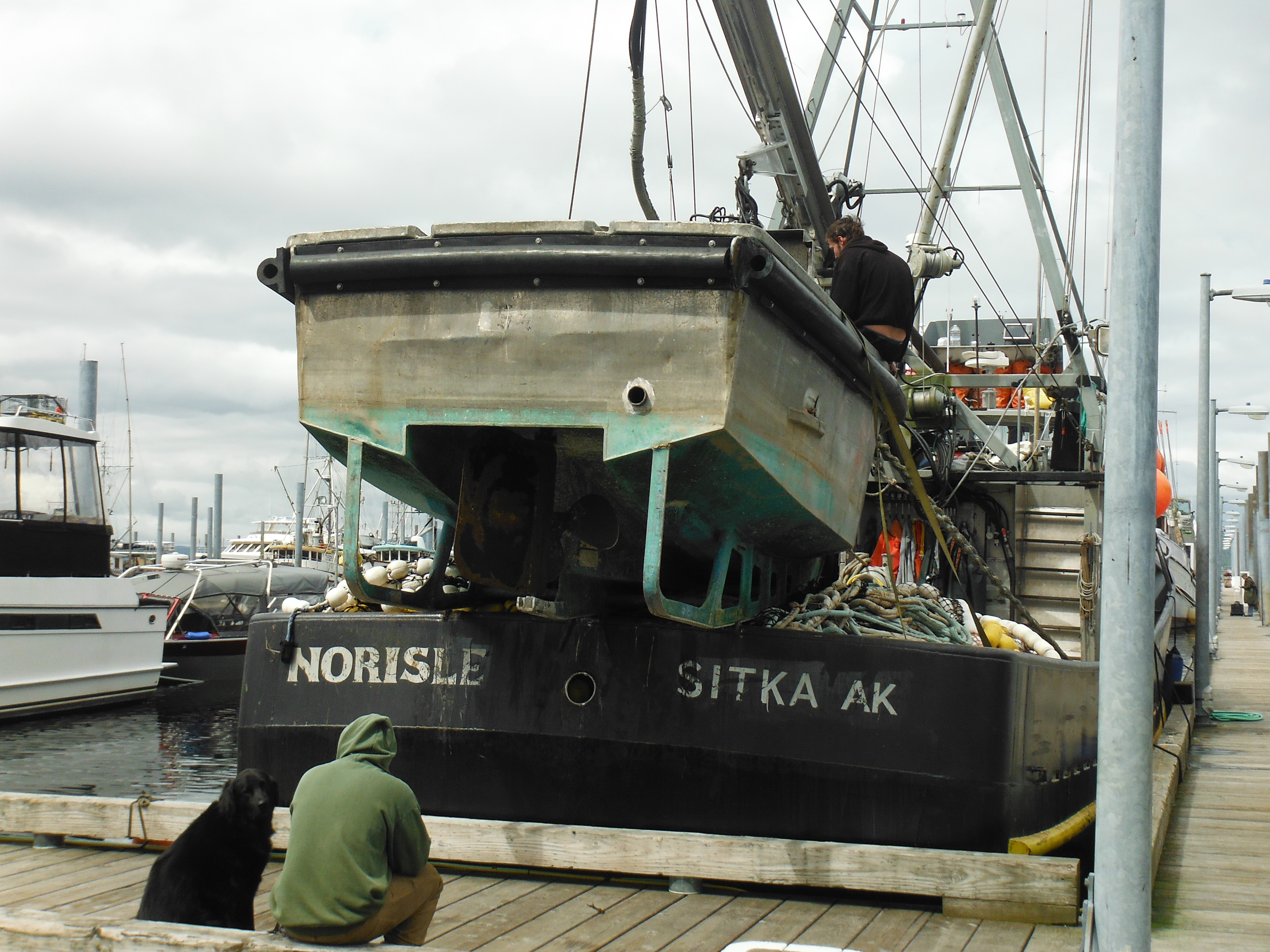
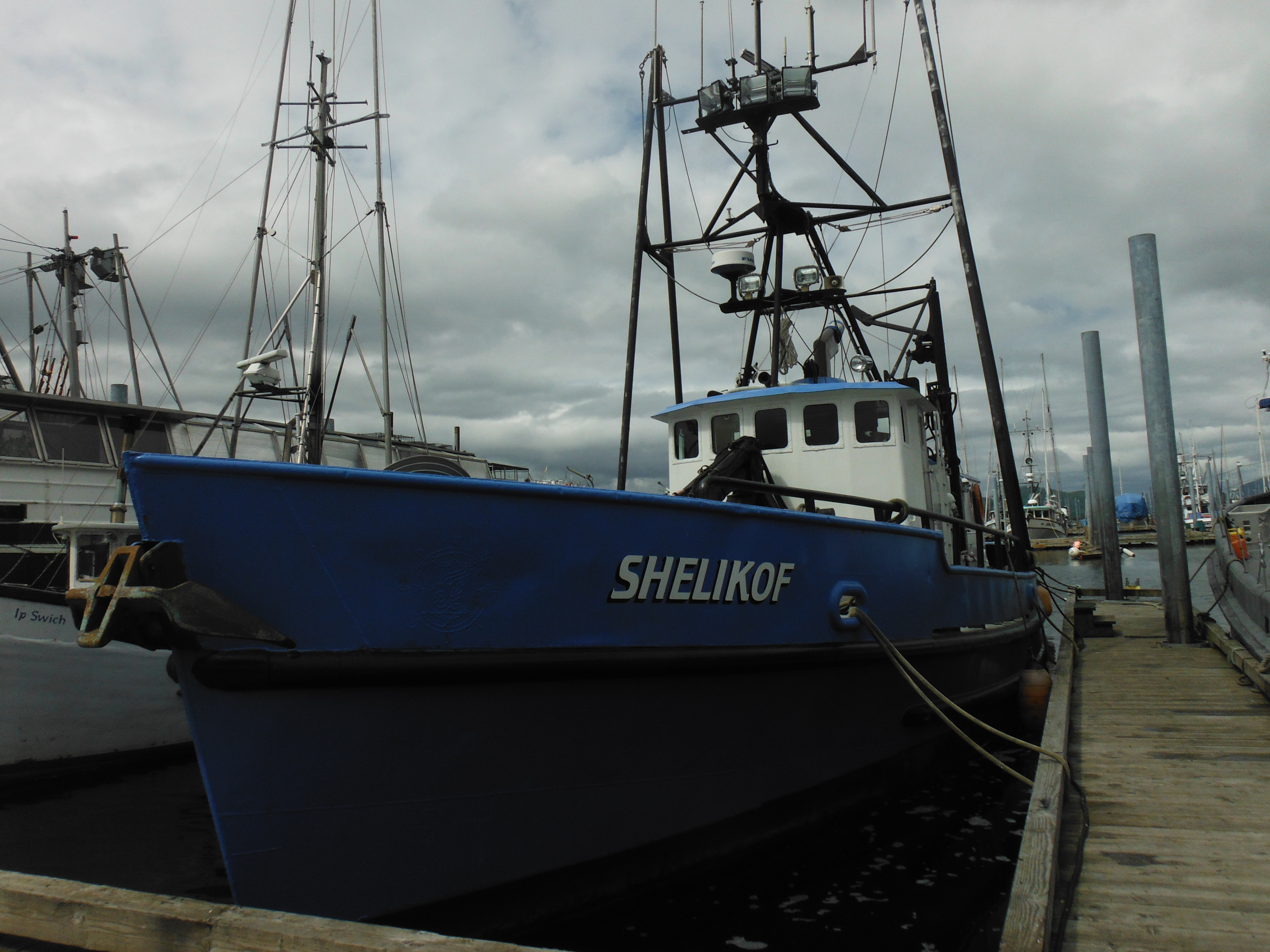
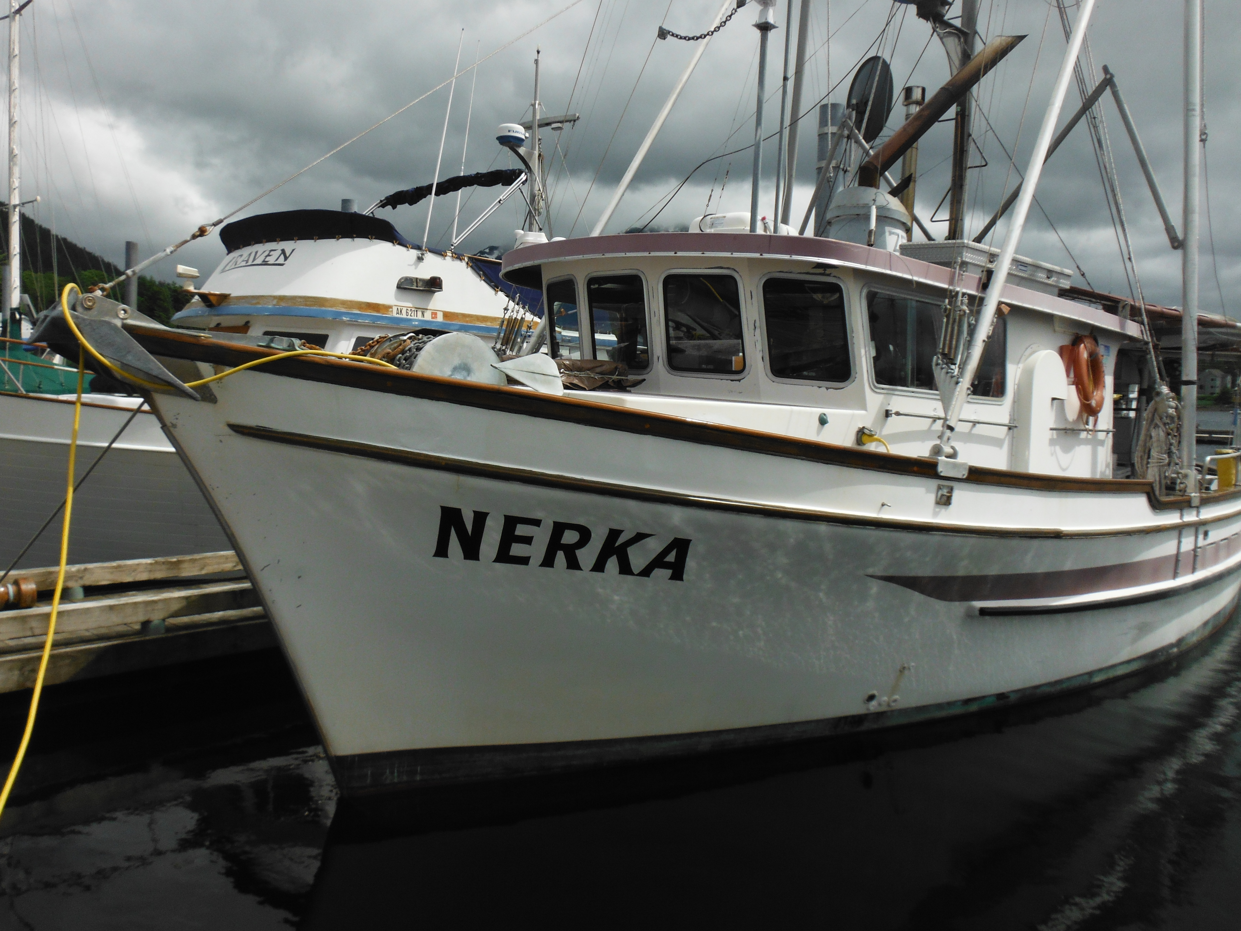
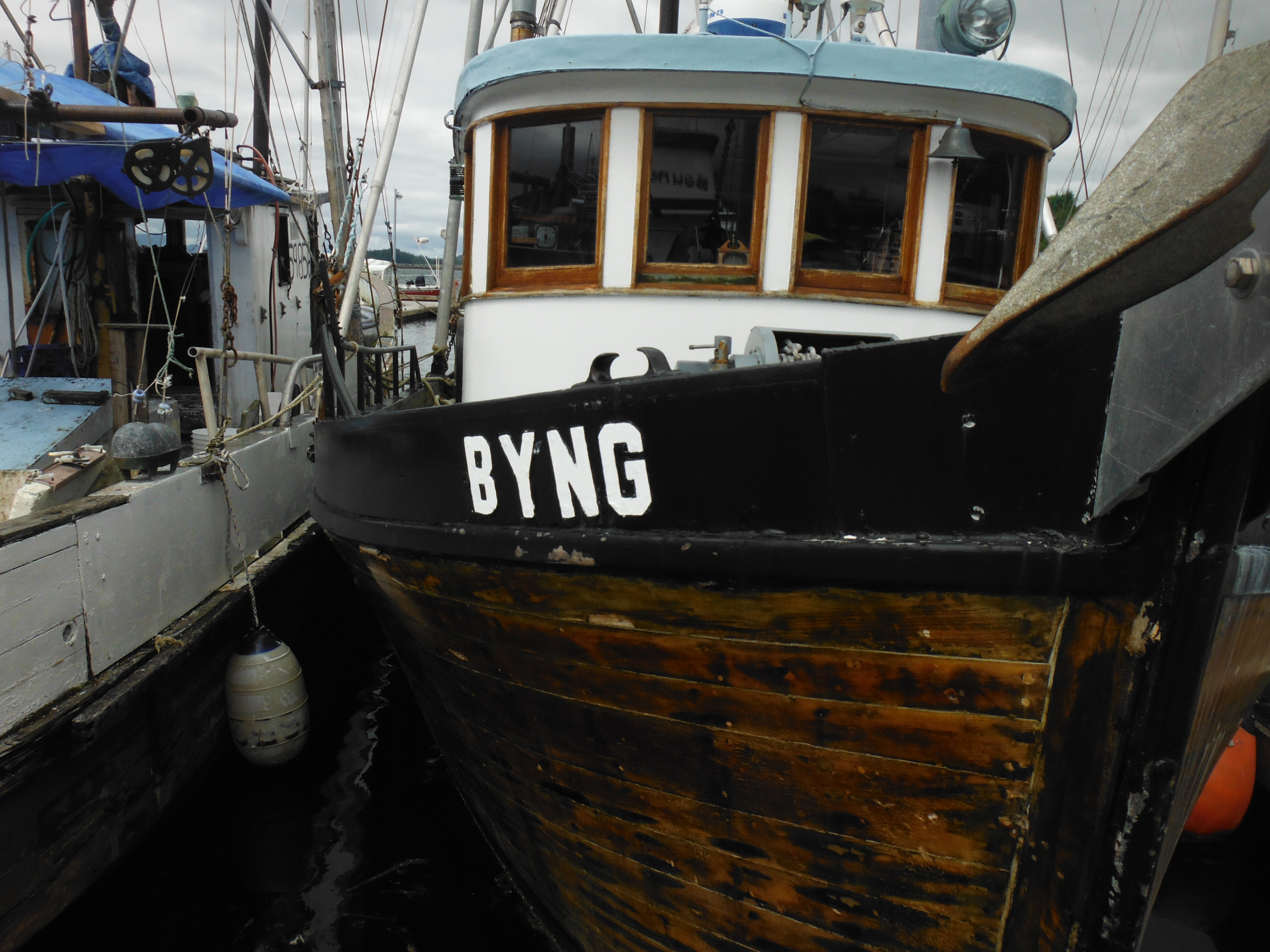
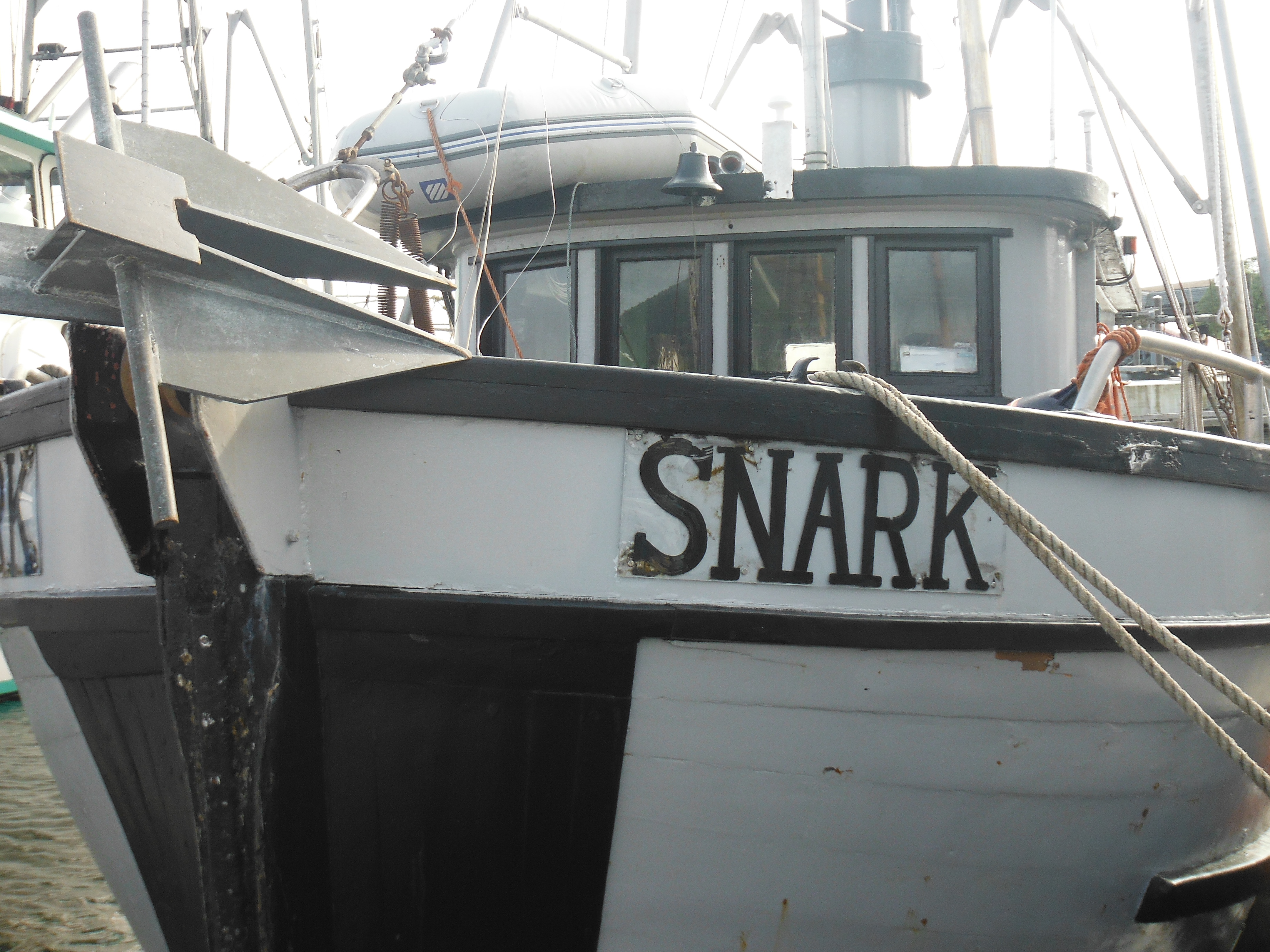
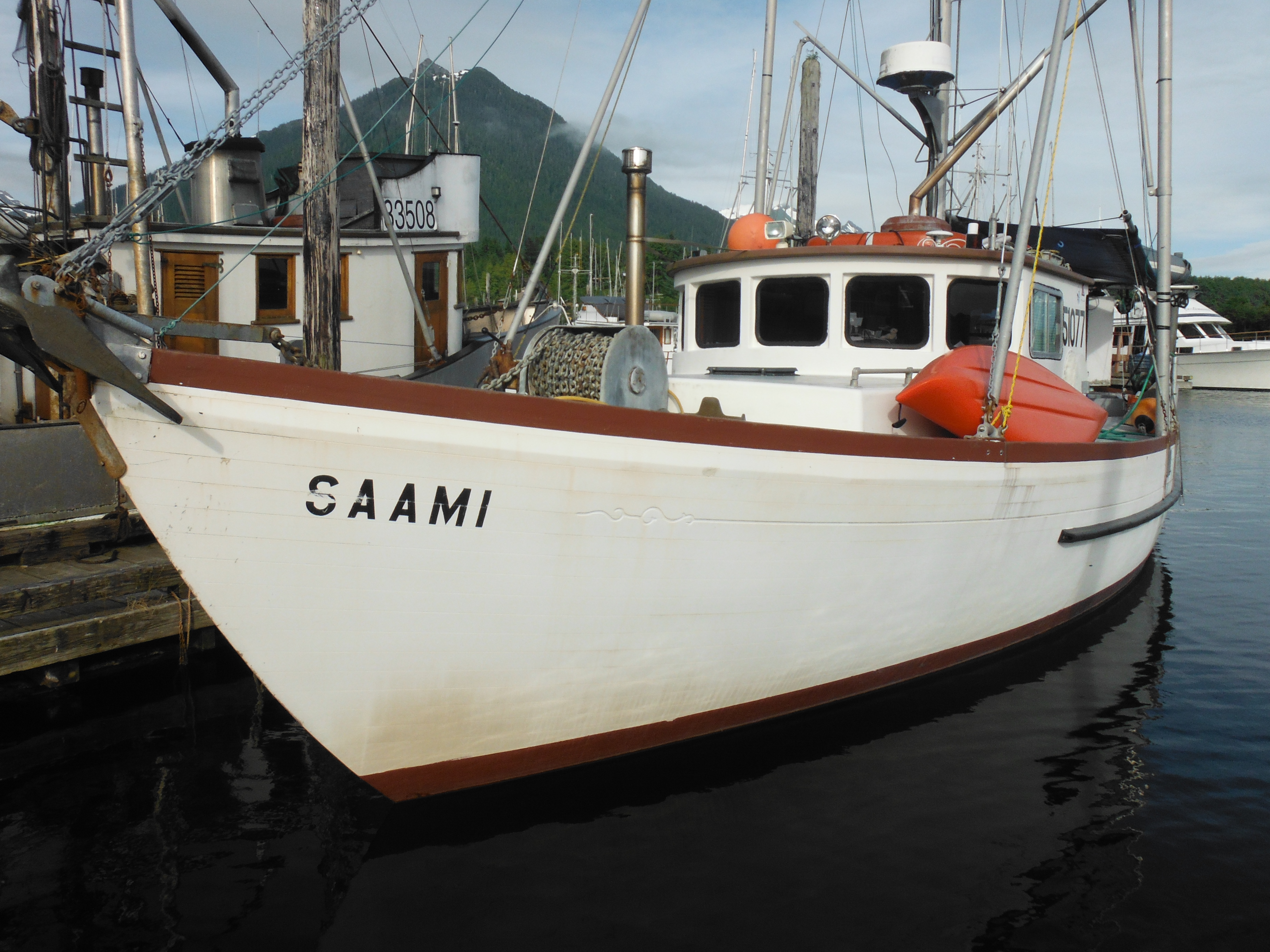
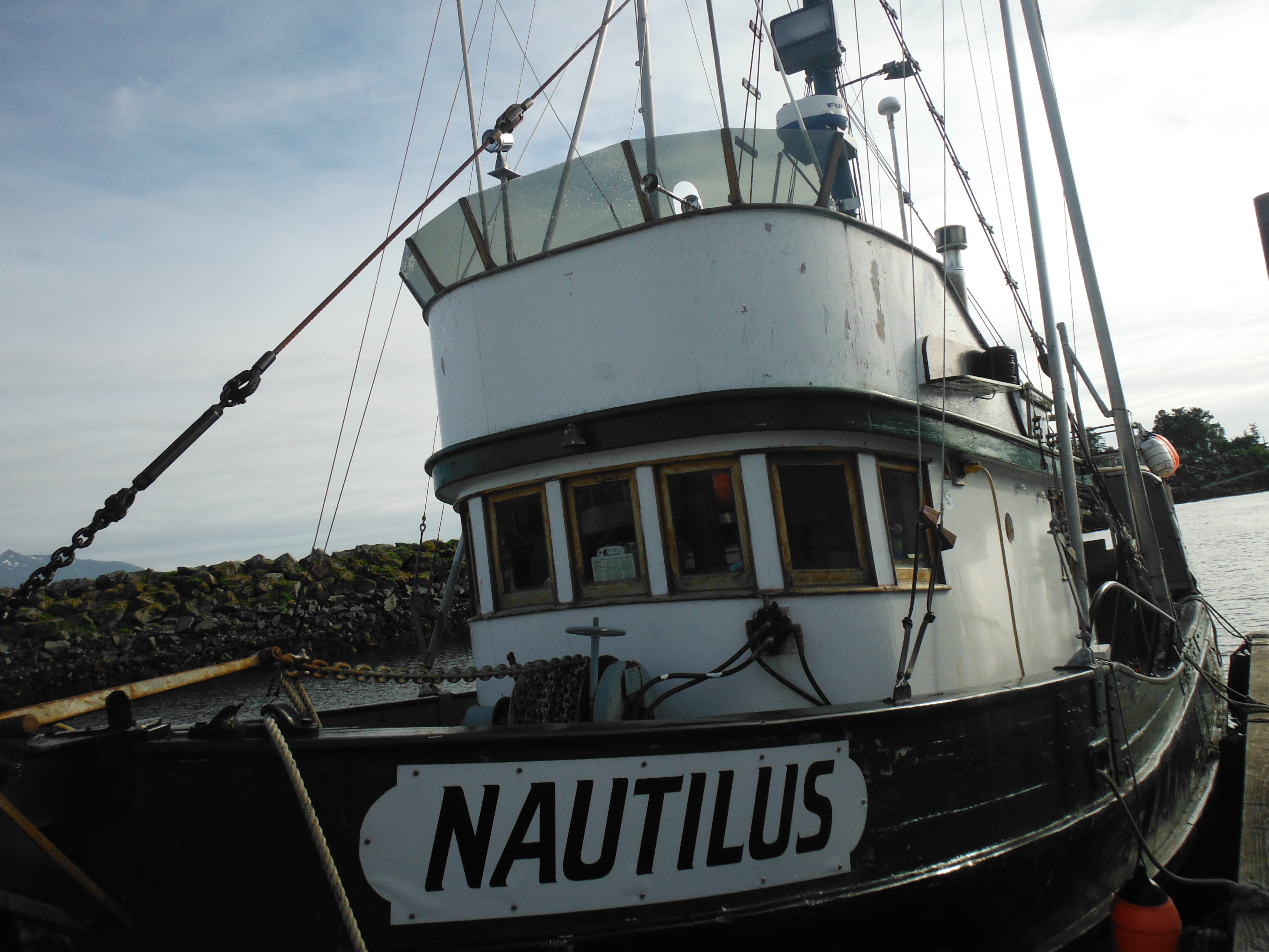
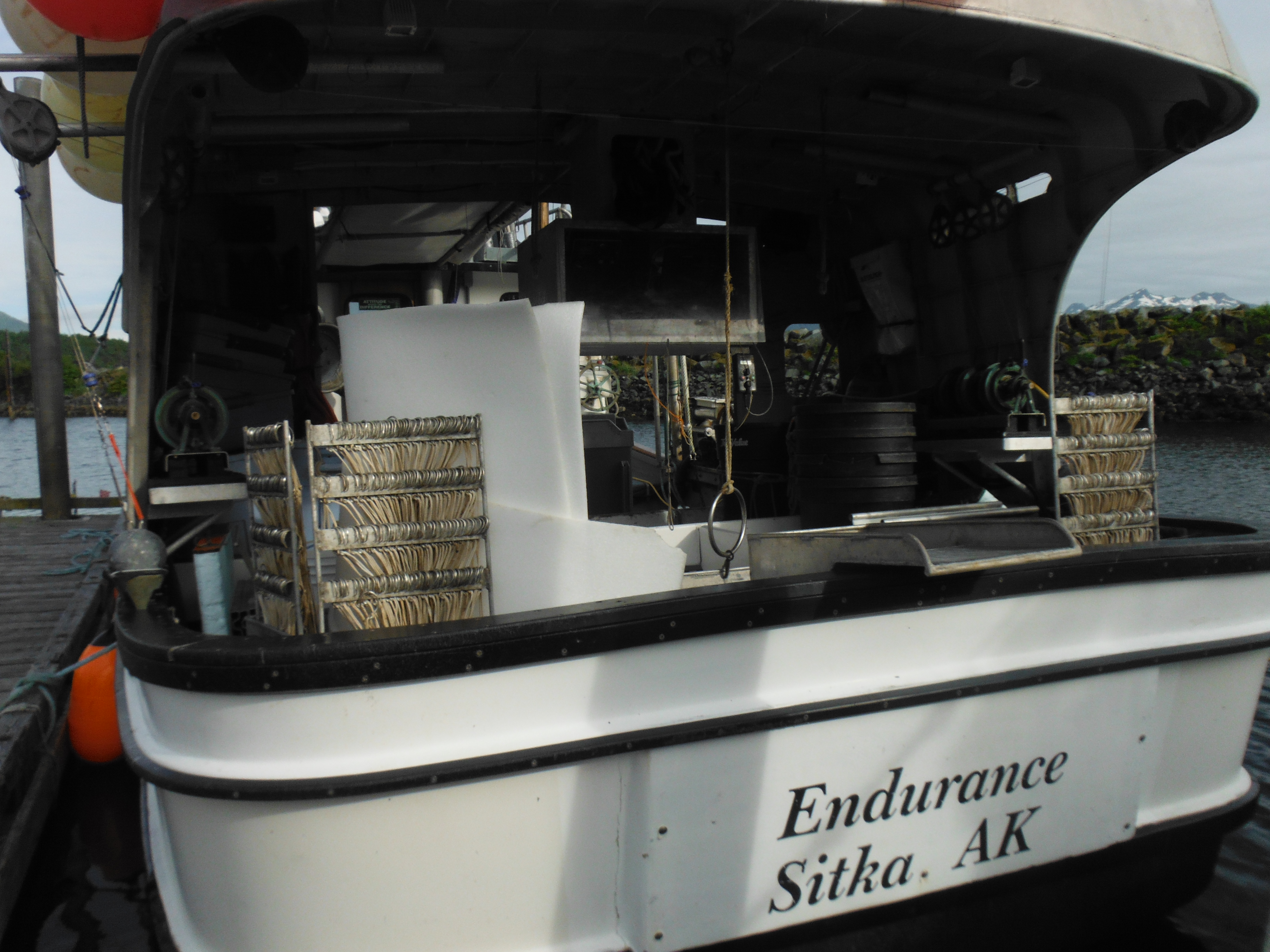
The uniqueness of each boat is carried right through to the name, as if the owner could see to the heart of the matter or the boat, a clairvoyant of her own destiny…
CLICK TO ENLARGE


Hawaii to Alaska, The Passage in Pictures
First, thank you to all who have commented on this blog with encouragement or concern or, sometimes, sarcasm during the passage north. I don’t receive comments while underway–my primitive email system is already overtaxed–but I have now read through all your remarks with enjoyment. I will comment back in some cases in the coming days.
Second, the transition into life near dry land (just a short walk) is almost complete. The boat and her crew are washed–the latter several times in a hot shower that costs “six quarters for seven minutes”. Order in the cabin has been returned to something approaching the domestic, the hammocks are aswing with fresh vegetables, the trundle to the laundromat accomplished, and the local brews sampled. Remaining only is the hunt for wifi–a critical problem for cruisers when in towns too small for Starbucks. In my case this article is coming to you from the local grocery store deli counter where the connection is pleasantly speedy and I need buy only one ham and cheese sandwich an hour to keep my account open.
So then, to serve as supplement to the logs, photographs of the passage from Hanalei Bay, Hawaii to Sitka, Alaska…
CLICK TO ENLARGE.
-
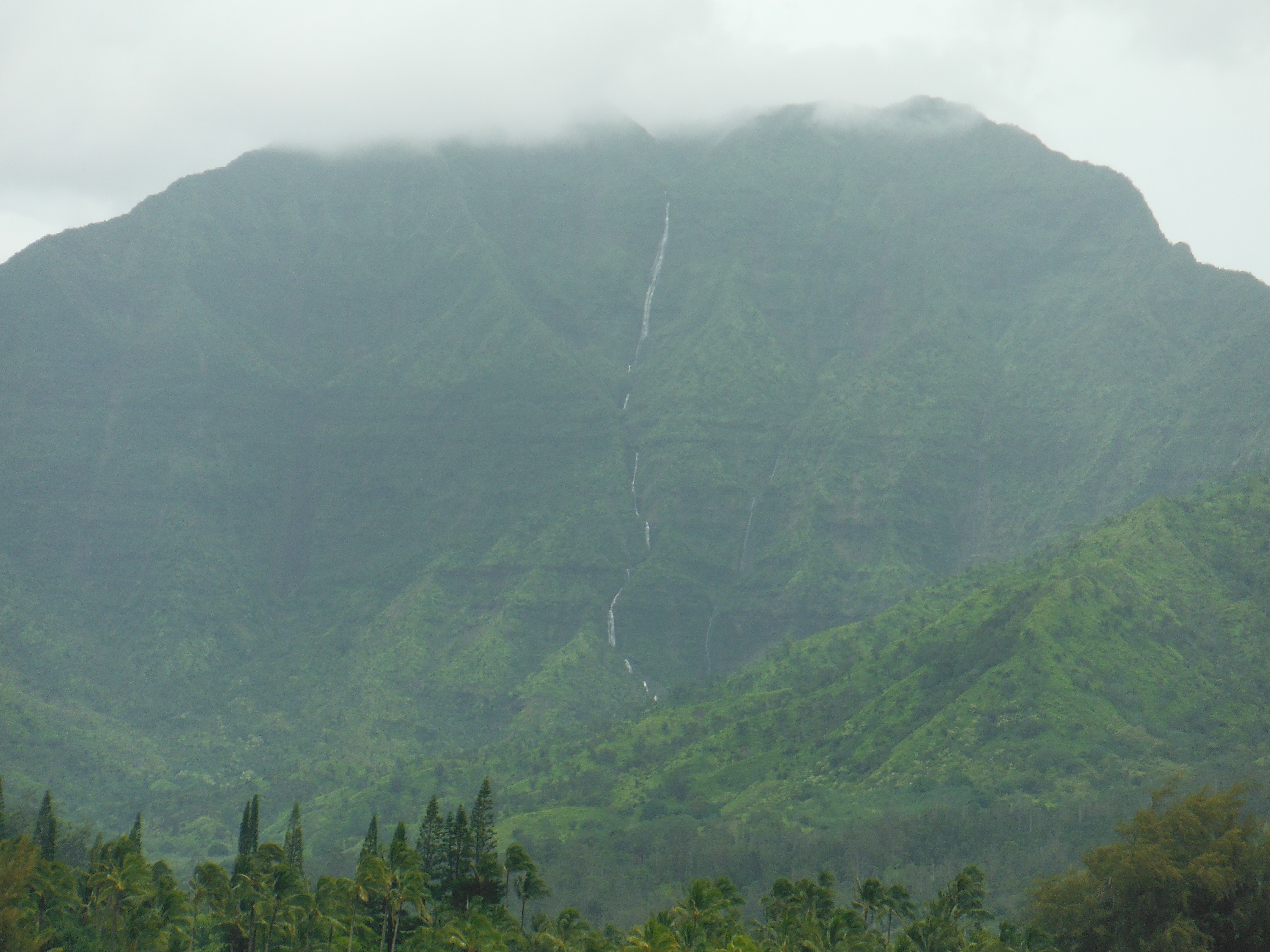
- Mountains above Hanalei Bay.

-
- Hanalei, pouring with rain.
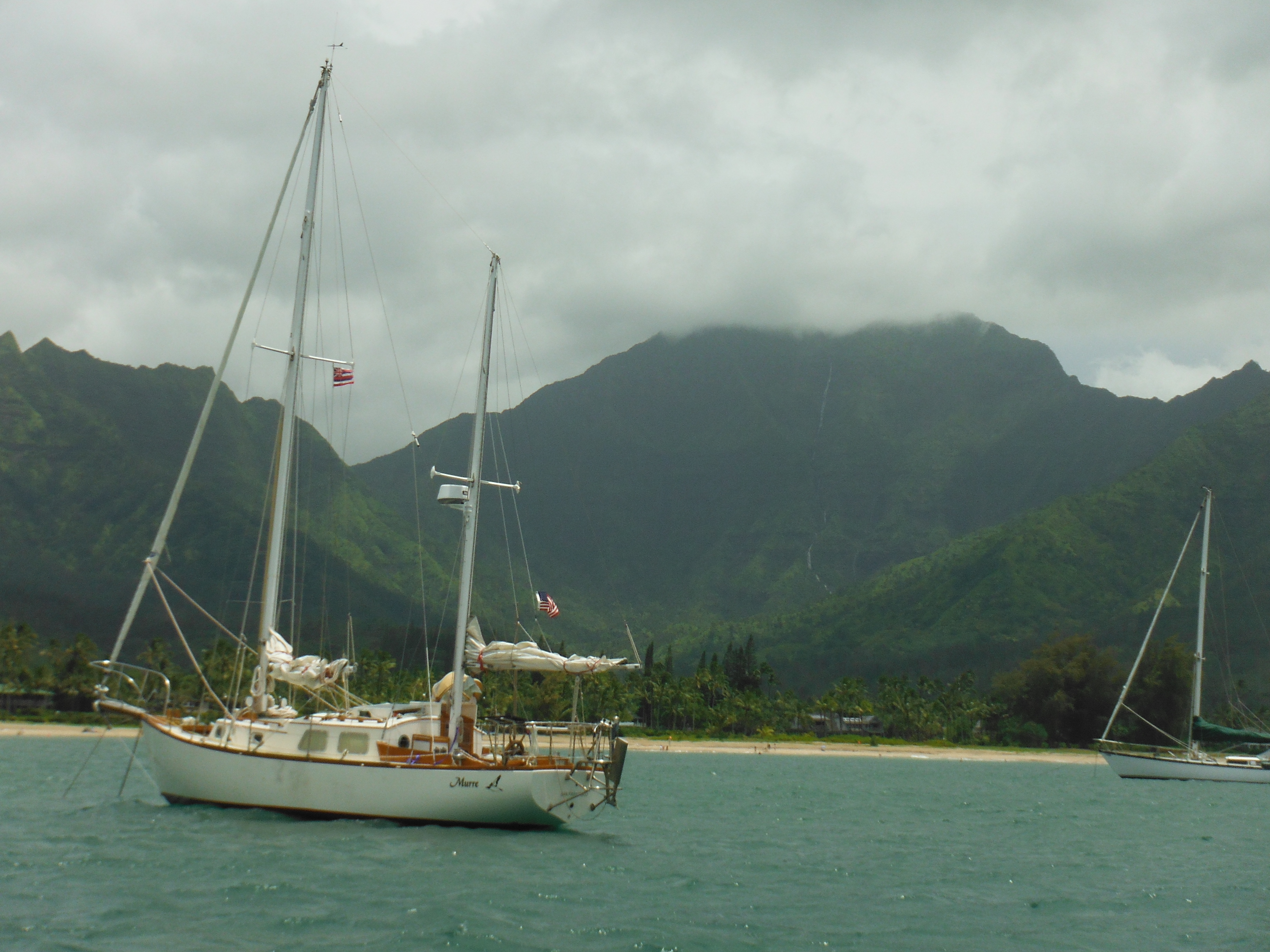
-

- Anchored Hanalei, awaiting our weather window.
-
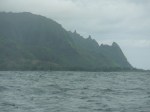
- Departure. Jagged Napali coast receeds.

-

- The view forward–open ocean.

-

- Strategy for first half of passage–up and to the left.

-

- Cabin was a wreck for several days.

-
- First morning after first night. So sleepy. So far to go.
-
- Oranges were the last item I bought…first to go bad. Not usual.

-
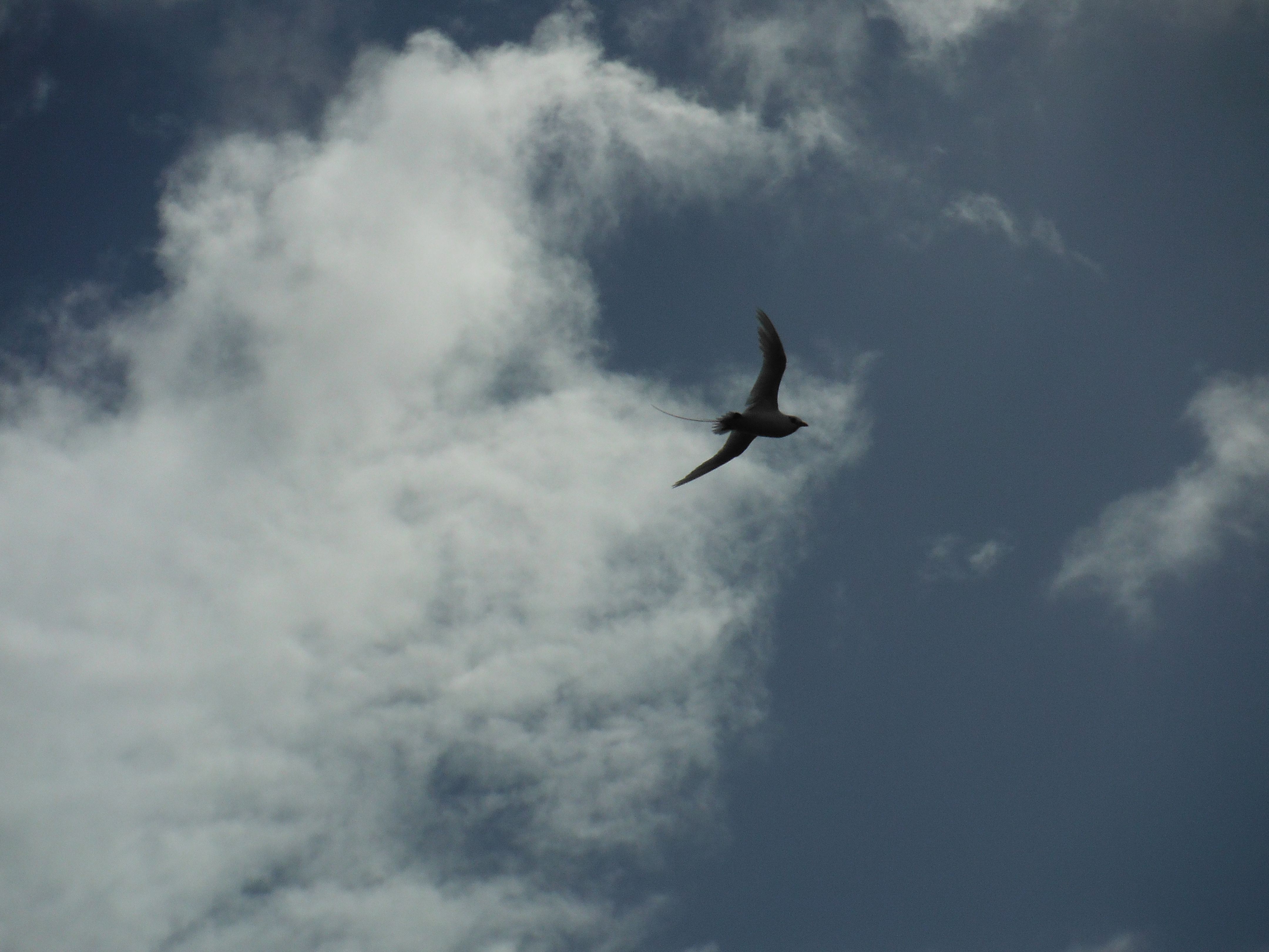
- A frequent visitor below 35N, the Tropic Bird
-
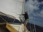
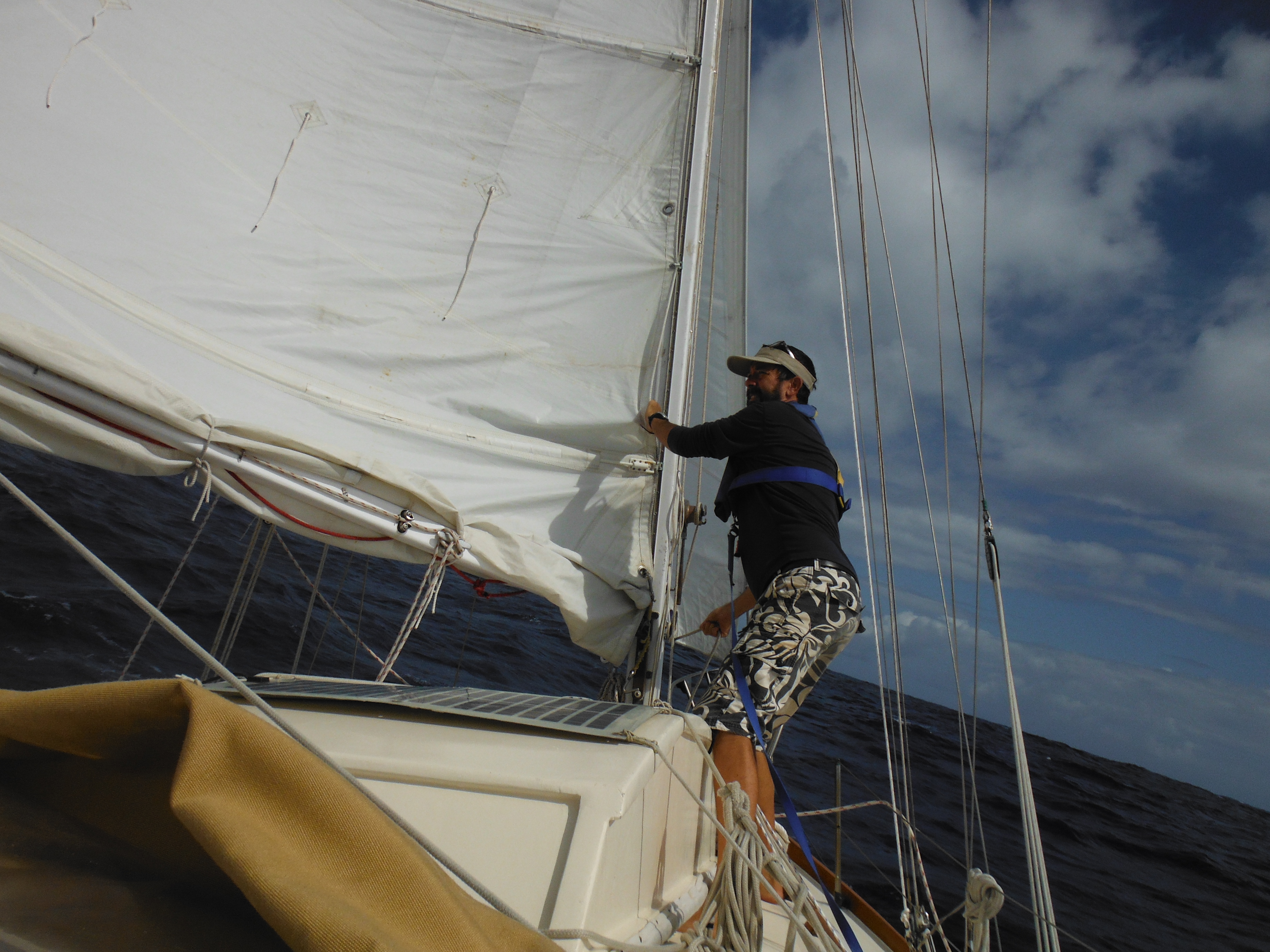
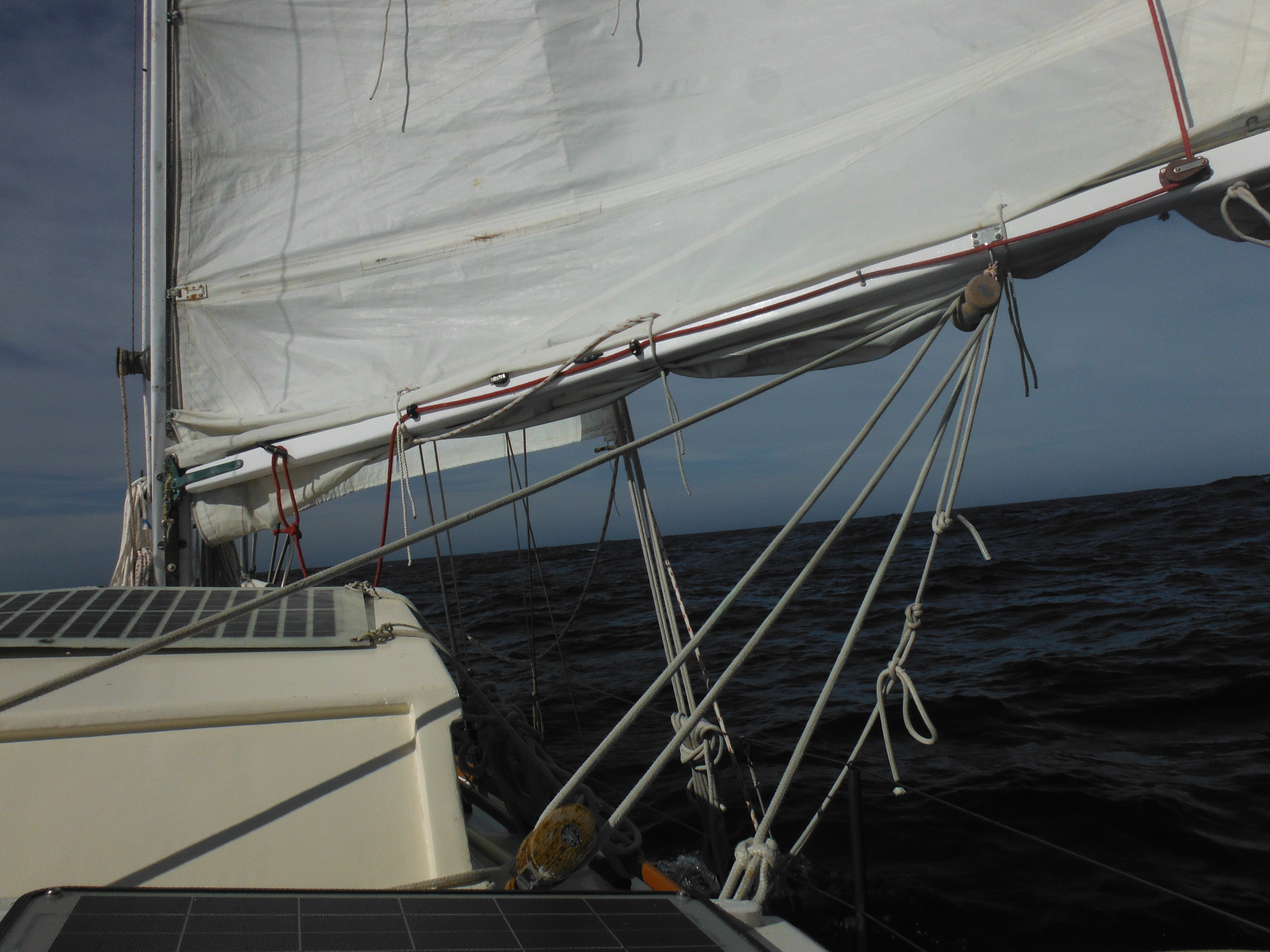
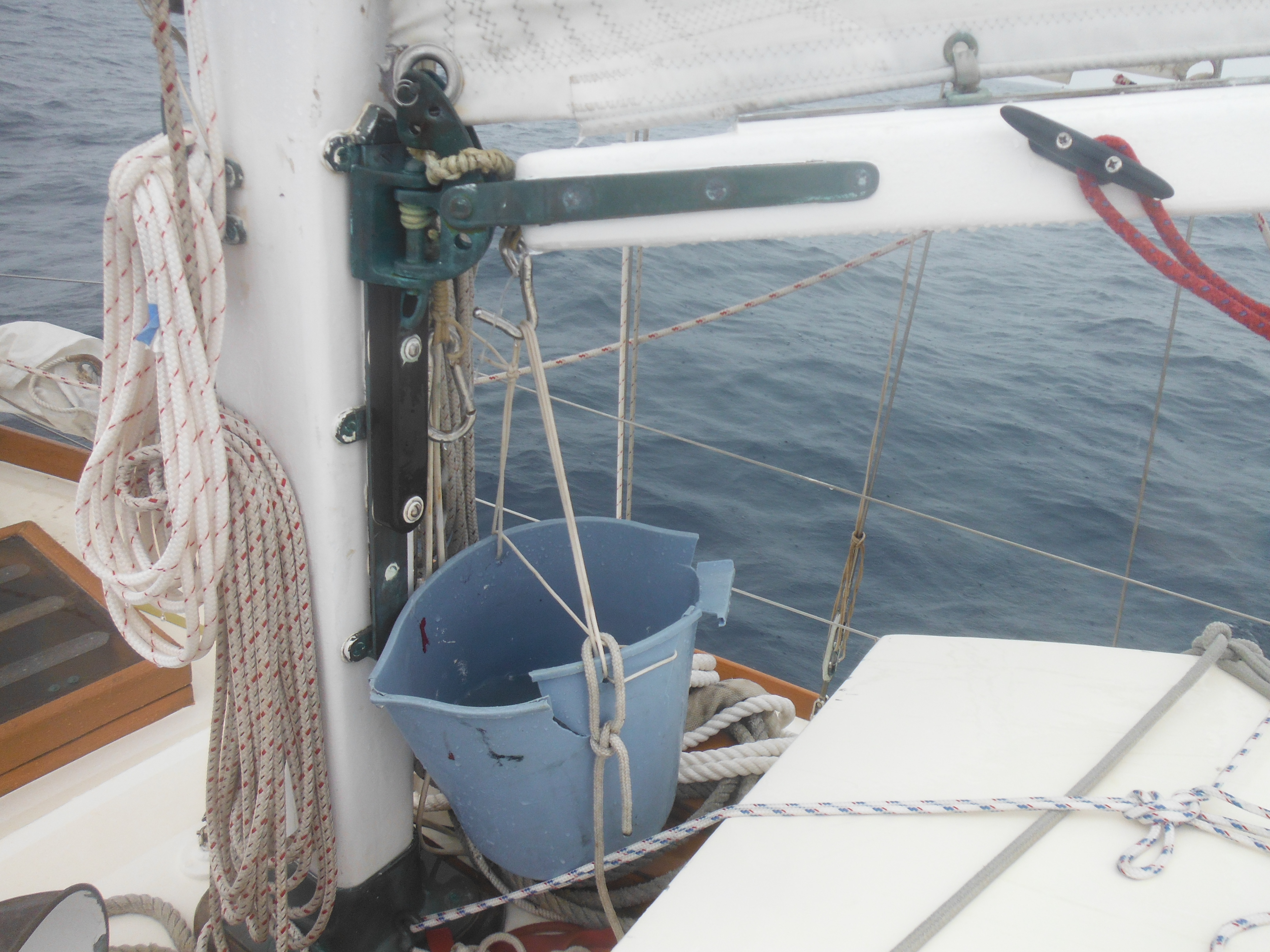
- Reefing sail.
-

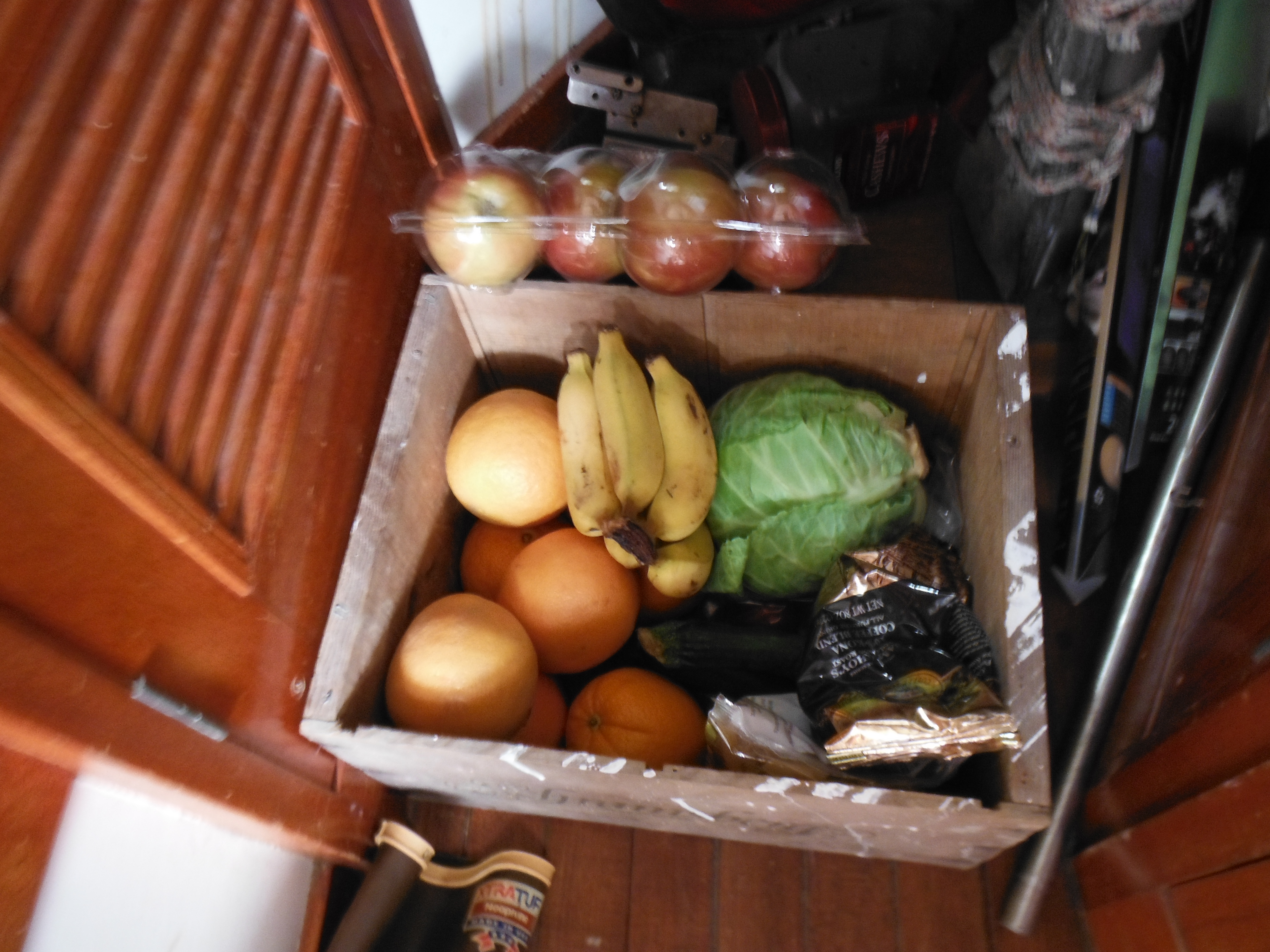
- The vegetable box. Not much this trip.
-

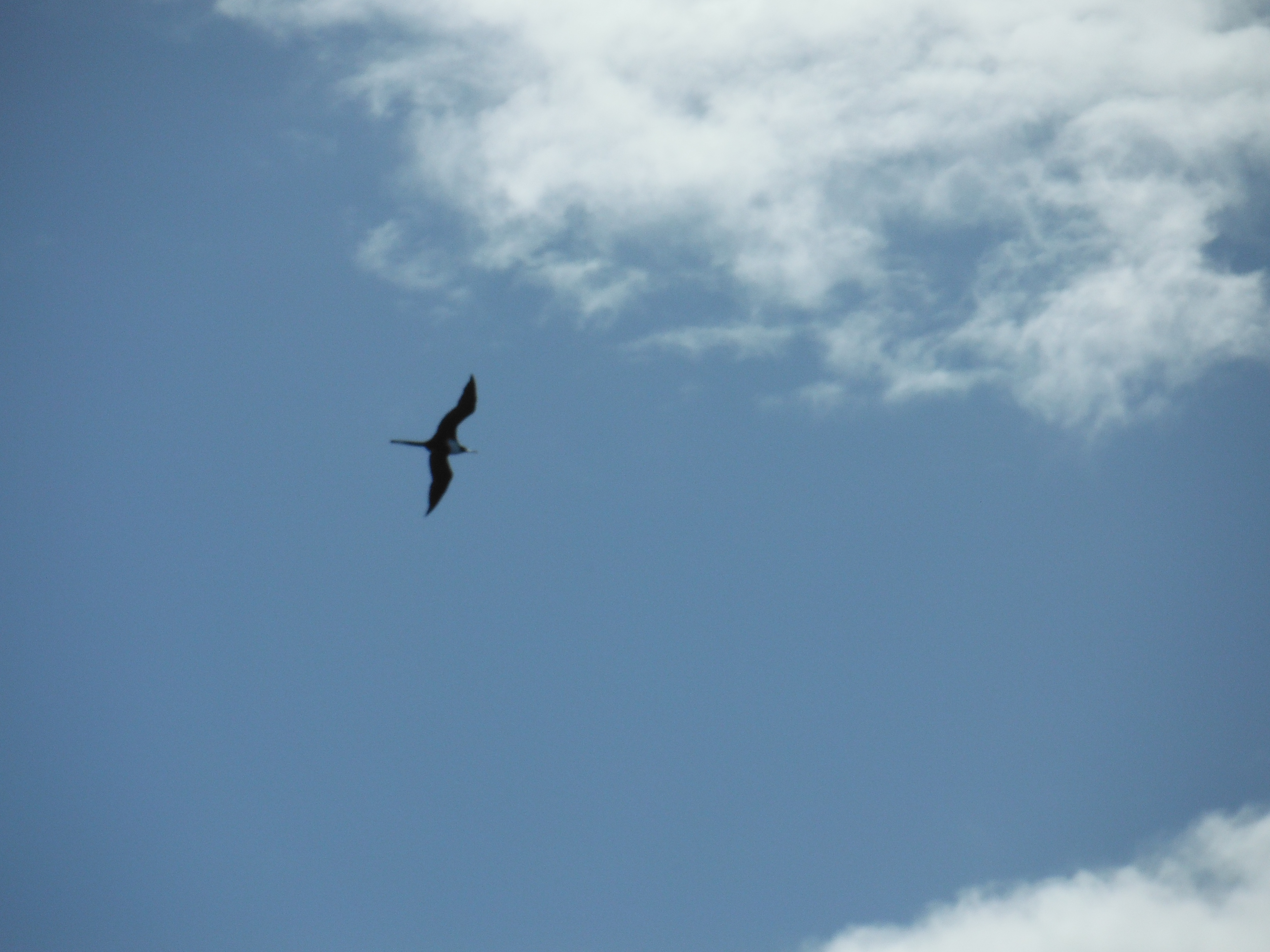
- A Frigate pays a visit.
-
- A fun day in the bilge. Check valve on bilge pump fails; has to be replaced.

-

- Newly set up secondary bilge pump–for emergencies. Lucky me.
-
- Flying fish scales…five feet up the mizzen mast.
-

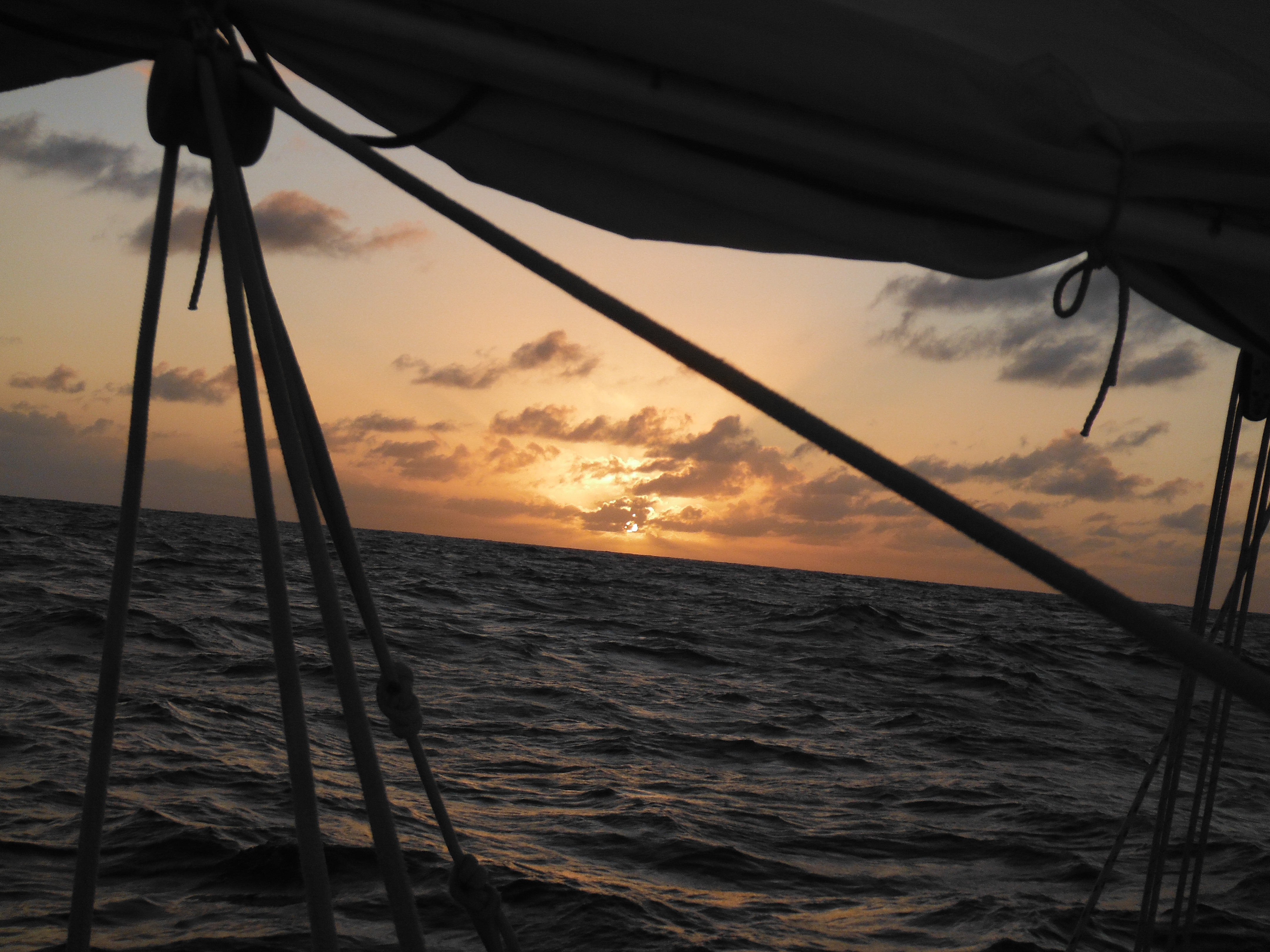
- Sunset through the main sheet.
-
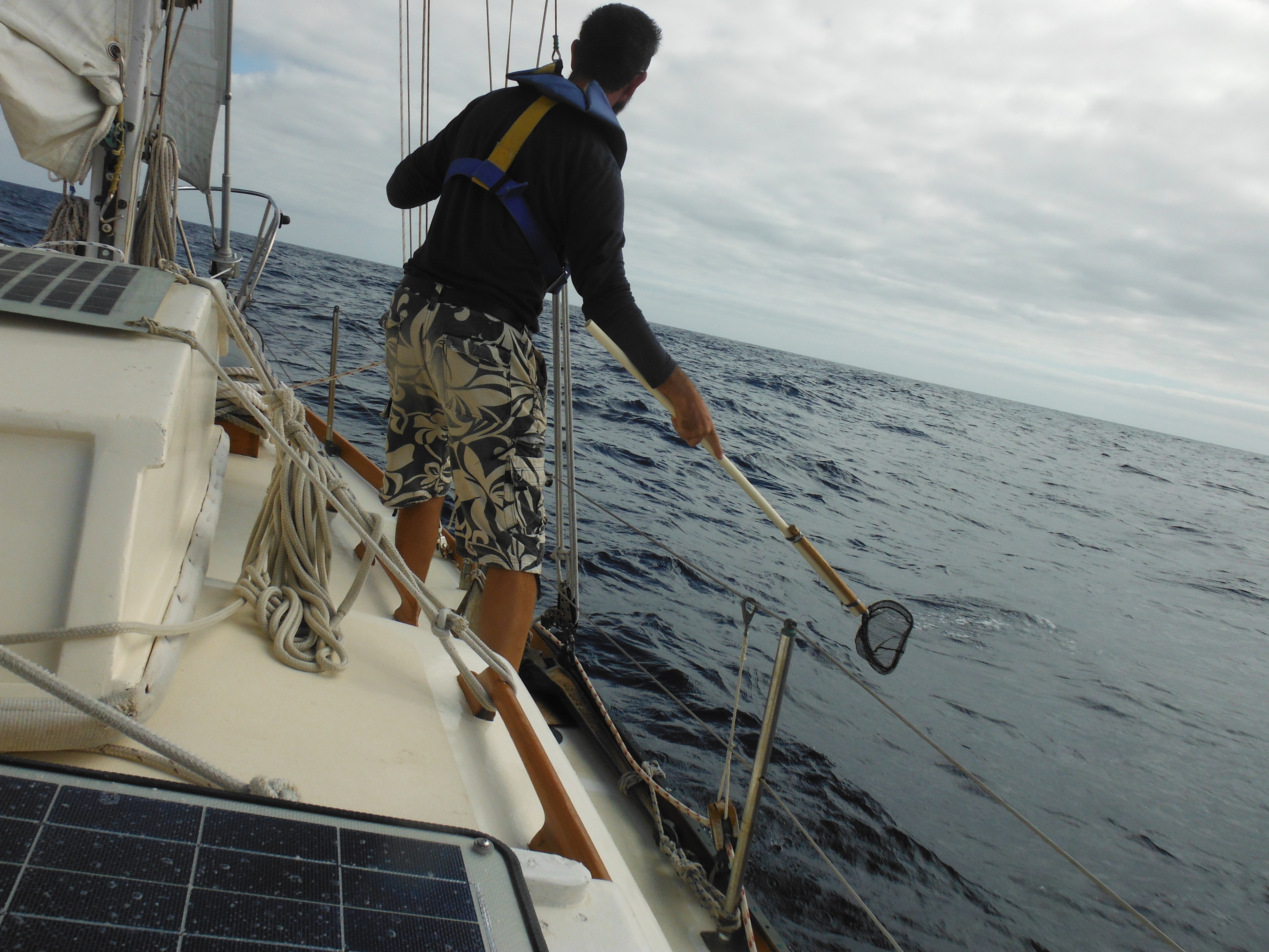
- Creating my debris capture system, a tiny net on a long pole.

-
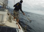
- Getting to work for the University of Hawaii.
-

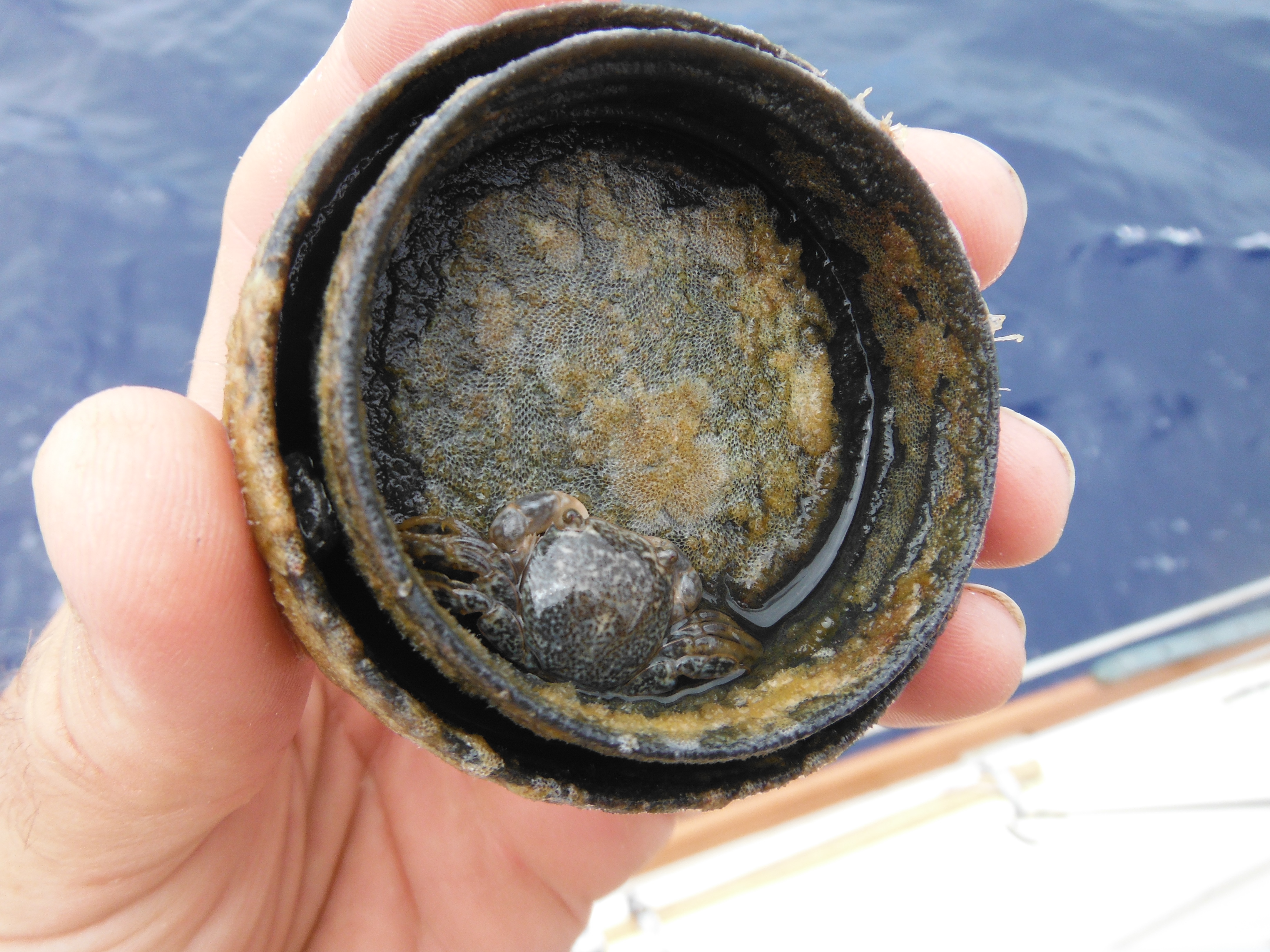
- First catch…a knot of rope with a crab attached.

-
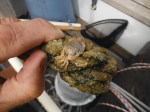
- See the crab?

-
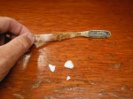
- Then a toothbrush was netted, along with small plastic.

-

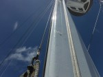
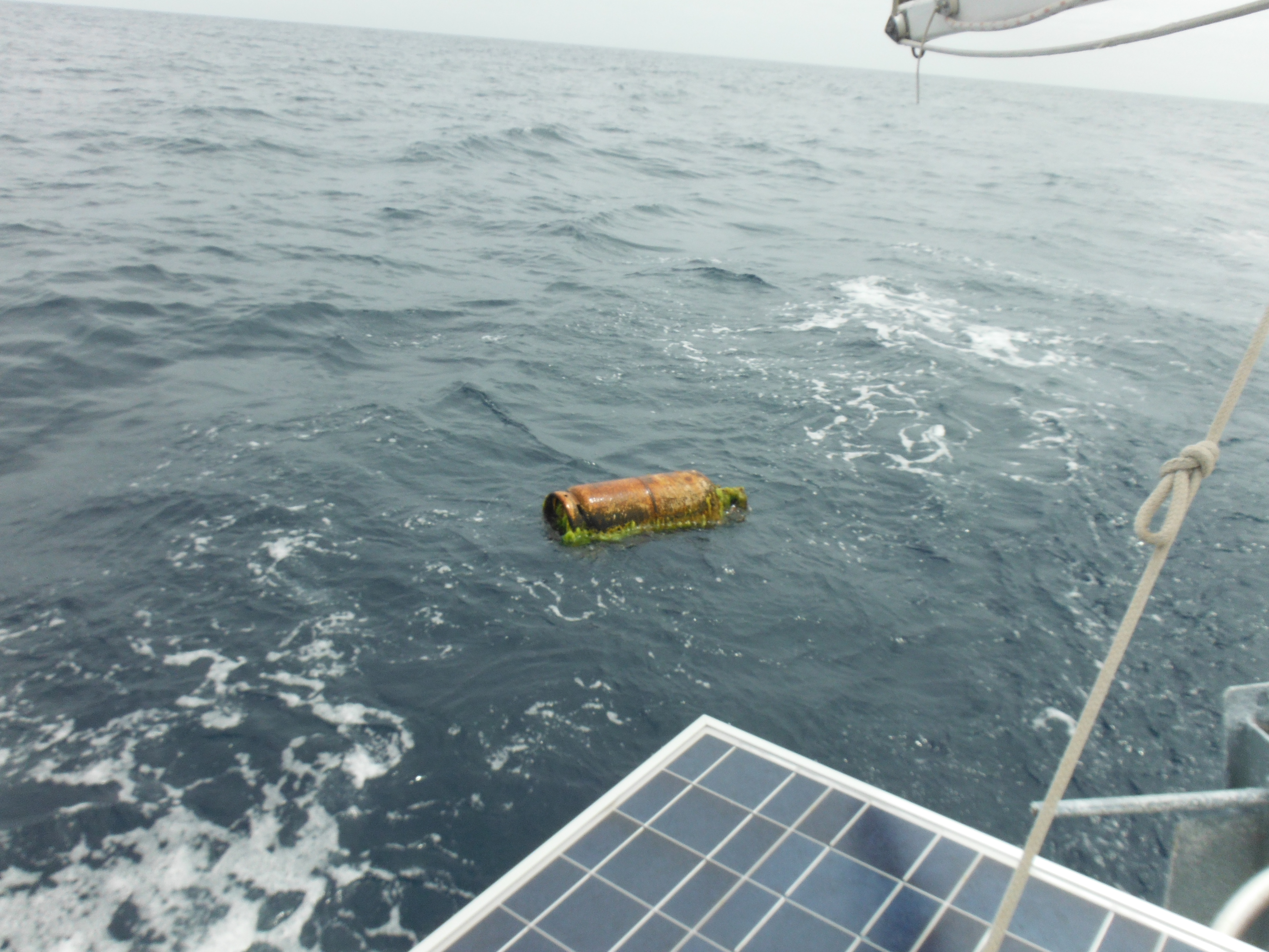
- Six foot Marlin–but this was caught with a big hook.
-
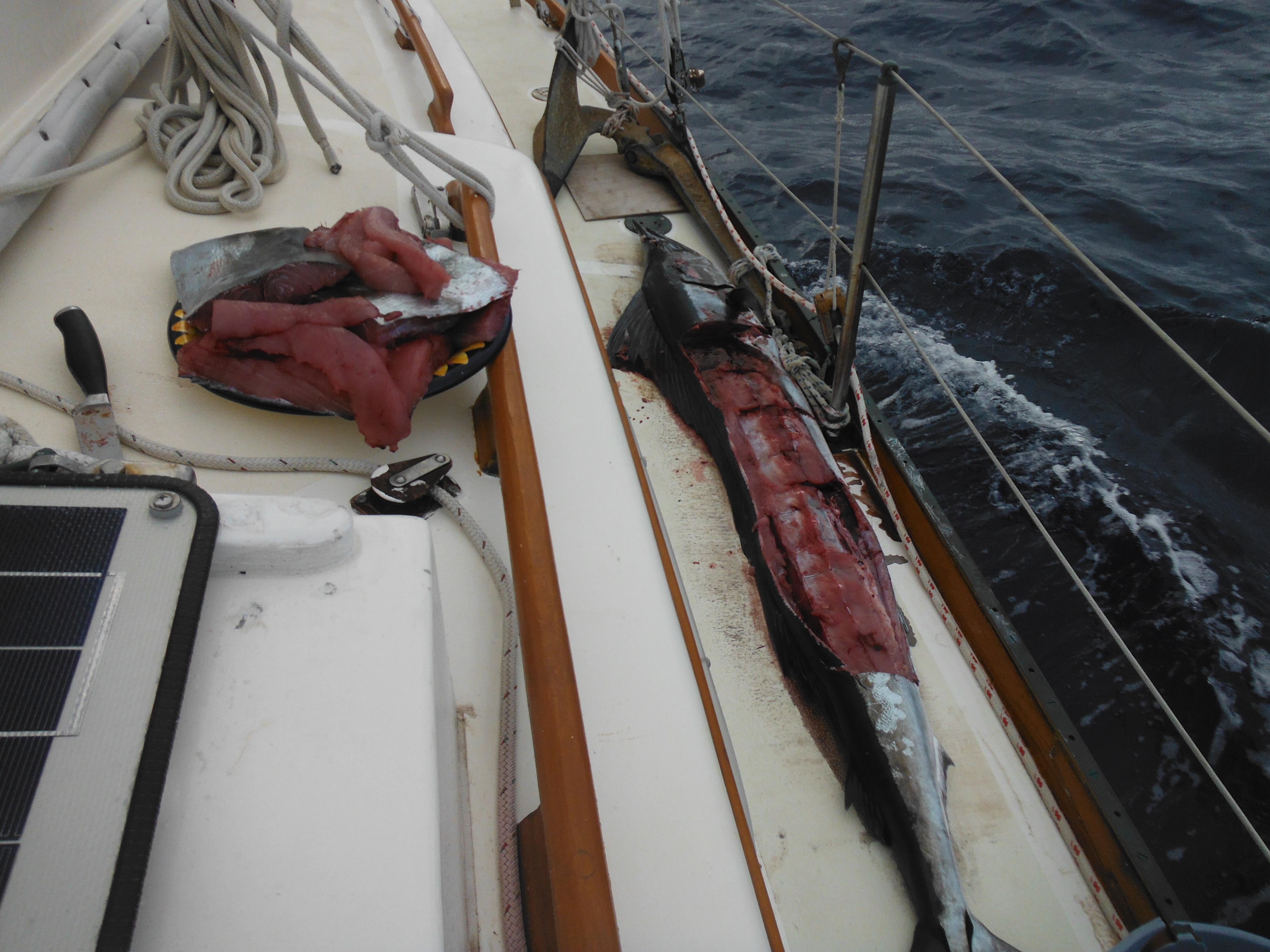
- It was too much meat…I could only take half.
-

- White bottle bottom stamped with Olympia SA
-

- Black bottle top.
-

- Yellow mat with yellow school of fish under.

-
- Plastic table with four of six legs.

-

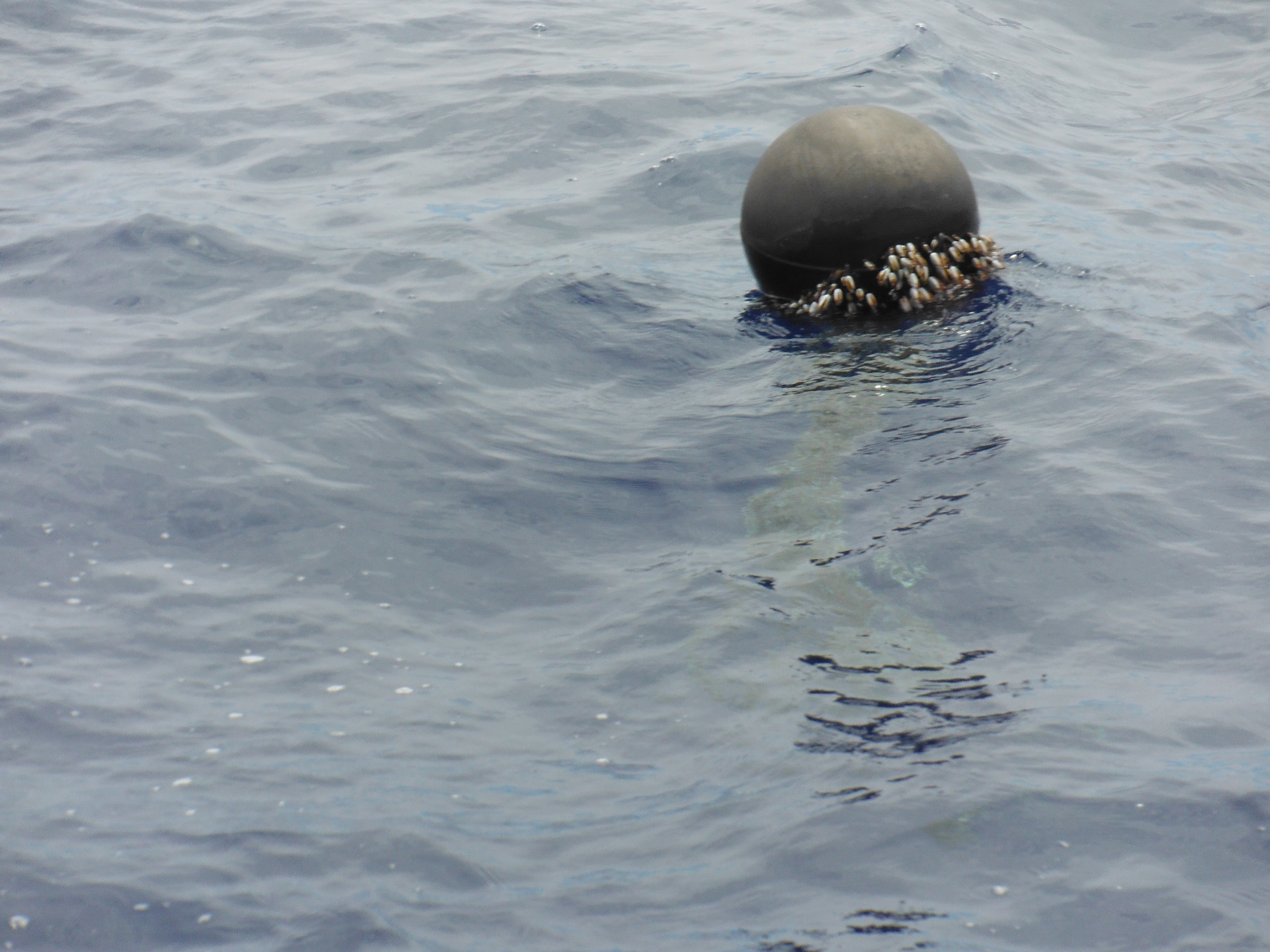
- Black fish ball (float) heavily encrusted wtih growth. Very common.
-

- Plastic jerry can. I almost had it on deck.

-

- Approaching the half sunk fishing boat.

-
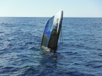
- Port side.

-
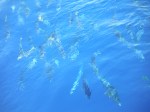
- Large school of Dorado under the boat.

-
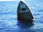
- Topside: note missing hatch cover.

-

- Starboard side: green layer is growth due to the boat’s pumping in the swell.
-
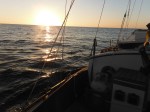
- Beautiful sunset with dolphins helps to ease memory of half sunk boat.

-
- Large plastic something.

-

- Cutting up Marlin for drying.
-
- Around 40N–it’s starting to get cold.

-

- I begin living life under the hood and drinking hot tea.

-
- SPOT: device used to relay location to wife and family.

-
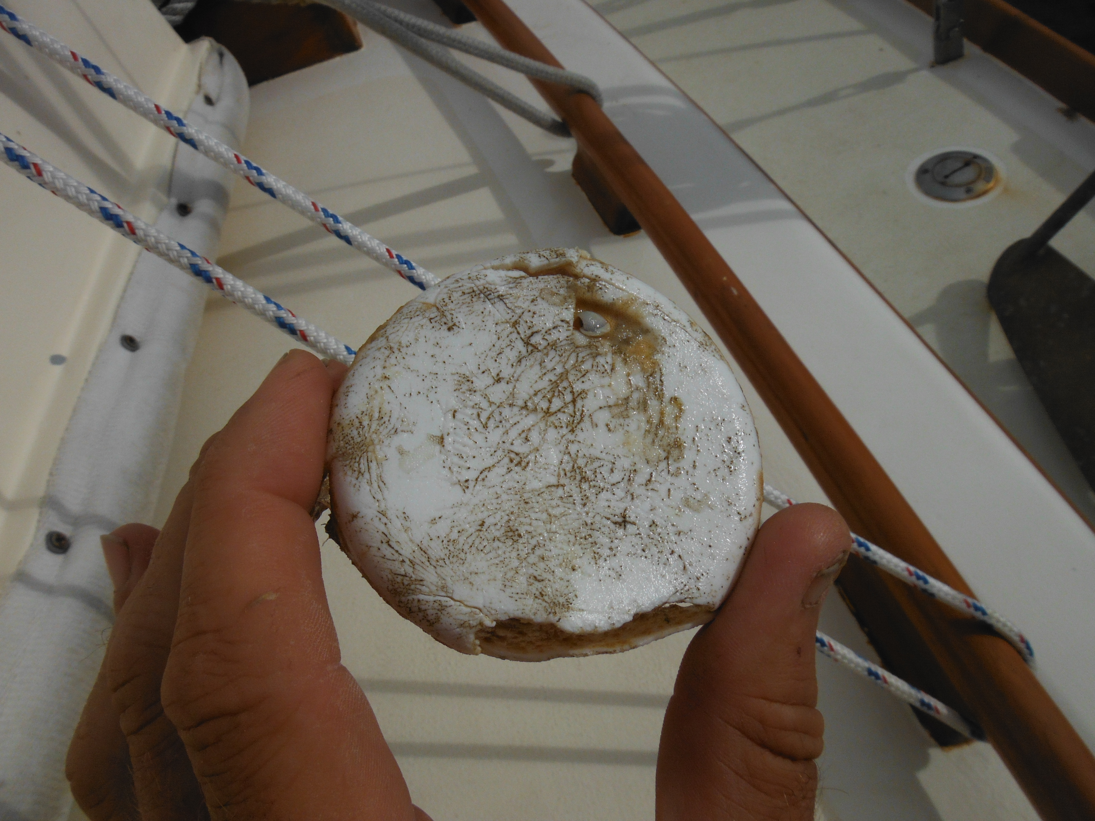
- Styrofoam peanut with peanut-sized crab inhabitant.

-
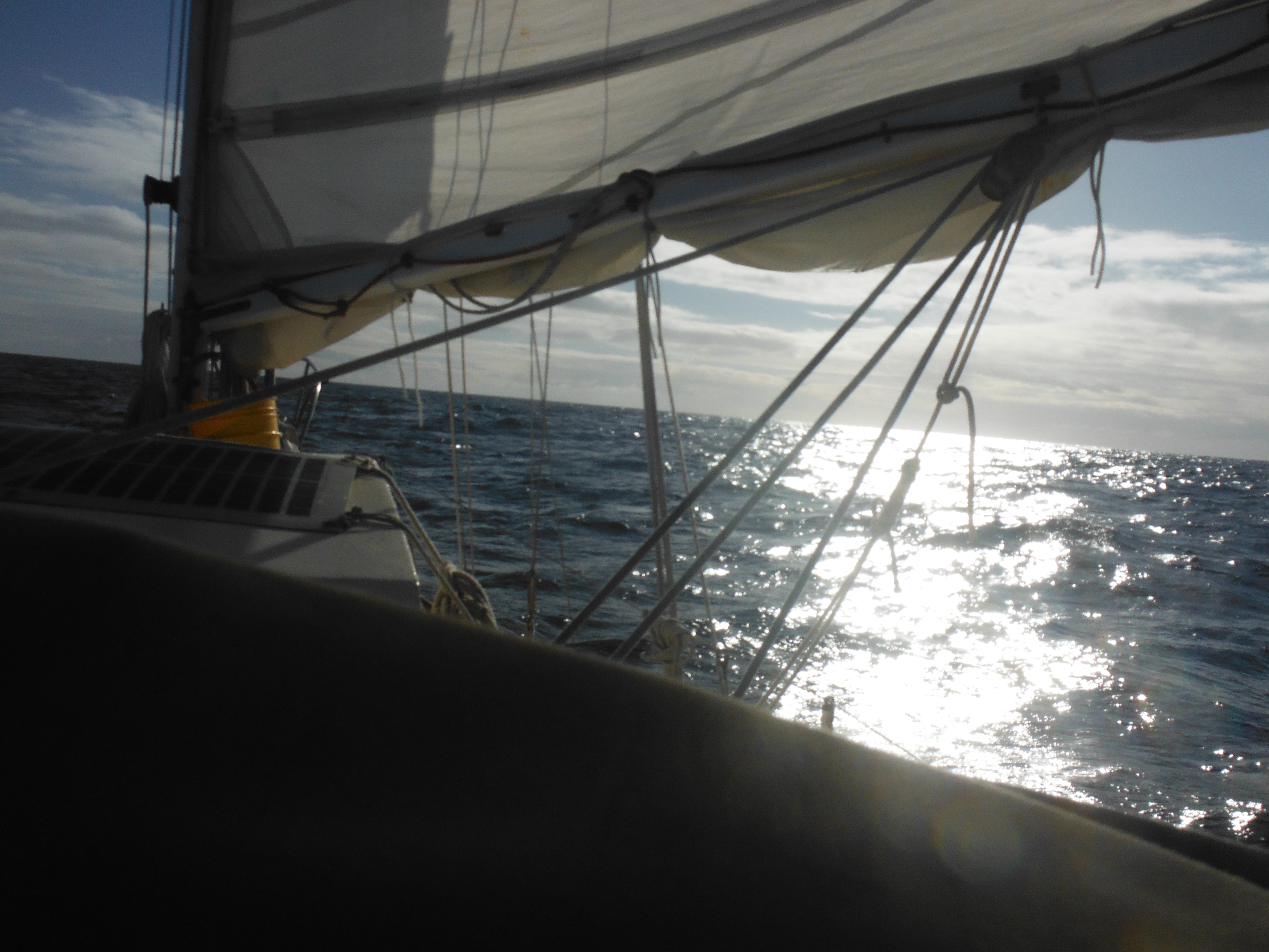
- Charging ahead on a clear day.
-

- Large sunken log encountered. A near miss.

-

- Murre approaches section of concrete dock.
-
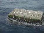
- Close up: approximately six by four feet. A tern was perched before we arrived.

-

- From the other side.

-

- The rice bag that pulled me off Murre. Japanese lettering distinct.

-
- A penitent moment: wet, cold, down one set of fleece.

-

- A 40# propane tank passes close.
-

- Electric sapphire blue ocean and a return to poetry.
-
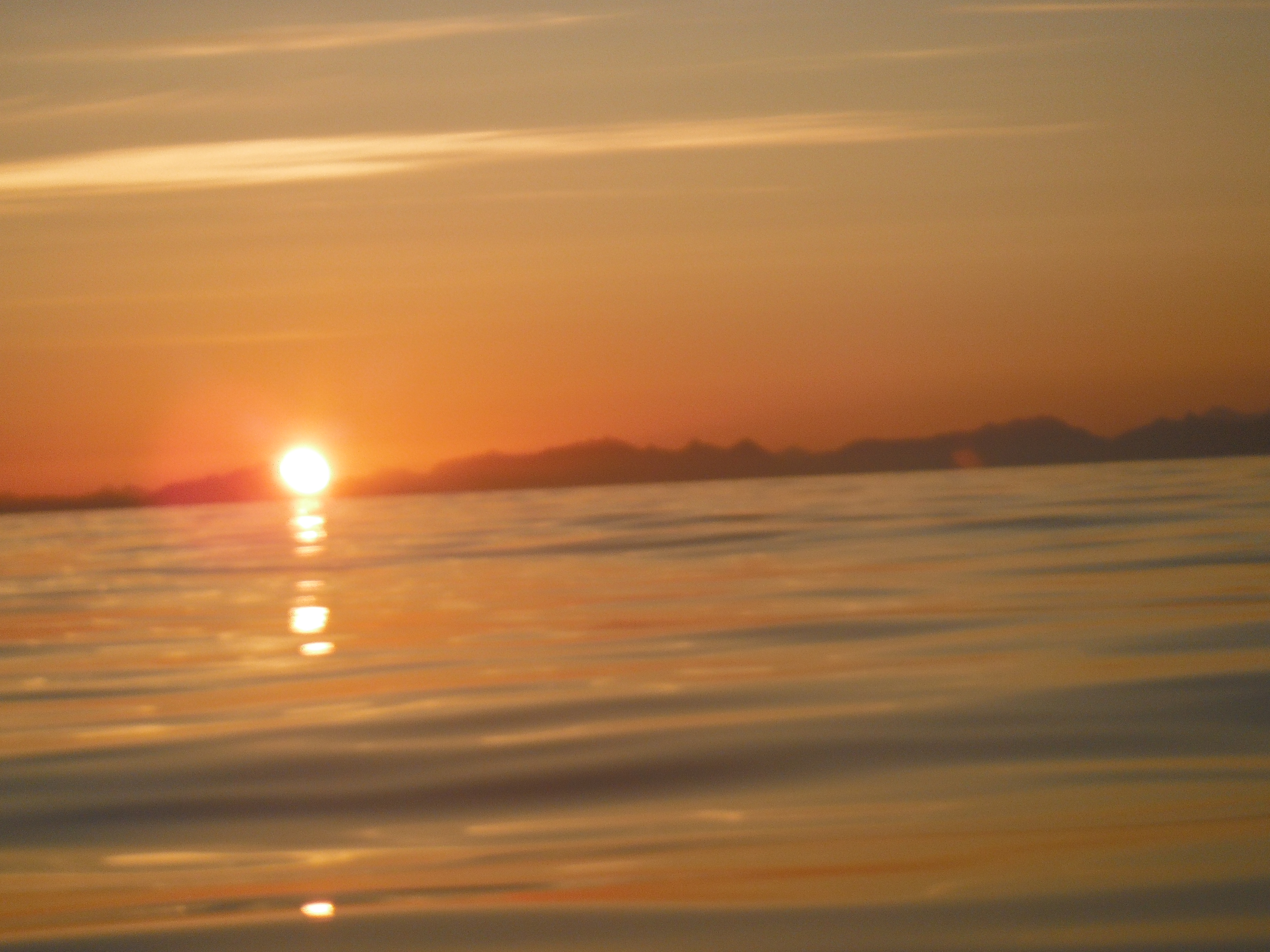
- Rosy-pink sunset.

-

- 42 degrees. Wow, it’s cold.

-
- Above the HIGH: trades good-bye: low and gray for days.
-
- I fret. Move the DITCH bag into the main cabin for easy access.

-
- And rig the forestay for the strom jib while it’s calm.

-
- First ship sighting. See it? No? Now you see the problem. 700 feet long; 21 knots of speed; no stopping till Tokyo.

-

- Last head wash while sea water is above freezing.

-

- Sunny day, but light so thin.
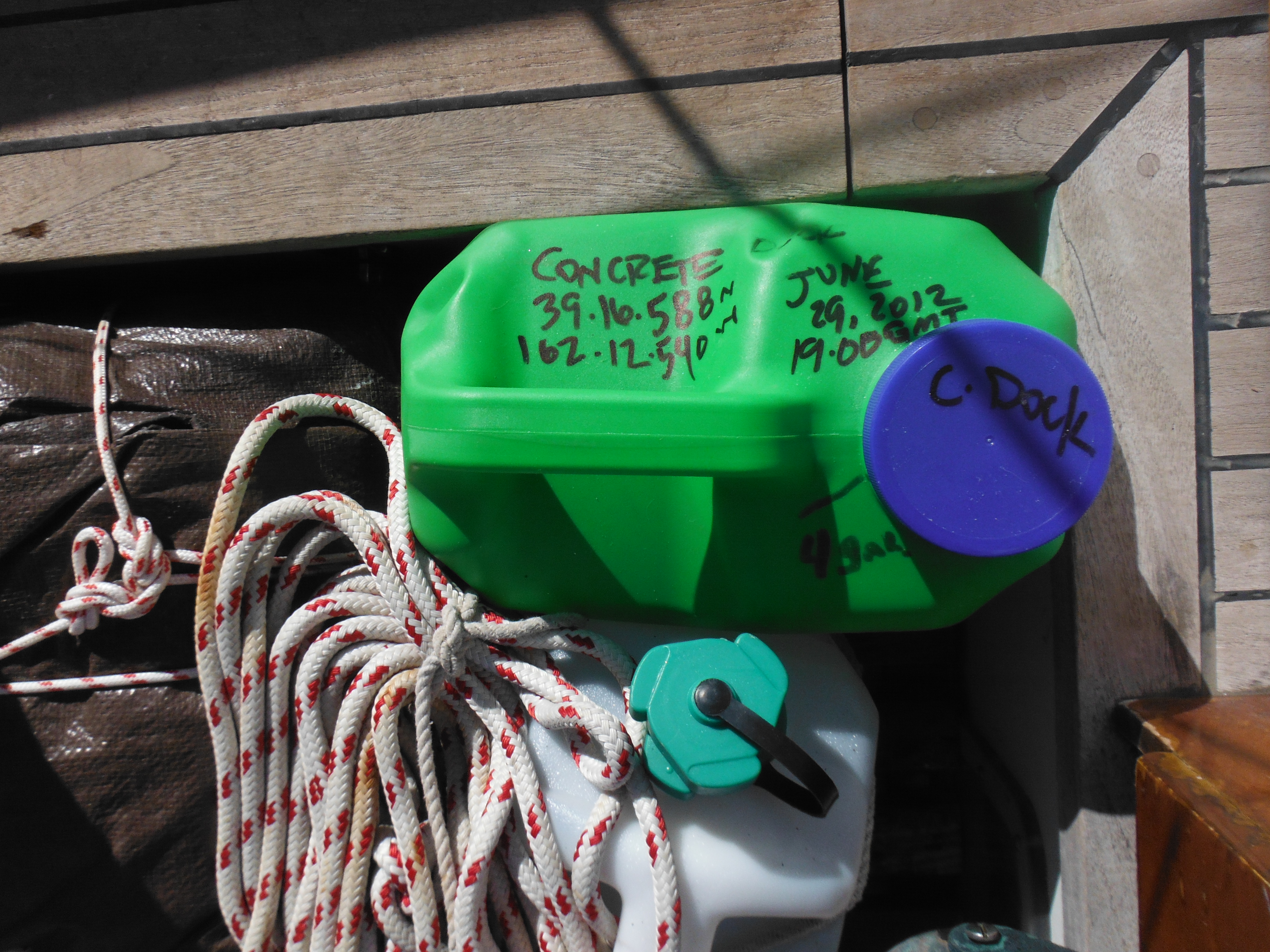
-
- Sea water collected for UofH. Container gift of Rob and Rosanne.
-
- A white sun. Almost no heat.

-
- No I mean it. I’m seriously chilly.

-

- Reefed Wing and Wing, no headsail, on a stiff southerly.
-

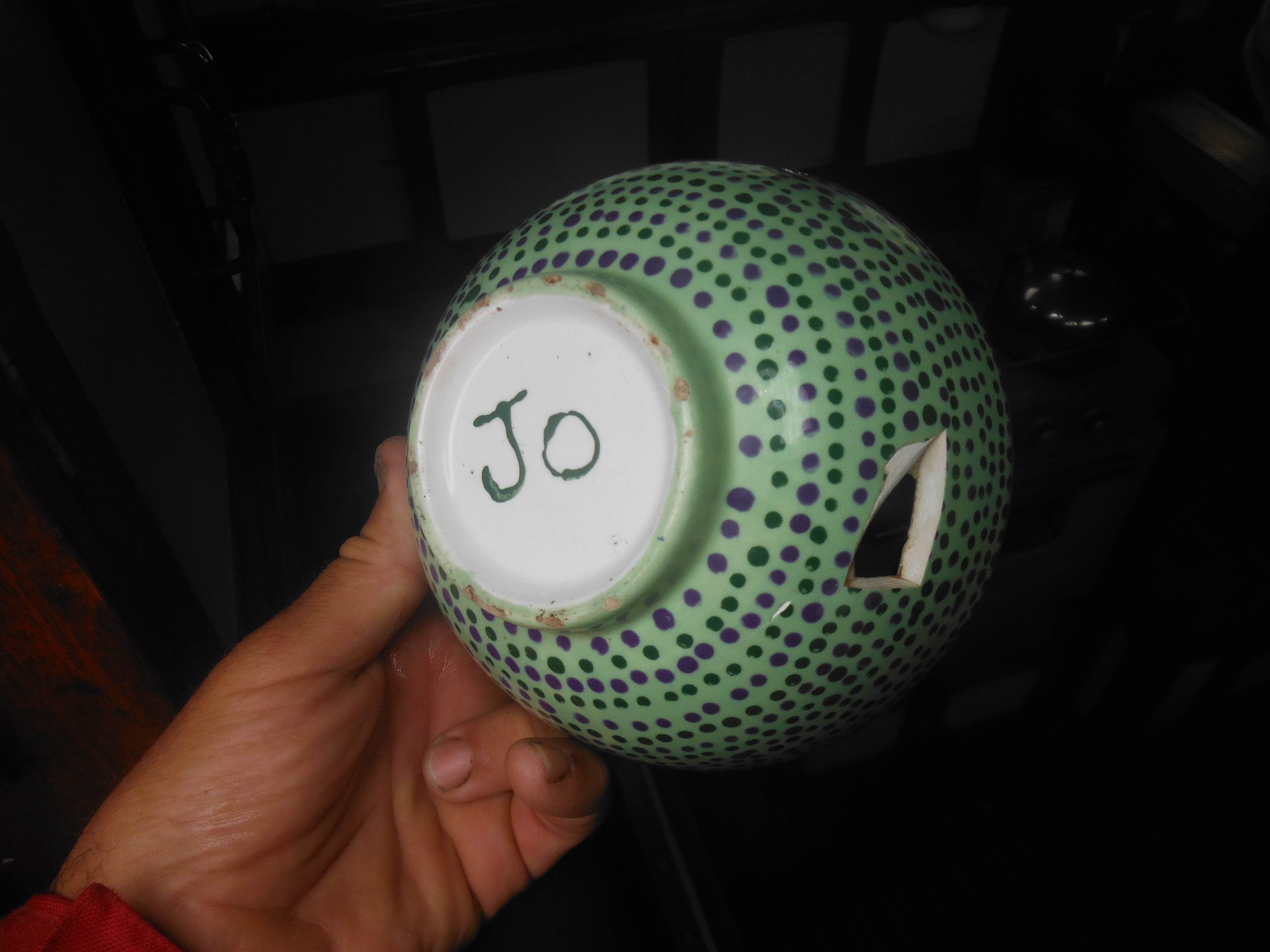
- My favorite bowl, a reminder of the wife. Broke. Sad day.
-

- In this image the lying camera will fail to show you a big wave from our Little Blow.

-
- Honey turns recalcitrant at 42 degrees.

-
- Under cloudy sun, the water top takes on a coppery hue.

-
- Beginning to get in a cold-weather groove.

-
- Cabin finally picked up.

-
- I see flame, but do I feel heat?

-
- Wolfing dinner from the pot.
-

- Catching rain from the main goose-neck.
-

- Filled within twenty minutes. Good for washing. But brackish until sail rinses.

-

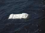
- Baseball helmut.

-

- Some sun.
-

- In control from my “conning tower” on a crisp day

-
- Making smart time on a clear day.

-

- Making smart time on a cloudy day.

-

- The log. Updated at noon and at least two other times, usually many more.

-
- Running under poled-out jib only.

-

- Passage strategy second half: up and to the right.
-
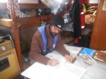
- Working out sun sights. Note the stove.

-

- A happy day…I learn to tilt the hood back to keep me dry in a following wind.

-

- Comfort or Pleasure. What if it’s neither.

-
- Yippie, say the solar panels that now have thin sun to work with.

-

- Black Footed Albatross. Typical vantage.
-
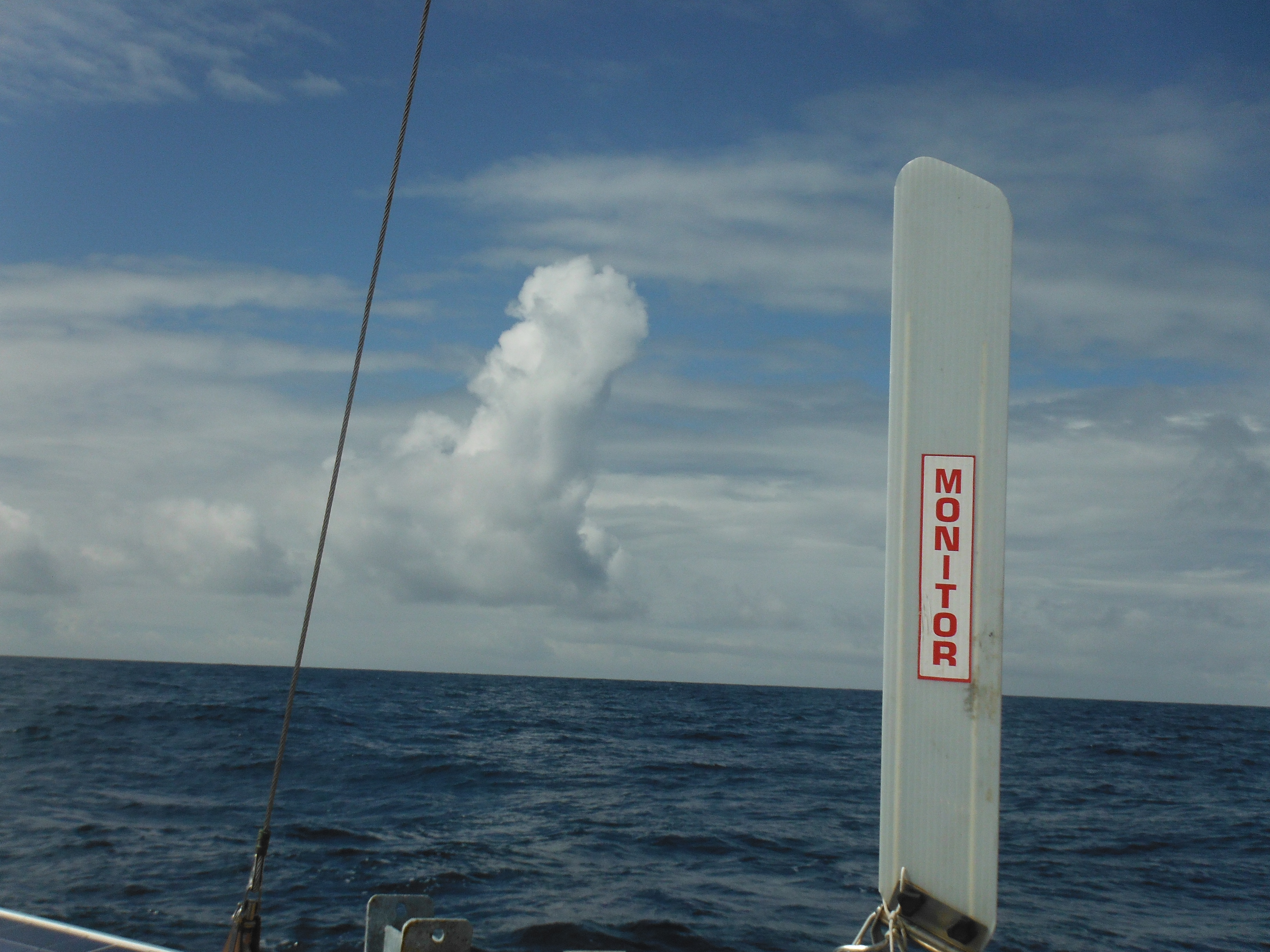
- A tall cumulus cloud way above its natural migratory range.
-

- Drying soggy clothes and towels on a warm afternoon.

-

- Relaxing on an unusually nice day above 50N.

-
- Flying the storm jib as a forestaysail. Very satisfying.

-

- Climbing close-hauled the last 100 miles.

-

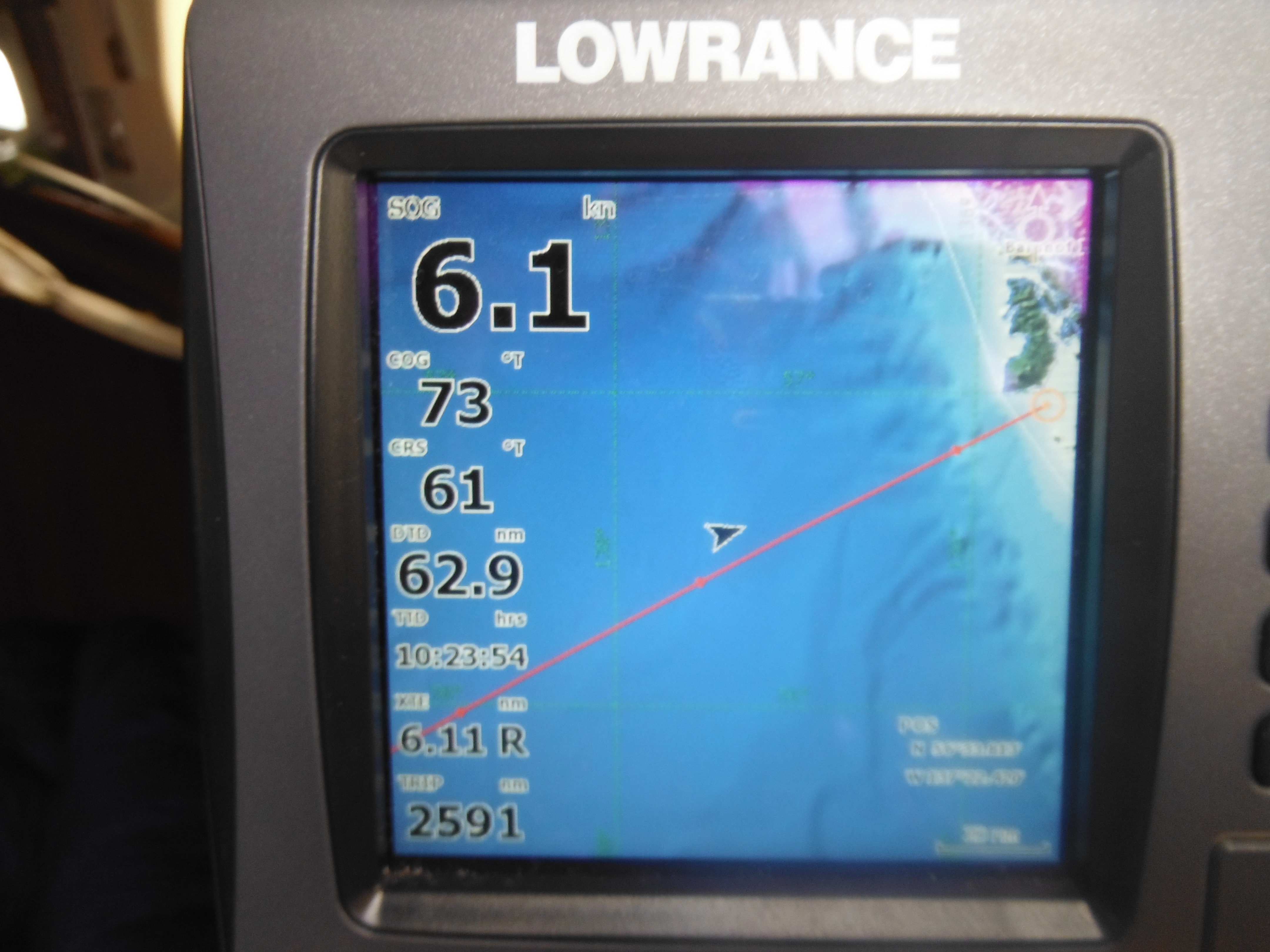
- Land in sight…at least on the chart plotter. 60 miles to go.
-
- Making myself presentable to the fine folk in Alaska.

-
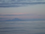
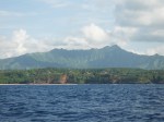
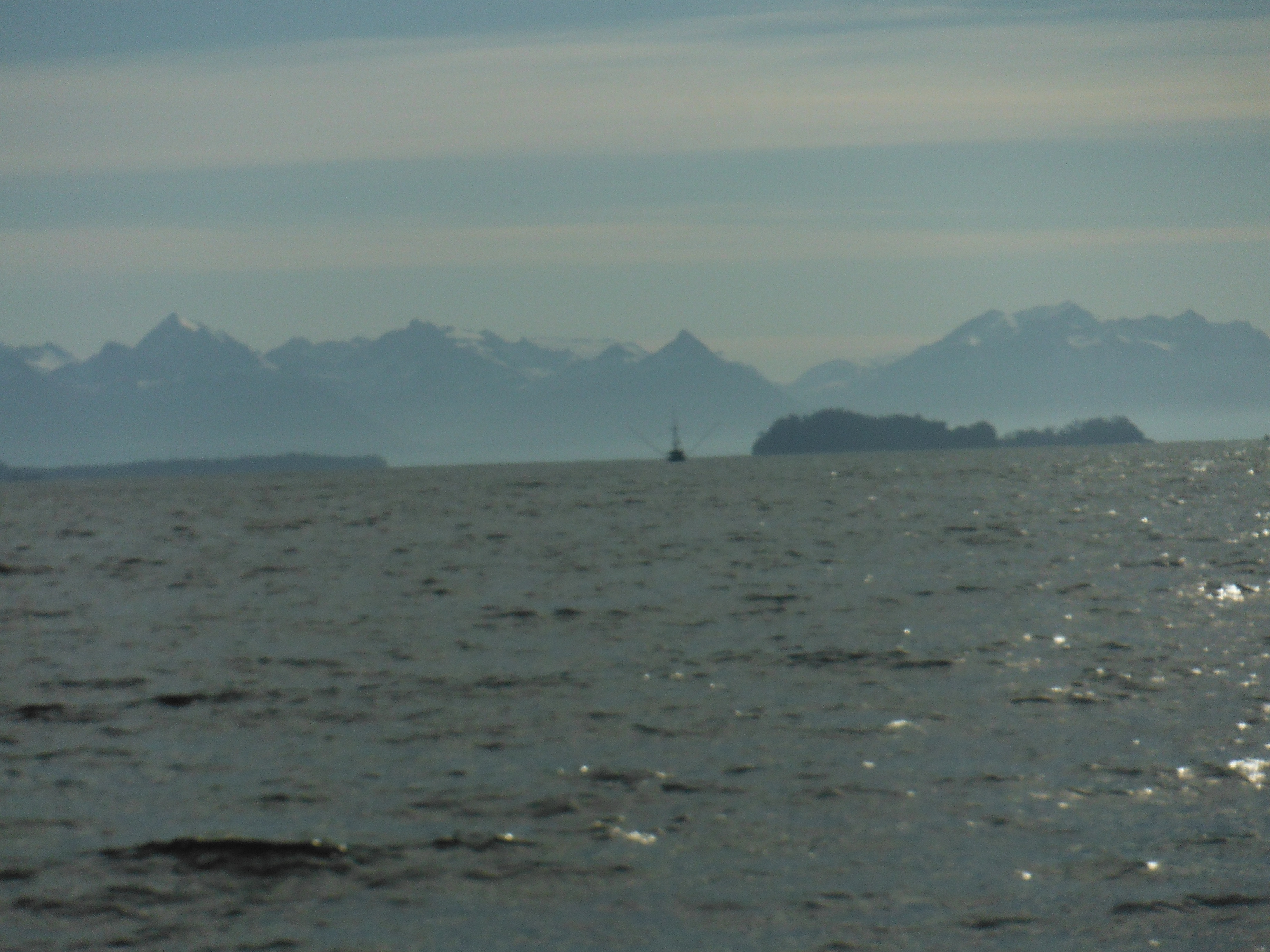
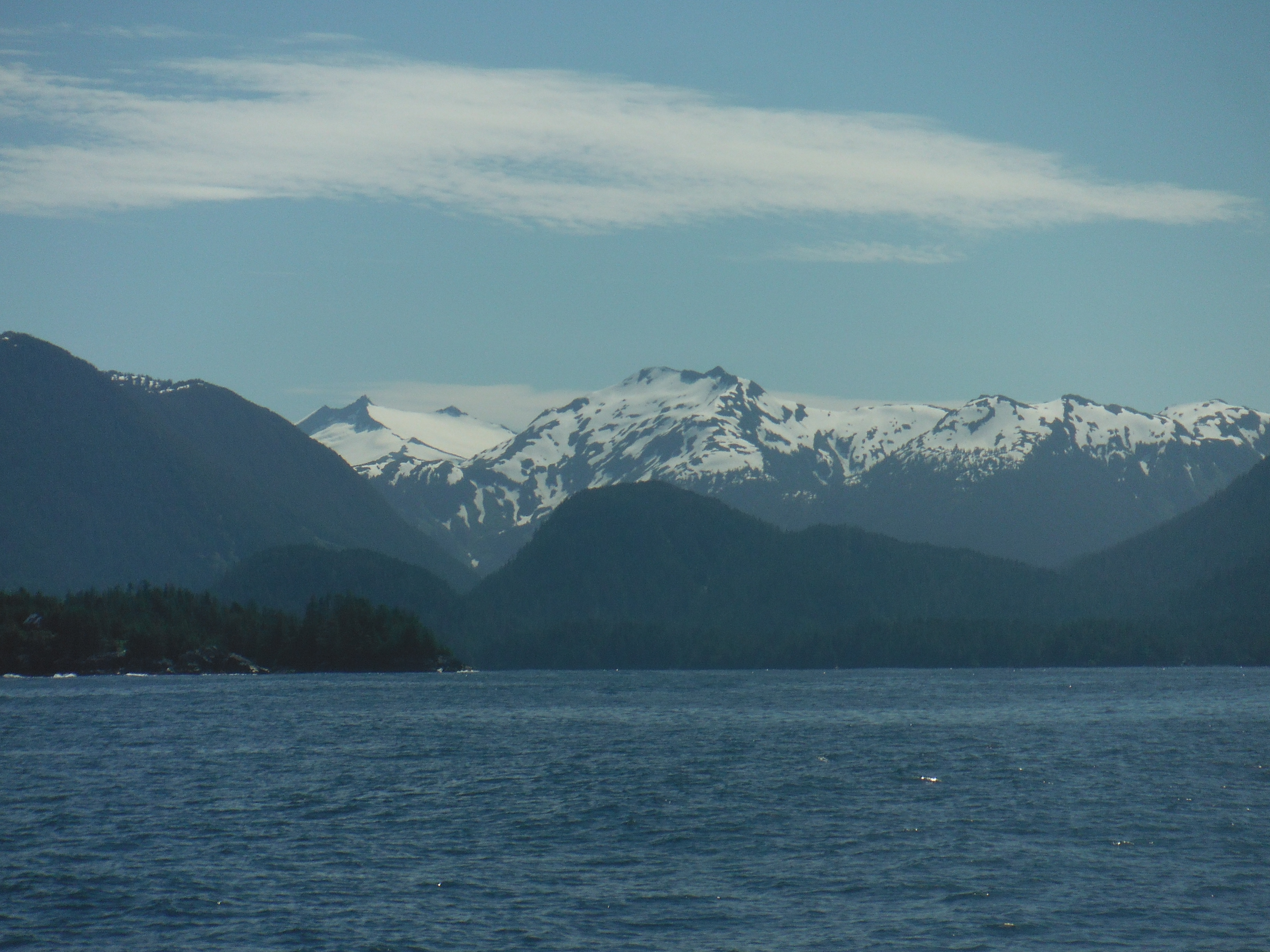
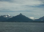
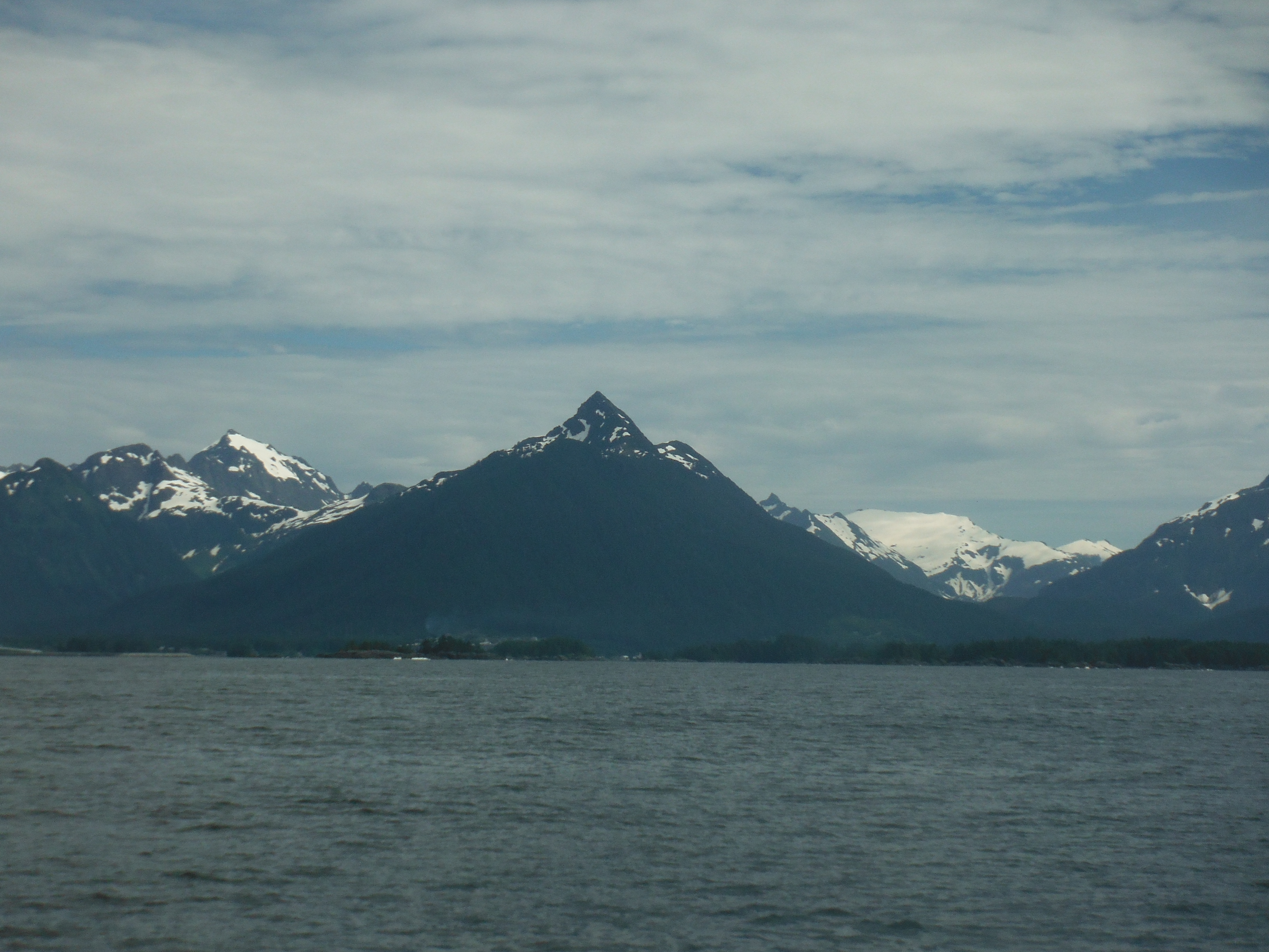
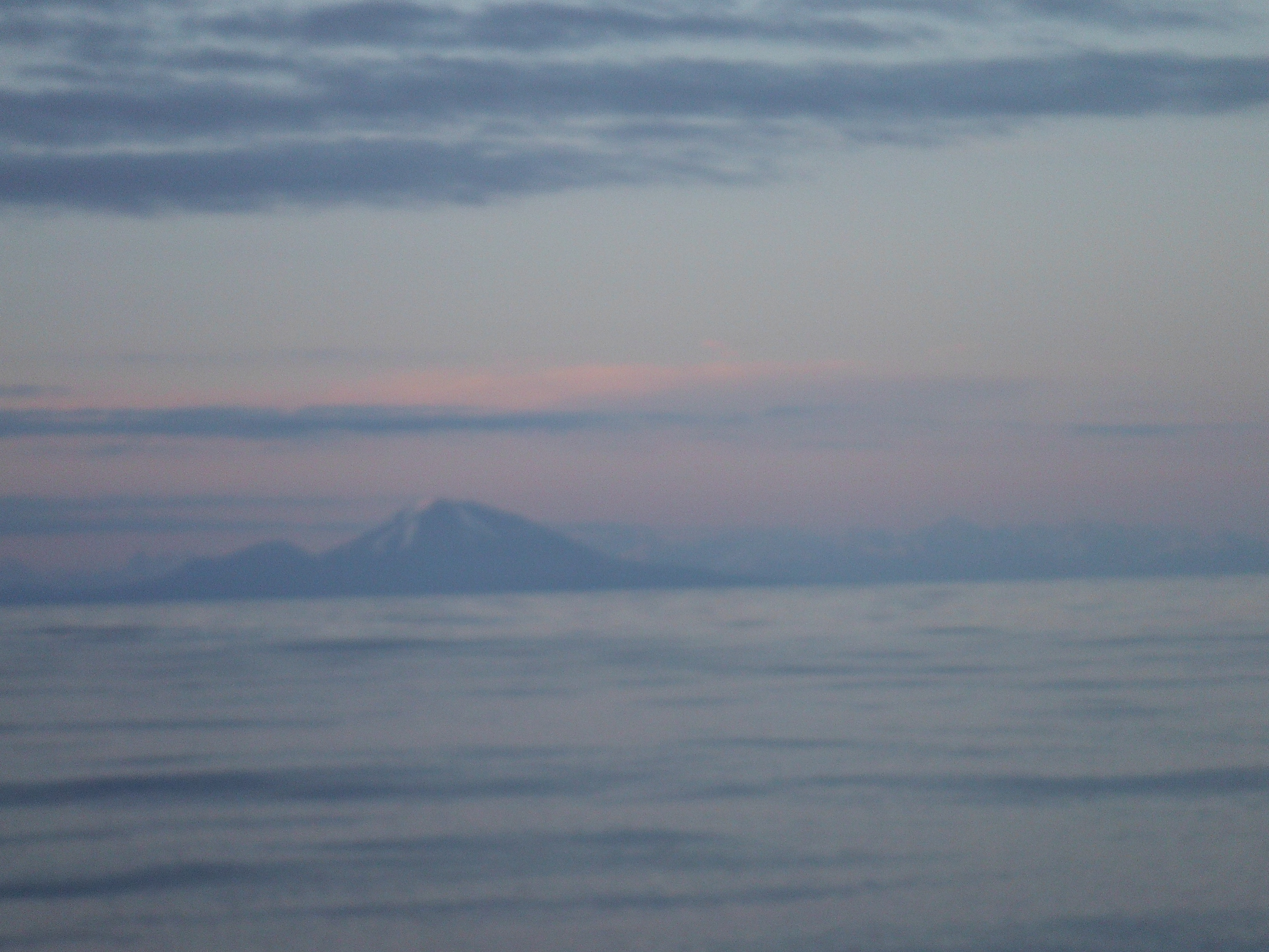
- Mt Edgecumbe from 40 miles offshore.

-

- Sunset over the Baranof ranges. It’s after 9pm.
-
- Evening sky in the water-top.

-

- Installing the autopilot on the rail for the last 30 miles.

-
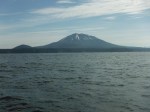
- Edgecumbe from inside Sitka Sound.

-
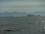
- St Lazarias Islands with the Baranof Ranges behind.
-

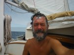
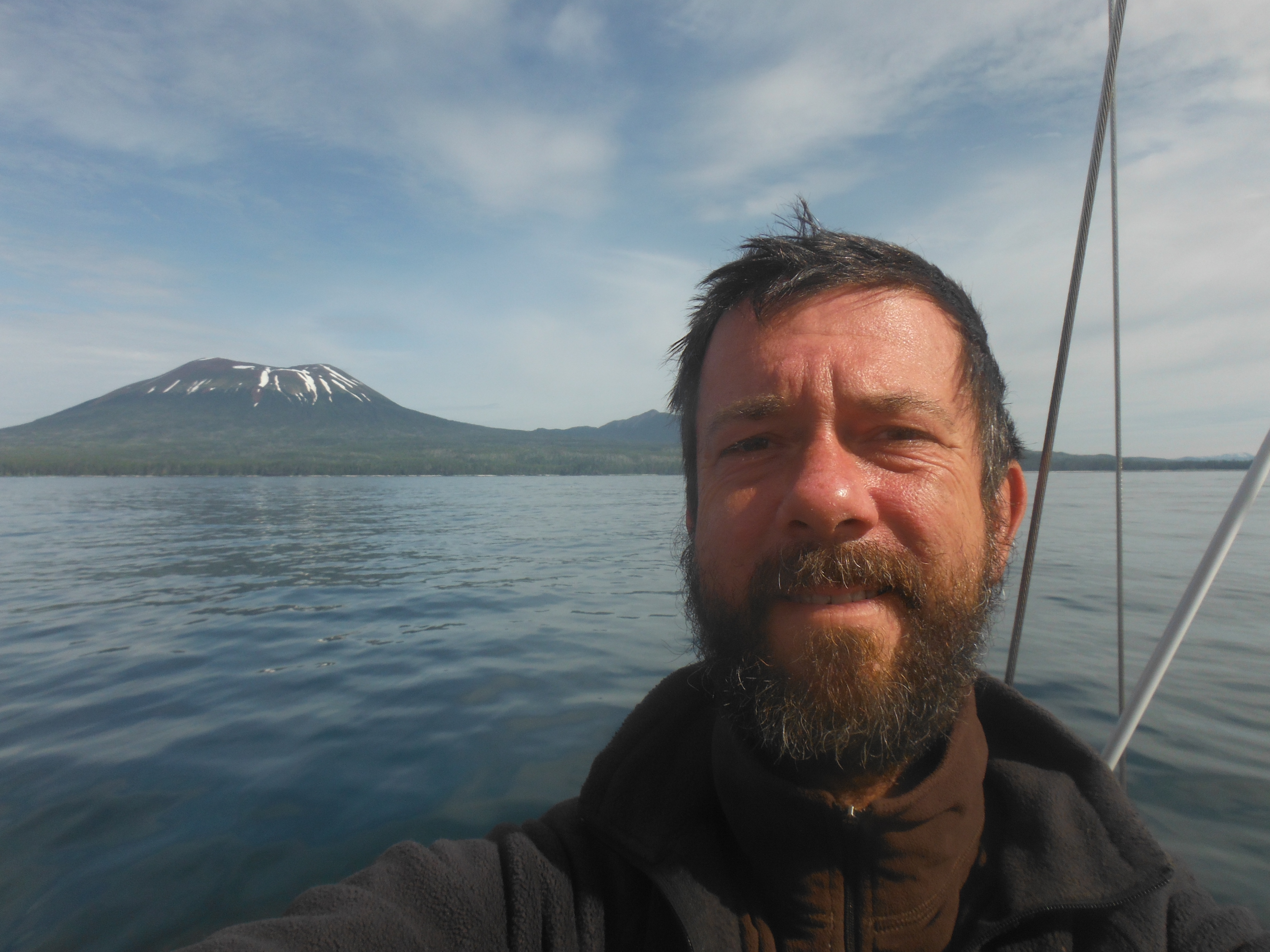
- Just proving it’s me what sailed here.

-
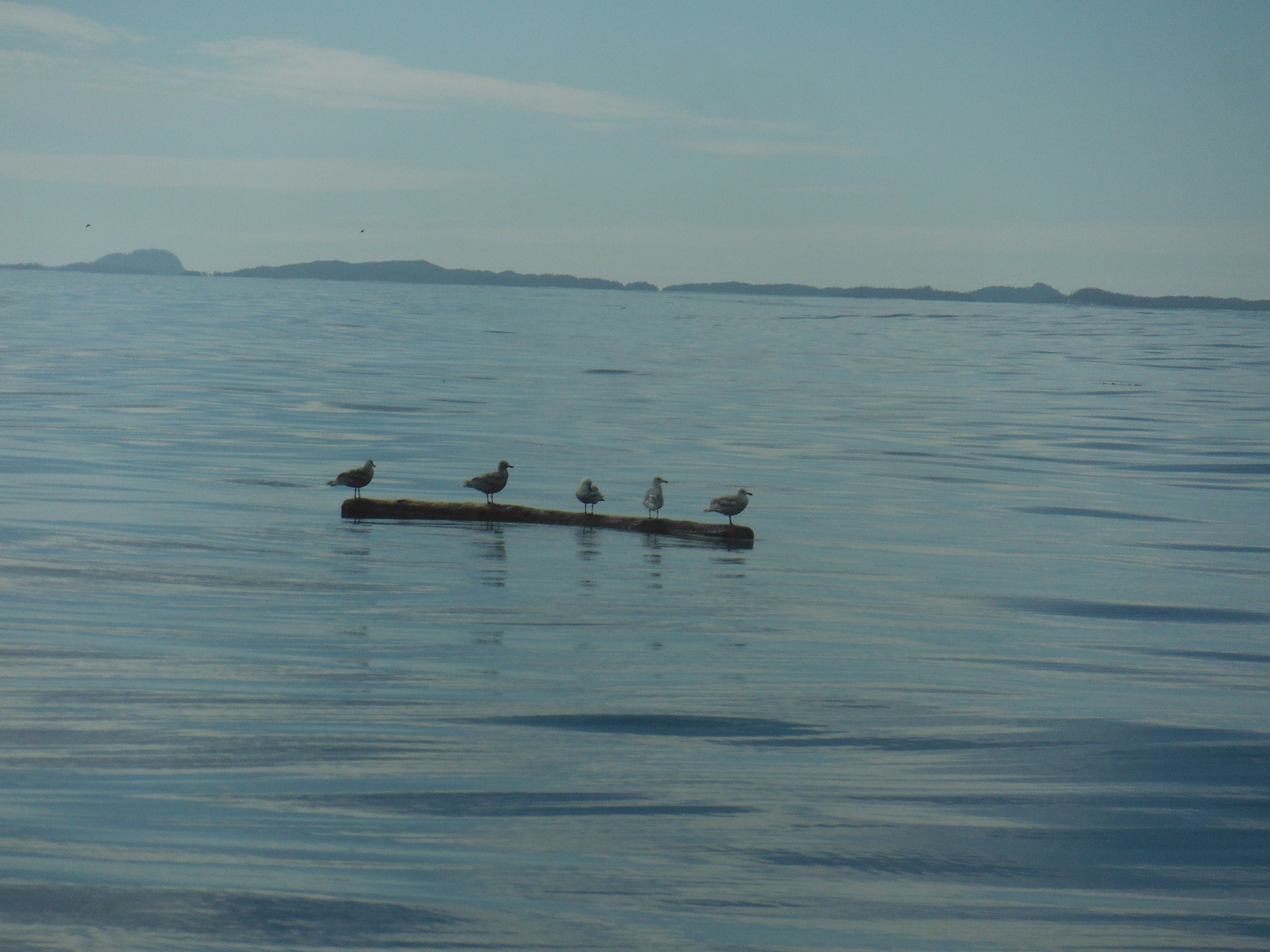
- First Seagulls in a year and a half.
-
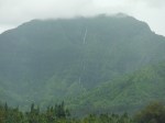
- Baranof.

-

- And more Baranof.
-
- And more.
-
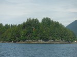
- Random island with which the sound is dotted.
-
- And another.
-
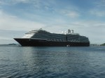
- The Oosterdam, whom we first met in Kauai.

-
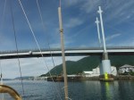
- Passing beneath the O’Connel Bridge to Japonski Island.

-

- Taking the channel to the marina.
-
- The Coast Guard buoy tender that once sent a boat to rescue me.

-

- Float planes perched in front of downtown.

-

- Docked in Sitka Harbor. 22 days out of Hanalei–2500 miles.
Safe and Sound in Sitka (with photos)
That last post came pouring out. All day its images and sounds rumbled, thunder in a room too small. When I opened the computer, the words shot like lightning.
Or so I thought.
In fact, I’d spent hours below. Back on deck the sun had finally set. An orange sky to the northwest, an open and breathless sea, slick; Murre still, her sails flapping like broken wings. I dropped and stowed them out of pity. I unearthed the autopilot, installing it on the rail. I cooked a dinner of canned salmon in stewed tomatoes and cous cous. I drank a glass of red wine.
Then I switched on the anchor light and slept with an ease and depth usually reserved for the quietest of coves.
I wake with sunrise, three-thirty in the morning, and Murre and I begin the last thirty miles to Sitka under power. Boredom and impatience almost immediate. How anyone can derive pleasure from a vessel that moves by engine is beyond me.
Slowly the land comes up full. Edgecumbe dark and heavy, its cape long and low and decorated with the Sitka fishing fleet out early to troll for Cojo. Then the ragged, still molten-looking San Lazarias Islands; then a period of threading rocky passes; then the bend in and behind Japonski.
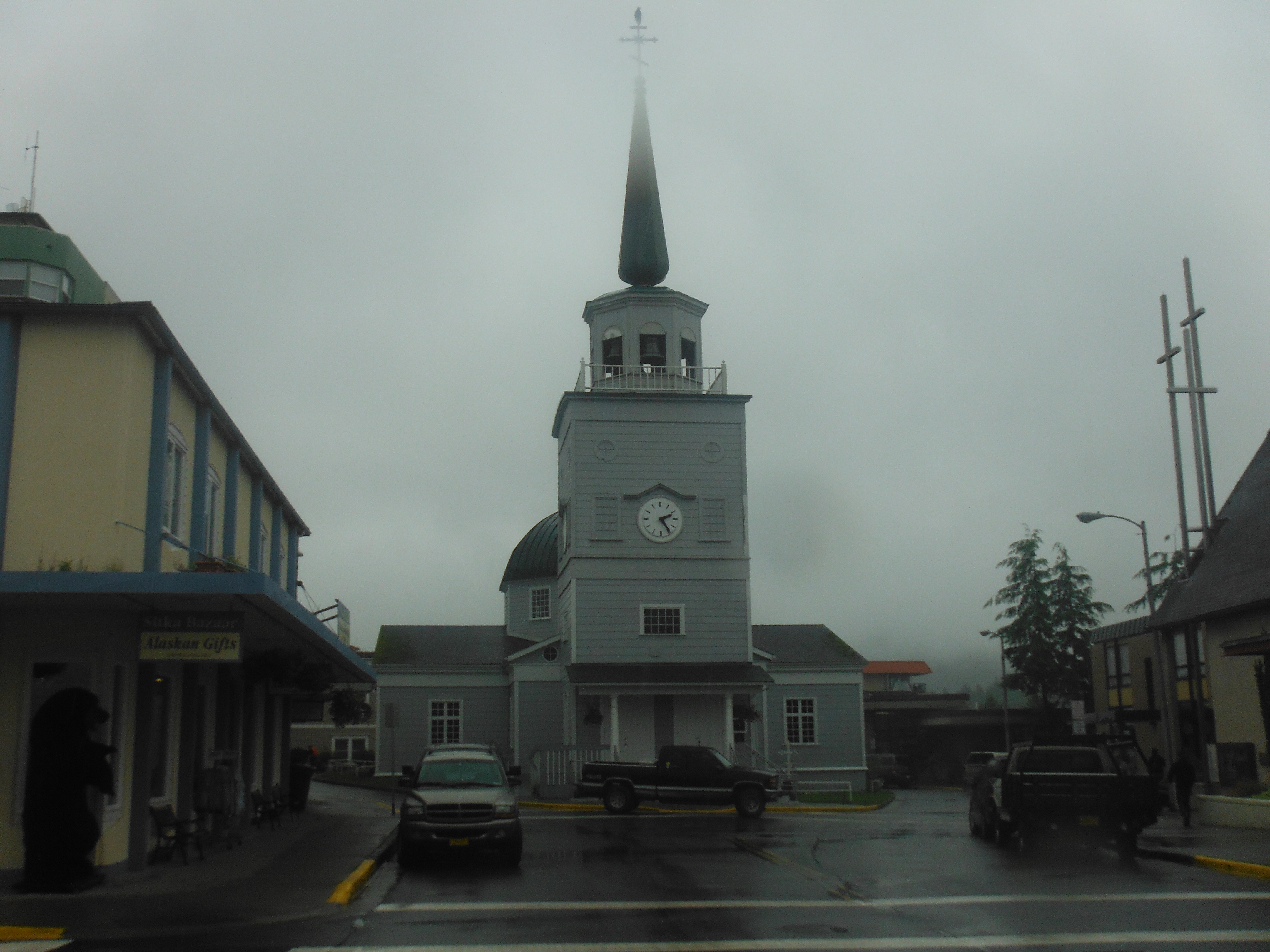
And there it is, the town nestled in a dense forest of fir and dominated by the snowy peaks of Baranof, its centerpiece, a small, gray Russian Orthodox church with a bronze dome. It looks to be right where I had left it.
A cruise ship at anchor, and as we pass she is the Oosterdam. By some twist it has happened that the first ship we see in Sitka harbor is the first ship we saw on entering Kauai’s Nawiliwili ten months ago.
By noon we are moored within a city of fishing vessels. Sitka town has but eight-thousand residents, but her vast marina can accommodate over a thousand boats.
Dock lines out. Engine off. An intense quite interrupted only by the chortling of ravens and the whooshing flight of eagles. A cormorant. A sea lion. A seagull. None of these seen by us since leaving California.
2500 miles from Hanalei to Sitka. 22 days. Steady winds, if cold. No serious weather or mechanical failures. A pleasurable passage, even after adding all my complaining into the sum.


Sail On, Sweet Boat
July 11
Day 21
Landfall
In the night sails whisper in my ear that the wind has changed. I wake at three to find we are heading northwest. Northwest, I think, is fine, and set the alarm for another hour. On deck at four the day is bright; cloud we have, but thin; the sun is clear and already two fists (20 degrees) above the horizon. I work to reset our course to northeast. I take down the jib pole, shake out reefs, and then we are close hauled for Sitka on a light breeze from the southsoutheast. Murre slips along on an easy sea.
Sixty miles to go.
Sail on, sweet boat.
I have one cup of coffee while watching the ocean and the boat from the hatch. And then another. I am thinking of my father. For several days now I’ve known he is in hospital. His legs have failed; he has fallen and can’t get up. He is 91. I think how once he must have thought his legs could carry the world. His son on his shoulders, the boy riding a giant and giggling, he felt the promise of forever. How could he not?
At nine-thirty, cloud is too dense for a morning sun shot. I decide to stow the storm jib, lashed to the lifelines at the bow this last 1500 miles and unused. Instead I raise it and am pleased. It is perfectly flat, a good little forestaysail. Why didn’t I think this before? Its contribution in thrust is small, but it adds beauty.
Sail on, sweet boat.
At ten-thirty our first diving bird. As we approach I dig out the binoculars, but it dives before I can focus. Go figure! I resume my watch.
I’ve wanted nothing more than to fly home immediately since learning of the situation. To help, to fix. To be the father to my father. But what is the fix? We grow up and we grow old, and we have known this always. Yet still, the surprise, the feeling of helplessness. I would give anything to restore him.
The noon sun shot for latitude is at eleven-fourteen and I almost miss it. Then as I am carrying the sextant below, I look up and…
..land ho! A craggy peak, nearly indistinguishable from cloud, its dark flanks and its white streaks of snow a shade too dark and too light to be a part of the surrounding gray. Then I can make out its cone shape. Mount Edgecumbe, a retired volcano of just over 3000 feet that defines the entrance to Sitka Sound.
Sail on Sweet boat. Sail! Sail!
Why bound for Sitka, you ask?
I might answer, and why not? Or that the mileage is shorter than a run to Vancouver or Seattle. But the reason is that I lived here for a time when I was young and adored it. Our family didn’t stay long. After only two years we moved back to the lower forty eight for better work. I was crushed, vowed to return, never did.
In Sitka I got my first taste of the wild. Mount Edgecumbe was visible from our front room, the ocean’s rocky coast at the end of our yard. Fishing trout or, at other times of year, salmon from a nearby stream was as easy as pulling socks from a hamper. Bald Eagles were our pigeons. We carried a rifle on hikes as protection from bear.
Once after a storm I saw a small skiff being swept out to sea on the tide. I borrowed my best friend’s boat, and together we rowed out to retrieve it. But on the tow in we too were caught in the tide. Now we were being swept out to sea. But I was too dumb to cut loose the rescued skiff. Someone called the Coast Guard who arrived in a large power boat. A crewman tossed me a line and I whipped a bowline into our own bow so fast he made comment of approval. I beamed with pride, forgetting utterly the shame of needing rescue.
Things like this happened all the time.
At noon I note our position and course. The bar is 1030. The cabin is 55 degrees–and the sea is 49.5–I am amazed at such warmth.
Fifty-two miles to Sitka.
Sail on, sweet boat.
I prepare for port by cleaning up. I boil fresh water and wash face, head and beard. I sweep up the cabin, fold and stow extra warm clothes no longer needed, hang foulies in their locker, scrub the galley counter, clean the stove top.
Lunch is a can of vegetable soup to which I add a can of what Walmart calls Vienna Sausages, but which taste like beef fat whipped with air and salt. A bad buy, but it must be eaten.
Molly needs constant tending. Winds continue light and she lets Murre wander. Thinking it is time to switch on the engine, I begin to dig out the autopilot from its locker, and then winds freshen. Our speed is back up to four knots. I close the locker door and admire the set of sails and that we move well on next to nothing.
Sail on, sweet boat.
This passage has been rough in ways I did not anticipate. I knew it would be cold, cloudy, rainy, and that I would be stuck in the cabin for days. Yet knowing of these difficulties did not make them less difficult. I resented giving up the comfort of Kauai, taking on the fear of big-weather sailing in the north. But today it is all changed. Today there is wind and sun, and today there is nothing else in the world for me but this.
I do not sail for my father. Merchant Mariners tend to think that anyone who sets out upon the sea in anything less than a full grown ship is a lunatic. He would not wish for himself this adventure. Nor do I sail to make him proud. I doubt it makes him proud, though knowing of it may give him pleasure. But I do sail because of him. Without my father the sailor to admire in youth, I never would have learned to admire the graceful curve of a set of sail or the curl of a great wave. My father did not wish this for me; he had left the sea by the time I was born. We give gifts we did not intend; we receive gifts unexpected.
At three in the afternoon I hear the first radio call on channel 16 since leaving Kauai, though the radio has been switched on the entire passage. It’s for a boat called My Escape, not for us. A Tufted Puffin flies around and around Murre, and our approach to a Black Footed Albatross resting on the water causes it to take flight, but it collapses back after just a few flaps, privacy not being worth the effort after all.
Again we stall. I move to adjust sail, adjust Molly. Again we resume our four knots, though I notice no change in the wind.
Sail on, sweet boat.
At three-thirty cloud that has veiled the coast begins to clear and reveals mountains, mountains upon mountains, whole ranges entirely covered in snow. I know from my charts that behind these lie a near infinity of fjords and passes–waterfalls, hot springs, glaciers; forests and more mountains, almost forever. It is hard to believe I have sailed HERE!
Five o’clock. Cloud has now almost vanished from the sea, from the land, and has taken with it our light wind. The sea that has been shifting all day from sapphire blue to emerald green is unruffled and glassy. Here and there the surface is marked with rafts of kelp. Below the surface a riot of pale jelly fish. Tiny silvery fry swim between them.
I sit in the cockpit thinking of boyhood, of this place, of my father. And Murre glides upon on her course without wind, her propulsion nothing more than the power of memories.
Thirty-five miles to Sitka.
Sail on, sweet boat.
Infinite Divisibility and an Otter Update
July 10
Day 20
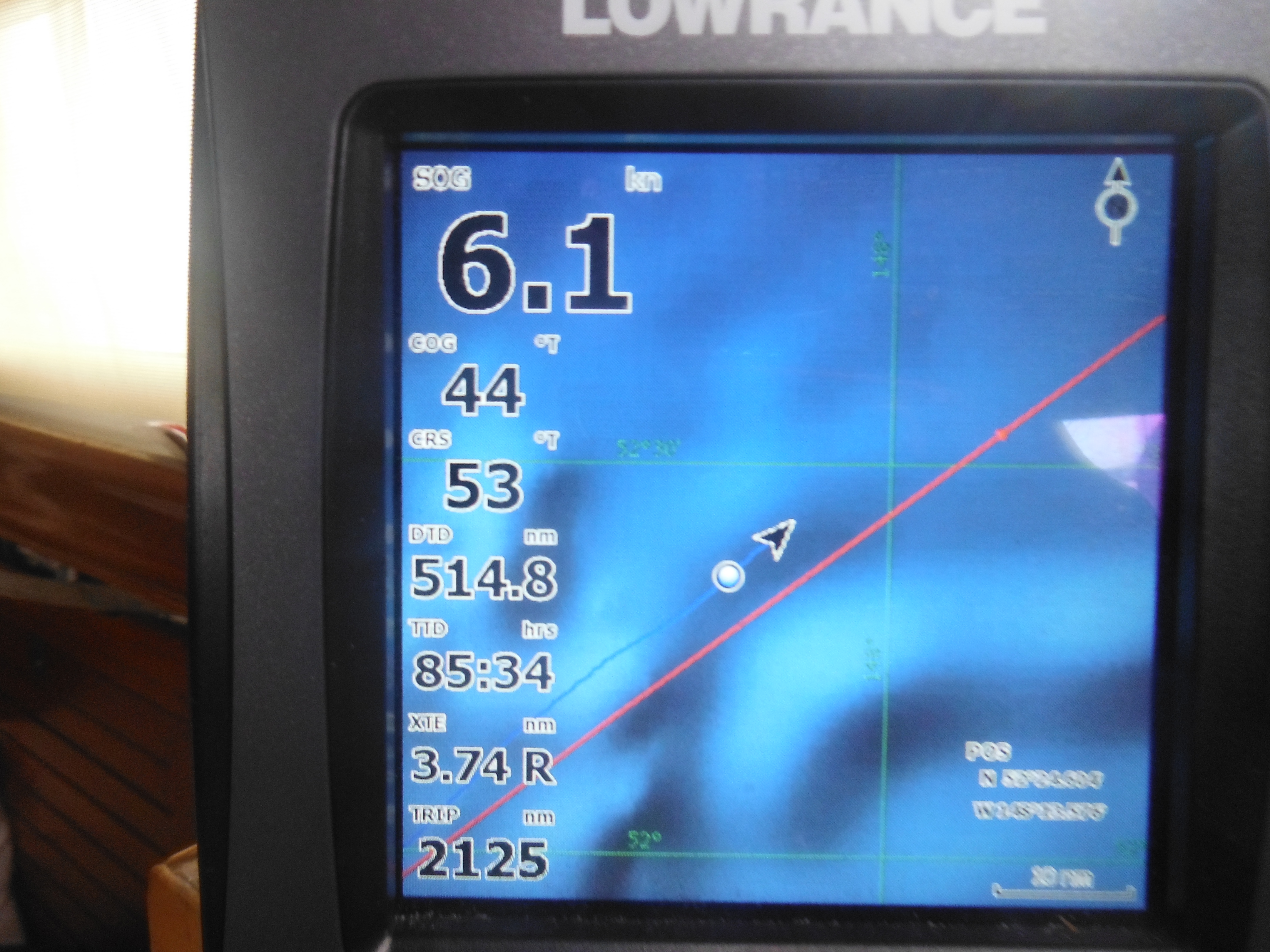
Local Noon Position (11:25am HST)
GPS: 55.52.443N by 140.00.614W
Sextant: 55.54.0N by 140.10W
Course: 59 degrees true
Speed: 4 knots most of day, decreasing
Wind: 6 – 8 SSW, decreasing
Sea: 1 – 2 feet
Sky: Mixed sun, mostly sun until evening, now high cloud, but an open sky Bar: 1030 … way up from yesterday
Air Temp (in the cabin): 50 degrees
Water Temp: 47.5 degrees, increasing
Sails: All up, all searching for a breeze.
MILES
Since last noon: 119
Total for passage: 2330
Daily average: 117
Miles to Sitka: 157
SIGHTINGS SUMMARY
Debris: Small piece of plastic, submerged. A liter soda bottle, crushed, floating at water top.
Ships and other piloted vessels: None.
Birds: One Black Footed Albatross. One Long Tailed Skua. Several shearwaters, puffins, storm petrels…I didn’t pay much attention today.
DAY SUMMARY
In high school geometry I learned of the infinite divisibility of numbers. The principle is simple and obvious: four can be divided into two, two into one, one into .5, to .25 to .125 to .0625, etc. and forever. But to my young mind, searching ever to be logical, this posed a problem for objects moving through space.
It was the logic of it, that and a pleasant lack of math, that made geometry my favorite math class. Frequently I stayed long after the period asking questions and arguing theorems at the blackboard with the teacher, Mr. Gifford, and it was here and after days of pondering the problem in private, that I posed my riddle.
On the black board I drew an arrow headed toward a target. “If the distance between an object and its destination can be halved infinitely, how does the one ever reach the other?” I asked. In truth I was proud of my discovery. It seemed a real stumper.
Mr. Gifford looked at the arrow I had drawn, then at the target, and answered with weight, “I think after a time the arrow simply runs out of patience.”
The arrow is luckier than we if it can shake free from its mortal coil and make that last leap to the bull’s eye simply by pitching a fit. I’ve tried that and failed. We in the North Pacific have no such fortune. We are bound to the infinite divisibility of, in our case, wind speed.
It is now a truism for Murre and me and passage making that the closer we approach a destination, the softer blows the wind, and just before we enter the long sought bay or round that final point, the sea turns to glass and we bob.
Same now. Earlier and earlier the day brightens (well before 3am–I have yet to be up early enough to see sunrise); it blooms crisp and fresh; views are expansive; clouds stretch out like mountain ranges above this great plain of blue. But the beauty comes at a price to be paid in wind. The bar has jumped to 1030, and all day wind has worked to become a dissipating vapor. Successfully. Each mile we make, there is less of it with which to make the next.
“Why are you so focused on mileage?” asked my friend. “Why not just slow down and enjoy?”
A fair question. I have the privilege of being a Thoreau aswim in a vaster Walden. Why not rest from the toil of chopping wood and admire the view?
And I do that. Some days, like today, that’s nearly all I do. For hours I sit in the hatch and watch the ocean be its ever-changing, ever-the-same self. Bathed in nearly-warm sunlight I nod off into a kind of monkish bliss that develops into a full blown nap. I wake. Murre is still here; the ocean is still there. Nothing could be grander. Seriously. Have I not made that clear?
But the ocean punishes dawdlers. This is not, after all, a pond. If we are to make port, we must work at it, which is challenging when our major resource, the wind, slacks off.
____
Otter Update
My good friend Jim was kind enough to ask a couple of experts in the field whether spotting an otter in the North Pacific 600 miles from anywhere was cause for concern. Could it be, or should he arrange to have a psychiatrist meet me at the docks in Sitka? (“Zis otter you say, it is more resembling your mozzer or your fazzer?”)
Here’s one response from Tim, as wildlife biologist at UC Santa Cruz:
“It is certainly not a location where we would expect to see a sea otter, although we do know they occasionally make very long distance movements. However the location is much more consistent with where we expect fur seals to go at this time of year – a female fur seal is similar in size to a sea otter, has prominent whiskers and does a similar “periscoping” type of behavior as sea otters.”
And another from James of the Alaska Science Center:
“I suspect that what Randall observed was a northern fur seal. It is extremely unlikely that a living sea otter would be found at such a location as they require frequent (daily at least) access to water less than 100 meters in depth for foraging. I looked at the approximate location of the sighting and could find no habitat suitable for sea otters until quite near the Aleutian chain. Otters feed almost exclusively on benthic marine invertebrates such as clams, urchins and crabs. Even after several decades of observing sea otters I have been fooled by a fur seal impersonating a sea otter, they can appear quite similar.”
So it was not an otter–but I am not entirely nuts. Jim, many thanks!
end
Easy Day
July 9
Day 19
Noon Position,
GPS: 54.49.25N by 142.57.33W
Sextant: 54.50.6N by 142.56W (only had pm longitude shot; so longitude iffy, though nicely on the mark)
Course: 57 degrees true
Speed: 4 knots most of day; closer to 6 know as wind increases Wind: 8 SW all day; in the evening 10 – 12 SW
Sea: 2 – 4 feet
Sky: Mixed sun, mostly sun until 3pm; then cloud; then heavy rain; now only high cloud Bar: 102-0
Air Temp (in the cabin): 48 degrees
Water Temp: 45.6 degrees
Sails: Been running dead downwind most of day, at first with jib and mizzen; now with jib and reefed main (reef only because sail tends to get stuck) on track when in full position.
MILES
Since last noon: 107
Total for passage: 2107
Daily average: 116
Miles to Sitka: 277
SIGHTINGS SUMMARY
Debris: Two logs, one a near miss and one a miss only because I diverted course, both telephone pole sized.
Ships and other piloted vessels: None.
Birds: One Black Footed Albatross flew close to Murre then landed in light airs nearby. Did this twice. A sign we are getting close to typical commercial fishing grounds? Puffins are now common, though I don’t know which species; none close enough to see but white belly, black chin strap and disk-like colored beak. Another scoter-like bird–all black in flight with redish beak. Two skua species visited today, the Arctic Skua, a chunky bird, dark, with hawk-like tan and brown striping and two tiny points protruding from its tail I took to be its toes, but which turn out to be the beginnings of a short streamer tail. So this bird was a young one. Then in the afternoon a group of four Long Tailed Skua. On approach I took them to be terns: a lithe bird, long, thin wings, thin body compared to the Arctic. Gray above, black head, white-ish below, but most distinctive is the very long twin streamer tails which two of the four had. Both skuas were curious about Murre, not because they were friendly, but because they were hoping she was edible.
DAY SUMMARY
Wind became light after dark. By midnight the hateful low cloud and rain had moved past us, and from the hatch I could see stars through a layer of high cirrus. Dimly they flickered as though the clouds were made of ice. I reckoned I had not seen stars in well over a week and thought for a moment to stay and admire them. It passed quickly, this thought. I moved to the task at hand, throwing Murre to wing and wing on the weak SW winds, for the night I hoped, and dived with a shiver back into my sleeping bag.
The slatting of sails woke me at three. Wind had diminished further, but the day was already bright. I dressed, made good the sails, and stayed on deck to enjoy a sky outlined in billowy cloud. I almost made coffee, but instead again retreated to the warmth of the sleeping bag, this time until eight.
The day was as beautiful as its predecessor had been foul. For long periods we sailed slowly under full, juicy, uninterrupted sun. The sea returned to its familiar, sapphire blue as if putting on a favorite shirt; small waves collapsed into giggles of dentine white. Cloud castles moved in like giant chess pieces, but somehow failed to steel the show. As a place, the sky was busy, innovative, cooperative, complex, fun to watch. It even delivered a modicum of heat down to the sea-bound.
Seizing opportunity, I draped Murre in wet towels, fleeces, socks, jackets, for drying. And the sleeping bag was drug into the open air as a relief from the stale smell of its occupant. I opened ports and hatches. I cooked up some *fresh* water and washed head and face. I shot the sun, a clear orb on a distinct horizon, and got results approaching precision. Then I lounged on deck and listened to the solar panels hum in rejoicing at having something to do. Murre, jib poled out to port, main to starboard, bubbled along. It was a happy ship.
Rain returned in the afternoon, the approach of its black cloud like an alien invasion. Then a heavy downpour that moved off an hour later leaving a mixed sky. Wind increasing, the barometer dropping slowly. A reminder: we are not there yet.
A reminder that the race is on. For the last several days a powerful low has been minding its own business up in the Bering Sea, twirling tightly, becoming deeper. The last two lows we’ve skirted, partly by luck and partly by design, have been small, neither deeper that 1010mb. This one is already 990mb and today it jumps the Aleutian chain, beginning its swoop eastward toward the mainland. Winds are already 25 to 30 knots, and the fetch of waves the whole gulf of Alaska. Murre and this low are pressing toward the same place. Who will arrive first? Will the sea deliver yet one more kick in the pants before we find safe haven?
end
Difficult Day
July 8
Day 18
Noon Position,
GPS: 53.54.20N by 145.31.48W
Sextant: No sky.
Course: 55 degrees true
Speed: 6 knots
Wind: 15 – 17 SSW, then a period of 25 gusting 30 SSW
Sea: 3 – 8 feet
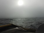
Sky: Very low cloud with rain, sometimes heavy, all day
Bar: 1021
Air Temp (in the cabin): 50 degrees (heater blaring)
Water Temp: 43.4 degrees
Sails: Various. Hanky sized jib when it was honking to double reefed main and hanky sized jib most of the afternoon.
MILES
Since last noon: 137
Total for passage: 2104
Daily average: 117
Miles to Sitka: 384
SIGHTINGS SUMMARY
Debris: None.
Ships and other piloted vessels: Three in the night, including one called MASS PROSPERITY.
Birds: Several Black Footed Albatross, Fork Tailed Storm Petrel, Leaches Storm Petrel, Mottled Petrel. Expected all day to see a Mallard Duck or a Flamingo. None observed.
DAY SUMMARY
A poled out jib overnight provided a controlled, quiet ride, interrupted only by the passing of three ships. The alarm woke me each time to find the ship always ahead of us. So high? I would not have expected the great circle route to take ships up into the 50s of latitude. One was strangely named: MASS PROSPERITY. Almost radioed over for a lump of coal and a crust of bread.
Rain in the night, heavy at times, and this has continued into the day with the addition of a crazy-eyed, knee-jerk, fitful, often strong wind from the south.
Went on deck early, before coffee, in the rain to take down the pole and shake loose a reef. Worked for 45 minutes and when I came below felt wetness inside the foulie jacket. Damn thing has lost its water proof coating, I thought. In fact, I had failed to pull up the hood or tighten the gaskets around my wrists. Had seriously wetted top three layers of fleece. An unintelligent way to manage a much needed resource; i.e. warmth, especially in an environment where once wet, a thing is difficult dry. Upset with myself all day. Fleece hanging all over the cabin swinging wildly as we gyrate in the swell.
Before noon wind came on strong–25 with prolonged gusts to 30–and I was back on deck dropping the main as fast as I could. Left out only a handkerchief of a jib. Lasted two hours. The wind came up so quickly it caught even the ocean by surprise and with no big waves at the ready. And from where? The barometer has been hovering at 1020 for days. We are riding the bottom edge of a low, and possibly this edge is being pushed on by a high extending north. I have no other explanation for a steady bar associated with such variance in the wind.
Rain and low sky and crazy ass, up-down wind all afternoon. Have spent the day in the “conning tower” with frequent dashes to the wind vane for adjustments or forward to work sail. A lull. I think it’s all blown over. The sky lightens to a more playful shade of dull slate. Then it all comes down again; the rigging howls as we are hit by another squall, indistinguishable from the last. With nothing to judge our progress by (a cloud with edges, say), the waves can play tricks and for a time I seriously think we are sailing in circles. I must stare at the compass to be convinced otherwise.
Each day there is simply less here, here. The sky, a gauze, slowly lowers without being closer, the ice-blue sea is drained of color; rain pulls the vigor out of the waves; there are fewer and fewer birds. As time passes our view is reduced such that I think at some point we must simply run out of world. I will wake one morning and cloud will be at the spreaders; rain will hover above a flat sea. Murre’s bowsprit will have bumped into a great, high wall of ice, and inscribed there in some ancient script will be two simple words, THE END.
Why it this man happy?
July 7
Day 17
Local Noon Position, (11:57 HST)
GPS: 52.21.52N by 148.19.57W
Sextant: 52.12.5N by 148.28.00W
Never got the afternoon longitude shot: too overcast. Morning AND afternoon are really a requirement, so my longitude here is iffy at best.
Course: 50 degrees true
Speed: 6 knots
Wind: 15 – 17 SSW
Sea: 3 – 8 feet
Sky: Broken cloud first part of day; low gray with rain the rest. Bar: 1020
Air Temp (in the cabin): 48 degrees
Water Temp: 44.7 degrees (up a bit)
Sails: Poled out jib only, most of day. Surfing.
MILES
Since last noon: 130
Total for passage: 1967
Daily average: 116
Miles to Sitka: 519
SIGHTINGS SUMMARY
Debris: None.
Ships and other piloted vessels: None.
Birds: One Black Footed Albatross, at last! Fairly certain now of my gadfly petrel ID: it’s a Mottled Petrel due to the deep M on wingtop and gray belly, and its size. Saw a Puffin today; no idea which.
DAY SUMMARY
Usual day. I woke, dressed, and hit the deck to unreef, unroll sail from the night-time, conservative, so-I-can-sleep configuration. Then coffee from the companionway hatch where cathedralesque clouds filled the sky in every direction. Such height, depth, structure, almost purposeful design. Worthy of all the admiration I could draw up, so I drew up as much as possible. Then the albatross. This was promise.
The first set of sail didn’t work. Wind on the quarter was light and the jib, main, mizzen combination only filled the mizzen and left the other two panting, unhappy. Murre steered like a squirrel. Mid morning I poled out the jib and doused the complaining main and over-achieving mizzen. This pleased everyone.
The grand clouds were erased. The sky lowered, taking on the color and texture of a cement floor. As interesting to look at as the sole of a shoe. Then it began to rain. I retreated to the cabin, again, and felt around for my depression.
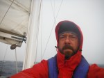
Most of my life has been lived indoors since we got above 40N as there is no place on deck to hide from the weather. The cuddy and “pram” hood I built in Kauai were designed to protect boat and crew when sailing on the wind (wind abeam or forward). It was what I anticipated most for this passage north, and when we get these conditions, the hood is a snug place to be.
Sadly, we’ve only been on the wind about three days in the last two weeks. Every other day it’s been wind on the quarter or dead aft. The hood is like an ice cream scoop in these conditions, funneling cold air and rain directly below, and forcing me to keep the hatch closed at all times.
But today came descending through leaden cloud an innovation. Quite without thinking about it I unsnapped the leading edge of the hood and tipped the whole thing aft. In an instant my life is transformed.
Now the rain on a dead run is caught by the hood and drained into the cockpit. What’s more, for the first time I have clear view forward. I am outside (at least my head is); I am dry; I can see. It’s bliss.
I stood in my newly named “conning tower” all afternoon. I had lunch up there, and later, tea. I put on music, the Wailing Jenny’s, and sang “Glory Bound” over and over as loud as I could without falling into fits of coughing. I was terribly out of tune but did not care any more than a singlehander I once met who sails alone into the ocean because he loves to sing but cannot hit one note, not one. “When I’m at sea, no one can hear me; there I can really belt it” he said. It rained, and then it continued to rain. I had more tea, this time with stale cookies, as waves grew and curled, and Murre surfed to 11 knots. From this new vantage I identified (I think) my mystery bird of many days as a Mottled Petrel. And from here I saw my first Puffin, a bowling pin with wings and a striped, vice-like beak. It flapping furiously into the wind and lost ground as fast as Murre was making it.
I only left to come below and write this report.
Today the weather was foul. How grand!
end
Where is Murre page fixed!
Hello all
This is the wife up dating from the heart of London about to head out for dancing and cocktails. I thought it was important that you knew while Randall froze his tush off in the northern latitudes I was making the most of my last days of singlehood.
Anyway, I got a couple of pings from folks that the “where is Murre” page link was broken. All is fixed now and you can see Randall’s current location.
Cheerio folks!
J
High Latitudes Sailing
July 6
Day 16
Local Noon Position, (12:09 HST)
GPS: 51.00.85N by 151.00.89W
Sextant: 50.55.3N by 151.10.00W
Good day for shooting the sun, but my results lacked accuracy. Second day that my afternoon shot for longitude failed to compute at all. Not sure the issue. Possibly my aim is bad, seas have been boisterous, or possibly our great speed moving east and the sun’s great speed moving west mean I’m having difficulty stopping it at the horizon.
Course: 50 degrees true
Speed: 6 knots
Wind: 17 WSW
Sea: 3 – 8 feet
Sky: Real sun first part of day; now back to gray on gray
Bar: 1020
Air Temp (in the cabin): 48 degrees
Water Temp: 41.4 degrees
Sails: All sails up for first part of day, but wind has increased, so mizzen down and a reef in both main and mizzen. Wind on port quarter.
MILES
Since last noon: 127
Total for passage: 1837
Daily average: 115
Miles to Sitka: 649
SIGHTINGS SUMMARY
Debris: None.
Ships and other piloted vessels: None.
Birds: Fork-tailed storm petrel and Leaches. Sooty Shearwater. The small, as yet unID’d gadfly petrel. An Eider Duck (see below). Sea is still mostly empty.
DAY SUMMARY
With the crossing of 50N in the night we are finally, officially in high latitudes. It has long been a dream of mine to sail the high latitudes of the southern ocean, down around Cape of Good Hope, Cape Horn, down where the 40th degrees of latitude are called the “Roaring 40s” and the 50th degrees of latitude, the “Screaming 50s”, down where full gales are the norm and waves can grow to 100 feet, down where the giant Wandering Albatross with a wingspan of ten feet circles the globe endlessly above an ocean that is a perfect loop.
But for now I am quite satisfied to have gotten Murre and myself well and truly into the high latitudes of the north pacific. It is reward enough to be punching our way through seas first explored by Captain Cook and then Vancouver and into territory entirely new to us.
Wind had eased overnight such that I raised the mizzen first thing in the morning. Up here it is light by four and a mature day before six, and today by six we had a full, if wane sun, and a return to blue sky, the familiar towering, complex cumulus and a sea of sparkling obsidian. It was grand. I felt I could breath.
I made a video extolling the virtues of the day and bragging that I’d “figured out the cold” with my layering system. Not much of a system. Just put on all the clothes you have. After that I basked.
It didn’t last.
By noon a leaden sky had rolled in from windward and stiffened the breeze. A steep, difficult sea built quickly; Molly and Murre tussled for control. I lowered the mizzen. This seemed to please them both. Then I retreated below to stare blankly at the odometer as it slowly ticked off the miles to Sitka and wonder if I would ever be warm again.
Breakfast was hot oatmeal; lunch, a can of raviolis heated on the stove. By midday I’d drunk two cups of coffee, two cups of hot cocoa, and two cups of green tea. Each warmed me for a moment, and then the seeping cold began again.
Low and gray the sky–just so, my mood–chill the bones. This too is the adventure.
In the afternoon the water color changed from a steely gray to an ice blue. Like the color found at the heart of a glacier. Also the color of water shoaling over sand. In the distance I expected to see breakers. The chart assured me depths were over a mile. So from whence the ice blue? There was nothing in the cast of sky to cause it.
Against the ice blue, knots of brown kelp are now common, and rafts of sooty terns who always wait until Murre is well past before taking flight en masse, flashing their silvery coverts. Then a lone Eider Duck, a Surf Scoter, dark overall, a shovel-nosed beak with some color, and a squat body. It did not take flight as we passed. I groaned, remembering my otter. No one will believe this one either.
end
Hearing Voices
July 5
Day 15
Noon Position, HST
GPS: 49.27.384N by 153.18.836W
Sextant:
Rain then heavy cloud blocked all sun shot opportunities.
Course: 45 degrees true
Speed: 3 knots
Wind: 6 WSW
Sea: 1 – 3 feet
Sky: Rain, sometimes heavy in the morning, low and gray the rest Bar: 1022
Air Temp (in the cabin): 43 degrees when I woke, up to 48 by noon Water Temp: 41.5 degrees
Sails: All sails up. Wind on port quarter.
MILES
Since last noon: 111
Total for passage: 1710
Daily average: 114
Miles to Sitka: 775
SIGHTINGS SUMMARY
Debris: A child’s baseball helmet, white, upturned and floating high.
Ships and other piloted vessels: None.
Birds: No albatrosses again today. Saw a tern over the masts, filling the niche of the Tropic Bird. Got it narrowed down to three potential species based on territory: Common Tern, Aleutian Tern, Arctic Tern. I think it’s the latter due to white belly.
DAY SUMMARY
Rain all morning took away the wind. In the afternoon there was a moment of clearing, a patch of blue sky the size of a postage stamp, and then a white sun made the sea look like undulating snow fields. This lasted two and a half minutes before both sky and sun were banished and cloud resumed its rule.
Light breezes then returned. I went wing and wing in the afternoon, polling out the jib. This lasted an hour before wind swung abeam and the pole had to come down. I reefed the main, and snugged all up. Then the wind went back astern and softened. Ah, the life of a sailor.
Have I mentioned I hear voices?
Not all that unusual for singlehanders. Some go one better and imagine real people. Joshua Slocum (first man to solo circumnavigate the globe) once developed a fancy for dried prunes in the middle of an ocean crossing and promptly ate the entire stock he had been given at his previous port of call. His fancy was immediately followed by a prolonged period of groaning from a position prostrate upon the cabin sole, and his boat, SPRAY, was left to fend for herself while Joshua worked through his agony. Occasionally he would lift his head to find at the helm an ancient Portuguese navigator. I forget his name, the navigator’s. Let’s call him Pigafetta. Pigafetta would doff his hat to Joshua and continue sailing the boat. When Joshua recovered, Pigafetta vanished, but under his care SPRAY had maintained her course all the while.
My visitors are not nearly so well developed nor historical. Often I hear an older woman speaking softly, reproachfully to a younger man. Softly he objects. The conversation is intimate without being amorous, and yet the woman is neither the man’s mother nor his wife. I cannot quite make out the subject line–encouraging examples upon a more upright or more profitable life, perhaps. I can make out words like “You should…” and “It would be best if…”, but always the tones are soft and the remainder is just beyond earshot. It took me a week to figure out that this quiet conversation was the alto and tenor squeaking of the mizzen sheet block.
In certain seas an “Ooh! Ooooh! Ooh! Ooooh!” can be heard inside the cabin that reminds of a female parrot at the very height of pleasure. This turned out to be a piece of line for one of the food hammocks rubbing up against a coach roof frame as the hammock swung. I’m not a prude, but hearing the pleasure of others does not necessarily increase my own, so I put a bit of grease between the line and the frame, at which point the parrot flew off to join crew on a less puritanical ship.
From below the jib sheet block, a big bronze piece, sounds very like gun fire when it is jerked hard against its car, also bronze. Worse, the active block seems always to be just inches from my ear when I’m sleeping, and so the sound has figured prominently in several dreams with unfortunate endings.
There are other, more random sounds. The fairly common and completely inexplicable honking of a New York Taxi Cab, for example, or the “ping” that announces I’ve just received an instant message from my wife. This would be lovely, but the phone has been off since departure. Occasionally a “Hey You!” very loud and from no where in particular or a “Hello” just behind my back, but when I look up there is never anyone there to take responsibility for the greeting.
I’ve not hallucinated any physical sightings as yet, like waking to find Joshua Slocum at Murre’s wheel when I’ve eaten too much now mouldy dried Marlin. With one possible exception.
After observing the Sea Otter a couple days ago, I asked my friend Jim to explore for me what the chances were of a Sea Otter being so far from land, and this was his response:
“Initial research indicates sea otters usually stay within 1 kilometer of the coast! They have no blubber (though they do possess the ultimate in water-repellent dense fur), and must consume 20-38% of body weight DAILY in order to fuel metabolism (100 degree F. body temp) in those cold waters. Diving capacity listed at up to five minutes and 350 feet, though rarely beyond 4 minutes and 75-90 feet deep. While they mostly eat
shellfish, apparently the western Aleutian population eats a fair a bit of fish,
but mostly slow-moving, bottom-dwelling fish. Hard to imagine your otter making it the many thousands of feet to the ocean floor for a meal. Thus, it sounds like your otter may have been entirely out of typical habitat. I’ll forward your sighting to some CA researchers, and we’ll see if they grace us with a response.”
So it could be I have hallucinated after all.
___
On a different tack entirely, I would like to announce that my friend Kelton has been appointed Poet Laureate of Murre, for his below master-work which celebrates my decision to stop listing in extreme detail each piece of marine debris I find, a practice he disliked intensely.
Randall Reeves, a sailor, he;
Saw concrete float upon the sea.
Ran into the concrete, twice,
Then overboard for a bag of rice.
Captain Reeves has left the boat!
Luck for him, his fleece pants float.
Climbed back aboard his ocean perch,
And quoth: A pox on sea research!
Please join me in saying “Bravo!”
end
Toughness
July 4
Day 14
Local Noon Position (12:28HST)
GPS: 48.06.80N by 155.07.90W
Sextant: 48.09.1N by 155.05W
Continue to be amazed at how little sun it takes to get a sun shot, and how, in mild conditions like these, a seemingly poor shot can yield good results.
Course: 40 degrees true
Speed: 5.5 knots
Wind: 10 – 12 WSW
Sea: 2 -5 feet
Sky: Low and gray all day
Bar: 1030, dropping to 1025 in the afternoon…careful!
Air Temp (in the cabin): 45 degrees (when I woke)
Water Temp: 43 degrees
Sails: All sails up. Wind on port quarter.
MILES
Since last noon: 131
Total for passage: 1699
Daily average: 121
Miles to Sitka: 886
SIGHTINGS SUMMARY
Debris: None.
Ships and other piloted vessels: None.
Birds: No albatrosses at all today. Got an I.D. for the Sooty Shearwater (dark above, light patches on underwing coverts, often sitting water-top in groups). One or two white-rumped storm petrels. Other gray jobs w/out I.D. But sea pretty empty.
DAY SUMMARY
Yesterday morning, whale spouts in the medium distance, a large pod by the six or eight puffs of white I saw glinting in the only unguarded sun we would see that day. The blows started dead ahead and I was as pleased to see them move out of our course as I was to see them at all.
This morning, nothing so dramatic. A knot of kelp, for one thing, followed by another knot of kelp, followed by no sun, but continuing layers of low and gray. I have searched the “wax lyrical” files under the category of “low gray cloud sometimes giving way to high gray cloud, sometimes ragged low, sometimes variously shaded, but usually simply low and gray, often with close fog, also gray” and have come up empty. It’s not that my surroundings are unbeautiful so much as they are undifferentiated. What am I supposed to say?
Two things cheer me. One, the temperature dropped by the usual three degrees overnight according to this morning’s reading. Down to 45, to be exact. But it came back up to 48 by noon. That’s a first. Two, the wind has been steady from the west these last days and our day-runs are solid. We’re making good time.
But the sea is empty. Even the Albatross has wandered off elsewhere.
I sat in the companionway hatch this morning pondering toughness. Pondering how yesterday I didn’t have any of it (I gave it up for whining) and today I have some. Pondering what the quality constitutes. There are things it is not. It is not brute strength, though that can help, or a practice of inuring oneself to pain. And it is not anything as ennobling as resolve–toughness does not come from planning, setting a goal. Rather, toughness is nothing but a set of mind. It is simple stubbornness. It is a cussedness. Toughness says “move forward” when all the evidence says “run away” simply because it hates being told what to do.
My father-in-law has on the wall of his main room a painting I admire. At first glance it appears as though a fishing smack has grounded on a lee shore in a gale. Winds are raging, the sky is fierce with ragged cloud, and waves upon the beach are heavy and dark and smashing. The smack looks to be taking a beating. A man in the foreground is hauling a line ashore. In fact, this is a typical day in the life of these boats and fishermen in the North Sea. The shore is a raging lee shore to be sure, but the smack is not wrecked; rather its being prepared to launch. It’s about to go out to earn a day’s pay; off that beach, through that surf and close hauled in that wind for the banks. Peter described the story as I stood gobsmacked before the painting.
I thought of that this morning when I thought of toughness.
end
Comfort vs Pleasure
July 3
Day 13
Local Noon Position (12:40HST)
GPS: 46.34.96N by 157.23.84W
Sextant: 46.36.6N by 157.30W
Low and gray–was surprised to get enough sun for any of the shots, much less all three. Good practice, shooting in such cloud.
Course: 40 degrees true
Speed: 5.5 knots
Wind: 14 – 17 W
Sea: 4 – 6 feet
Sky: Low and gray all day
Bar: 1033
Air Temp (in the cabin): 48 degrees
Water Temp: 43.5 degrees
Sails: All sails up, a reef in each. Wind on port quarter.
MILES
Since last noon: 132
Total for passage: 1568
Daily average: 121
Miles to Sitka: 1017
SIGHTINGS SUMMARY
Debris: None.
Ships and other piloted vessels: At 3am observed the NYK TERRA on course of 105 degrees true, making 15 knots for Manzanillo Mexico; due to arrive on July 11. Closest point of approach: two miles ahead. Seemed close.
Birds: Layson’s constant company all morning, but have seen none in afternoon. The Layson’s is the only bird left from our days in Hawaiian waters. Many other brown birds shaped like bullets–what they are no man can say.
DAY SUMMARY
My favorite explorer/author H.W.Tillman said that “Comfort cannot be expected by those who go a pleasuring.” By “pleasuring” he was not referring to a tropical vacation at a fancy hotel, where comfort is top of the list, but rather to such things as he had done: sail his old boat from the UK above the arctic circle and into the fjords of Greenland or deep into the southern oceans to climb a wind-wracked rock of an island. “Pleasure”, for him, aligned with “satisfaction”–accomplishing a certain thing of little utility and no promise for the simple satisfaction of having done so, and comfort be hanged.
Tillman would not be pleased with me these last days. He was famously hard on his crew, disliking such signs of weakness as the donning of sweaters and gloves much before the first ice berg was sighted.
But I am not as tough as he.
Each day that we lose another three to five degrees of warmth my mood becomes more grim. This morning the cabin temperature was 48 degrees and it has not shifted all day. It will tonight. It will go down. I calculate that if we continue losing degrees at this pace it will be 68 degrees below zero by the time we reach Sitka. Given my current frame of mind, this does not seem implausible.
The days are drab and gray. Occasionally a low layer of featureless cloud peals back to reveal yet another, higher layer of featureless cloud. For minutes at a time, a wane sun fights through to show itself no brighter than a moon before it is smothered and must retreat. The wind, so welcome as it moves us along so briskly, also bites, the sea, once so blue, is now slate and heavy.
I wear two hats, five shirts, four pants, two pair of socks. I have broken out the *heavy* foul weather gear, itself multiple layers and such a complication of zippers and velcro it requires an operations manual. I now sleep in the winter bag, and I drink all my liquid heated. I’m as kitted up as I can be.
But I’m finding it challenging to adjust. No way around it, it’s no fun being cold when tomorrow promises to be colder still and cold the rest of the way. I am having to remind myself today that I am not here for fun, I’m here for pleasure. At the moment its a tough argument.
Tale of a Sea Otter and a Little Blow
July 2
Day 12
12 Noon HST Position
44.57.113.N by 159.40.540W
The sky was too low except for the morning shot. I was on deck most of the day and did not compute local noon.
Course: 40 degrees true
Speed: 6 knots
Wind: 20 to 25 till about 3pm, then just 20
Sea: 8 – 15 feet
Sky: Low and gray all day
Bar: 1027, falling slowly until late afternoon; now back up to 1029 Air Temp (in the cabin): 53 degrees
Water Temp: 48.5 degrees
Sails: Wing-and-wing; then a tiny jib; then a tiny jib and double reefed main.
MILES
Since last noon: 118
Total for passage: 1436
Daily average: 120
SIGHTINGS SUMMARY
Debris: Two pieces of small wood. Band aid sized piece of plastic. Nothing else. UoH and other boats report we are above the main debris fields for now.
Ships and other piloted vessels: none.
Birds: Layson’s gliding strong over waves; storm petrels dancing and rolling amongst them like waves were hills of grass.
DAY SUMMARY
Overnight Murre chopped slowly NE under a reefed main only, a set of sail not for speed but for sleep. Without foulies or boots this time the bag could do its job, and I had a solid night of shut eye. I bathed in the warmth. The cabin was 53 degrees at dawn. I didn’t move.
Already the wind was getting up when I did. As coffee boiled I put us before the wind wing-and-wing, a reefed main on one side and a reefed mizzen on the other and no headsail, and we made an easy six knots for a time. I sat on the bow sprit enjoying the view of a boat being sailed as a square rigger, I thought. Or a granny, said a voice.
Then the Sea Otter. Just before the bow and looking at first like a dead head (a log standing vertically in the water with only its top sticking out). A dead head that was dead ahead, that moved. A dead head with whiskers and dark eyes that looked at me with surprise as we passed, a look that said, “What the hell are you doing here?” which was exactly what I was thinking.
I dashed below to check the chart, expecting any moment to run aground on a tiny island I’d previously missed. But as I suspected the nearest island, the nearest anything was 600 miles north.
In a new country, one gets use to seeing the unexpected: birds and fishes he cannot name, an upturned boat where should be only water, a floating dock. But here was something I was perfectly used to seeing but had never dreamed of seeing HERE (Here, by the way, was 44.35.870N by 159.59.616W at 0730HST). The experience was a little like being far out in the ocean off Florida and sailing past an alligator. There was context; it was just wrong.
With the day came no sun and the cabin stayed 53 degrees. I fired up the heater.
Then it really started to blow. The sky came down gray and drizzly and by noon wind was 20 knots with prolonged periods of 25. There was too much wind to jibe the main, and it was the wrong sail now anyway. With difficulty I lowered it, and as I worked its wrapping up, Murre made 4 knots through the water on bare poles. A little jib eased out and we put before the wind in comfort.
I spent hours measuring the wind with my hand held indicator. The water whipped and spat, got gray and streaky; wave tops exploded, and real sea started running. Still the indicator read 20 knots with long periods of 25. The rigging whined, our jib was but a scrap of sail and yet we made 6 knots. It didn’t make sense.
Frustrated with the wind indicator, I turned to measuring the sea, which grew and grew as the afternoon passed. I stood on the cockpit hatches and pointed at one roller that must be at least 12 feet high.
“No it’s not,” said the camera.
“How would you know,” I said. Cameras hate telling the truth about waves. “It’s getting pretty rough out there.”
“Rubbish. Click. See?” it said, showing me a photo of an ocean that looked like … “it’s a mill pond.”
“That’s wrong,” I protested. “Here, I’m standing on the cockpit hatches, which I have previously measured, with a tape, at four feet above the water line. I’m near enough to six feet tall to call it even, and I’m looking UP at that wave there, so it must be over ten feet.”
“Click. Nope.” said the camera. “I’d estimate three and a half. And look at the pretty blue water with not a white cap for miles.”
“You can’t see straight is your problem.”
“But what I see can be verified.”
“Verified wrong! Look,” I said, “Here comes another.”
A giant of a wave rose up over the stern, thick, steely blue and muscular. As it crested I pointed at its head (which, by the way, was at a 45 degree angle above my own) and yelled, “HOW TALL ARE YOU?”
It said, “I dunno” and proceeded to collapse in a fit of laughter all over me. The camera had fled to the cabin, and I was left no choice but to leap for the mizzen mast and hug tight as Murre, unhappy herself at being drenched, shook like a dog.
But I swear THAT wave was 15 feet.
end
A Usual Day if Brisk
July 1
June 30, 2012
Day 11
Local Noon Position (12:52pm Hawaii Standard Time):
By GPS: 43.17.110N by 160.54.061W
By Sextant: 43.19.5N by 161.06W
Course: 25 degrees true
Speed: 6 knots first, 5 knots second half
Wind: 18-20 WSW until 10am; 8-12 WSW after
Sea: 8 feet in the morning; 4 this afternoon
Sky: Low and gray until noon; crystal clear now
Bar: 1031, falling slowly
Air Temp (in the cabin): 58 degrees
Water Temp: 54 degrees
Sails: Double reefed jib and main in the morning; all plain sail by end of day; wind on port quarter.
MILES
Since last noon: 12
Total for passage: 1318
Daily average: 120
SIGHTINGS SUMMARY
Debris: Nothing in the morning at all, possibly due to grey-sky interference and a moderate, breaking sea. Yellow plastic drum in the afternoon, along with a plastic bottle and a piece of styrofoam turning in the surf; two black fish buoys; a piece of wood, 1 by 2, about a foot long.
Ships and other piloted vessels: One ship at 0915HST. The Vincent T Thomas Bridge. Heading 269 degrees true at 16knots. Destination: Tokyo.
Birds: Today is all about Layson’s. Have seen no less than nine separate Layson’s this afternoon. Leaches Storm Petrels played in Murre’s running lights all night long. Phalarope in early morning. A Kermadec Petrel this afternoon–whitish around face, whitish primaries under–playing in the disturbed air in front of the jib. First Fork Tailed Storm Petrel of the passage as I write.
DAY SUMMARY
Cold night. I slept in my foulies and boots again and under the sleeping bag but could not get warm. Wind grew quickly with sunset and by midnight I had been on deck three times. Leaches storm petrels played in our running lights as I doused the main sail, swinging like bats in the glow of red and green, trilling softly in their glee. Job done I did not stay to watch but dashed for the cabin. Now we were down to just the jib. We rolled and sloshed mercilessly in the night. By morning wind was 18 touching 20 from the WSW, seas were lumpy and steep, but nothing Murre hasn’t seen. I had slept little and dreamt badly.
Low, complex cloud, hazy below, shadings of slate above. I put up a double reefed main before anything just to help stabilize my drunken boat. And then I stamped my feet as the water boiled for coffee. My urine steamed as it went over the side. I made very hot oatmeal. I put on more layers and wondered what I will do when it actually gets cold.
I sat for hours watching the day. Would the wind increase? Waves were in a rush and nearly vertical. As we crested, I could see them stack and then mushroom in a froth for miles. We took their weight just off the beam, sometimes sliding up a wave that the second before had looked as though it would crash over the cabin. Some tried, but Murre seemed to sidle just enough to slip over the top. Not always. One put 20 gallons of water into the cockpit, but only one. I watched as it was sucked down ever so slowly and wished for larger drains.
No debris that I could see. Are we above it? Then the ship, seen by my electronics eleven miles away. Half an hour later it came hull up out of the mist like an island. I was tempted to call on the radio for a chat–so many cruisers do–but what would I say? They on their heated, unmoving bridge–me in the wind, huddled, hanging on for grim death. Except for the sea between us, we had little in common. It was a workday for the folks on the Vincent T Thomas Bridge, bound for Tokyo. Best to let them be.
By mid morning the wind had backed off. By noon the clouds sailed on ahead leaving us in bright sun. No need to run the engine today. But the layers did not come off. Chill the wind remained.
Projects I had promised to finish before latitude 40N I did finish today. The drogue and its 250 feet of line are now rigged and ready. The storm jib is hanked on the inner forestay, waiting. The jugs of sea water collected for the University (they are testing for radiation) are lashed in the cockpit. I stuffed towels into the Dorade vents to slow their leaking and put wax (the kind used to seal toilets in place) over other small vents that can squirt in water in a big sea. Who knows if we are ready for the north Pacific, but we are as ready as we can be.
Then I found myself lounging on the forekdeck in the sun remembering yesterday, remembering how I wept for no reason that I could figure. I had been thinking of people I know in Tokyo, of the lives pulled out to sea from the coast, the fragments I am sailing through. But that wasn’t it. There was some other thing, a quick flash of memory, and then in a moment I was in tears but the memory had vanished. Emotions flow more freely here where there are no natural impediments, but their source is not necessarily any the more clear.
The comedy of Layson’s Albatrosses pulled me back. For an hour I was always in sight of a Layson’s sitting in the water to starboard, always to starboard, always alone, always facing the sun. I’d pass one, and there in the distance, another bobbing like a fat seagull. And this on a day with such fine wind. I have seen so many Layson’s on the cliffs of Kauai. Could any of those birds be these?
Moon rising, sun setting. Time for dinner, a glass of wine, and the next project: how to stay warm tonight.
end
Big Decision
June 30, 2012
Day 10
Local Noon Position (12:52pm Hawaii Standard Time):
By GPS: 41.13.477 by 161.43.495W
By Sextant: 41.42.7N Way out. Fog has obscured the horizon so that no morning or afternoon shot was worth attempting. Had good sun at noon, but no clear horizon line, so I guessed; thus the result.
Course: 10 degrees true
Speed: 5.5 knots
Wind: 8 WSW first half, 12 WSW second half
Sea: 2 to 4 feet
Sky: Pea soup fog all day until an hour ago; now crystal clear Bar: 1033, falling slowly
Air Temp (in the cabin): 64 degrees (60 when I woke)
Water Temp: 59.5 degrees
Sails: All plain sail. Wind on beam most of afternoon. Nice gentle run.
MILES
Since last noon: 109
Total for passage: 1189
Daily average: 119
SIGHTINGS SUMMARY
Debris: Nothing major today, and many thanks. Well OK, another log of about 15 feet, but not in our path, a large piece of styrofoam with a shearwater roosting on top, a plastic tray, a lotion bottle, a water bottle, bits of styrofoam.
Ships and other piloted vessels: One ship at 1pm passing west, seven miles ahead.
Birds: Two Layson’s, one Blackfooted Albatross. But the real story is the Skua that came by–thick dark body, white patches on primaries, squared off tail. ID? No idea. And the Newall’s Shearwater. We are really starting to see northern birds. Also Cook’s Petrels in groups at water top and mixed in with white rumped Storm Petrels.
DAY SUMMARY
Woke to thick pea soup fog that has hung around much of the day, reducing visibility at some points to a hundred yards and less. I left the radar on if I wasn’t standing watch, and when it was off I did nothing but stand watch. Sometimes the fog would lift to reveal a world of gray with fog on the horizon. Then fog would blow back in covering all in a thin vale if you looked up and a thick blanked if you looked dead ahead.
Its being such a new phenomenon (the tropics don’t know from fog), I marveled over it as I had morning coffee. That is, after I got dressed. Thick socks, boots; fleece pants, cotton pants, foulie pants; undershirt, fleece shirt, fleece sweater, foulie jacket; fleece hat. Getting dressed takes so much time! What happened to the days of shorts, flip flops and a shirt if you were feeling formal?
The solar panels, struggling to keep up on the best of days this passage, could put out no more than 2.5 amps in this goop–about what we were using with the GPS, Radio and Radar running–but not nearly enough to replenish what we had used overnight, or the day before, or the night before that. I ran the engine for two hours to charge up the batteries and worried. My math says I could use the engine as a generator for an hour every day for the next two weeks and still make landfall with half my fuel aboard. But I’m not very good at math, and two weeks is optimistic.
At one o’clock, our first ship sighting, not my sighting for there was too much fog, but announced by alarms blaring from both the radar and AIS. Seven miles out, headed west at 13 knots, name, destination unknown. We are now in the shipping lanes. Routes used by cargo ships passing from Asia to North America pass more north than you might suppose–and for the same reason that a flight from New York to the UK passes over Iceland.
Then a Skua flapped heavily above Murre’s masts the way the Tropic Birds did where it was warmer–a dark, lumbering, mean bird reminiscent of a flying bear with a knack for cruelty. Not playful and inquisitive like the Tropic Birds, but hungry, willing to take you down for a bit of scrap. I will not ever name a boat SKUA.
The cold, the fog, the westerly wind, the ship sighting, the northern-water birds all point to our having passed our voyage’s first threshold. We are now over the HIGH and are beginning to experience life in the North Pacific.
Which leads to a big decision: when to make a right turn for North America.
Murre has been pressing north because at first she had no choice and now because she’s looking for the best position. When to turn is complicated and I don’t really understand it, but what’s involved is needing to be enough north so that when we approach the coast near Sitka we don’t have to beat up in the N and NE winds that can come down the coast there. But too far north (especially too soon) puts us in the way of north Pacific LOW pressure systems. The HIGH is too big for them to mess with; they approach and give way, sliding up toward Alaska. We can’t avoid them now that we’ve gone beyond the HIGH’s protection, BUT we want to do our best to pass below them as they swing up. Winds below will be favorable, if often stronger than we’d like; winds above will be contrary and trouble. Sailing a low on the wrong side is like petting a cat backwards.
Today and tomorrow we maintain course, coasting this moderate westerly, and we think over the next move. I rig the inner forestay for the storm jib, set out the heavy line for the drogue, and check lines and lashing. Murre contemplates how to dodge when kicked in the seat of the pants by the bigger waves.
But three days hence the first LOW approaches, which may make for us the decision about when to turn.
end
A Toast to Science, Three Cheers the Dancing Wave
Day 9
Local Noon Position (12:52pm Hawaii Standard Time):
By GPS: missing, busy
By Sextant: 39.26.5N by 162.04W
Course: 10 – 20 degrees true, depending on wind
Speed: 1 – 5 knots. Slow until noon, better after
Wind: 2 WSW first half, 8 WSW second half
Sea: 2 to 4 feet
Sky: 100% cloud in morning; 50% cloud in afternoon.
Bar: 1034, little change
Air Temp (in the cabin): 68 degrees
Water Temp: 63.9 degrees
Sails: All plain sail. Wind on beam most of afternoon. Nice gentle run.
MILES
Since last noon: 99
Total for passage: 1080
Daily average: 120
SIGHTINGS SUMMARY
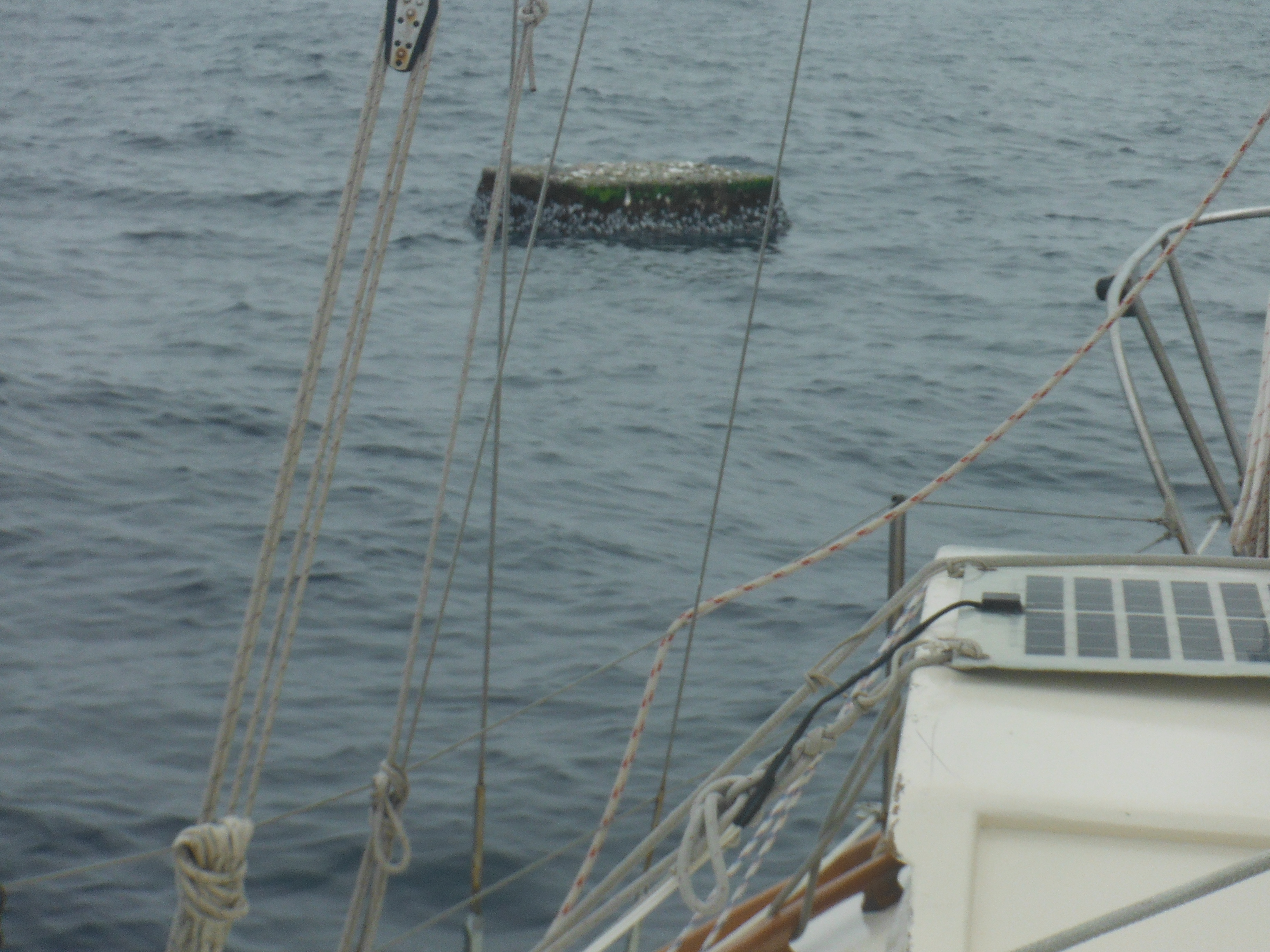
Debris: Concrete Dock early in the morning.
Ships and other piloted vessels: None.
Birds: Again more Layson’s than Blackfooted Albatross; I’d say two to one. Many Wilson’s Storm Petrels. A few small Gadfly Petrels, no ID worked up yet, but this is a new one. Two small Terns, one sitting on the dock and another sitting on a large, very rusty, very fouled propane tank we passed today. Maybe arctic Terns, but their black cap had a white center.
DAY SUMMARY
We stayed close hauled all night and the sea continued to shove us around unduly. I slept propped up against a lee bulkhead by pillows and dressed in my foul weather gear, partly to be ready for a dash on deck if conditions required and partly because I’m beginning to feel the cold. I’ve gotten the sleeping bag out. I had it draped over my foulies. I was not too hot.
Wind began to ease by 2am. My sleepy response to this kindness was to unroll the jib, but I didn’t touch the double reefed main, which could wait till morning. And by morning wind was a whisper. Murre made two knots in the wrong direction when I came on deck, easily corrected.
Daylight showed night had delivered up San Francisco style fog, but this the low-to-the-water and drizzly kind. And very like San Francisco, much of it burned away with the sun. By 9am it was clear enough that I could see we were about to collide with a concrete dock.
A very good friend of mine has recently complained that the passage reports of this crossing tend to be overburdened with itemizations of marine debris. He prefers entries where the author is enthralled with his aquatic surroundings and uses weighty, complex and sometimes mixed metaphors to prove it.
But how many words are there for the color blue, as in the sapphire sea, or white, as in it cottony cloud? I don’t know, but I think I’ve used them.
So on the one hand, all this debris-finding has served as lexigraphic relief for this author. It’s like always having Ranch dressing on your salad and then one week, nothing but Thousand Island. Even if you don’t like Thousand Island, it’s nice to have a change.
More importantly, however, has been the citizen science aspect. As a child I was a fan of the exploits of Captain James T. Kirk; just so, as an adult I am an admirer of the explorations of Captain James Cook. (It was no accident that Rodenberry named the ship in his series the Enterprise or that he inserted the ring of Cook in Kirk.) In both these tales, one fiction and one not, the objective of the exploration is learning. For some reason, piracy and plunder never caught hold of my young mind so much as discovery of a new world.
The connection here is a bit thin, I grant. But to me, helping to gather deep ocean information for a group of scientists in Hawaii who rarely leave the office and likely blanch at the thought of a small boat cruise excites me. It gives the cruise purpose. And it’s fun.
But I must say that a close encounter with a concrete dock some 2000 miles from the closest marina has led me to reconsider. In fact, after today I’m in favor of defunding these scientists and having all the artifacts whose location they so dearly wish to know shot immediately to the bottom.
The hour that changed my attitude went like this.
I look up from my cup of coffee. A few hundred yards ahead, a large object. I change course, but only slightly, to intercept (“only slightly” does not register until later). It’s a six foot by four foot piece of concrete, heavily encrusted with barnacles but floating two feet above the water. We are moving so slowly and have so little steerage, I have trouble not colliding with it. I take a few photos but want more (for science, remember). I tack back. Another near miss. That we were going so slowly we could have collided with the Empire State Building without sustaining damage misses the point.
Moments later I see a bag made of woven plastic, like the kind rice comes in, with Japanese script across the top. Though I have seen many, I have yet to collect (for science) a clearly Japanese, clearly domestic item. I reach for it with the boat hook. Miss. I tack back. I lean way out.
I fall off the boat.
There are but two rules to a successful ocean crossing. One, keep the boat moving; two, stay onboard. Of the two, the latter is winner. By a large margin.
I did not let go of the boat. I only went in up to my hips. And the boat was moving at all of one knot. But its the kind of maneuver that takes a whack at your self-confidence and gets you called Jonah by other, more practical-minded sea-folk–of whom I used to think I was one. And possibly worst, the dunking soaked the fleece pants and shirt I was wearing. Without enough fresh water to rinse them in, they will be damp the rest of the voyage.
So a toast to science as we wave it good-bye and three cheers for the complex metaphor about growling, frothing, barrel-chested waves.
end
The magic of technology – pictures and commentary…
Hi there! It’s not Randall/Murre it’s the “wife”.
I’m not sure if any of you are aware of the magical technology that allows Randall to post his blog updates on here, but it’s all pretty low tech and high tech all at the same time. Everything you see here is passed through space through a ham radio signal.
This means that posting pictures and videos is virtually impossible. The boat sighting recently noted in a previous post piqued everyone’s interest so we’ve managed to get a photo for you all.
Voila!

How weird is that? Can you imagine what it must have been like to come across this in the middle of basically nothing but ocean. I know my mind is blown almost every day when I read Randall’s posts.
On a separate note – I’d like to refute that yesterday I was shopping for shoes (that’s what he was implying) online when Randall passed 38 degrees latitude and San Francisco. I was, as every good wife should be, looking out to the west and thinking “Wow, Randall’s right out there. So close and yet so far.” And then I ran off to another meeting at the office. This means I can stay employed, get a paycheck, and keep Randall in the lifestyle he’s accustomed.
Ok. Needed to get that out. And I’m totally kidding (for those of you who don’t know me). I do have a shoe shopping problem so his comment was not without some merit. We may be miles apart but my husband knows me.
Well I’m back to work. Thanks for following his journey!
Bash and Crash North
Day 8
Local Noon Position (12:55pm Hawaii Standard Time):
By GPS: 37.56.876N by 163.02.079W
By Sextant: 37.58.3N by 163.10W…or so. Somehow I completely screwed up the afternoon sight for longitude. Struggled with it till my brain leaked out my ears. All I can figure is that I simply pointed the sextant in the wrong direction, a thing that is, in fact, somewhat difficult to do.
Course: 10 degrees true
Speed: 5.5 -6.5 knots most of day
Wind: 10 WSW first half, 15 WSW second half
Sea: 3 to 6 feet and growing
Sky: 0 to 10% occluded.
Bar: 1031 stable
Air Temp (in the cabin): 70 degrees
Water Temp: 64.2 degrees
Sails: All plain sail with one reef in each until about two this afternoon. Now a double reef in the jib and main as we attempt to go close hauled to the north in strengthening WNW winds.
MILES
Since last noon: 125
Total for passage: 981
Daily average: 123
SIGHTINGS SUMMARY
Debris: Much the same as last several days to the degree I can tell; cloud cover in the morning and wave action this afternoon make identification difficult. Two black fish floats, an automotive oil bottle, a large plastic crate, clear plastic water bottles, and around noon, a bloody great log twenty feet long and four feet in diameter. Ancient and entirely covered in greedily reproducing barnacles, except for a kind of monk’s bare spot on top. I had to tack up to this one for a photo. Please mention to any divinity with whom you correspond that kindness would leave these out of Murre’s path.
Ships and other piloted vessels: None.
Birds: More Laysson’s albatrosses today (5 sightings) than Black Footed, and again, one set seeming to fly in company. Several Wilson’s Storm Petrel, several in groupings of three to five. Three of a smaller Gadfly Petrels I’ve not had a chance to look up.
DAY SUMMARY
Low and gray the passing sky
And sharp the passing wind
A drizzle from its wing tips
Foretells climes crystalline
Close hauled all night in easy wind and woke to a sky of high, whipping, wet fog, much like encountered in San Francisco, which is appropriate, because about an hour after noon, Murre passed latitude 38N, the line on which rests my favorite city. It made home feel close; actually, it made me home sick. I’d like nothing better than to go for an evening walk in the park with my wife, and I’m half tempted to run this westerly all the way to the Golden Gate Bridge.
I waved at you. Did you see me? Unlikely, as you, at your desk, sitting over a sandwich and surfing the internet for a new pair of (fill in the blank) weren’t looking. Admit it.
Would not have mattered. We are currently separated by over 1800 miles of ocean.
An ocean that is increasingly boisterous as the day progresses.
Wind has backed into the north a touch this afternoon and accelerated such that Murre now wears a double reefed jib and a double reefed main and is still on her right ear half the time. My wind indicator tells me the velocity is a mere 14 knots. Rubbish. It’s a real rip snorter out there. Waves are getting on toward 8 feet and are quite happily flinging themselves over Murre with a wet amorousness she is having difficulty rejecting. Some particularly forward waves slide up and give her a thwack on the bottom. If you happen to be below decks when this happens, you may think she’s about to come unglued. If you are not hanging on, you may end up in a pile on the other side of the cabin. Murre’s not coming unglued, of course. Her shuddering is designed to remind you she is not a thing. She too takes this weather personally.
Being close hauled in such business is not so fun below. Whatever isn’t fastened down flies and usually knocks you up side the head on its way. Books set down end up in the bilge, as do pens, and galley knives and the trays of only half-dry Marlin that were supposed to be on slow bake in the oven.
Drizzle gave way to brilliant sun by late morning, but the sun has now surrendered again to this high, whipping fog and it looks we will continue our bash-and-crash indefinitely.
Bash-and-crash or walk in the park with the wife. Hmm.
end
Moving Again, but to where?
Day 7
Local Noon Position (12:55pm Hawaii Standard Time):
By GPS: 35.55.088N by 163.25.569W
By Sextant: 34.56.3N by 163.26W
Course: 5 degrees true
Speed: 5.5 knots most of day
Wind: 10 SW first half, 12 – 15 W second half
Sea: 2 – 4 feet
Sky: 80 to 100%
Bar: 1031 falling
Air Temp (in the cabin): 74 degrees
Water Temp: 70.1 degrees
Sails: All plain sail. Wind abeam till noon. Now one reef in all sails, close hauled.
MILES
Since last noon: 80
Total for passage: 856
Daily average: 122
SIGHTINGS SUMMARY
Debris: Not much change. Less small stuff, more big stuff, but still not a lot of anything.
Ships and other piloted vessels: None.
Birds: In the morning a Black Footed Albatross, then a Layson’s, then a Blackfooted all headed west and each within earshot of the other. Rare gull type bird, all brown, including feet and beak–one of the dark Petrels? Beginning to see what I think is Wilson’s Storm Petrel more frequently: small bird, quick flyer, white patch on rump. Still unsure of ID however. My bird guide has a way of reassuring me that whatever I think the bird may be, it may be, or it may not.
DAY SUMMARY
Quiet night. Slow sailing, but gentle, even progress on a calm sea. So still as almost to be at anchor, and yet Murre glided along at 3 and 4 knots as I slept. Waking in the early morning, I realized I’d missed the alarm and had stayed down for more than three hours in one go. I can’t tell if this should worry me. This is my first passage with radar, which is designed to see what I can’t, whether ship or upended fishing boat. So why not get a full night’s sleep? Somehow that seems imprudent as a practice. But three hours by accident I’ll accept.
Wind in the SW today. Murre took it as easy, full-sail sailing while I did chores. A little more calking. Some cleaning. Debris watch. Sun sights. Fish prep.
The meat of the big Marlin I caught has been in the fridge. Couldn’t face it so close to the slaughter. But today I dug it out, all 10 pounds or more. Cooked off half and cut for drying the other half. And ate a goodly portion as sushi while at the task. The drying bits I dipped in soy sauce and placed on trays, and have been nibbling at them all afternoon. Nothing more than a day had changed living flesh into meat, a living thing in its own right into delicious food.
Radio reception was poor this morning, and I missed grabbing my weather chart. This allowed me to remain all day in a fantasy that this growing westerly wind is good for me. Clearly I’m at the top of the high–don’t need a forecast to know that.* And I do want to go west. But not too early.
But the weather chart, once received, painted a troubling picture. The high moves back up a tad tomorrow. My wind goes from west to northwest, while the southerlies I need in order to get cleanly above 40N are several hundred miles off toward Japan. I may have committed a grave error in not going VERY far west while I had the chance. I cannot beat all the way to Alaska, after all.
The disjunct between daily life aboard ship and the broader view of the world on a weather chart can be boggling. Rationally I know the ocean I inhabit is a vast piece of water. But I can’t see more than four miles in any one direction. The horizon may be limitless, but it approaches and fades with equal haste, and always there is more of it, so that in fact my world feels quite small. A corollary is airplane travel where too the sky is vast, but your world from seat 26A feels contained as you peer out at continents.
This is part of the charm–access to big things in small bites. Though moving constantly, you always have the sense of being off in a private corner where life can be absorbed at your own pace, say, at a small desk near the window at the Library of Congress. Here you can linger, fingering at leisure through a sea of books.
Then the weather chart opens on your laptop, and the tiny icon of your boat on the big, trackless ocean explodes any sense of privacy, ownership, security, safety, play. The world is not cuddly after all. LOWS are forming near Japan with your name on them. The HIGH you should use as a conveyor belt to the north has been reversed. There’s a typhoon in the west, and a tropical storm in the east. Even the California coast is gale-wracked and unfit for boats like yours. There was this window of opportunity for sliding up to Alaska. That was last Wednesday, but you were too far south dawdling over tsunami debris. Now you can’t get there from here. You can’t get anywhere you want to go.
Then again, it’s just a forecast. The weather you have today was not in the forecast two days ago. Things could be rosy tomorrow, the arctic tern still calling your name. Reef down and hope.
end
*If you are trying to round or run from a large weather feature, a HIGH or a LOW, for example, you need to know where its center is in relation to your boat. A quick way to ascertain this is to stand on deck with your back to the wind. If you are working a HIGH as I am now, raise your right arm away from you at a 90 degree angle to the wind. Today my wind is west. I stand on deck, back to wind, and raise my right arm–it points south. Which is, in fact, where the HIGH’S center is at moment. Wind rotates clockwise around a HIGH, counterclockwise around a LOW, so for LOWS, use the other arm.
Upended Ship
Day 6
Local Noon Position (12:55pm Hawaii Standard Time):
By GPS: (failed to check)
By Sextant: 34.35.2N by 163.38W
Course: 350 to 0 degrees true
Speed: 2 to 3 knots most of day
Wind: 0 to 5 SE first half, 5 -7 SW second half
Sea: 0 – 3 feet
Sky: 80 to 100% occluded until afternoon, then entirely clear Bar: 1033 down to 1032
Air Temp (in the cabin): 73 degrees
Water Temp: 72.1 degrees
Sails: All plain sail. Wind abeam.
MILES
Since last noon: 66
Total for passage: 776
Daily average: 129
SIGHTINGS SUMMARY
Debris: Same density as on other days but pieces are starting to be bigger, and some floating above water. Bigger items included a four by four piece of plastic mat, a whole five gallon jerry jug, a small plastic table, and an orange plastic flashlight. Then there was the half sunk fishing boat. Below.
Ships and other piloted vessels: None.
Birds: Three Black Footed Albatross throughout day, and three Layson’s Albatross. Two Gadfly Petrels. Several Black Storm Petrels and one very small storm petrel with white barred rump, a first for this passage!
DAY SUMMARY
Slept in one hour increments as Murre drifted. There was some wind but it was light and would have required significant effort to get Murre to hold a course, especially in the dark of a moonless night, so I slept.
At 5:30am I got to work. And I call this work because in very light wind, in this case 2 – 6 knots from the SSE, Molly, the wind vane, struggles tremendously. There simply isn’t enough wind to push the paddle that turns the wheel. She wanders off and needs constant minding.
Debris was sparse at first, then suddenly an upturned bottle and an upturned boot, heavily encrusted with growth.
The boot reminded me that I regretted the use in yesterday’s post of the word “trash” in reference to the flotsam in this part of the ocean. Some of what we have already seen and much to come is material that was sucked away from peoples’s lives by a great wave. It often sucked away the lives too. I am told that many of the boots and shoes in the debris field had bodies attached to them when they first entered the water. In some respects this part of the ocean is a burial ground and deserves more respect than my flippant remark.
Still, bobbing for plastic is challenging and a diversion from tending Murre’s wheel in whispers of wind.
I made a grab for the small bottle and got it. Printed on the under side was OLIMPIA, SA, a hint, but to what I did not know. Later I made a valiant effort at a laundry detergent bottle, but its handle alluded me. We passed a four foot by four foot piece of plastic floor mat, home to a school of small yellow fish. I hauled up a plastic table with four legs but missing a top. At the insistence of the crabs and barnacles now calling it home, I tossed it back after a photo shoot. I got a small, blue fishing float covered in Japanese script and missed a five gallon jerry jug by inches.
For a time wind was south and Murre wore her sails wing and wing. Then it swung to the southwest to the benefit of no one because it was still all of five knots.
A piece of Styrofoam floated by. Got it. Its resident crab objected. I threw it back. Then an orange plastic flashlight, but too late, already past.
I had fish sandwiches for lunch and sat watching stuff float by. The field is not dense. One item in view at a time every minute or so and often fifteen minutes pass with nothing.
At 330pm and as the day began to clear, I noticed a white speck on the horizon to the north. In binoculars the speck was triangular. Sails for sure. I had company.
For a long time I watched as the sail seemed to make no way. The sail positions also made no sense–it was as though she were running with a blue spinnaker down to my location, though we were upwind of her.
And the blue spinnaker was tiny compared to the white sails. Something didn’t add up.
Then in a flash I knew, though I’m not sure how. My visitor was an upended ship and the blue was its bottom.
I shivered. I started the engine.
Murre and I motored at five knots for half an hour to its location. Under a now brilliant sun the white sides of the vessel had shown like sails and the blue was indeed its underside. It stood half in and half out of the water, bow pointing straight into the air like a boat perpetually in the act of dying, falling in the swell but then rising, gaining as much as six feet in the exchange. A Japanese work boat of some forty feet in length, open, undecked, the name in Japanese script on each side of the bow from which a long rope sagged off to leeward. I wondered for a moment if it was anchored. A small cuddy over the bow and a hatch whose cover was missing. The boat was bare. Not stripped bare, just bare of any hardware, no cleats, no winches, no fenders, no fishing equipment, no sign, except the name, of a specific identity or function. Up close the water was so clear I could see all the way down to its stern from which a school of Dorado swam out to greet Murre. I circled twice, took nine photographs, and left.
Not then but later I thought the Dorado leant to it a certain naturalness. A certain fitness. It was in fact not a boat any longer–that was my mistake. I got the clues wrong. It was a floating reef.
Late in the afternoon a school of dolphins found Murre and escorted her until the sun touched the horizon. Now night. Clear and blazing with stars. The wind is again but a breath, but tonight I’ll leave the sails up.
end
____
For those who want more detail, here is the email I sent UoH
Half sunk vessel observed.
Location of Vessel: 34.40.660N by 163.40.904W
Date Observed: June 27, 2012
Time Observed: 02:31 GMT
Vessel description: Vessel is sunk by the stern with bow sticking nearly vertically out of the water. Overall length is 30 to 40 feet and vessel is approximately 15 feet wide. From about half to one third of the overall length is above water, and a growth line of six feet describes the difference as the vessel pumps in the swell. Vessel is an open hull design (no deck, no house, etc.). There is, however, a small cuddy deck right at the bow with a hatch opening of two feet by two feet square; the hatch is missing. Hull is white; bottom paint is blue; interior of boat is bluish. There are five Japanese or Chinese characters on each side of the bow that together form two words, the first of three letters the second of two if read left to right; text color is black, and each letter is about six inches square. Construction is fiberglass and presumably double hulled, which allows it to float. The angle of repose is not exactly vertical, but rather the vessel lists inward (leans away from its bottom) by about 20 degrees. A rope is attached to the bow and extends out about 20 feet. A large school of Dorado is in company.
Weather Description:
Wind: SW 5 – 7 knots
Sea: Local sea zero; background swell up to 3 feet from the east. Sky: Clear
Bar: 1032 and dropping slowly.
An Uninvited Guest and Two Moral Quandries
Day 5
Local Noon Position (12:55pm Hawaii Standard Time):
By GPS: 33.28.629W by 163.35.640W
By Sextant: 32.22N by 163.36W
Course: 350 to 0 degrees true
Speed: 3 to 4.5 knots most of day
Wind: 7 ESE
Sea: 1 – 5 feet ESE (Bigger swell coming in from elsewhere)
Sky: 80 to 100% occluded. Mid level cumulus.
Bar: 1033 Stable
Air Temp (in the cabin): 72 degrees
Water Temp: 72.1 degrees
Sails: All plain sail. Wind abeam.
MILES
Since last noon: 138
Total for passage: 710
Daily average: 142
SIGHTINGS SUMMARY
Debris: Below.
Ships and other piloted vessels: None. But I could have sworn that at 4pm I heard an airplane engine in the east, similar to that a C131 would make. Lasted about five minutes.
Birds: Many Black Footed Albatross throughout day. One Layson’s Albatross at noon. Two White Tailed Tropic Birds, one around 9am and another at about 2pm. Two Gadfly Petrals. Several Black Storm Petrals, one sitting water top.
DAY SUMMARY
I have done my best to show respect, to give the North Pacific HIGH room to maneuver in private and unencumbered by the thought that a little sailboat is slipping quietly by. I didn’t want any trouble–I’m just passing through. And each day that I have averted my eyes and born away to the northwest the HIGH has dropped down from its typical haunts into the southwest as if we two have an appointment for lunch. If this is so, I have yet to receive the invitation. I would have declined.
I woke to full cloud cover and diminishing wind, sometimes none. This is the gift to be found at the center of the HIGH.
So, with not much else to do, I have today become a trash farmer.
Debris sightings have been much the same as yesterday. Actually, at times there seems to have been less debris, but then our speed over the water has been cut in half thanks to you-know-who.
Here’s a selection of observed items from the early morning:
0648 (Hawaii Standard Time): Orange fish float, anchored, 12 inches diameter, 100 feet to starboard. 0707 Plastic lid and 3 inch by 5 inch piece of plastic, white.
0712 Orange fish float, anchored, 12 inches diameter, also roughly 100 feet to starboard.
0717 One foot by one foot sheet of white plastic. Then a whole (i.e not broken, which is rare) white, plastic bottle, half gallon, just under surface.
0721 What appeared to be an upside down boot floating at the surface, 60 feet to port. 0722 Roughly triangular piece of white plastic, three inches to a side.
0732 Commercial fishing line, nylon, a small tangle of. I snagged it with the boat hook! Loaded with crabs and other life. Took pictures. Tossed back.
0735 Way to port, an orange rectangle at water-top, maybe three feet by four feet. Box lid or cushion? 0801 Piece of a white plastic box, one foot by two feet.
I rigged a six foot long piece of PVC pipe to the only dipping net I have on board. It’s small, but with it I suddenly had a reach into the water of eight feet, and more if I leaned way out.
With this long wand I stood amidships, poised, and saw not one thing pass by between 0810 and 0840.
0910 First catch with the net…a tiny knot of commercial fishing line with one crab of one inch carapace, mottled, maroon. Took photos. Tossed back.
1037 Had been fishing for some time and had a collection: three tiny pieces of white plastic half the size of a postage stamp and one tooth brush. A TOOTH BRUSH! No markings. White. Bristles gone. Warped.
1120 While shooting the sun, a Layson’s Albatross flew in front of the sextant view finder.
1127 Hauled in the “Mystery Item”. A clump of … something … like paper mache and wrapper with printed designs … not Asian. No idea. A crab crawled out. I helped him over the side. Same mottled carapace, but perfectly white.
Lunch, then to chores that mattered. I caulked the leaking Samson posts. Raised the main full and saw it get stuck up in the air again. Figured out it’s the track, which is not continuous. Lowered the main and removed the sticking car. Now we have one less, but hopefully the sail will come down when it should.
Dropped a lure over the side and let it run out 100 yards. Almost instantly a small Dorado arced astern. Missed the lure. Went on. But that was promising. I could see two fillets neatly nestled in the pan.
In the afternoon I resumed bobbing for plastic. My success rate was about ten percent, but I now have a collection five more white pieces, some with character, some without. None with writing or other specifying characteristics.
Each time I collect a piece, it comes aboard with a crab or two. Always they look the same, the same intricately designed carapace in maroon or white or a pale, powdery blue, and always they evince the same sense of shock at being discovered. On deck they run with obvious panic as I nudge them toward the scuppers. In the water they swim one way and then the other. Lost.
This is the first moral dilemma: is it worth collecting this trash if it displaces other lives, however small?
I took a break from writing this report for a breather on deck. I felt the fishing line, over the side since noon. Though I could see the pink lure on the crest of waves, the line was taught. Hooked a knot of fishing net, I thought.
I pulled.
The I pulled hard.
What ever it was it was heavy.
Then the dorsal fin. A shark?
Close to the boat it resolved to be a Marlin, and only close to the boat did it fight. It took all my might to hold its head out of the water at the transom while it beat and beat and slowly suffocated. Blood poured from its gills, splattered over the wind vane and on the stern rail. Such fighting was intensely beautiful, but I wished that the line would break. Take the line, the lure. I don’t want you. I don’t need this much fish.
On deck it was a full six feet, sleek and shivering after death. The large hook shot clean through its beak. My gaff had ripped a six inch gash in its head as it fought. I stared as it shimmered, but it had about it a growing grey before I could bring myself to fetch the knife.
I cut away only half its flesh and dumped the carcass over. I could not eat so much fish in a month.
This the second moral dilemma.
Two hours after dark. No wind. I’ve dropped sails. We drift.
end
Entering Debris Zone
Day 4
Local Noon Position (12:55pm Hawaii Standard Time):
By GPS: (Ooops. Forgot to check.)
By Sextant: 31.16N by 163.06W
(Note: In case it becomes important at some point, I emphasize LOCAL noon, above, because a sextant noon shot for latitude can only be done then. Our idea of “12 o’clock noon” is a convention that works nicely ashore, but not here. The time listed above is the time, to the minute, that the sun was directly overhead Murre on this day.)
Course: 340 degrees true
Speed: 5.5 to 6.5 knots
Wind: 14 – 18 ESE
Sea: 4 – 8 feet E
Sky: 10% occluded. Just small, cottony cumulus, again, all day. Bar: 1028 and rising…still rising.
Air Temp (in the cabin): 72 degrees F
Water Temp: 73.2 degrees F
Sails: All sails up with one reef. Plowing along.
MILES
Since last noon: 145
Total for passage: 572
Daily average: 143
SIGHTINGS SUMMARY
Debris: Below
Ships and other piloted vessels: none
Birds: Several Black Footed Albatross. Several large and small all-dark storm petrels. One Large Gadfly Petrel. Maybe ten birds all day. Not a one was close enough for better identification. No White Tailed Tropic Bird.
DAY SUMMARY
Note: At the bottom of this post is a longish email I received yesterday from the University of Hawaii regarding tsunami debris. Posted here for those interested.
Night much the same. Sleep for an hour. Wake to the radar yammering on about an approaching rain cloud. Get up. Watch it. Ensure it’s not actually an approaching ship. See rain. Wait till it passes. Slide back to bunk.
But the day has been quite different. Today we are beginning to see consistent signs of debris in the water.
For ease (mine–I’m reporting to UofH as well), I’ve itemized the day as I’ve seen it, simply copying here what I wrote in Murre’s log. I’m not on deck at all times, so there are great gaps in the day.
All the debris has been small, mostly plastic, mostly white (oddly) and all submerged; that is, at or just below the water-top. Because the sightings are of small stuff, they were all within 10 to 60 feet of Murre when seen. No photos were taken; no debris was gathered.
0801 (Hawaii Standard Time): A tangle of colored, one inch diameter nylon rope of the kind used by commercial fishermen. The tangle was about four feet in diameter.
0808 White, plastic lid, like that of a yoghurt container; tinges of green. Then a plastic bottle too far away to define well.
0811 A small bit of plastic the size of a slice of bread.
0831 Three small unidentifiable bits of hard white plastic roughly four inches by four inches in size. Then what can only be described as a six inch cream colored nudibranch, undulating in Murre’s wake. No idea!
0850 A piece of perforated plastic approximately one inch by two inches, white, lightly covered in slime. Then one square, pint sized bottle, white with pale blue lid, also brownish with slime. Then something yellow a foot below the water.
0854 Black Footed Albatross to our lee.
1050 Been on deck last 40 minutes. Debris sightings coming consistently at one to five minute intervals. Usually individual, small bits of white plastic lightly covered in brown slime. Typical size range is one inch by one inch to six inches by six inches (i.e. very small). Always at or just below the water surface; never floating on top of the water. Pieces are often/usually broken and often unrecognizing. One piece looked like the corner of a bread delivery tray (perforated). Saw, only once, a distinctly orange piece of plastic. Once a grouping of 5 to 7 pieces in proximity, but that is rare; pieces are usually one at a time.
1100 A whole fish float, round, roughly twelve inches in diameter, white, capsized, floating on top of water! A first.
1110 Flying fish: some are as big as a healthy trout and fly with expertise several hundred feet. Others are fry; they crash and burn in their frenzy to escape Murre’s black hull. They know that they are to leap from the water in response to fear, but there all coordination ceases. They do end-overs, collide with each other, leap directly into an oncoming wave and then leap straight up. Saw a fry today that must have been all of one inch long. Also noticed flying fish scales eight feet up the mizzen mast. Bet that got his attention.
1130 Larger piece of white plastic, like a part of a bucket. Black Footed Albatross. Way to lee, again. They just aren’t curious.
1200 A whole plastic “bladder”, roundish container the size of a volley ball with long, tapering neck and a snout of one inch opening. Yellowish brown. Like something from a chemist’s laboratory. Floating with several other bits of plastic, unidentifiable.
Noon HST position by GPS
31.09.380N
163.02.138W
Course: 340 degrees
Speed: 6 knots
1221 A ten foot by six foot tangle of fish net.
1236 A whole bottle, quart sized, like small detergent bottle, lidless, white, brown slime covered, submerged.
1257 Length of white PVC pipe, four feet, about three inches in diameter, coated black inside. One foot by two foot piece of bucket (looked like a bucket), broken.
1318 Black Footed Albatross. Far away. What’s new. They could learn so much from me if they just came by for coffee.
1402 Wind up. 17 gusting 20 ESE. Double reef in jib, reef in main. Still making six knots.
1425 Plastic tubing, like surgical tubing, six inches long. More flat, white pieces, unrecognizable. Black Footed Albatross, downwind.
end
______
June 23, 2012
Dear Randall
Thank you very much for helping us to collect information about tsunami debris. Below are important updates.
1. Sailing yacht Dana Felicia, who started from Kauai on June 13, started seeing debris along 160W, 32N. The density was increasing and reached its maximum between 38N and 40N. It was then dropping between 40 and 42N, and north of 42N they do not see debris any more. Please use this information to coordinate your safety and observations. It is unlikely that you can go around the debris in the west or east. Please take as many high-resolution photos as possible. If photos are difficult because you are moving fast, try to take movie. Also, if possible at all, please collect 20 litters (minimum 10 litters) of sea water at 40N – we will help arrange its shipping to Hawaii for analysis.
2. We have just received a report from a fishing boat, who (about a week ago) spotted 20’x10′ concrete dock, floating at 38N, 162.5W. We are now trying to assess its trajectory but presumably it is drifting towards east and may be in your way.
The same fishing boat also mentions salvage companies, both from Japan and US active in the area. Please make a note about ships that may belong to salvage companies. If possible, please take photos. Let us know if you will hear anything about their activity?
3. There are three more boats, sailing or preparing to sail from Hawaii to Alaska, so we have a good chance to collect excellent data from the section along 160W. Please promptly share with us important
information so that we could advise other sailors, especially, if if you spot anything dangerous.
3. Please also beware that
according to our models, supported by reports from Alaska coast, there is debris floating within a few hundred miles near the coast. This debris is the leading edge of the debris field that is moving from Japan along 40N. Presumably, it consists of light objects, that under force of wind
reached the west coast early and now are carried by the Alaska Stream from the south and east along the shore. Unfortunately, “light” may include such objects as ships and boats. Currently we do not have any specific reports but the US Coast Guard may have. Please be careful and share with us your observations.
Best regards, Nikolai
Please continue sending your emails to marinedebris@soest.hawaii.edu , Jan will forward them to me.
Best,
Nikolai
Back to Work
(a day late: noticed this morning the below did not send last night)
Day 3
Local Noon Position (June 23, 12:46pm Hawaii Standard Time): By GPS: 28.59.310N by 162.00.174W
By Sextant: 28.58.5N by 162.04W
Course: 340 degrees true
Speed: 5.5 to 6.5 knots
Wind: 10 – 16 ESE
Sea: 4 – 8 feet E
Sky: 10% occluded. Just small, cottony cumulus
Bar: 1025 and rising…still rising.
Air Temp (in the cabin): 74 degrees F
Water Temp: 73.4 degrees F
Sails: All plain sail with a reef in the main and the mizzen run way out to reduce weather helm. Wind between abeam and starboard quarter.
MILES
Since last noon: 149
Total for passage: 278
Daily average: 142
SIGHTINGS SUMMARY
Debris: In fact I did see debris yesterday: a basketball sized wad of fishing net I didn’t think to report until I started to see other pieces today: just now a broken fish float at water top; around 1pm another length of fishing net then a liter sized white plastic bottle, submerged, and then another, smaller; then what looked like a tortilla; then what looked like a slice of bread. Am half expecting to come upon another cruiser, maybe a Mexican one. All this went by quickly, so no better description available. No expectation of tsunami debris until around 40N, but am keeping my eye open.
Planes, Trains, Automobiles, and other Ships: none
Birds: Another long visit by a White Tailed Tropic Bird that flew off east. A few Black Storm Petrals. Slow day for birds.
DAY SUMMARY
I haven’t touched sails or wind vane in two days. Murre rolls along, lifting and dropping with grace, dipping her rail, wetting her bow. The sky, the sea are endlessly the same, endlessly different. Like time travel through a timeless realm…I could be anywhere…I could be no where…I am right here.
I could drift on like this for a good many paragraphs, but…
..snap to. Today was a work day.
I tend to stick my head into the bilge, engine room, storage lockers, etc., with some frequency. Murre is an old boat, and she likes to deliver the odd surprise now and then. If, for example, she intends to surreptitiously leak away all our fresh water, I’d rather catch her in the act. Now.
Take today. Since departure, the main electric bilge pump has been running frequently, like every minute or so, for no obvious reason. Early on I had thought this was due to the heavy movement of the boat, that the water always in the bilge was sloshing around and engaging the float switch. So I forgot about it.
But today that seemed bad logic, and besides, the water in the bilge was clear. Murre takes on little water, so what is there is usually rank and greasy, not clear.
Exploration before breakfast showed no water coming in via hatches or stuffing box or any obvious place until I lifted the bilge pump from its socket and saw that as a wave raised the stern, water drained in through the hose. Not much. A few cups. But its a cardinal rule with bilge pumps: they’re not suppose to let water in.
The check valve had failed.
This happened to friends of mine on Gypsy Moon as we both trended down the Baja coast before Christmas of 2010. I remember the “Mayday” call vividly. Water was already above the floorboards when they caught the problem and called for help. I was an hour ahead and steamed back with all the haste Murre could make. I found them still afloat–they’d figured it out, but we were all shaken.
Murre’s main bilge pump system is the same as theirs: the trough hull is above the water line only when the boat is at rest; the pump hose is not looped or protected against siphoning. It relies on a blocking valve in the pump. It’s a weak design, but Murre’s hadn’t ever given signs of failure.
So in La Paz I bought a spare check valve, tossed it into a locker, and got on with cruising.
Till today.
It only took an hour to insert the new check valve into the line, but I was lucky to find it before the frequent switching burned up the pump.
I made a video of this operation for those of you wishing to seem what I look like in a penitent mood.
Then I made oatmeal and tried to relax.
But the day kept calling.
I checked the solar panels for output. The radar uses only 1.4 amps, but if run all night and our days are cloudy, the math quickly looks bad for full batteries. In fact, one solar panel wasn’t pumping. Had to clean the terminals.
Then I greased the squeaking wheel. One flaw in using a Monitor wind vane on this boat is the side load it puts on the bronze wheel’s shaft. Salt water washes the grease away as quickly as I apply it.
Then I shot the sun, thrice, and worked up the sights, one of which made my head hurt.
Then I observed birds and searched for debris.
Lunch was tofu, a bell pepper, carrots, and bread. One goal is to eat through the fresh stuff by 40N so I can shut the fridge down. It’s our only hope for battery charge in the north.
Then another video, but outside, so you too can appreciate the beauty of trade wind sailing before the wind dies. I tried wrapping the camera in foam so as to protect against wind noise. No go. It appears the entire camera is a microphone. How it can also be water proof, which it claims, is beyond me.
Then this write up…
..and suddenly its 5pm.
You see, it’s not all tea and cakes on a sailboat.
end
Where did all the Poetry Go?
Day 2
Local Noon Position (12:42pm Hawaii Standard Time):
By GPS: 26.39.35N by 161.01.81W
By Sextant: 26.40.2N by 161.04W
Course: 340 degrees true
Speed: 5.5 to 6.5 knots
Wind: 10 – 16 ESE
Sea: 4 – 8 feet E
Sky: 30% occluded. Mostly clear after 9am with here, there tropical cumulus. Bar: 1022 and rising–am I getting too close to the high?
Air Temp (in the cabin): 74 degrees F
Water Temp: 76.1 degrees F
MILES
Since last noon: 131
Total for passage: 278
Daily average: 139
SIGHTINGS SUMMARY
Debris: none
Planes, Trains, Automobiles, and other Ships: none
Birds: One Fairy Tern early in the day above Murre heading east. Later a Black Footed Albatross, maybe–he didn’t pass close by. A Black Storm Petrel–all dusky dark, lightly bared underwing, no white rump, failed to check for forked tail, large for a Storm Petrel. Then a White Tail Tropic Bird heading south. First Gadfly Petrel: dark above, white below, very dark cheeks, and white strip around tail, of the large variety, very strong flier, mostly soaring–likely the Hawaiian Petrel. Then another Tropic Bird. Then a Great Frigate who came close because Murre had flushed a flying fish. Then a Newall’s Shearwater. One at a time and all before noon.
DAY SUMMARY
Squally overnight. I was up often to increase, decrease sail depending on where we were relative to the the approaching cloud. I could see the cells coming on the radar, but this failed to help my mood because it failed to keep me dry, and after the third, I resigned the contest, leaving Murre under a reefed jib and reefed main only. This meant we made poor headway, but I got to sleep.
By early morning we had left the realm of squalls and appear now to have entered typical trade wind sailing. No more of this huff and spit nonsense, but steady 12 to 16 knots from the ESE and a sky mostly clear save the dispersed, haughty towers of cumulus cloud. Murre is under all plain sail and frothing steadily away.
But it has taken much of the day to get back the poetry. Maybe it’s jitters for what I know we face in the north, or that I’d grown accustomed to my home, my family, my friends on Kauai, or that the cruise started so late and even then under a heavy sky. Whatever the reason I have not felt any love for this passage until today.
But today the Tropic Bird came calling.
The company of sea birds is superior in many ways except for their reticence, a disinterest in conversation evidenced by a disinterest in proximity or anything that could possibly come between them and their being on the wing. Sea birds are busy folk. Success is movement. Better to avoid eye contact.
But the Tropic Bird is a curious creature. Typically when I spot him it is because he has spotted me first and is already hovering above the masts, looking straight down at Murre and me and holding forth with his metallic squawk, a surprisingly pleasant sound for its being nothing but that, upon a subject of mystery. His pursuit may be nothing more than, “Dude, where are all the fish?”, but for some reason neither Murre nor I can suss it. Never mind; that he is talking is a good start, and we enjoy his company.
And too, the Tropic Bird combines the exotic (long, pensil-thin tail, orange beak) with the tough (stocky body always flying, never soaring like those lazy Frigates) that together endears him to this sailor. If Murre should some day give me up I shall name my next boat Tropic Bird.
Then there was the great wave. Occasionally the even, shoulder-high swell makes way for a set of larger stuff coming down from the north east. One in particular wandered through while I was sitting in the companion way hatch. Twice the height of a person he stood with crashing white hair and a body thick-set and obsidian. The sun glinted sapphire in his eyes. Then he just slid under.
I wish you could see this, for there is nothing like seeing the ocean from a small boat.
Muscular waves roll and shove at Murre who takes their force, rolls away in a feint and then shoves back, as though wave and boat are nothing more than two dogs wrestling happily on the carpet. The wind blows fresh, turning the water top into a great field of diamonds, and as far as the eye can see, these diamonds are tossed into the sky where they stick to the bottoms of cloud.
Everything is doing what it should. We’re all fine. Thanks for asking.
end
Departed Hanalei
Day 1
Local Noon Position (1242 HST):
By GPS: 24.30.52N by 160.16.80W
By Sextant: 24.27.5N by 160.22.0W
Course: 350 degrees true
Speed: 5.5 knots
Wind: 10 – 12 ESE
Sea: 4 – 8 feet E
Sky: 50% occluded. Large, weak squall cells, one after the other on the horizon. Bar: 1020
Air Temp (in the cabin): 75 degrees F
Water Temp: 74.4 degrees F
MILES
Since last noon: 147
Total for passage: 147
Daily average: 147
SIGHTINGS SUMMARY
Debris: none
Planes, Trains, Automobiles, and other Ships: none
Birds: Two Masked Boobies, several Black Noddies, a Fairy Tern, several White Tailed Tropic Birds, Storm Petrels I can’t ID; Shearwaters I can’t ID. One Layson’s Albatross yesterday about 1800 hours and up close; today I think a Black Footed, but it did not approach.
___
DAY SUMMARY
Finally underway from Hanalei Bay noon yesterday. Only a light breeze off the mountains and it took an hour to pass the breakers with Murre under reefed jib and main in nervous anticipation of plus 20 knot trades. Once out, we found that winds were moderate from the NE at 12 to 16 knots unless a squall passed through, and then it was higher winds in front and dead in back of the cloud mass. We either rounded up or flopped around when near a squall. Reefs in, reefs out…wait, repeat. This has happened five times so far.
Kauai mercifully hid in a blanket of cloud as we sailed north, jagged, lovely Na Pali under soft cover, so that the island was already lost to us two hours out. This was good. It made the parting less severe.
Rain heavy at times last night, and I was up from 2am to 4am attempting to match sail to wind. Futile as it refused to remain constant.
Am still learning how to dial the radar, which gave alarms every hour or so; I’d rise to find nothing. At about 2:30am an approaching squall showed clearly on the screen. While on deck one of my Zebra head lamps started to cycle through dim-to-bright levels over and over–must have gotten soaked in the deluge. Attempting to dry it out today. Bubbles coming from the LED lens. This a first.
Our course is 340 to 350 degrees true, partly because the wind was initially NE and this heading was an easier ride. The bigger reason, however, is that the HIGH pressure system I have and will talk so much about is parked directly over our heads between 30N and 40N. The plan is to take our present course to about 35N where we should be at about 165W. My hope is that by that time (about 5 days), the high will have moved a bit east and we can at that point take a heading due north. The risk in going too far west is the miles of easting that will need to be made up later and that one could get into the track of LOWS coming across the Pacific from just north of Midway. As they approach the HIGH, they are usually pushed north and the channel of air between them and the HIGH accelerates. The desire is to find one of these conveyor belts moving north, but where to catch it is the gamble: too far west and one could get clobbered by a passing LOW; too far east and one runs out of air.
So we shall see.
When not tuning sail or adjusting the windvane or reacquainting myself with celestial navigation math, I have spent the day getting accustomed to being underway. A bit queasy yesterday and generally uncomfortable, but after one night am already getting into the groove. There is something about a night underway that seems to set the clock, and I have already fallen into the old pattern of wasting hours in the cockpit watching wave after wave rush forward, rise up, and pass on. This does not become tiresome.
end
PS. Thanks to all for the comments on the blog over the last several days. Lyle, Drat, I left all my bug spray with the in-laws. Lawrence, so sorry to hear of your scratched cruise. Nina, all I know of debris information is posted in links on the blog from day before yesterday. My regards to the published novelist–well done!
Scratched Again.
Day two of departure and have not departed.
Woke to find that NOAA predicted 30 to 40 knot NE winds for all Hawaiian waters. Not sure I believed that. The weather buoys north of here only showed to 25 knots, but the very low sky obscuring the mountains and reaching dark, witchy fingers to the water top convinced me otherwise. The day consisted of rain and prolonged periods of zero visibility. I sat under the hood most of the morning pondering possibilities and threw in the towel at noon.
Having made the decision, I took the day off. After lunch I napped, read from Bruce Chatwin’s In Patagonia, repaired my foul weather gear, shampooed my hair and beard in a bucket of salt water (we’re on sea rations now), and watched the day from the cabin.
Winds in Hanalei Bay were light. Rain came in squalls, sometimes heavy. When cloud cleared, six separate waterfalls on Waialeale could be seen with the naked eye, tumbling white streams churning their thousands of feet to the valley . The main fall, the one that runs most every day, gushed thick and white and bullish, like an elder river in fury at finding itself suddenly, inexplicably without bottom.
“You’re such a tease,” said the wife. “How am I supposed to get you home if you don’t ever leave? There’s no magic carpet, you know.”
I know. Each day of delay gets me no where. But winds should turn east tomorrow. Tomorrow…
Also received debris observation instructions from the University of Hawaii. I mentioned in most recent post that cruisers passing north through the Japanese tsunami debris field are being asked to report what they see. Am appending below the UoH instructions as some readers may find them as interesting as I do.
___
June 18, 2012
Randall,
Thanks for your help in collecting data on tsunami debris in the North Pacific.
Probably Jim on THIS BOAT has mentioned to you we are trying to collect as many reports as possible since there are almost no direct observations of debris and tsunami debris in particular. Your planned route would take you directly across our projected field of the tsunami debris. If Jim has not given you our instructional pamphlet, the information summarized below:
1) Date (preferably GMT) of each debris sighting.
2) Lat/Long coordinates of sighting.
3) Description of debris.
4) A brief statement regarding the weather and sea conditions.
For the description of the debris please note the type of the debris, e.g. household type of objects, or fishing gear, shapes, colors, estimate as to the bio-fouling, estimate of what percentage of the object is submerged. Also it would be appreciated if you can spot any markings on the debris which could help identify its origin. Equally important are observations of no debris. If you happen not to see any debris in the area where it should be anticipated, please note that too. Please, if possible take photographs and once on land and fast internet email is available, send them to us. While at sea only short email messages are possible, which still will be wonderful.
As to the collectioh of sea water samples, it is better to have fewer in number of a larger volume. As the radioactive substance are of extremely low concentrations it takes a much larger larger volume of water for them to be detected accurately. Three or four gallons is about the right size per sample; please if you could collect 2 – 3 samples each of a three or four gallon volume and note the time and lat/long. The best location to start collecting would be once you cross the 42 deg. N latitude. Once on land we can arrange the shipping here.
If you happen to collect some unusual debris that would be fantastic; however, only if safe and convenient for you to do so.
Regarding to the map on your webpage it is based on our older model which takes into account only the currents. It assumes that debris are carried by currents only and that there is no direct effect of surface wind. However, as you can imagine lighter types of debris are floating on the water and exposed to the force of wind. That allows them to move faster and some have already reached the West US Coast (e.g. derelict fishing ship, large floating dock). Just recently we have included the effect of the wind into consideration and the schematic map is on our leaflet.
Just in case you do not have it, based on our computer modelling the heavy debris are most likely along 40 deg.N between 170E and 150W, the light type of debris is east of 140W and stretched along the West Coast from Oregon to Alaska coastlines, as displayed in the attached map.

In the map, contours of various colors indicate the most likely location of tsunami debris with the effect of wind at 0, 1 , 2 , 3 and 4 % . In other words the speed of floating debris is ocean currents + 0, 1, 2, 3 , and 4 % of the actual wind. The percentages are based on various observation of actual objects floating in the water done in the past.
From the map it follows that the lighter types of floating debris are already reaching the West US Coast, and the heavy debris are trailing behind. The large squares denote the center of the debris mass. If the large squares are connected by a line that would indicate the most likely path of the tsunami debris ranging from heavy to light. The red line along the West Coast is the area most likely affected by the tsunami debris. However, the actual impact on the coast line will depend on locations, as some places are more prone to receive marine debris than others.
Regarding the sea water sampling the radioactive isotopes from Fukushima power plant would closely follow the water currents, which would correspond to our model calculations for windage 0 %, that is the red contours. That would be the best place to collect samples, that is once you cross 42 degrees N. The exact locations are not important as long as you record time and lat/long. Probably the best is to collect your one 4 gallon jug at one location (or two jugs if you will have enough empty ones), and a few samples as you transect the area outlined roughly by the red 0% windage contour.
Randall, wishing you safe and pleasant voyage. We all here at IPRC will be happy to receive your emails and reports, as well as follow your progress on your blog page.
Thanks !
Jan Hafner (IPRC/SOEST U. of Hawaii) with Nikolai Maximenko and Gisela Speidel
Scratched!
Day … 0
Local Noon Position: 22.12.44N by 159.29.49W
Course: 0 degrees
Speed: 0 knots
Wind: 20 knots E, sweeping across Hanalei Bay
Sea: 0
Sky: 100% occluded.
Bar: 1024
Temp: 75 degrees
Debris: none save the banana peal I tossed over.
MILES
Since last noon: 0
Total for passage: 0
Daily average: 0
Miles to Kauai: 0
___
Mission scratched for the day.
Winds north of Hanalei Bay and for several hundred miles are 25 to 35 knots NE; seas are head on at 11 feet and higher. Starting out close hauled in a near gale failed to engage my enthusiasm this morning.
One might wonder why a man who faces the possibility of much worse weather in the Pacific’s frigid high latitudes would opt to shirk a warm-weather blow in favor of one more day in the comfort of port. I believe the answer to that is self-evident.
It’s called prudence. Or maybe it’s called cowardice. This is the mariner’s eternal quandary. Or may be it’s just my eternal quandary. Prudence or cowardice. Toss a coin.
Adding insult to injury, The Wailin Jennys are right now singing in Murre’s cabin: “When that storm come, don’t run for cover…don’t run from the comin storm for there ain’t no use in runnin.” For the record I didn’t run. I didn’t move.
The afore mentioned High Pressure System is now positioned directly above the islands, a great wall blocking our path and blowing us backward before we’ve had the chance to depart.
I spent the day at chores. I was ready to sail, but there are always more tasks to be done on a boat than there are days.
- Lashed down the stern anchor.
- Rigged a lashing for the captain’s seat–must tie that thing down in a blow.
- Double supported the solar panels on the stern rail and lashed them.
- Rerove the main second jiffy reef–I’d rove it up twisted at Nawiliwili.
- Double lashed the dingy.
- Renewed two frayed lines running to the windvane.
- Secured the “Ice Chest”, an open hatch in the cockpit I’ve fastened down with plywood and woodscrews. Ugly. Serviceable.
- Secured loose objects below: a case of apples, that last 5 gallon bottle of water, five empty kitty-litter containers that will be used to gather sea-water samples for the University of Hawaii. They are testing for evidence of Japanese tsunami-driven nuclear radiation in the North Pacific.
- Dug out the storm jib. Here forward it will be my pillow unless it’s in use.
Sauteed organic kale, fresh tomatoes and spicy tofu for dinner. Bought the kale only yesterday at the local, chic, expensive, organic foods market. By way of example, their bell peppers are $7 a pound. This afternoon I noticed that half the head of kale was already yellow. So I ate the whole thing. So much for my stock of passage greenery.
Tonight the Giants won over the Angels 5 to 3. No big deal except it was Cain’s first outing after his historic perfect game, first in Giant’s history, last week. His outing tonight was neither perfect nor historic, but it was gritty, baseball-tough and successful, and the bullpen was perfect. One looks for little signs that his fragile flight across the ocean will also be successful. Lacking other, grander evidences of divinity, this happy win will suffice.
end
Last…
A list of pre-departure lasts…
-

- Last must-do-before-sea job. The main has recently had a tendency to get stuck up in the air. Not so bad when one can curse very loudly and dash behind a nearby headland to sweet talk it back onto the boom. Cursing loudly I can do at sea, but the nearest headland will be several thousand miles on. So I changed-out the metal shackles that attach the cringles to their cars, they are the culprits, with nylon webbing. The supplies for this were a gift from a rigger in Mexico. I’ve been slow, too slow, to get to this job.
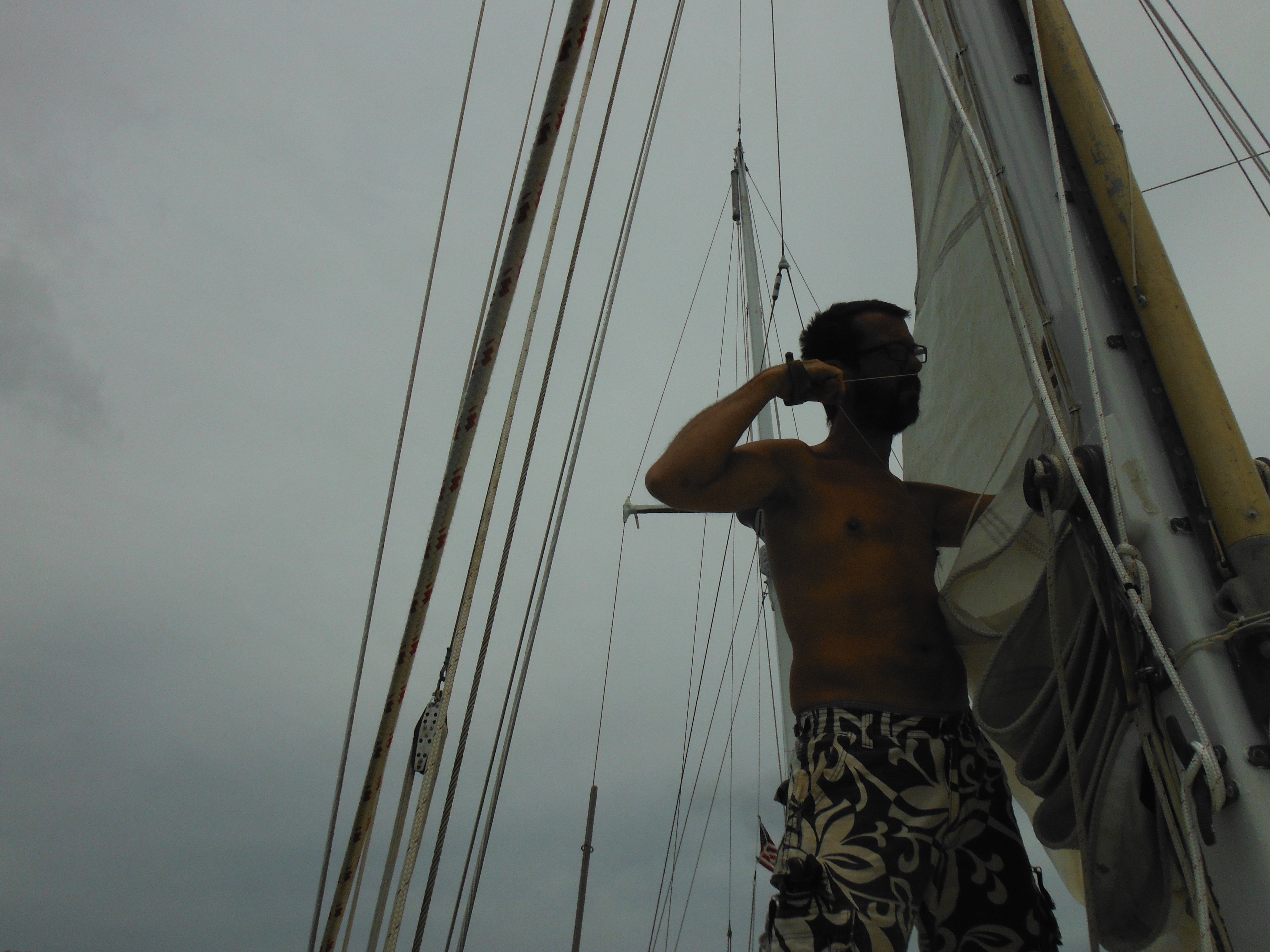
-

- Last tropical waterfall visible from the anchorage. Mt Waialeale was positively gushing today.

-
- Last glory shot of Murre anchored in a tropical paradise.
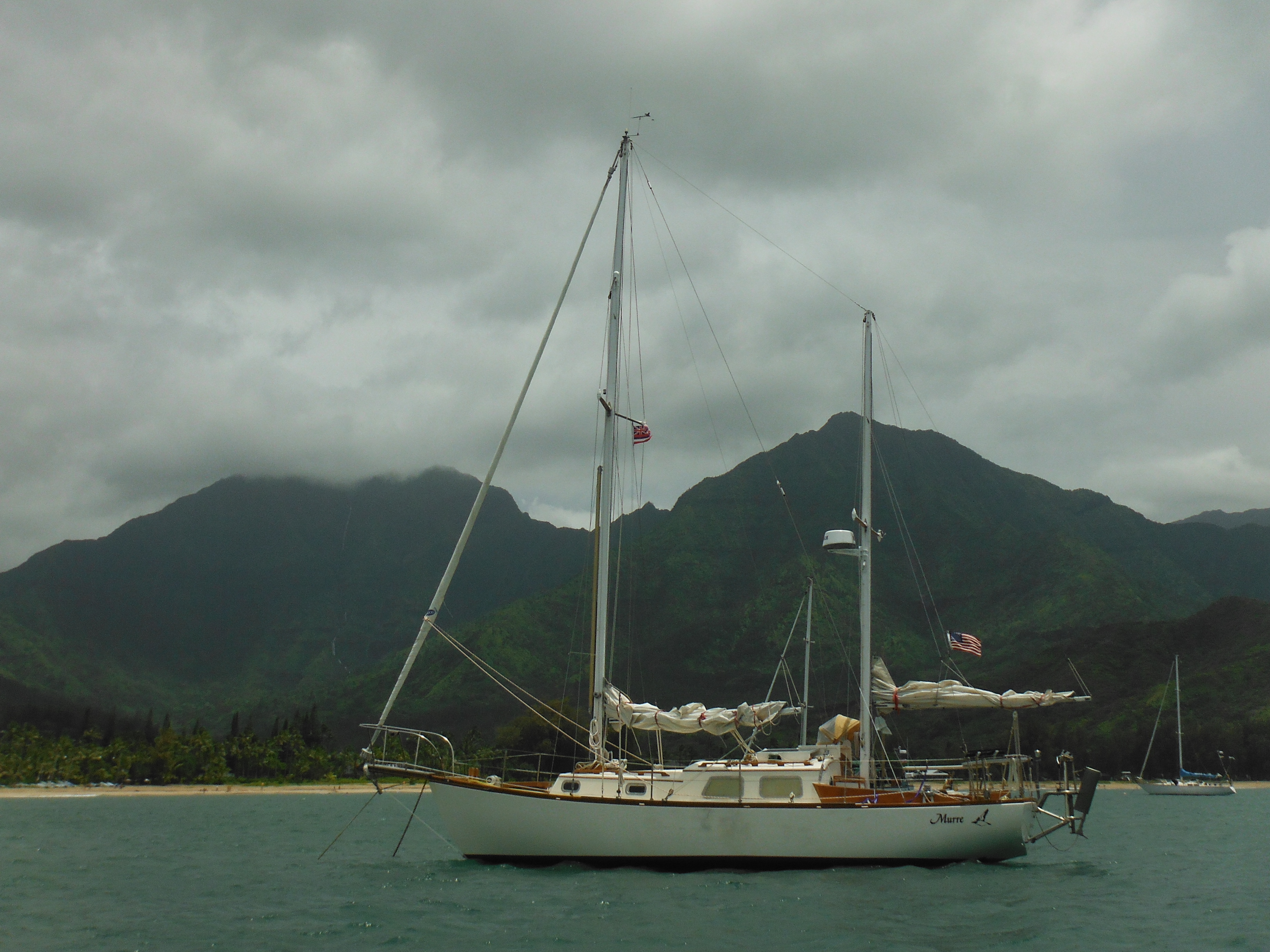
-

- Last row ashore to a long, lovely sandy beach.
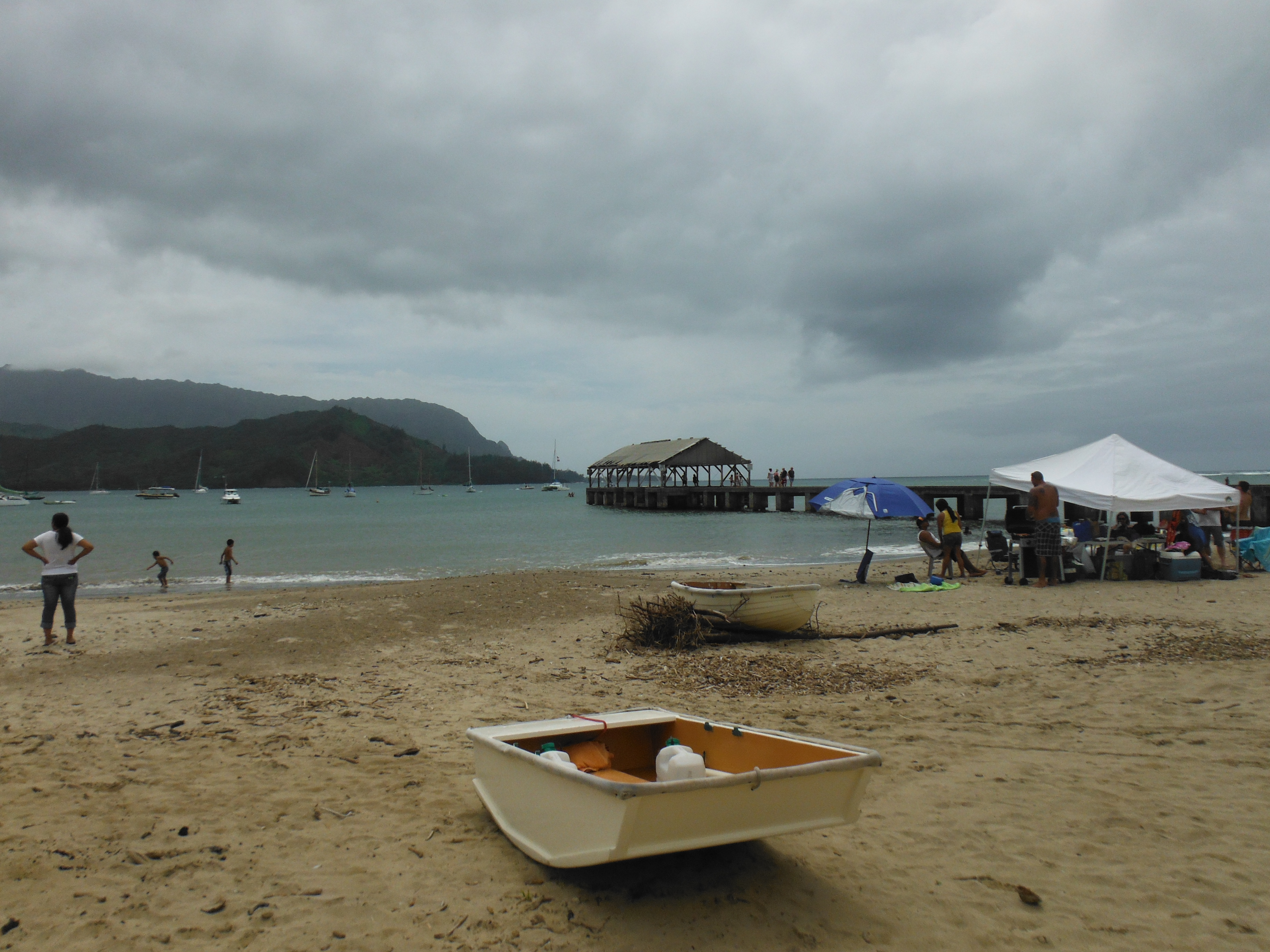
-

- Last shower in a public place under a cold-water tap. The Hawaiians I asked to take my picture were not amused. Thought me a bit queer for asking. Almost got a black eye out of the deal. The tight shorty-shorts I was wearing, so usual in Tahiti, may have had something to do with it. In Hawaii all dudes wear swim trunks that go down to their knees, always; even if their dates are wearing thongs, which THEY usually are.

-

- Last multi-million dollar beach home surrounded by palm trees.

-

- Last shirtless schlep into town for supplies.

-

- Last missionary chruch. On the mainland everyone has always been Christian.
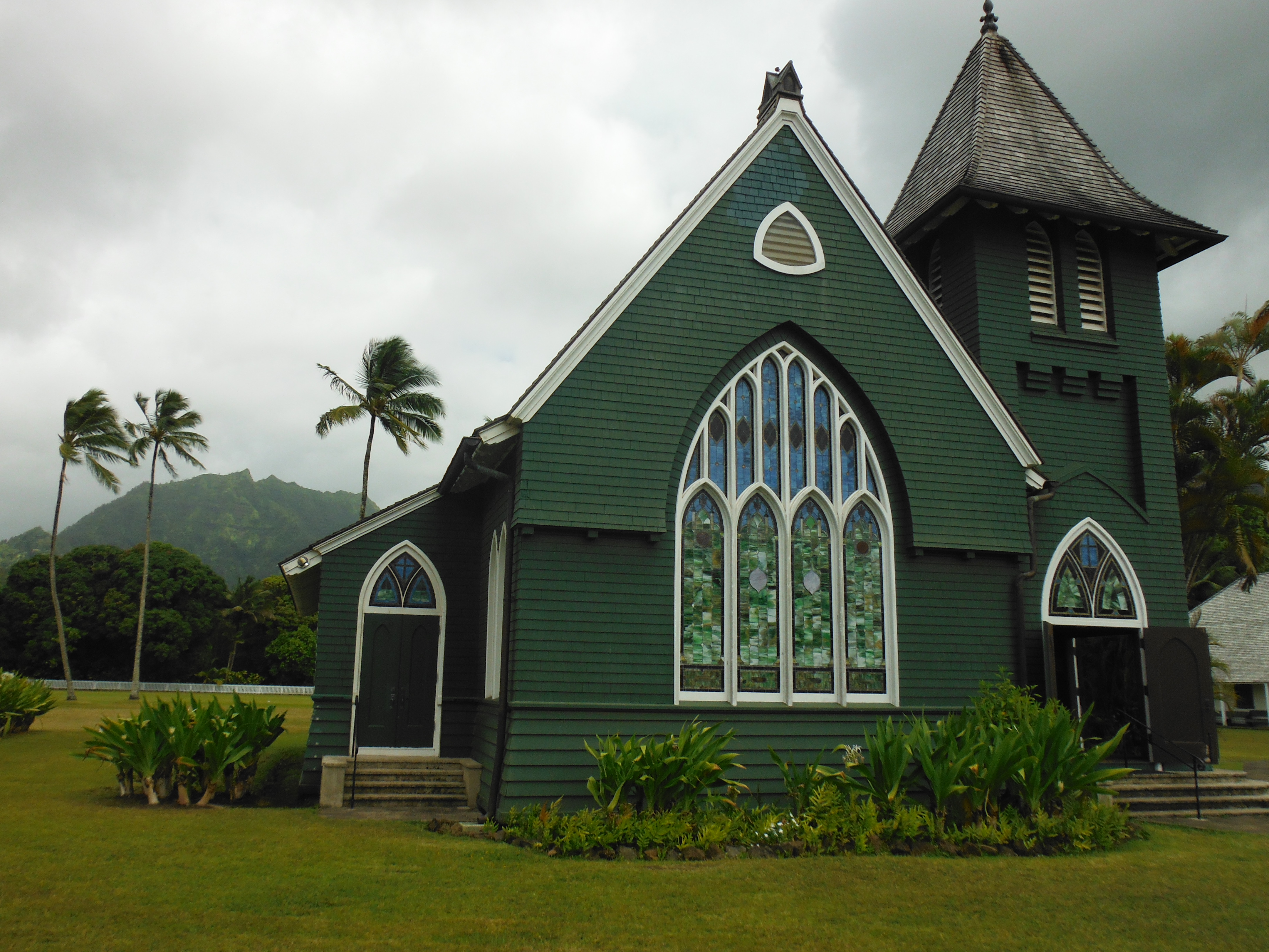
-

- Last field of taro.
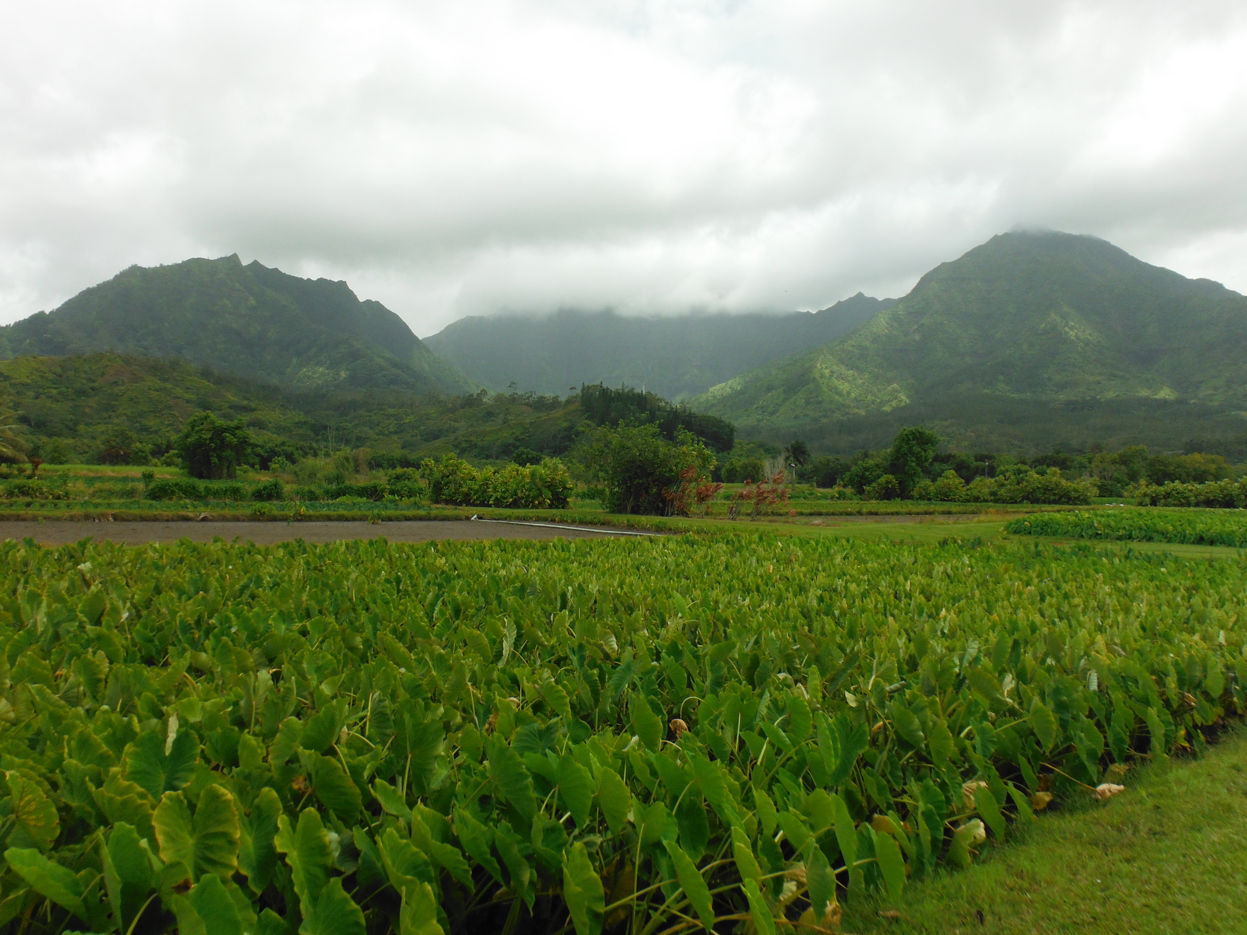
-
- Last shop selling Kauai kitch–waves, sunsets, giggling dolphins painted on black velvet. No Elvis. He never was much for yoga.

-

- Last purchase of extra-yummy taro mochi cake … except the stand was closed. Drat! Taro mochi cake is one of the seven wonders of the world. It even rivals chocolate chip cookies–which is something.

-

- Last fish tacos from Tropical Taco.

-

- Last Zebra Dove. Where we are going the grizzly bears would have gobbled up these little fuzzies as snacks centuries ago.

-
- Last Fire Rock. Cooked in Kona, a damn fine brew.

-

- Last LeBron.
-

- Last chance to chat with Dylan, a fellow cruiser, Pacific Ocean veteran, and a man of exuberance beyond measure. He also seems never to wear a shirt. Admirable. Now he owns a fine shop that sells authentic Polynesian artifacts. Except he spends Sundays with his family and was not available for a good bye. If you are ever in Hanalei, stop here. His inventory comes from island artisans who are distributed all over the tropical Pacific.
-
- Last chance to buy fresh, organic veg. Sadly everything in Hawaii is refrigerated, so it won’t last long on my mostly unrefrigerated boat. Eat often, eat fast.

-
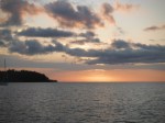
- Last tropical sunset from a lovely anchorage.

-

- And where are we headed? Well, the weather will decide that, but our goal is here. This is Baranof Island in 57 degrees north latitude, home to the town of Sitka, Alaska. 2800 miles onward, more or less.
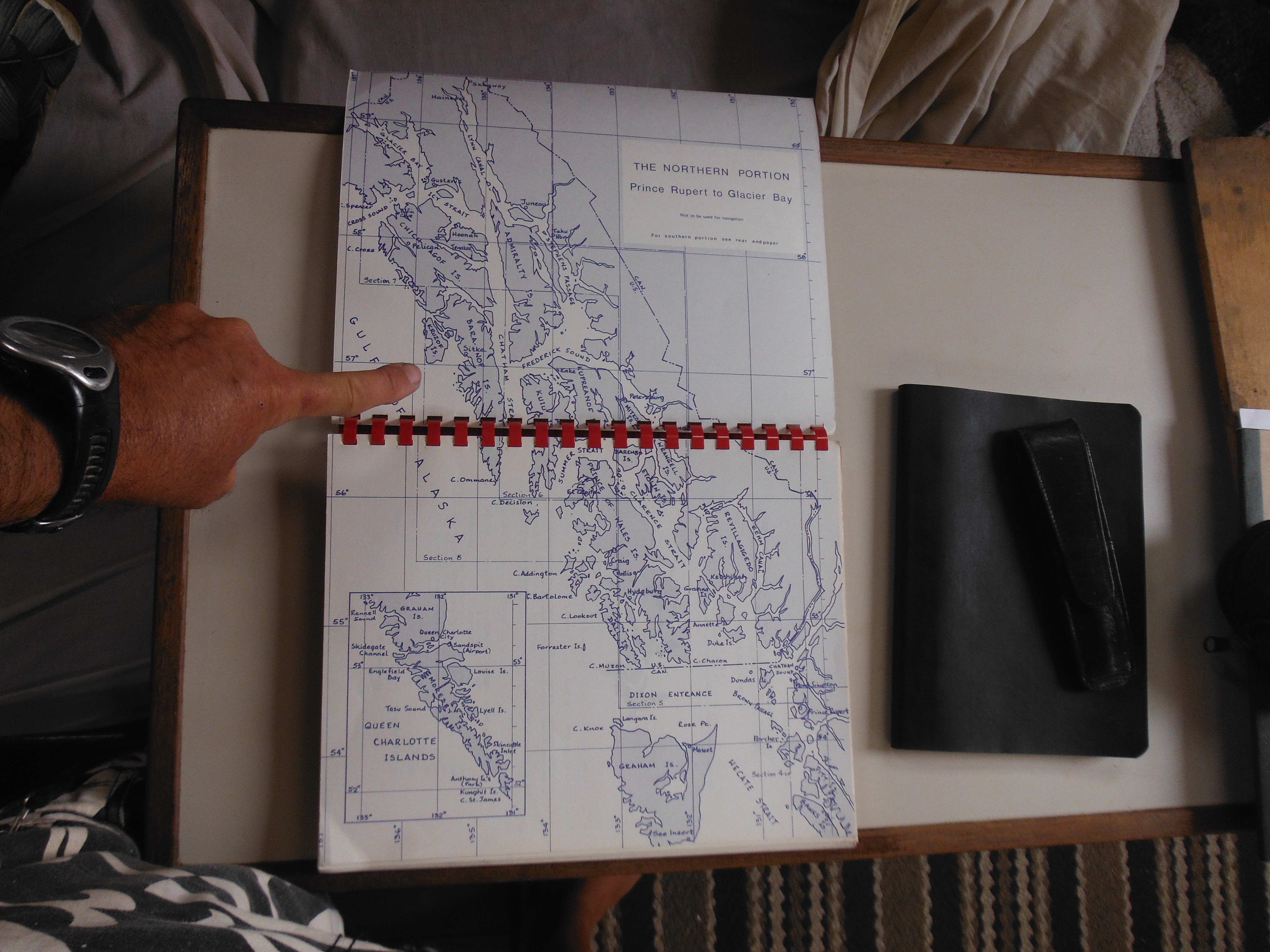
And lastly, LAST photos posted to this blog for a month!
Bon Voyage!
Preparing to Haul North
From Hanalei Bay, Kauai.
Readying for a passage has all the charm of packing for a business trip. Your flight is a red-eye, as usual. It’s late when you dig for the suitcase. Your brain moves with resentment between counting out underwear and the next day’s as yet unassembled presentation. That’s for doing on the plane. There will be no sleep for you. Where is the deodorant? Don’t forget the laptop. Did you remember to book a hotel?
The morrow will contain adventure, but it is attended by a sense of dread.
That’s how I feel about this passage.
First there’s the weather, the main feature of which is the North Pacifc High, a great mass of still air as big as Texas that sits between Hawaii and the US. It cannot be gone through; it must be gone around, and to do so Murre and I will likely have to sail due north to the latitude of Vancouver before we can bare east for the continent.
A typical year could look like this: out of Hawaii we’d be sailing close hauled on brisk northeast trades. It’s a wet, rough ride euphemistically called the “barf run” by cruisers. These winds could hold out as much as a week, but each day they’d grow lighter as we press north. As we approached the western flank of the high and at roughly the latitude of San Francisco, we’d enter what are called the “Horse Latitudes” (origin uncertain), a transition zone between the trades and north pacific weather. Wind here would be light and variable, especially if we were too far east, too close to the high. Further north we’d encounter the northwesterlies coming down out of Asia and Alaska that should carry us on a run to the coast. These northwesterlies are typical winds, not “trades”–they aren’t that steady or predictable; rather they are called “prevailing”, which means, in fact, that wind could come from any direction. Making so much northing would put us squarely into the high latitudes and into the train of lows that march from Japan toward Alaska all year. Our chances of seeing a strong blow in this region would be good, even in summer.

This is a surface analysis weather chart of the North Pacific for June 16, 2012. Note that Hawaii is located in the lower middle right and is easy to miss given the chart’s scale. Today the North Pacific High, denoted by a large “H”, is north and east of the island chain and west and south of San Francisco. It is not yet as far north as is typical at the height of summer. Today there is a long stream of strong southwesterly winds blowing from its northwestern edge toward Canada. Also note the very large low pressure system, “L”, in the gulf of Alaska.
And it’s going to get cold. After a year in the tropics where typical attire includes shorts, just shorts, blasting winds in the 30s and 40s will surely get my attention.
Then there’s the debris. Dr. Nikolai Maximenko of the International Pacific Research Center’s School of Ocean and Earth Sciences writes, “The March 11, 2011 tsunami in Japan swept millions of tons of debris into the ocean. At the moment, anomalous…debris is already washing onto the US/Canada west coast but up to 1.5 million tons of debris may still be drifting in the North Pacific. Since the tsunami the debris has dispersed over a vast area so that, typically, only one object at a time can be seen. Satellites and airplanes have serious difficulties with detecting such debris on the high seas, and visual observations from ships remain our most reliable source of information.” The “anomolous debris…washing ashore” referenced above includes one abandoned ship, one 60 ton concrete dock and one Harley Davidson, all between April and June of this year and all widely reported upon in the media, but the catalogue of items remaining ranges from innocuous bottles and bits of styrofoam to TVs, refrigerators, rafts of wood, steel drums, fishing boats, shipping containers, other floating docks, other ghost ships. Collision avoidance is a major issue.

One of many, often conflicting, charts of tsunami debris dispursion.
–

A concrete dock washed up on the Oregon coast earlier this month.
References
General information: http://iprc.soest.hawaii.edu/news/news.php
Latest debris charts: http://iprc.soest.hawaii.edu/users/hafner/PUBLIC/TSUNAMI_DEBRIS/tsunami_tracers_no_vector_large.html
What NOAA has to say: http://marinedebris.noaa.gov/tsunamidebris/
—
Finally there’s how late in the season it has gotten. My first plan had Murre and I departing Hawaii in mid May; that was pushed back to June first, and it is June 16 as I write this report. Granted we are now anchored in Hanalei Bay and plan to weigh for the big ocean tomorrow, but there is a burden that comes with being so late.
The delay was due almost entirely to preparations and the complications of preparations. Given the unique challenges associated with this passage, especially the potential of collision with heavy debris, I’ve added to Murre’s kit. Things like radar–a new, high tech, Lowrance broadband radar that is famous for seeing little stuff close in. And a Switlik liferaft. And an Imperial cold-water immersion suit, also known as a “Gumby” suit.
The radar was the biggest problem. Its bracket would fit any mast, so said the sales guy in Honolulu. Any but mine I learned too late. I had to fashion a new one from wood and fiberglass, twice. And the radar dome was worryingly large and heavy–I took to calling it the wedding cake–for Murre’s small mizzen, so more supporting shrouds had to be added. Other projects had less to do with this passage and more to do with a year on the water. Much of the boat was revarnished and painted. Leaking deck fittings were removed and recalked. The propane box was rebuilt mere moments before it disintegrated; the main boom was removed, explored for rot, repainted, the hatches removed and rebuilt. Luckily my father-in-law, Peter, has a shop, which he kindly donated and where I worked for the better part of two weeks. Back at the boat I painted the engine, the fuel tank, changed the oil in the transmission, refreshed frayed running rigging. I’ve scrubbed the bum, bought 300 pounds of canned goods, taken on 70 gallons of water.
On Friday Murre and I moved to the north side of the island.
Now we are ready for departure. Ready in the sense that there is really nothing left to do but depart.
There is a knot in my stomach. My wife reminds me it is the same knot that forms prior to every passage. But it just feels bigger. I’d give anything to exchange this for a business trip red-eye.
end

I made several friends the month in Nawiliwil, amongst them two notable singlehanders. Right next to Murre was Deja Vu, built by Jonathan Reid in South Africa many years ago and sailed extensively by him in the South Pacific before his “capture” in Kauai. He’s recently published his memoirs in DAYS OF DEJA VU available on Amazon.
–

Another was the camera shy Australian, Jim Mackey, who set out to singlehand the globe non stop four years ago. Off Cape Town he came on deck one morning to find his wind vane paddle missing. Then he hit a submerged object. So that was the end of “non stop” ideals. Any hard data we have on tsunami debris drift we owe to Jim, for he was the guy who, last December, sailed his small boat from Honolulu to Midway placing drift buoys along the way for the University of Hawaii. He will also depart for the North Pacific, then later this year, it’s south to Cape Horn and home. This photo of his boat, THIS BOAT, is the closest I could come to a photo of Jim. But he has a grand sense of humor. For example, “What was I thinking calling my boat THIS BOAT. Can you imagine me on the radio to the coast guard in an emergency? Me: ‘May day, May day, THIS BOAT.’ Coast Guard: ‘Which boat?'”
–
Photos of the month’s work…
-

- The long list of jobs.
-
- Sanding and taping.
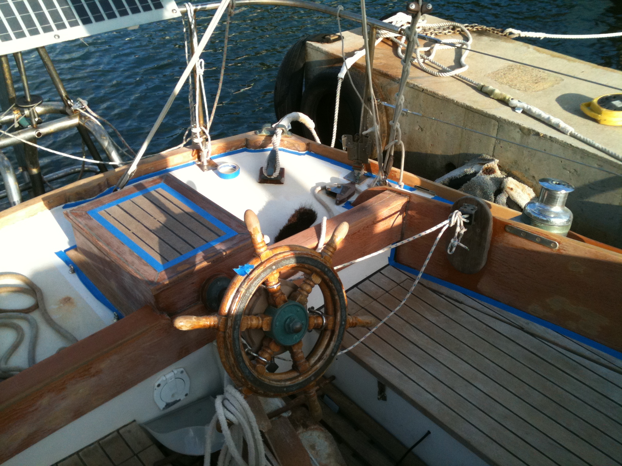
-

- Sanding that last bit always requires putting your butt in the air.

-
- Ready for varnish.

-
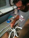
- Splicing new line to replace what had chaffed through on Lanai.

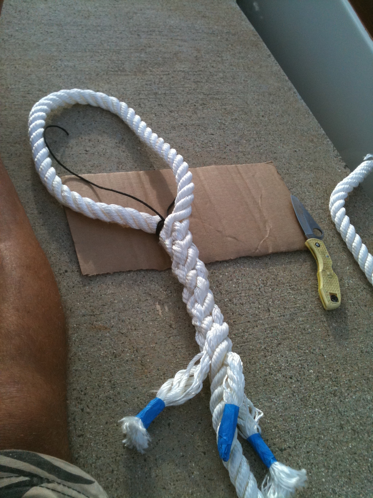
-

- Taking main boom to Peter’s shop to explore for rot.
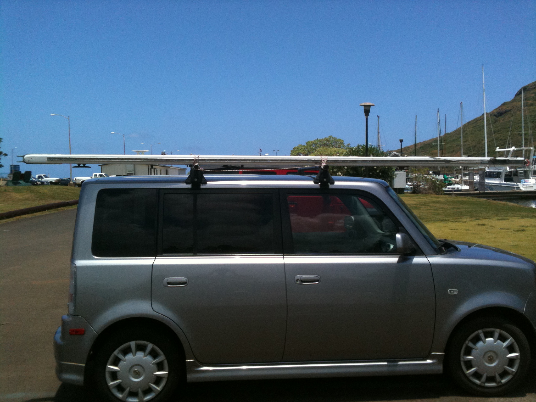
-
- No rot afterall. Good.
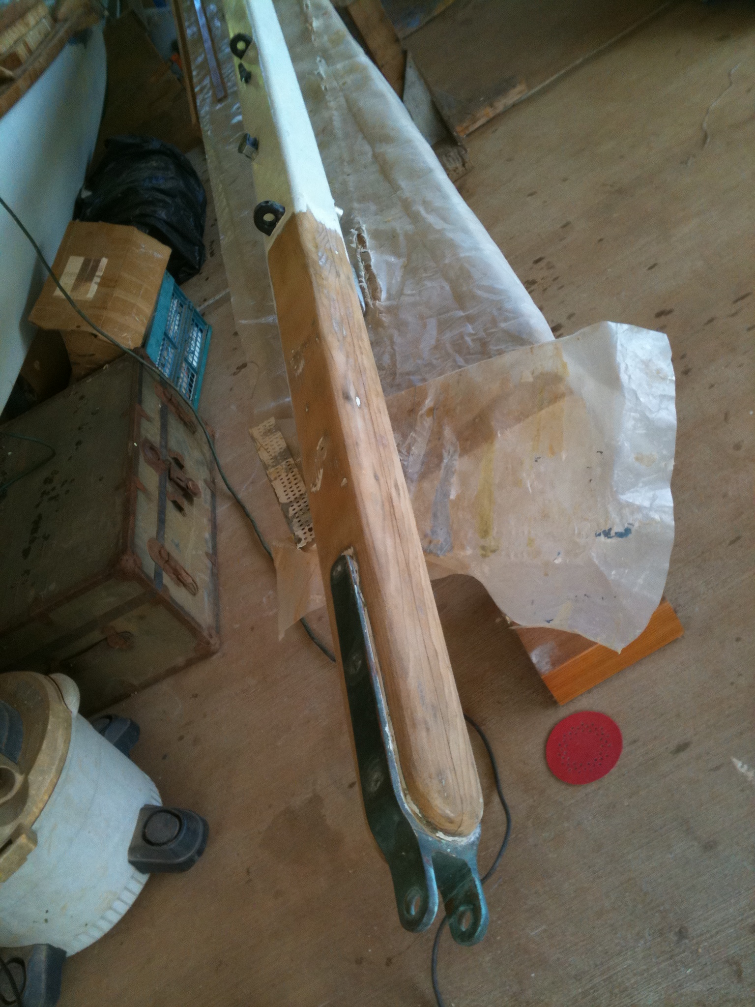
-
- Rebuilding propane box.

-
- Fresh paint.

-

- Freshly cut and shaved. Wife calls this my “bowling ball head” look..

-
- Bracket being shaped and glued. Note aluminum “universal” bracket for radome in the back…

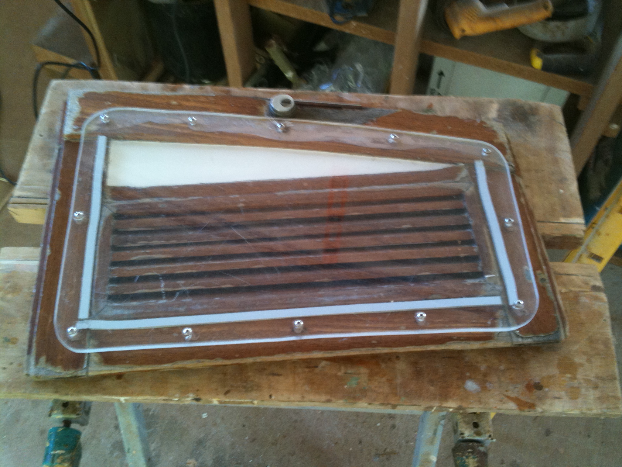
-
- Removing rotten inserts.

-
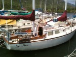
- Murre under construction.


-
- Radar mount bracket, first go. Next day took it to the boat where my neighbor Gary mentioned right off that it wasn’t nearly strong enough. Of course he was right. So back to the shop.

-

- Makeshift router table.
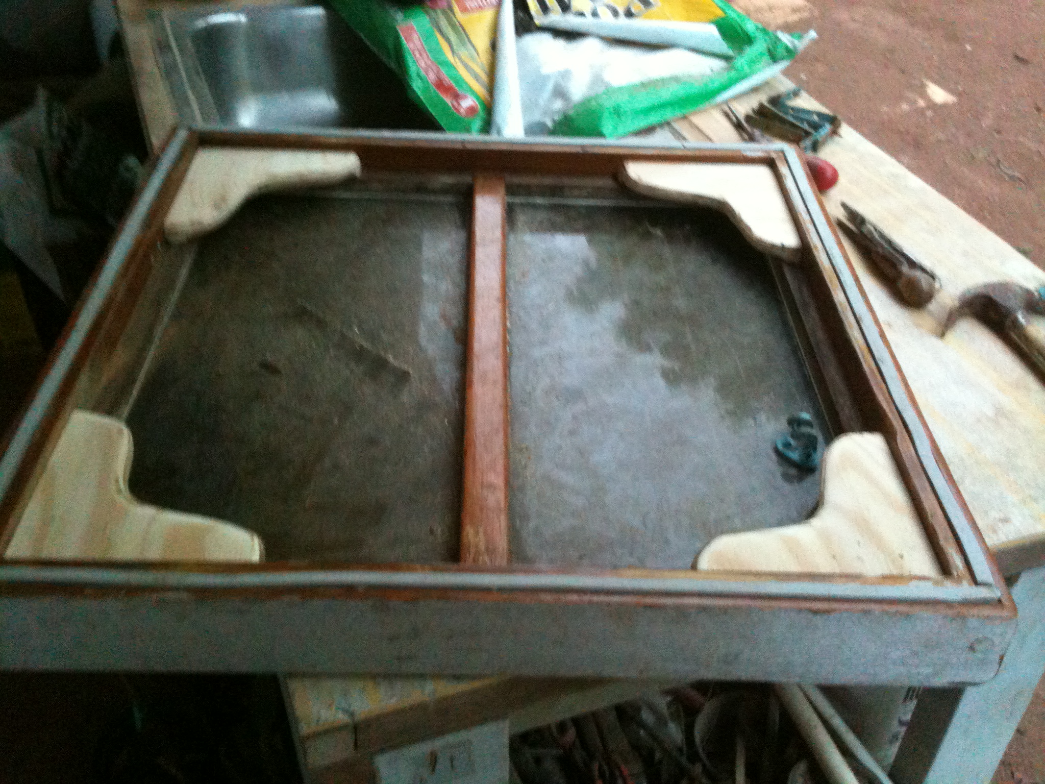
-

- New corner knees to strengthen forehatch.
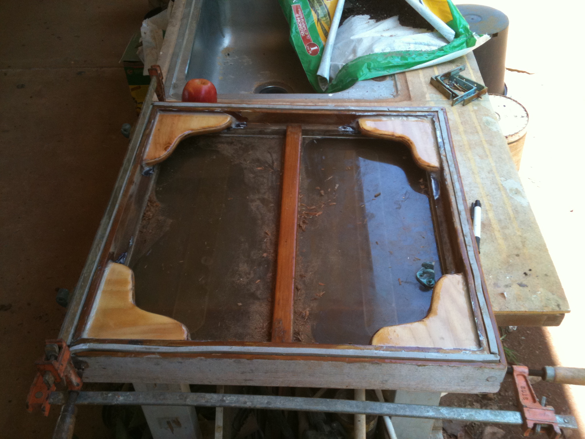
-
- Bracket being glued.

-
- Bracket redux. Elongated and strengthened.

-

- Radome finally mounted.
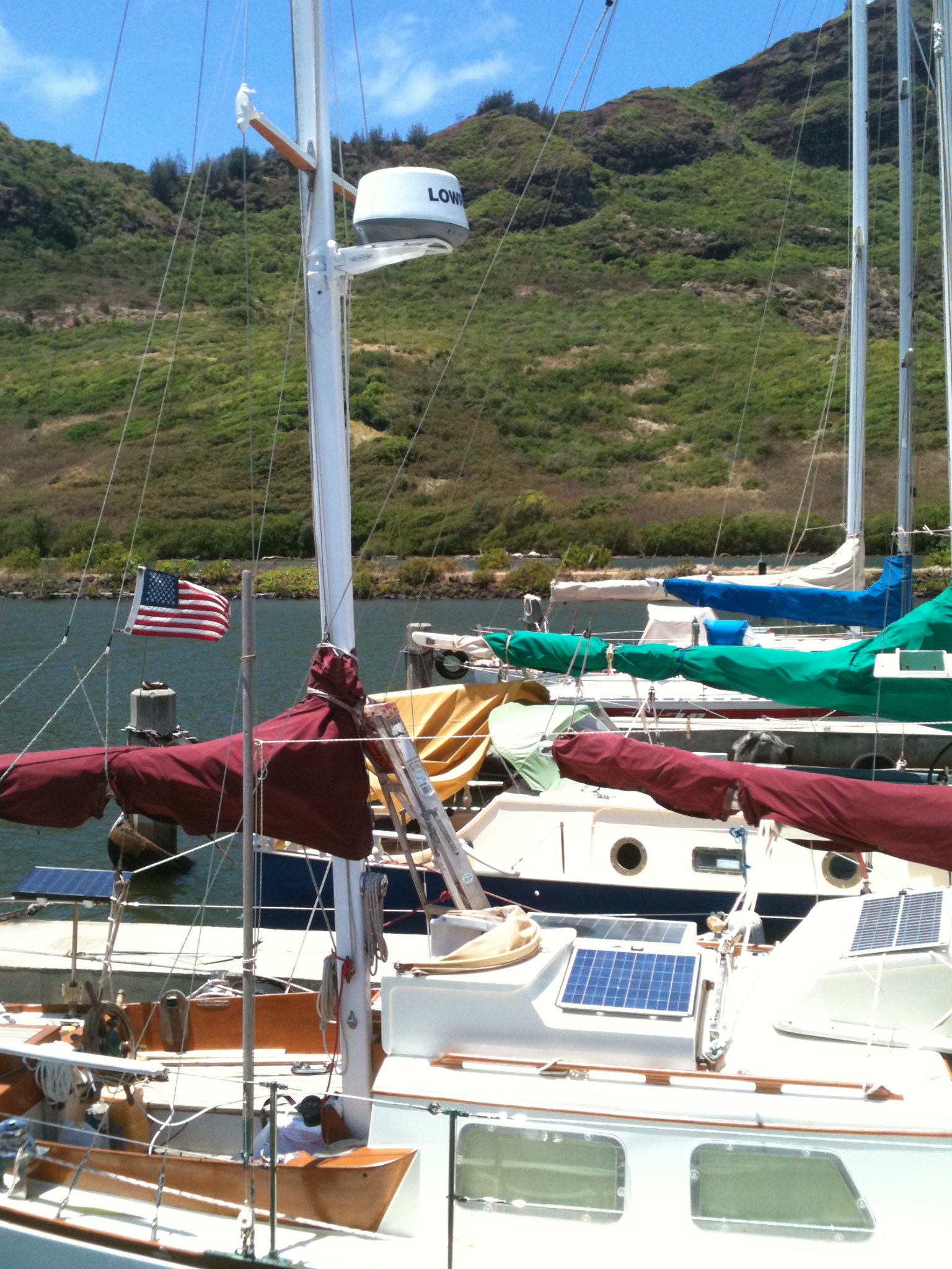
-

- First look at Radar.

-

- The new bracket on the mast with “universal” bracket attached to it.

-
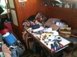
- The cabin during refit. Not too comfortable a living space.


-

- Shroud attach point in new radar bracket.

-
- Chainplate for new mizzen shroud fashioned at local weld shop.

-

- Two Gekos on the boat. One I put ashore; the other has taken up residence in the wind vane tubes and refuses capture.
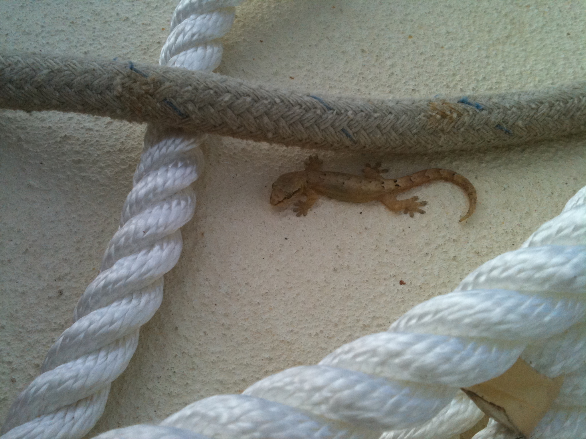
-
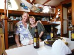
- Friends Rob and Rosanne came by for dinner. Thanks you two for the help.

-
- Awkward storage for life raft. Instructions call for stowage in an “accessible and dry” place. Both on a boat?

-

- Holes to drain water off back deck, where it tends to gather in a sea.
-

- Propane locker back in place.

-

- Canned goods. There are three more lockers below this one, also full of cans.
-

- Dry goods.

-

- One reason for delay. This NMEA multiplexer had to be shipped from New Zealand.
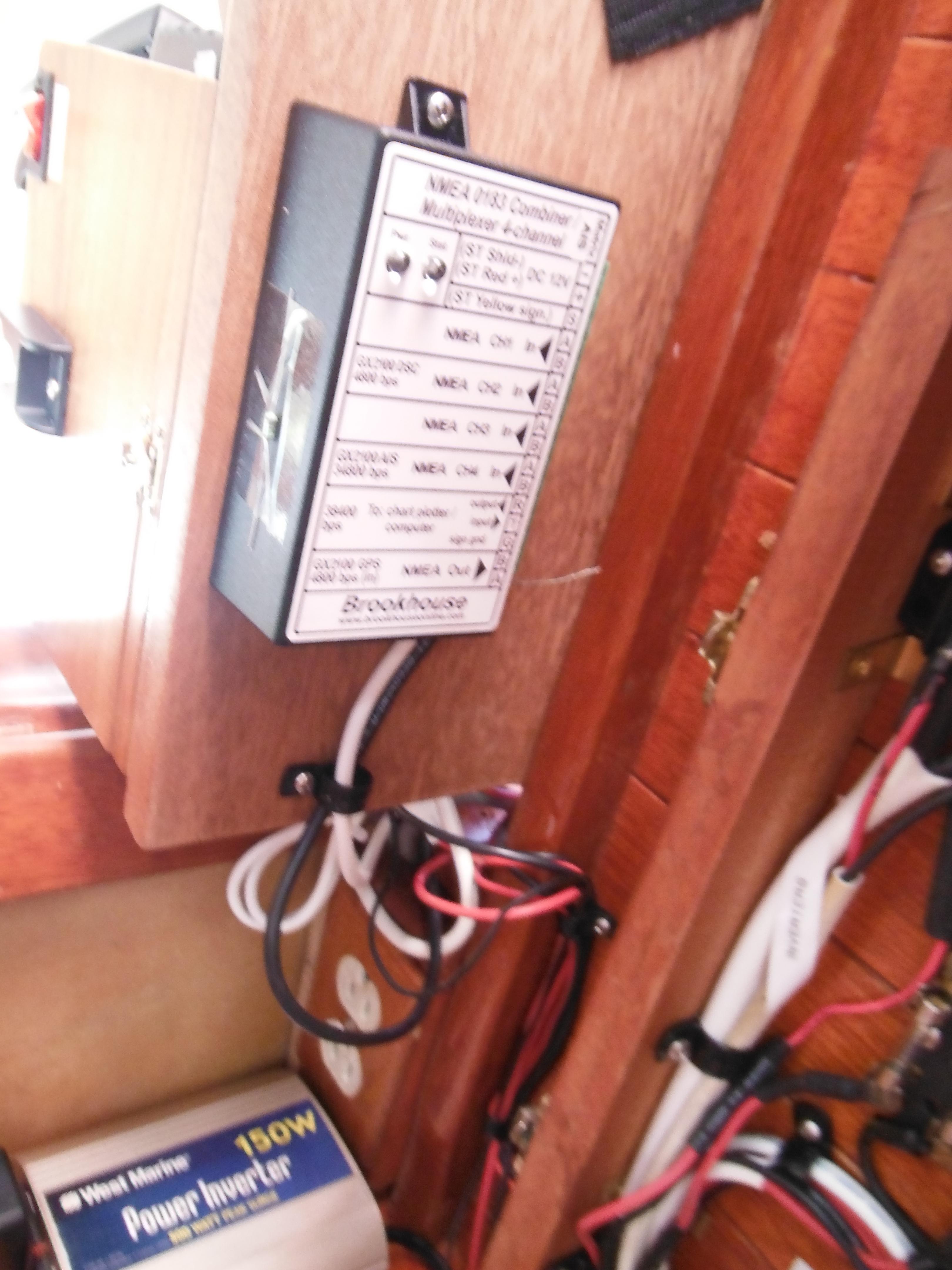
-

- Locker full of food.
-

- Spiffy MAHA C9000 battery charger.
-

- Murre’s tiny nav station.

-

- New Chartplotter showing that the AIS alarm works.
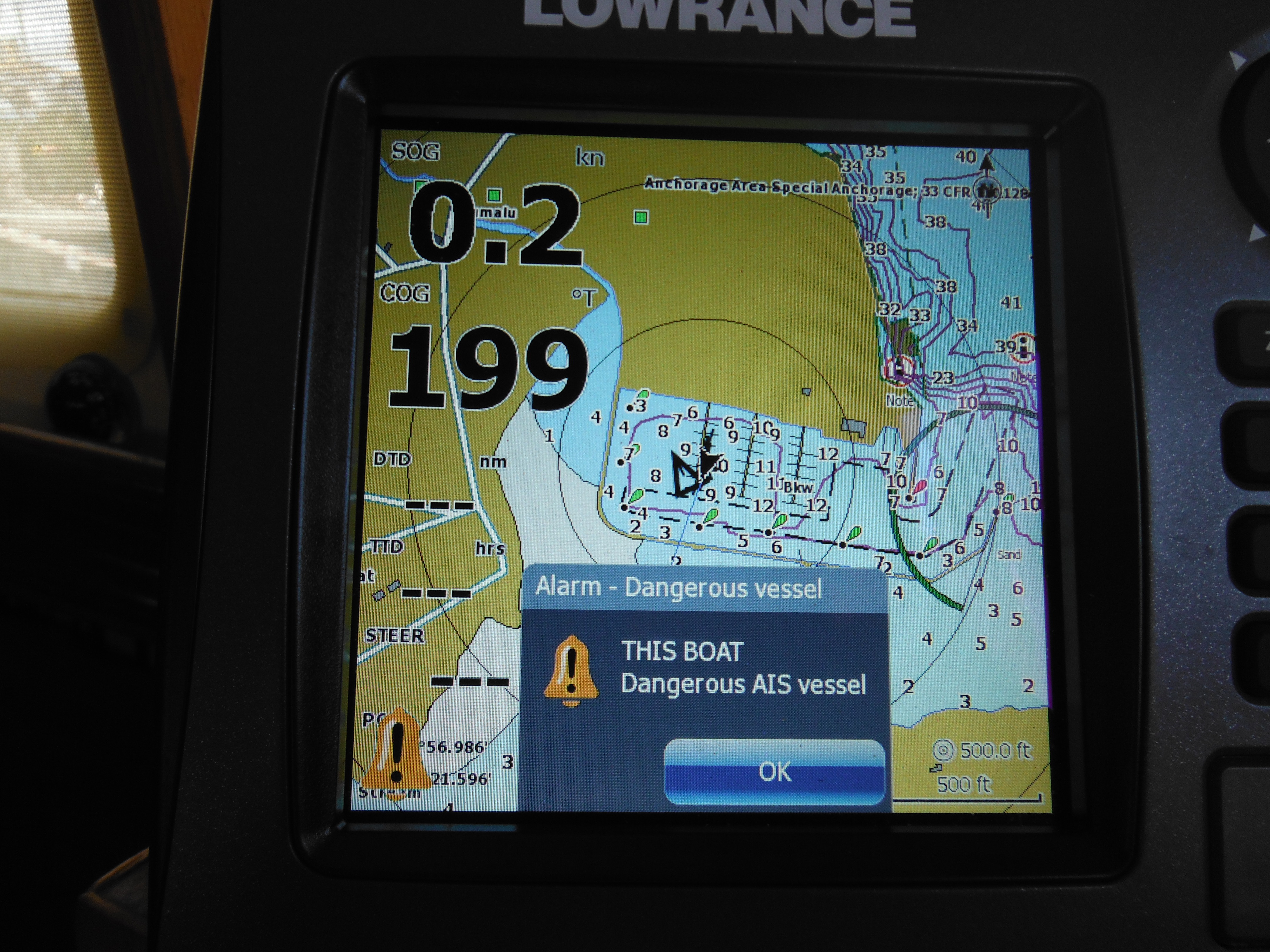
-
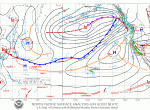
- This is a surface analysis weather chart of the North Pacific for June 16, 2012. Note that Hawaii is located in the lower middle and is easy to miss. Today the North Pacific High, denoted by a large “H”, is north and east of the island chain, but not as far north as is typical at the height of summer. Today there is a long stream of southwesterly winds blowing from its northwestern edge toward Canada; perfect for Murre…if she were there. Also note the large low pressure system, “L”, in the gulf of Alaska.
-

- A concrete dock washed up on the Oregon coast earlier this month.
-

- One of many, often conflicting, charts of tsunami debris dispursion.
-
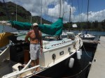
- I made several friends the month in Nawiliwil, amongst them two notable singlehanders. Right next to Murre was Deja Vu, built by Jonathan Reid in South Africa many years ago and sailed extensively by him in the South Pacific before his “capture” in Kauai. He’s recently published his memoirs in DAYS OF DEJA VU available on Amazon.
-

- Another was the camera shy Australian, Jim Mackey, who set out to singlehand the globe non stop four years ago. Off Cape Town he came on deck one morning to find his wind vane paddle missing. Then he hit a submerged object. So that was the end of “non stop” ideals. Any hard data we have on tsunami debris drift we owe to Jim, for he was the guy who, last December, sailed his small boat from Honolulu to Midway placing drift buoys along the way for the University of Hawaii. He will also depart for the North Pacific, then later this year, it’s south to Cape Horn and home. This photo of his boat, THIS BOAT, is the closest I could come to a photo of Jim. But he has a grand sense of humor. For example, “What was I thinking calling my boat THIS BOAT. Can you imagine me on the radio to the coast guard in an emergency? Me: ‘May day, May day, THIS BOAT.’ Coast Guard: ‘Which boat?'”
–
Return to Kauai, plus two videos for your review
As planned, the crossing to Kauai from Oahu did take but one day, a gentle ride overall. On approach to the island wind moderated such that we ran under full sail for the first time since arriving in the Hawaiian chain last September. Murre ghosted along on a blue ocean under a blue sky without cloud and entered Nawiliwili mid afternoon as the northeasterly faded to barely a breath. Here my father in-law, Peter, met us to hand dock lines as we eased into the slip.
This return to Kauai completed a two month cruise of all Hawaii’s inhabited islands except Ni’ihau.
Joanna flew in that weekend but has now departed. Peter and Nansy have also left to pursue their own adventure in Europe. So Murre and I are in familiar territory but alone, which is for the better. All energy is now being focused on a long list of projects whose completion is necessary before our passage north. For me, this upcoming leg is fraught with uncertainty and fear, but we can discuss that later…

Murre dressed down in Nawiliwili: cockpit taped for varnish; propane box and cockpit hatchboards off for painting, main boom down for repair. Etc.
For now you must be satisfied with two short, poor quality videos of two channel crossings, one from Lanai to Molokai via the Kalohi Channel and the other from Molokai to Oahu via the Kaiwi Channel. Both of these are one-take experiments on low-tech devices–an iPhone in the first instance and a Flip camera in the second. Neither camera is able to adjust to boat motion, especially as I struggle to hold onto the camera and the boat without falling off my perch. And neither seems to focus worth a damn or modulate for wind “noise”, so watch your volume as the view steps outside.
What’s with all the movies? I have been toying with the idea of shooting periodic video logs of the passage to the Pacific Northwest, but I am unphotogenic and not extemporaneously inclined. A keyboard is a friend, a camera, foe to a man of my temperament. So beyond the need for some practice with the device, there’s the psychological preparedness that attends being “on stage”. Thus these rudimentary experiments.
The question is this. Is it worth the bother? Are these videos interesting? Remember, I could not post them while at sea as I have no uplink capacity aboard Murre. If they have value at all, it will be historical.
Lanai to Molokai via the Kalohi Channel
—
Molokai to Oahu via the Kaiwi Channel
—
Photographs of uninhabited, western Molokai. Beautiful, barren, and littered with No Tresspassing signs.
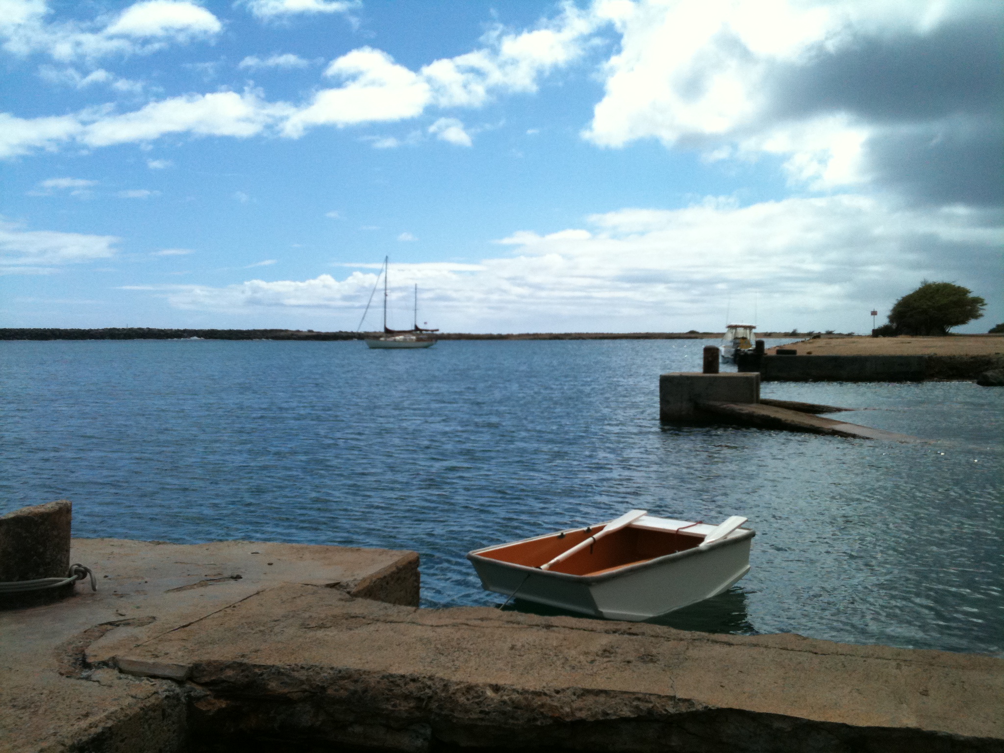


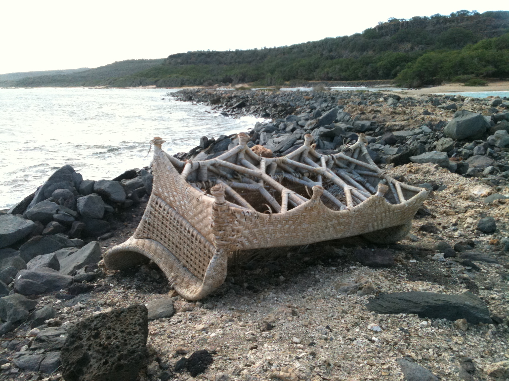


-

- Murre dressed down in Nawiliwili: cockpit taped for varnish; propane box and cockpit hatchboards off for painting, main boom down for repair. Etc.

Testing Testing, One Two Three
Day 1 (of 1, with luck)
Destination: Nawiliwili, Kauai
Time: 8:08am Hawaii Standard Time
Position: N21.40.454, W158.41.458
Course: 295 degrees true
Speed: 4.5 knots
Wind: 10 – 12 NE
Sea: 4 – 6 feet NE
Sky: 25% occluded. Mostly clear, but some cumulus to windward Bar: 1113
Temp: 72 degrees
Since last report we have crossed from Manele Harbor on Lana’i to Lono Harbor on Molokai for two nights anchored amongst a fleet of sport fishing boats, mostly Hawaiians, celebrating a local form of Cinco de Mayo. Following this we dashed across the Kaiwi Channel to Honolulu for another two nights in a marina so large it is a city within a city. But here we did not spend money painting the town red (unless a visit to Outback Steakhouse counts); instead we spent money on supplies for Murre not available in the outer islands–shackles, running rigging, new mooring line and fenders the state harbor docks have chewed to bits, hose clamps, electrical connectors, an infrared temperature gauge (what a find!), a water proof jacket to replace the one no longer waterproof, a new harness tether to replace one that is nearly frayed through, radar (more on which later) and new cabling for the single sideband radio (SSB).
That’s why this post from the middle of the Kauai Channel–to make sure the new wire still runs the radio.
By way of explanation, while at sea my only form of communication with the mainland is via simple, text-only email, this post as example, transmitted over SSB. The system that allows this is comprised of a Toshiba Netbook connected to a Pactor USB Modem connected to an Icom IC-M710 Marine Transciever (SSB radio) connected to an Icom 1400 Automatic Antenna Tuner which splits, one part connects to two bronze plates bolted to the outside of the hull and another to the ultimate fastener on the starboard, aft backstay (the backstay is the antenna; the bronze plates the ground). Email sent over this system is transmitted to an organization called Sailmail (Sailmail.com) and from there into your inbox. It is at once primitive and complex. That it works at all, especially given the skill of the installer, is a miracle. A miracle I cherish.
But some of the connections have begun to rust of late. And so are now replaced. And thus this test.
I have mixed feelings about making for Kauai. On the one hand it ends an enjoyable, educational cruise through the islands and begins preparations of Murre and crew for the passage north. I am sad of the one and worry almost constantly about the other.
On the other hand, returning to Kauai is like coming home. I look forward to a visit with the in-laws. How is the garden growing? Is Peter’s canoe finished? More importantly, my wife arrives tomorrow for a stay of four days, a stay she is calling a vacation. To a man who has not worked in a year and a half, four days off seems more like a flyby, but I’ll take what I can get.
Soon all thought and energy must turn to that expanse of water between Hawaii and the Pacific Northwest. But not just yet. Today we are still in Hawaii where the water is blue, the sky wide, the wind warm–if a bit light. A grand daddy of black footed albatross came calling just last hour, and fairy terns play at wave top. Oahu is still visible in profile astern; Kauai in cloud ahead. At dawn I dropped a lure over the side in hopes of inviting the company of an emerald Dorado, a gift (once cleaned) for Nansy’s dinner table. No luck yet…
We departed Pokai Bay at 2am for a passage of 72 miles of which 34 remain.
Sending now… Did you receive?
end
Lana’i is a Lump, and other facts
The insertion of a super-script comma in words like Hawai’i and Kaua’i I have often thought a needless addition, a popular insistence on the part of the politically correct that is a silly affectation if not downright wrongheaded.
For example the local hue and cry against the US Mint’s 2008 release of a Hawai’i Commemorative Quarter was not that its graphic of the group added two islands as yet undiscovered by science, but rather that the coin misspelled the state’s name. “It’s Hawai’i in Hawai’ian, not Hawaii” they argued, forgetting that this beautiful, ancient language was entirely oral until first put to paper by Europeans in the 18th century.

Hawaii Commemorative Quarter with Extra Islands
Sadly, though not unusually, my trenchant observations reveal their own prejudice. As translated into English by the west, the Hawai’ian alphabet contains 13 letters, all five vowels employed by the other states of the union but only eight consonants, which goes some ways toward explaining the bewildering number of place names that start with a “K” or an “H”. There is, however, a third element in spoken Hawai’ian not easily captured in English script; it’s a glottal stop called the ‘okina, represented visually by the super-script comma.
How important is this mark? Take this island as a case in point. If, like me, you thought I’d spent the last week on Lanai, named such by the ancients because the rich agricultural plateaus of this land resemble a comfortable porch or veranda (defined as such in none other than the Oxford English dictionary), you’d be wrong. In fact, residents of old on Maui who frequented the beaches on the lee of the island looked upon this interruption of their seaward view as nothing more than a lana’i. To them this place was just a lump.*
Other Facts:
More recently tourist literature has prefered “The Pineapple Isle” to “The Lump”, this in commemoration of the 1922 purchase of the island by James Dole and the subsequent establishment here of the largest pineapple plantation then known. If you enjoyed Dole canned pineapples prior to the plantation’s closure in 1992, the pineapple you enjoyed likely grew on Lana’i.
With just 47 miles of coastline and a stable population of 3000, Lana’i is the smallest, least populated of the accessible, inhabited Hawai’ian islands. (Ni’ihau, just west of Kaua’i, is smaller and has fewer than 200 residents but is not open to the public.)
Most of the island’s population lives in Lana’i City, a plantation town built by Dole, the only such town in existence. The “city” is at the center of the island at 1600 feet elevation and thus is often in cloud. Being thoroughly planted with Cook Island Pines gives it a faintly New England feel. It also has the distinction of being one of the 11 most endangered historic places in th US.

Restaurant Row, Downtown Lana’i City
Racial demographics, according to one local, are 50% Filipino, 30% Chinese and Japanese, 10% White, 10% Hawai’ian. Filipinos were brought in by Dole to help work the pineapple fields and, just like the rest of us, found it difficult to leave.
In Lana’i City there are no stop lights. There is one coffee shop, one gas station, one playhouse, one post office, one Cultural and Heritage Center and two groceries. There are five churches; most of these are on the same street.
Want to live here? A one thousand square foot home in town runs $500,000; a gallon of milk costs almost $9.00; a gallon of gas is $5.73. There are no signs at the filling station advertising the price. “We don’t even look anymore,” says Becka at the Dollar car rental facility. “Everyone knows last week the price is going up this week.”

A gallon of milk is almost $9.00
When pineapple production on Lana’i became too expensive, Dole sold to developer David Murdock. (Dole had purchased the island from rancher Charles Gay, so Lana’i has a history of one-person ownership.) Under Murdock tourism has taken on a new flare, or rather flare at all. Of the three hotels, two are Four Seasons. In 1994 Bill and Melinda Gates rented all of Lana’i, all 600 hotel rooms and every helicopter within a radius of several islands, to ensure their 15 minute, 150 guest wedding remained private. Since then Lana’i has been marketed as “The Private Island” or “Exclusive Island”, and Murdock has sought to make it anything but…but without success. Murdock claims to lose money every year and is looking for a buyer.

Luxurious Four Seasons above Hulopoe Bay
Hotels are staffed with locals; men and women who once worked the fields are now the backbone of the service industry. One story has it that an English butler was brought over to run the training program.
On such a small piece of land, land in the rain shadow of Maui, finding sufficient water for crops of pineapple and then later for crops of tourists has been a problem. Average rainfall at elevation is 25 inches, a not insignificant amount except that there is only one mountain up there to catch it; elsewhere on the island gets much less. Early ranch manager George Monroe planted Cook Island Pines along the ridge crest to drip-filter water from the cloud cover into the aquifers. Dole used this water to irrigate his corps, and now hotel pools and world-class golf courses drink it up. Water use is a controversial issue on Lana’i.

Most of the island is dry grass and rock, like this ridge above Manele Harbor
But not half as controversial as Murdock’s plan to establish the northwestern part of the island as a wind farm. This unpopulated area of Lana’i is rocks, grass, and wind. Endless wind. And on an island whose domestic electricity comes from a diesel generation plant (see above price of fuel) this issue appears to be a no brainer. It isn’t. I spent most of an afternoon talking to local elder Albert Morita at the Culture and Heritage Center about this and other subjects. Albert is a soft-spoken, subtly intelligent man of charm though his trademark cowboy shirt might initially suggest otherwise. From him I learned that:
1. Wind farm proponents base success claims on production up-times of 40% due to the island’s very consistent winds, while industry standards are more in the range of 18%. No one expects that wind turbines will be consistently productive. If wind isn’t blowing, they can’t turn; but few know that there is such a thing as too much wind, which endangers their delicate parts. The northwestern edge of Lana’i faces the Pacific’s Pailolo Channel, one of the nastiest channels in the islands. There’s just too much wind here.
2. The wind farm will not directly benefit Lana’ians. Electricity produced here will be piped over a large, under-sea cable to Honolulu. Lana’ians will pay Honolulu rates for the their electricity. What’s more the one undersea cable in the plan will most likely be three, one primary and two backups, and so capital costs will be huge. The project may never pay for itself.
3. The project won’t bring jobs to local people and it will cordon off large areas of traditional hunting ground.
4. Even many of those residents who support the project do so under duress. For example, Murdock has threatened to cancel local union contracts unless these unions openly support the proposal. It’s become a divisive issue and “it’s tearing the community apart,” says Albert.

This sign advocating wind power on a fence line right next to …
–

… this sign protesting it.
Printed and hand-made signs for and against are posted in yards and along fences and bumper stickers are numerous, but from my perspective, that’s as far as the divisiveness goes.
Though Molokai is officially the “friendly isle” I have found that appellation appropriate for Lana’i. Everyone waves like they know you and there is no such thing as a five-minute conversation.
From Sherry, the Harbor Mistress, I learned that the solar panels on her roof make using her electric car free. “And solar panels mean my electricity bill doesn’t double when my daughter visits,” she said. From Emily, Director of Guest Experience at the Four Seasons, I not only hitched a ride the eight miles into town (she is the only woman who has ever stopped for me) but got a short tour of its sights. The man who runs the one art gallery showed me a map of the off-roading available and introduced me to the mouflon sheep. Albert, the elder in the cowboy shirt, patiently answered my many questions for three hours, well past the Culture and Heritage Center’s regular hours. “I’m a volunteer; I get paid overtime,” he said smiling. I learned later he was also president of the CHC board.
*****
Now we are waiting for wind, or rather, less wind, for our passage to Molokai across the Pailolo Channel. Small Craft Advisories have been posted every day in memory, and the harbor has at least one other vessel also waiting for the right moment, a small fishing boat whose owner is Al, a tugboat stevedore from Molokai who was here for some deer hunting. He and his two young children looked grim when they pulled in. They’d tried to make it home; they’d been to the point. “The sea was all big stuff, all smoke,” said Al. The boy was crying.
One might ask why a heavy cruising boat like Murre would feel obliged to be wind-bound in weather that binds an open, 20 foot fishing run-about, and that would be a very good question.
end
*This and several of the below facts from Lana’i, The Elusive Hawaiian Island–the One that Captain Cook Missed, Anderson Duane Black, Vintage Press, New York, 2001.
